New South Wales
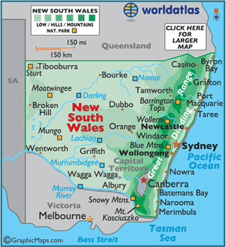
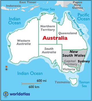
Located on the southeastern coast of Australia, the state of New South Wales can be divided into four geographical sections: a thin coastal strip, mountains, agricultural plains, and the western plains.
Extending from Victoria, moving through New South Wales and on into Queensland, the Great Dividing Range includes the Snowy Mountains, the Northern, Central and Southern Tablelands, the Southern Highlands, and the South West Slopes. Although these mountains aren't steep, many peaks rise above 3,281 ft. (1,000 m).
The highest point of New South Wales is Mount Kosciuszko, located in the Snowy Mountains, at 7,310 ft (2,228 m). The lowest point is the Pacific Ocean (0 m).
The arid or semi-arid Western Plains cover nearly two-thirds of the state, and have a sparse population compared to regions closer to the coast. The agricultural plains to the east of the Western Plains are central to the economy of New South Wales.
Major rivers of the state include the Darling, Namoi, Lachian, and Murrumbidgee rivers; there are no significant lakes.
The Darling River, 1,160 miles (1,879 km) in length, flows southwest from the edges of the Great Dividing Range into the Murray River. The Murray rises in the Australian Alps and flows 1,200 miles (1,930 km) to the Spencer Gulf, directly west of Adelaide. It's the longest river in Australia and is a vital source of irrigation for the country's major agricultural industries.