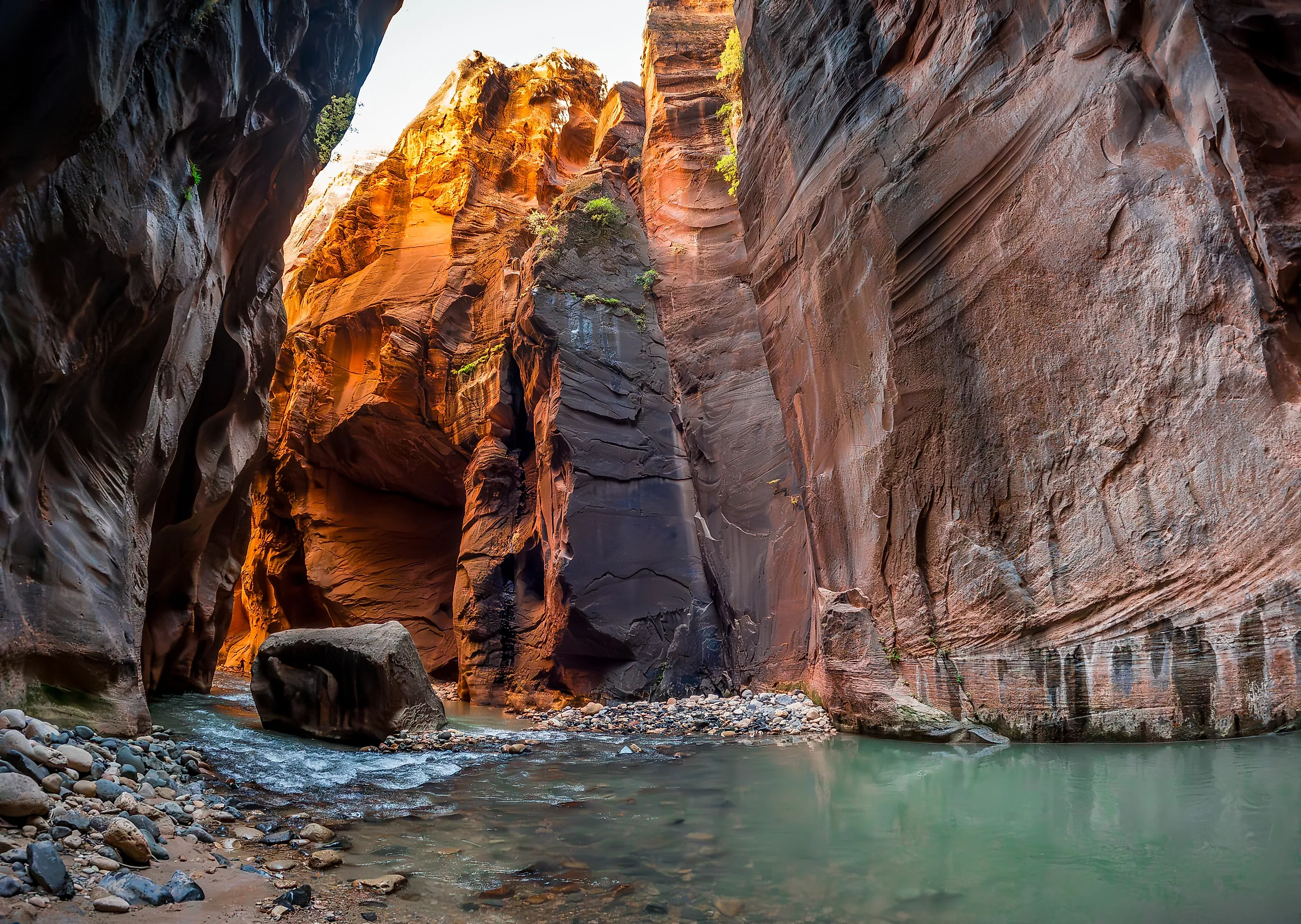
The National Parks With Slot Canyons
Within the National Park system, the US Southwest holds the highest concentration of slot canyons, narrow fissures carved by water into sandstone and limestone where vertical walls can rise hundreds of feet while the space between them shrinks to a couple of feet, and sometimes mere inches. Unlike subterranean caves, these formations are open to the sky, yet the view above is often reduced to a thin ribbon of light by the sheer proximity of the rock faces. Water, acting as a liquid sandpaper over millions of years, scours these passages into smooth, undulating shapes that lead visitors in a world of beige to red walls, shadow, and echo. Five national parks protect these distinct formations, ranging from world-famous, permit-controlled river routes to remote, unmaintained fissures in the desert backcountry.
Zion National Park, Utah

The Narrows in Zion National Park represents the most famous slot canyon experience in the National Park System, where the Virgin River itself serves as the trail through a gorge with walls rising 1,000 feet above the water. The canyon narrows to just 20 to 30 feet wide in sections, requiring hikers to wade upstream through water that can range from ankle-deep to waist-deep depending on the season and flow rate.
The geology consists of Navajo Sandstone, a formation deposited during the Jurassic period that is prone to exfoliation, creating the smooth, undulating walls that define the route. Access begins at the Temple of Sinawava, the final stop on the park's mandatory shuttle system, where the 1.1-mile Riverside Walk leads to the mouth of The Narrows. Beyond this point, there is no maintained trail. Navigation requires walking on a riverbed composed of slippery, algae-covered boulders that demand careful footing.
Hikers can venture upstream as far as Big Spring, a 4.5-mile one-way journey that marks the limit of day hiking without a permit. To traverse the full 16-mile length of the canyon from Chamberlain's Ranch, a permit is required, limiting the number of hikers in the most constricted sections. The National Park Service strictly monitors flow rates, closing the canyon when the flash flood risk exceeds a specific threshold or when water temperatures drop to dangerous levels.
Capitol Reef National Park, Utah

Capitol Reef National Park protects a network of slot canyons within the Waterpocket Fold, a 100-mile-long monocline that tilts sedimentary layers to create a rugged, fractured landscape. Unlike the river-bound Narrows of Zion, the slots here, such as Grand Wash and Sulphur Creek, are often dry washes that only carry water during rare storm events.
Grand Wash is accessed via a 1.2-mile graded dirt road that leads to a parking lot near the head of the trail. The slot canyon hike is an easy, 4.4-mile round trip path where walls of red and white Wingate Sandstone rise vertically, creating a quiet, enclosed environment distinct from the open desert outside.
Another notable feature is Capitol Gorge, accessible from the main scenic drive, which features a narrow section known as the Pioneer Register, where early pioneers carved their names into the soft rock walls from 1871 to 1946.
The geology here includes the Wingate Sandstone, which forms the sheer cliffs, and the softer Chinle Formation below, which erodes more quickly to create the slot profile. Flash floods are a severe hazard. The park closes these canyons immediately when rain is forecast in the watershed, as water levels can rise several feet in minutes with no warning.
Canyonlands National Park, Utah

Canyonlands National Park contains some of the most remote and technically challenging slot canyons in the United States, located primarily in the Needles and Maze districts. The Maze District, often cited as one of the most inaccessible regions in the lower 48 states, holds a labyrinth of narrow fissures that require advanced navigation skills and high-clearance vehicles to reach.
In the Needles District, the 1.3-mile Joint Trail winds through a series of deep, narrow cracks in the Cedar Mesa Sandstone where the rock has fractured along parallel lines, creating passages so tight that hikers must turn sideways to pass. The Joint Trail is an established, signed route, part of the longer Chesler Park loop. Deeper in the park, the Maze District's slots are wild and unmarked, where navigation relies on topographic maps and GPS rather than signage.
The geology is dominated by Cedar Mesa Sandstone, a formation known for its vertical jointing that creates these straight, wall-like fissures. Permits are required for all overnight trips in the Needles and Maze districts, and day-use fees apply for vehicle access to the remote trailheads.
Grand Canyon National Park, Arizona

While known for its vast scale, the Grand Canyon also protects deep, narrow side canyons that function as classic slots, particularly where tributary creeks have cut through the ancient Tapeats Sandstone. Deer Creek Narrows, located along the Colorado River at mile 136.8, is a premier example of this geology, where the creek has carved a vertical fissure approximately 100 feet deep but only a few feet wide.
Unlike the maintained trails of the rim, Deer Creek Narrows is reached mainly by Colorado River raft trips, or on foot by experienced backpackers via remote, unmaintained routes such as the Bill Hall and Thunder River trails from the North Rim. The narrows themselves form a short, tight gorge of water-polished walls, and the area features the 180-foot Deer Creek Falls. The Tapeats Sandstone here is Cambrian in age, the oldest of the canyon's flat-lying sedimentary layers, and its hardness creates sheer, smooth walls that offer little friction for climbing.
The National Park Service requires a backcountry permit for any entry into these inner-canyon slots, and the routes are strictly for experienced hikers. The narrowness of the passage creates a unique microclimate, often remaining cool and shaded even when the rim temperatures soar.
Death Valley National Park, California

Death Valley National Park protects two distinct slot canyon experiences in its mountain ranges, Mosaic Canyon in the north and Sidewinder Canyon in the south. Mosaic Canyon, accessible from a graded dirt road near Stovepipe Wells, features smooth, polished marble walls that have been scoured by flash floods into a narrow, winding passage.
The canyon floor is covered with "mosaic" breccia, a rock composed of angular marble fragments, giving the canyon its name. The upper sections narrow significantly, requiring hikers to squeeze through openings barely wider than their shoulders. In contrast, Sidewinder Canyon is located in the Black Mountains along Badwater Road in the southern part of the park. It offers a more rugged, technical experience, cutting through dolomite and limestone with tight narrows, dry falls, and boulder chokes that require scrambling and occasional down-climbing.
The approach involves a rough drive followed by a hike of varying length depending on the specific route chosen, often exceeding three miles one-way to reach the significant constrictions. Both canyons are strictly dry environments where flash floods are rare but catastrophic. A storm in the distant mountains can send a wall of water through these narrow fissures with no warning underscoring the need for frequent weather monitoring before embarking on the route. The park maintains no trails inside the narrowest sections, leaving navigation to the visitor's discretion.
The Slot Canyons of the US National Parks
Visitors traveling through the national parks of the US Southwest will find the country's highest concentration of slot canyons, where narrow fissures carved by water into sandstone and limestone create a unique landscape of towering vertical walls. From the water-filled depths of Zion's Navajo Sandstone to the dry, marble-polished passages of Death Valley, each site represents a distinct chapter in the erosional history of the Southwest.
The accessibility of these features across the five national parks varies significantly, ranging from the shuttle-served river walks of Zion to the high-clearance vehicle requirements of the Maze District, yet all share the inherent volatility of flash flood risks that demand vigilance and proper planning.
These narrow corridors offer a perspective distinct from the open vistas typical of the region, compressing the visitor's field of view to focus on the texture of the rock and the acoustics of the enclosure. Preserving these fragile sandstone and limestone environments requires strict adherence to permit systems and weather monitoring, ensuring that the dynamic forces which created them do not become a hazard to those exploring their depths.