Maps of Louisiana
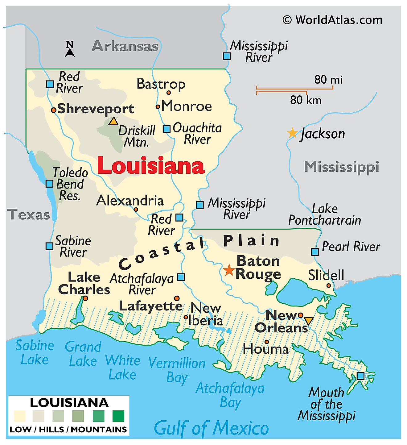
Louisiana is a state in the southern United States. It shares its borders with Arkansas to the north, Mississippi to the east, the Gulf of Mexico to the south, and Texas to the west. The state covers an area of roughly 52,271 square miles (135,382 square kilometers), ranking 31st in size, and it is divided into 64 parishes rather than counties, a usage found nowhere else in the country.

Louisiana is the only state largely built by a river. Over the past 7,000 years the Mississippi has repeatedly shifted its course across the coastal plain, and each abandoned channel left behind a lobe of sediment. Those overlapping lobes are the southern third of the state. It is young ground, geologically speaking, and unstable: the land is sinking as the sediment compacts while the sea rises against it. Louisiana holds roughly 40% of the coastal wetlands in the contiguous United States and has been losing them faster than anywhere else in the country.
Where Is Louisiana?

Louisiana measures about 380 miles at its longest and 144 miles at its widest, and its outline is often described as boot-shaped, with the heel in the southwest and the toe at the mouth of the Mississippi. The eastern boundary follows the Mississippi and Pearl rivers, the western follows the Sabine, and the northern is a survey line.
The state has almost no vertical relief. Elevations run from 535 feet at Driskill Mountain in the north down to about 8 feet below sea level in New Orleans, with an average of roughly 100 feet. With about 4.6 million residents, Louisiana is the 25th most populous state.
North Louisiana

The northern third of the state divides sharply down the middle. Its western half, part of the West Gulf Coastal Plain, is the highest and most broken country in Louisiana: rolling hills of sand, clay, and gravel cut by creeks, carrying pine and mixed hardwood forest.
Driskill Mountain, the highest point in Louisiana at 535 feet (163 meters), sits here in Bienville Parish, in North Louisiana rather than Central Louisiana, roughly 40 miles from the Arkansas line. Despite the name it is a wooded hill with about 225 feet of prominence, marked by a cairn, and it ranks 48th among the 50 state high points. Only Florida and Delaware have lower summits.
The northeastern half is entirely different. There the Mississippi Alluvial Plain reaches into the state as a flat expanse of dark, deep floodplain soil, locally called the Delta though it lies hundreds of miles from the coast. Cotton, soybeans, and rice grow on ground built from silt the river dropped over thousands of years of flooding.
Central Louisiana

Central Louisiana is organised around the Red River, which enters from Arkansas and Texas and runs southeast across the state. Its valley carries reddish alluvial soil, coloured by iron-rich sediment carried down from the plains of Oklahoma and Texas, and is among the state's most productive farmland.

Kisatchie National Forest, the state's only national forest, protects about 604,000 acres across seven parishes here. Its Kisatchie Hills section includes sandstone mesas and outcrops that produce the closest thing to rugged terrain Louisiana offers, and the forest preserves significant stands of longleaf pine, a fire-dependent ecosystem that once covered much of the South and has been reduced to a small fraction of its original range.
For centuries the Red River was blocked by the Great Raft, a logjam of driftwood up to 160 miles long that made the river unnavigable and backed water up into a chain of side lakes. Its clearance in the 1830s opened the valley to settlement and drained several of those lakes.
Acadiana

South-central and southwestern Louisiana form Acadiana, named for the French-speaking Acadians expelled from Nova Scotia in the 18th century. The land here is nearly level and dominated by water.
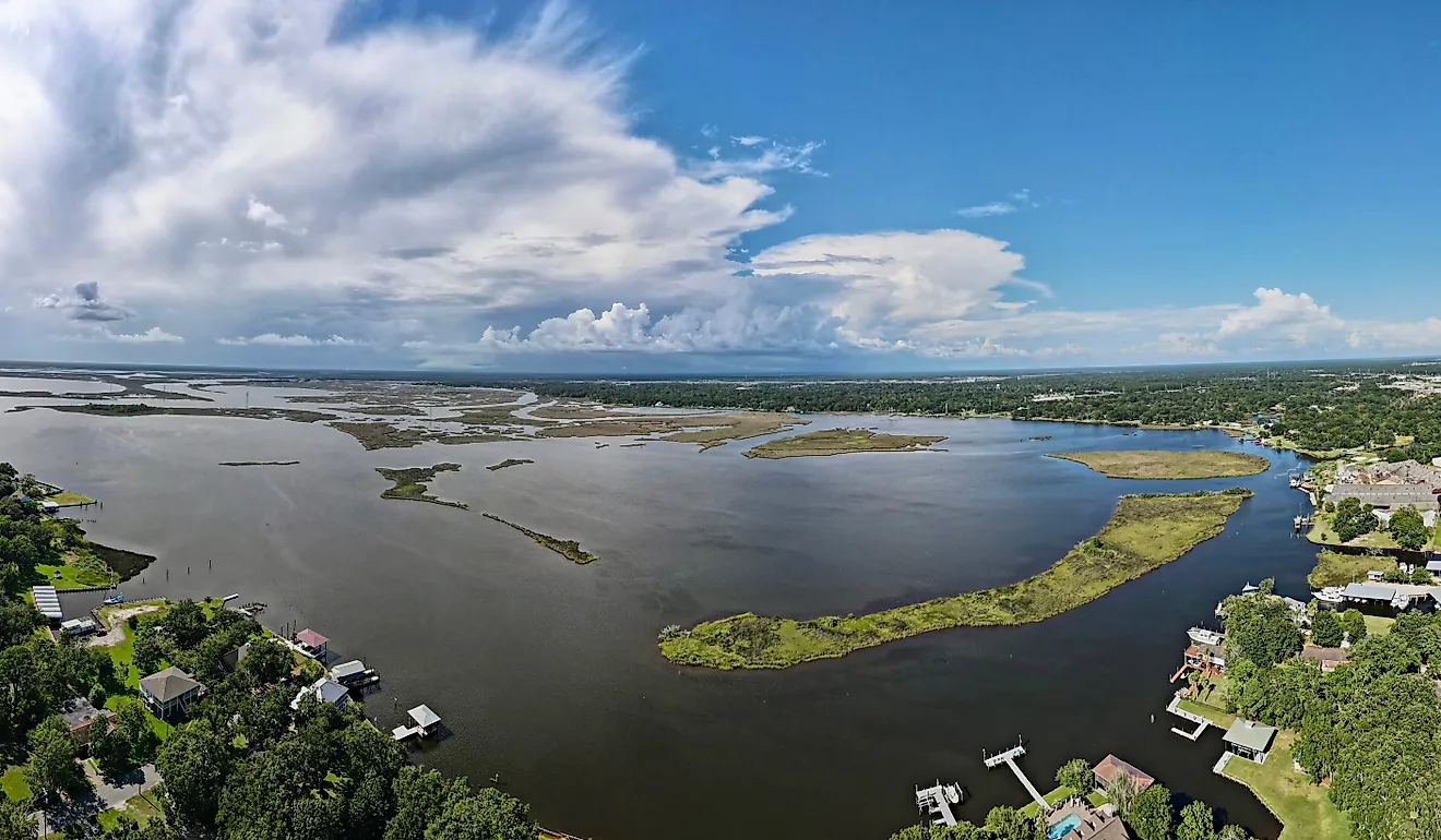
Its centrepiece is the Atchafalaya Basin, the largest river swamp in the United States at roughly 1.4 million acres. Bald cypress and tupelo forest, bayous, and backwater lakes fill a floodway between two enormous levees. The Atchafalaya is also the only major delta in Louisiana still actively building land rather than losing it, because it still receives sediment.

North and west of the basin lie the Louisiana Prairies, a flat expanse of heavy clay soils that was originally tallgrass prairie and is now the state's rice and crawfish country. The southwest holds the Chenier Plain, a distinctive landscape of long, narrow wooded ridges called cheniers, which are stranded former beaches left behind as the coastline advanced seaward, separated by broad marsh.
Scattered across Acadiana are the salt domes, including Avery Island, Weeks Island, and Jefferson Island. These are plugs of ancient salt that have risen buoyantly through the overlying sediment, pushing up low hills of 100 to 150 feet that stand out sharply on an otherwise flat plain.
The Florida Parishes

East of the Mississippi River and north of Lake Pontchartrain lie the Florida Parishes, so called because the area was part of Spanish West Florida rather than the Louisiana Purchase and did not join the state until 1810.
Geologically this is the East Gulf Coastal Plain, and it is noticeably different from the deltaic land to the south. Rolling hills of sand and gravel support longleaf pine, and along the Mississippi the ground rises into loess bluffs near St. Francisville. Rivers including the Tangipahoa, Tchefuncte, and Amite drain south into Lake Pontchartrain, which is not a true lake at all but a brackish estuary of about 630 square miles connected to the Gulf.
Greater New Orleans and the Delta

The southeastern corner is the active Mississippi River Delta. New Orleans sits about 100 miles upstream of the river's actual mouth, on the natural levee ridge the river built along its own banks, with lower ground behind it.
Below the city the Mississippi runs out into the Gulf through the birdfoot delta, a set of long narrow passes extending into open water at the Head of Passes. The delta's characteristic shape comes from the river depositing sediment faster than waves can redistribute it.
Much of Greater New Orleans lies at or below sea level, and the state's lowest point, about 8 feet below sea level, is here. That is partly natural subsidence and partly a consequence of drainage: pumping water out of the backswamp behind the levees caused the peat soils to compact and the ground surface to drop.
The Coast and Barrier Islands

Louisiana's coastline is the most complex in the country. Measured as a straight general coastline it runs about 397 miles, but counting every bay, bayou, and island the tidal shoreline exceeds 7,700 miles, second only to Alaska.
A chain of low barrier islands fronts the marsh, including Grand Isle, the Chandeleur Islands, Timbalier Island, and the Isles Dernieres. Grand Isle is the only inhabited barrier island in the state. These islands are thin, low, and highly mobile, formed from sand reworked out of abandoned delta lobes, and they take the first impact of every hurricane that comes ashore.

Land loss is the defining coastal issue. Since the 1930s Louisiana has lost roughly 2,000 square miles of coastal land, an area larger than the state of Delaware. The causes compound each other: levees now carry the Mississippi's sediment straight past the marshes and out into deep water, canal dredging has let salt water intrude, the delta sediments naturally compact, and sea level is rising.
Rivers

The Mississippi runs roughly 600 miles through and along Louisiana. Its lower course is entirely leveed, and the river now flows in a channel raised above the surrounding land, held in place by engineering rather than by gravity.
That arrangement is deliberate and precarious. The Atchafalaya offers the Mississippi a much shorter, steeper route to the Gulf, and the river has been trying to switch into it since the mid-20th century. The Old River Control Structure, completed in 1963 above Baton Rouge, diverts about 30% of the combined flow into the Atchafalaya and holds the rest in the main channel. Without it the Mississippi would have changed course decades ago, leaving Baton Rouge and New Orleans on a tidal backwater.
Other significant rivers include the Red, the Ouachita and its lower course the Black, the Sabine along the Texas border, the Pearl along the Mississippi border, and the Calcasieu in the southwest. Louisiana also has thousands of miles of bayous, which are slow, often tidal channels occupying abandoned river courses. Bayou Lafourche and Bayou Teche are both former main channels of the Mississippi.
Lakes

Most of Louisiana's large water bodies are not conventional lakes. Lake Pontchartrain, at about 630 square miles, is the biggest, but it is a brackish estuary open to the Gulf through the Rigolets and Chef Menteur passes. Lakes Maurepas, Borgne, Salvador, Calcasieu, Grand, and White are similar coastal or brackish basins, and Lake Borgne is effectively a bay.
Others are oxbows, crescent-shaped remnants of abandoned Mississippi meanders such as False River and Lake Providence. Catahoula Lake in the centre of the state is a rare natural freshwater lake whose water level rises and falls seasonally by many feet, exposing mudflats that draw enormous numbers of waterfowl.
Toledo Bend Reservoir, on the Sabine River along the Texas border, is the largest artificial lake in the South at roughly 185,000 acres, and Louisiana shares it with Texas.
Climate

Louisiana has a humid subtropical climate throughout, with long hot summers, short mild winters, and high humidity year round. Its low latitude, flat terrain, and position beside the Gulf mean warm moist air reaches every part of the state with nothing to block it.
Rainfall is among the heaviest in the continental United States, running from about 50 inches a year in the northwest to more than 65 inches in the southeast. Snow is rare outside the northern parishes.
Hurricanes are the dominant hazard, and Louisiana is struck more often than almost any other state. Katrina in 2005, Rita, Ida, and Laura all caused catastrophic damage, and the flat coastal terrain allows storm surge to push far inland. The state also records frequent tornadoes, many of them spawned by landfalling tropical systems rather than by spring thunderstorms.
Louisiana Geography at a Glance
| Feature | Detail |
|---|---|
| Total area | Approx. 52,271 sq mi (135,382 sq km), 31st largest state |
| Dimensions | Approx. 380 mi long; 144 mi wide |
| Highest point | Driskill Mountain, 535 ft (163 m), Bienville Parish, North Louisiana |
| Lowest point | New Orleans, about 8 ft below sea level |
| Bordering states | Arkansas, Mississippi, Texas |
| Coastline | Approx. 397 mi general; over 7,700 mi tidal shoreline |
| Wetlands | About 40% of the coastal wetlands in the contiguous US |
| Coastal land loss | Roughly 2,000 sq mi since the 1930s |
| Largest water body | Lake Pontchartrain, approx. 630 sq mi (a brackish estuary) |
| Largest swamp | Atchafalaya Basin, approx. 1.4 million acres |
| Administrative divisions | 64 parishes |
Counties Map
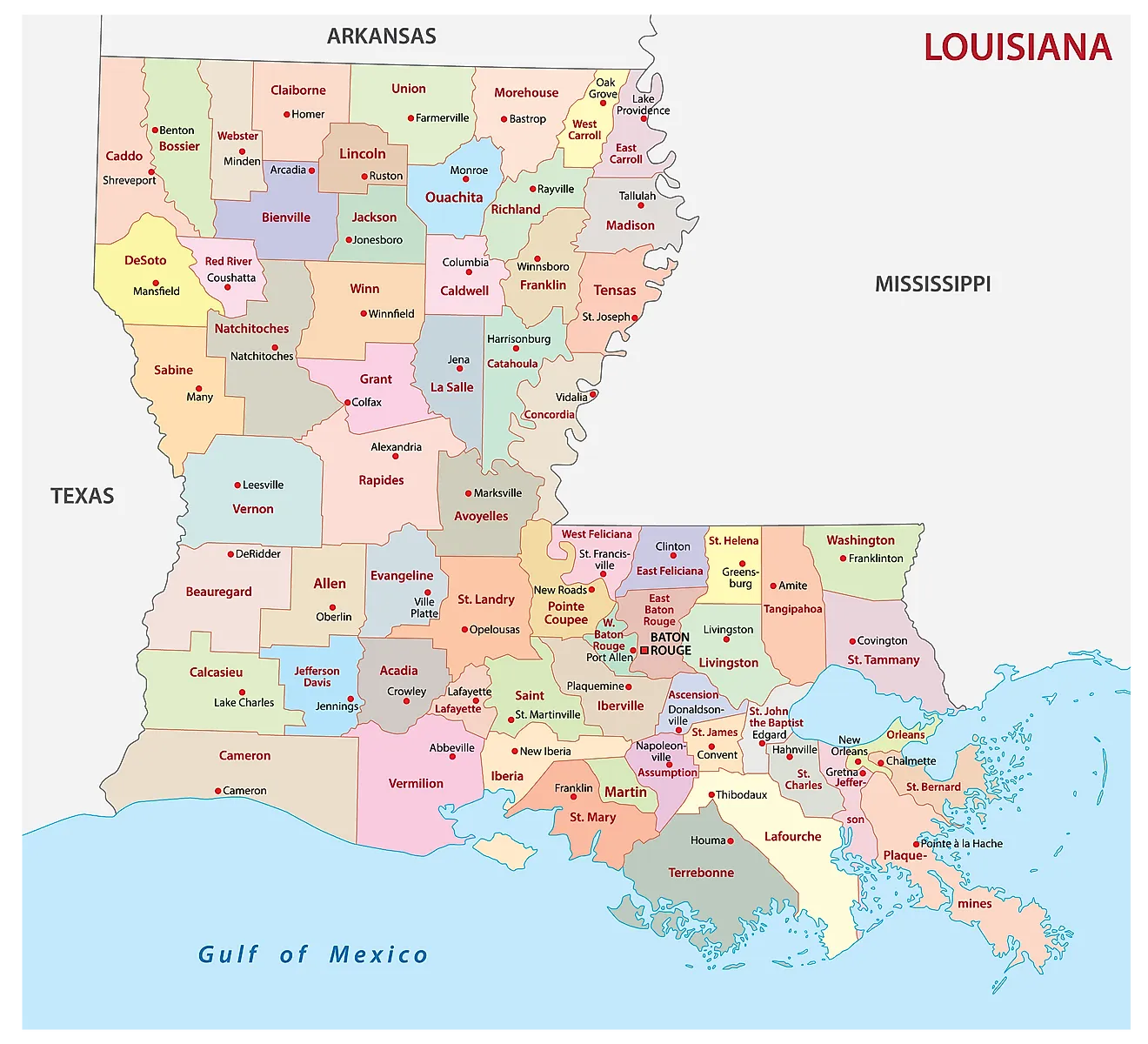
The State of Louisiana is divided into 64 parishes. In alphabetical order, these parishes are: Acadia, Allen, Ascension, Assumption, Avoyelles, Beauregard, Bienville, Bossier, Caddo, Calcasieu, Caldwell, Cameron, Catahoula, Claiborne, Concordia, DeSoto, East Baton Rouge, East Carroll, East Feliciana, Evangeline, Franklin, Grant, Iberia, Iberville, Jackson, Jefferson, Jefferson Davis, Lafayette, Lafourche, LaSalle, Lincoln, Livingston, Madison, Morehouse, Natchitoches, Orleans, Ouachita, Plaquemines, Pointe Coupee, Rapides, Red River, Richland, Sabine, St. Bernard, St. Charles, St. Helena, St. James, St. John the Baptist, St. Landry, St. Martin, St. Mary, St. Tammany, Tangipahoa, Tensas, Terrebonne, Union, Vermilion, Vernon, Washington, Webster, West Baton Rouge, West Carroll, West Feliciana, and Winn.
With an area of 135,382 sq. km, the State of Louisiana is the 20th smallest and the 25th most populous state in the USA. Located in East Baton Rouge Parish, along the eastern shores of the Mississippi River, is Baton Rouge – the capital and the second-largest city in Louisiana. It also serves as a political hub and an industrial center of the state. Situated in southeastern Louisiana, along the Mississippi River, is New Orleans – the most populous city in Louisiana. It also serves as a major port and as the cultural, commercial, and economic hub of the state and the wider Gulf Coast region of the United States.
Where is Louisiana?
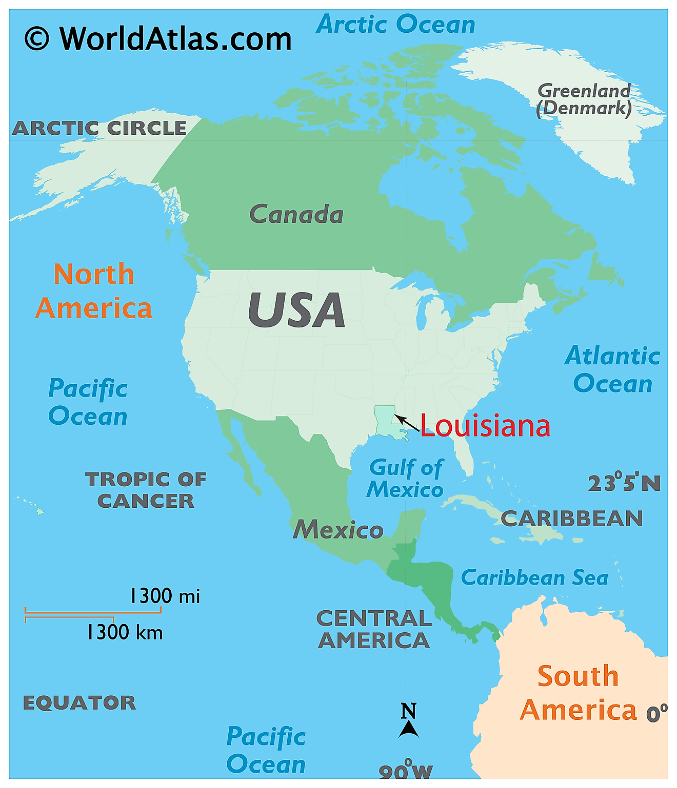
The State of Louisiana is located in the Gulf Coast (Deep South) region of the South-Central United States. Louisiana shares its borders with the State of Texas in the west, with Arkansas in the north, and with Mississippi in the east. It is bounded by the Gulf of Mexico in the south.
Regional Maps: Map of North America
Outline Map of Louisiana
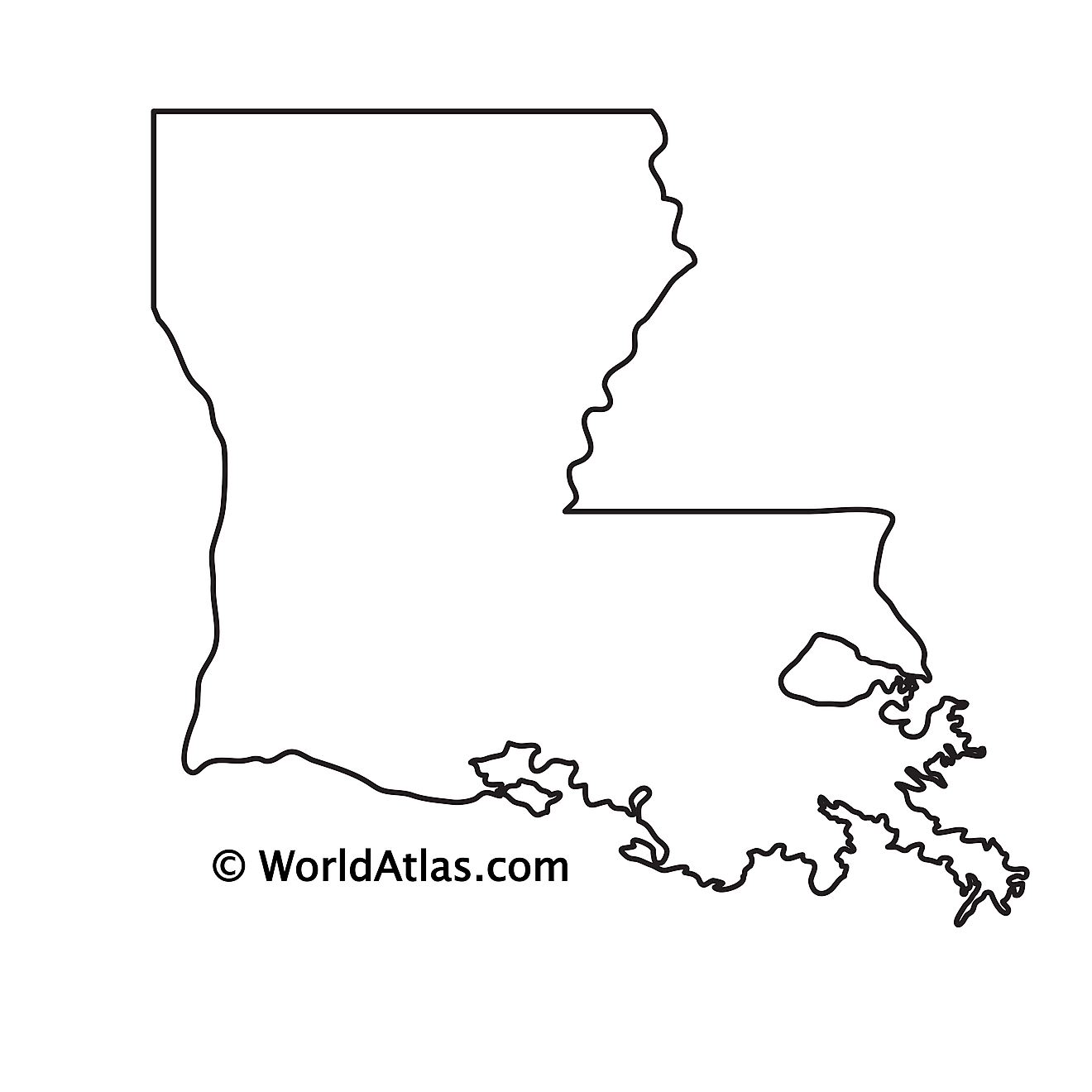
The above blank map represents the State of Louisiana, located in the Gulf Coast (Deep South) region of the South-Central United States. The above map can be downloaded, printed and used for geographic education purposes like map-pointing and coloring activities.
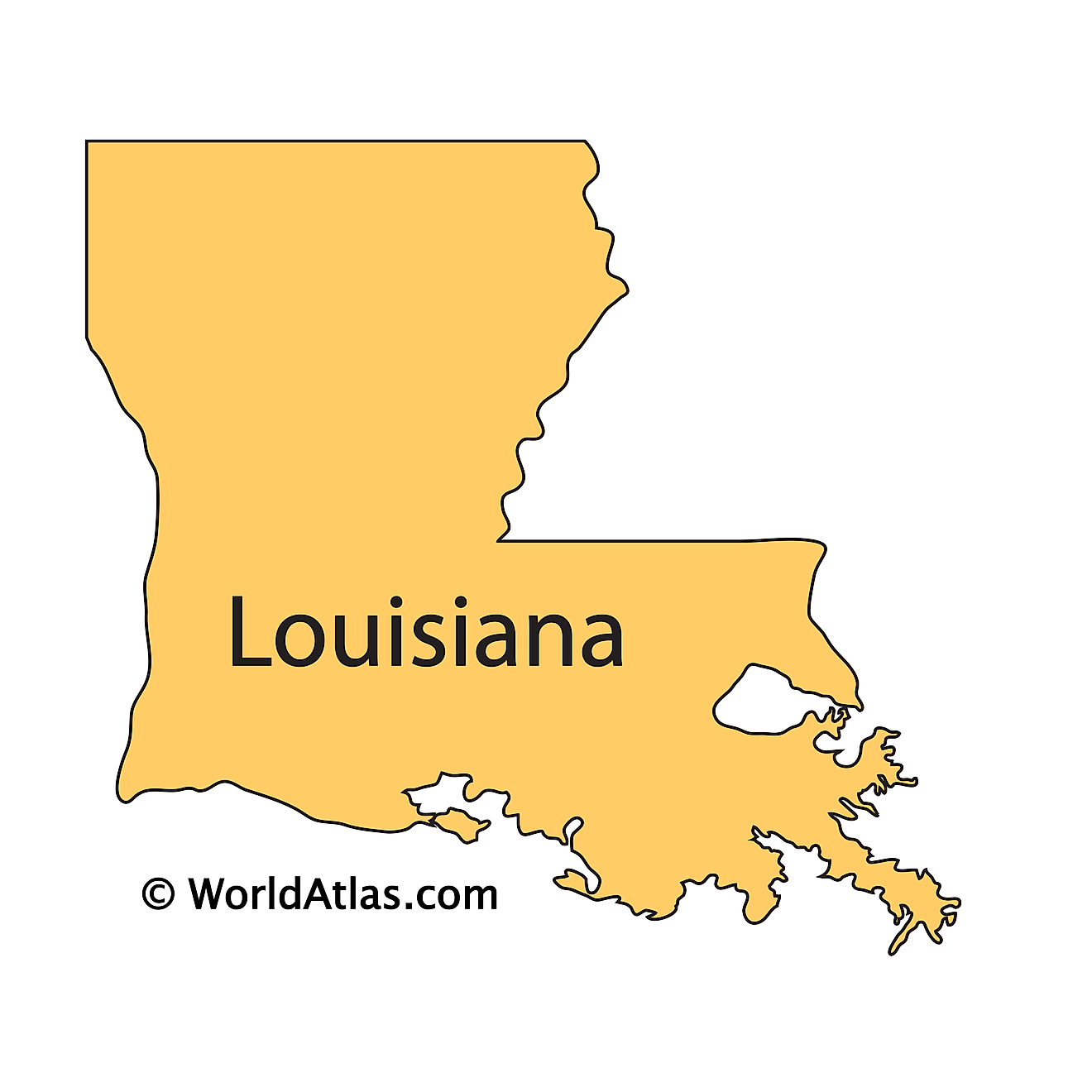
The above outline map represents the State of Louisiana, located in the Gulf Coast (Deep South) region of the South-Central United States.
Key Facts
| Legal Name | State of Louisiana |
|---|---|
| ISO 3166 Code | US-LA |
| Capital City | Baton Rouge |
| Major Cities |
|
This page was last updated on September 22, 2026