The Most Remote Valley In The Lower 48
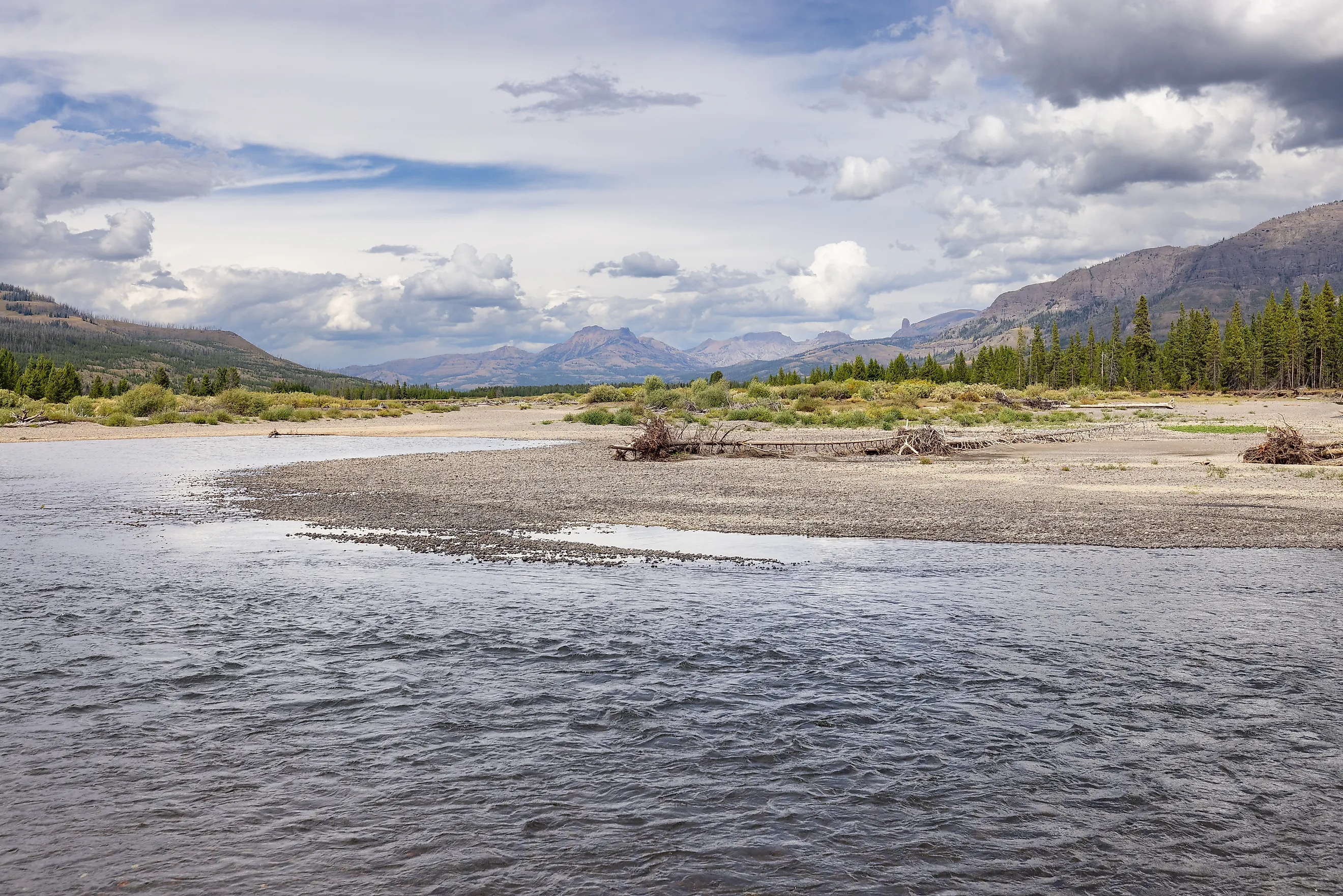
Walk to the middle of this valley, and you are farther from a road than you can get anywhere else inland in the Lower 48. The nearest one is more than 20 miles off in every direction.
The place is the upper Yellowstone River valley in Wyoming's Thorofare, where the river comes out of the Teton Wilderness and into the southeast corner of Yellowstone National Park.
The name is the strange part. The Thorofare was a thoroughfare, a broad valley that American Indians and fur trappers used to cross the southern Absaroka Range, and no road ever followed them in. Getting there still takes days on foot or horseback. The elk that summer on the valley floor make the trip on their own, some of them from winter range near Cody, where the pavement runs out long before the herd's summer ground begins.
Twenty Miles From The Nearest Road

The record comes from a 2007 study in the journal Science, led by U.S. Geological Survey geographer Raymond Watts, that calculated how far every part of the contiguous states lies from its nearest road. The most remote landlocked spot it found was in the southeastern corner of Yellowstone, 20 miles from a road. Only a point on the Louisiana coast lies farther from one. The Center for Land Use Interpretation puts the Thorofare spot at 21.7 miles, a few miles east of where the Continental Divide leaves the park.
A 2003 national analysis gives that distance its scale. It found that 83 percent of the land in the Lower 48 sat within about two-thirds of a mile of a road, and only 3 percent was more than about 3.2 miles away. For most of the country, a road is a short walk from wherever a person happens to be standing. From the bank of Thorofare Creek, the shortest trail to a road is 25 miles long and crosses the Continental Divide on the way.
A Valley Named For The Way Through

The Thorofare got its name as a route. Its broad valley gave American Indians and early trappers easy passage through the southern Absaroka Range, and those travelers followed the trails of bison, elk, and bighorn sheep. In the 1820s and 1830s, fur trappers seeking beaver pelts followed Native American trails up the Thorofare.
Thorofare Creek's valley meets the upper Yellowstone at Hawks Rest, a 9,761-foot mountain just outside the park's southeastern boundary. Explore Big Sky describes it as the farthest peak from a road in the contiguous states. Above the confluence, Thorofare Creek rivals the Yellowstone in size, and fording it is usually manageable by mid-July. Near the park boundary, Bridger Lake sits at about 7,860 feet between The Trident to the east and the Two Ocean Plateau to the west, a 1.5-mile walk off the Thorofare Trail. Atlantic Creek joins the Yellowstone about a mile southwest of Hawks Rest.
A Creek Above The Valley Splits Between Two Oceans

Followed upstream, Atlantic Creek leads southwest to Two Ocean Pass on the Continental Divide. At the pass, North Two Ocean Creek branches into two streams exactly along the divide. One becomes Atlantic Creek and flows northeast toward the Yellowstone. The other becomes Pacific Creek and runs to the Snake River. The mountain man Jim Bridger reported a stream whose waters parted on the divide in 1827, and the split is now a National Natural Landmark called the Parting of the Waters, where a sign gives the distances as 3,488 miles to the Atlantic Ocean and 1,353 miles to the Pacific.
When the meadow at the pass floods in the spring of a wet year, a fish can swim from the Pacific watershed into the Atlantic watershed. Snake River cutthroat trout are believed to have made that crossing about 10,000 years ago, which is likely how they colonized the Yellowstone River and Yellowstone Lake.
Elk Summer On The Valley Floor

Larger animals still use the Thorofare as a passage. In February 2020, Wyoming Game and Fish and researchers from the University of California, Berkeley collared a cow elk in the Meeteetse Rim area, in the Cody region, and tracked her as she moved to summer range in the Thorofare. On May 21, her collar signaled that she had given birth near the confluence of the Yellowstone River and Thorofare Creek.
She was one of thousands. Elk from six to eight populations migrate from far-flung winter ranges around Greater Yellowstone to summer near the core of the park, and some of them, like the Meeteetse cow, calve in the Thorofare. Moose, bighorn sheep, bison, deer, grizzly bears, and gray wolves live in the same country.
Snow And High Water Set The Season

People reach the valley on foot or horseback, and the calendar decides when. From the east, the Eagle Pass Trail climbs 14.9 miles through Shoshone National Forest, from the Eagle Creek Trailhead about 6 miles east of Yellowstone's East Entrance, to Eagle Pass on the park boundary at 9,486 feet. It is not recommended before late July because of snow near the pass, and from there the Mountain Creek Trail continues into the park toward the Thorofare. Down in the valley, Thorofare Creek is usually fordable by mid-July.
The few people who work here keep to the same short season. Rangers stay in the Thorofare Ranger Station cabins only in the summer months. The University of Utah keeps a seismometer on the summit of Hawks Rest, the most remote station it manages, and servicing it takes a few days of horseback riding. Hikers and riders who come in for the remote spot itself number a couple of hundred a year.
Montana's Bob Marshall Comes Closest

Montana's Bob Marshall Wilderness holds the closest rival. Project Remote, a hiking project that set out to reach the most remote spot in each state, measured Wyoming's in the Thorofare at 21.6 miles from a road and Montana's, in the Bob Marshall, at 18 miles. Florida's, on an island in the Everglades, is the most remote place in the eastern United States at 17 miles.
Airplanes once served the middle of the Bob Marshall. Big Prairie Ranger Station sits on the west bank of the South Fork of the Flathead River, squarely in the middle of the wilderness, and in 1928 the Forest Service built an airstrip there. Pack strings and airplanes supplied the station until the 1964 Wilderness Act forced airstrips in wilderness areas to close, and Big Prairie still serves as a wilderness outpost. The road to the Meadow Creek Trailhead, a major entry point to the South Fork, ends 67 miles south of Hungry Horse.
The Thorofare's calendar shows who gets into the valley first. Elk do. The Meeteetse cow walked in from the Cody region and calved near the mouth of Thorofare Creek on May 21. For people, the valley opens later. Thorofare Creek is usually fordable by mid-July, and the Eagle Pass Trail is not recommended before late July, so the easiest weeks for travel begin when a calf born in late May is close to two months old. The route the trappers used never became a road. Even in midsummer, the nearest one is more than 20 miles from the cabins at the Thorofare Ranger Station, and the shortest trail out runs 25 miles over the Continental Divide.