This Michigan Scenic Byway Is The Peaceful Road Trip You Need
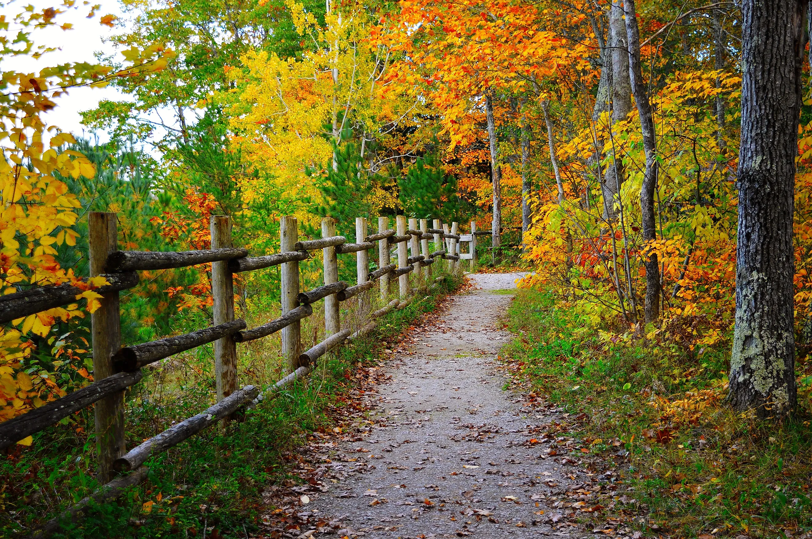
Michigan's River Road Scenic Byway offers travelers a 22-mile journey through one of the state's most memorable natural corridors. Visitors drive through an area that showcases northern Michigan's landscape while accessing numerous recreational opportunities and historical sites. The byway changes with each season, presenting spring wildflowers, summer shade under thick foliage, brilliant autumn colors, and quiet winter scenes that attract people from all over the state and surrounding regions. Five particular stops along this route stand out as photo spots for anyone seeking a road trip they will remember for years.
Foote Dam

Foote Dam lies along the eastern half of the byway, providing visitors with a clear view of the Au Sable River's power. The dam backs up the river to create Foote Dam Pond, where tourists observe waterfowl, including common loons and mergansers, diving for fish in the calm waters. Visitors can explore the public access areas around the dam, listening to the rush of water as it moves through the hydroelectric turbines that generate power for the region. Nearby overlooks and day-use areas provide picnic tables and interpretive signs that describe the river, Foote Dam Pond, and the area's hydroelectric history. Anglers cast lines from the banks and fishing areas below the dam, targeting bass that congregate in the turbulent waters, while photographers capture images of the spillway during high-water periods when excess flow cascades over the structure.
Lumberman's Monument

Lumberman's Monument is approximately 15 miles from the byway's eastern end. It's a bronze statue depicting three figures that honor Michigan's logging heritage. The monument sits on a high bluff that provides views of the Au Sable River Valley, where tourists can observe the river winding through dense forest below. Visitors can stop by the adjacent interpretive center, which houses exhibits explaining the dangerous work of 19th-century loggers who harvested the region's white pine forests. The center brings history to life through photographs, artifacts, and detailed displays that illustrate how lumberjacks lived, worked, and shaped Michigan's economy. Tourists then descend a staircase that leads down the bluff to Cooke Dam Pond, where they can relax by the shoreline, launch a kayak, or simply enjoy a picnic near the water. The well-maintained grounds include restroom facilities.
Canoers Memorial

Canoer's Memorial is a short drive from the last stop. It is a great place to understand the Au Sable River's reputation as one of the Midwest's premier paddling destinations through a sculpture that celebrates the sport's enthusiasts. It stands as a tribute to the athletes who have competed in the annual Au Sable River Canoe Marathon. The inaugural race took place in September 1947, with competitors navigating the course in traditional wood and canvas canoes that tested both their physical stamina and watercraft handling skills. This event has since evolved into a prestigious race that draws accomplished paddlers from across the continent. The monument is situated at a popular river access point, where tourists watch canoeists and kayakers launch into the current during the summer months. Visitors who arrive without watercraft can rent canoes or kayaks from nearby outfitters and experience the river firsthand, floating past tall banks and through tunnels of overhanging cedars.
Iargo Springs

Iargo Springs is the next stop as you head westward and presents visitors with a series of natural springs that bubble up and flow toward the Au Sable River below. Tourists descend wooden steps built into the hillside, passing through a stand of mature trees that provides shade and quiet during the journey downward. The name “Iargo” is commonly described as coming from a Chippewa word meaning “many waters,” and the springs have long been used as a drinking water source by Native Americans and early settlers. Visitors read interpretive signs along the stairway that explain the geological forces responsible for creating these springs and the historical significance they held for people who lived and worked in the area. The observation deck at the base allows tourists to watch clear spring water emerge from the ground before cascading toward the river, creating an atmosphere that invites reflection and photography. A boardwalk and accessible overlook near the parking area enable visitors with mobility challenges to experience the setting without having to descend the steep staircase.
Rollways Campground

The final stop is the Rollways Campground, situated on a bluff overlooking Loud Pond, offering visitors rustic camping facilities and historical architecture. The site includes the Rollways Picnic Shelter, one of the region's remaining log structures constructed by the Civilian Conservation Corps during the 1930s. This building displays Depression-era craftsmanship through its heavy timber construction and two stone fireplaces. The shelter's practical design makes it a comfortable spot for picnics, while its historical significance adds character to any gathering. Groups and families frequently use the building for get-togethers or simply pause here to admire this architectural landmark. The campground typically operates as a seasonal facility, generally open from spring through early fall, so travelers planning winter trips should confirm current opening dates before expecting to camp here.
A Destination and a Gateway

Each recommended stop on Michigan's River Road Scenic Byway offers distinct attractions at convenient intervals, allowing travelers to pace their journey while experiencing the region's diverse ecology, numerous recreational opportunities, and rich cultural history. Visitors discover that moving sequentially from east to west provides a natural progression to the day, with early stops offering active exploration and later stops presenting more relaxed experiences. The route serves as both a destination and a gateway to the broader Huron National Forest, where recreation continues in every season, from summer paddling to winter cross-country skiing. Many travelers find themselves returning to follow the byway again, exploring new trailheads and viewpoints during future trips to Michigan's northern wilderness.