The State Parks That Feel Like National Parks
Often lesser known and underappreciated, many state parks can actually rival the national parks in scale, scenery, wildlife, and geological significance. California's Humboldt Redwoods State Park, for example, protects vast old-growth forests that often see fewer crowds than Sequoia, while Utah's Dead Horse Point State Park overlooks the deeply carved Colorado River canyons near Canyonlands and Arches. And in terms of sheer size, Alaska's Wood-Tikchik State Park encompasses more than 1.6 million acres of remote wilderness that you can seemingly spend forever exploring. While these preserves lack federal status, their wonderful landscapes and plethora of recreational opportunities should not be overlooked, especially for any national park fanatics looking for something new this year.
Humboldt Redwoods State Park, California

Humboldt Redwoods State Park covers a sizable 53,000 acres in Northern California, making it the state's third-largest state park. Its size, ancient forests, extensive trail network, and towering trees give it the same sense of wilderness associated with a number of California's more famous national parks.
Established in 1921 after conservationists began acquiring threatened redwood groves, the park expanded substantially through purchases supported by Save the Redwoods League. Its defining feature now is the approximately 17,000 acres of old-growth coast redwood forest, including Rockefeller Forest, the largest contiguous old-growth redwood forest remaining in the world.
Some local coast redwoods here even rise more than 300 feet above the forest floor! To best see them, take the nearly 32-mile Avenue of the Giants highway, which provides the park's most recognizable route through these enormous trees. If you prefer to travel on foot, more than 100 miles of trails also extend into the groves, along the Eel River, and through the Bull Creek watershed. With that, Founders Grove is another worthwhile attraction, with a short nature trail passing some of the park's largest and oldest tree specimens.
Wood-Tikchik State Park, Alaska

If size alone implies what should and shouldn't be a national park, then Wood-Tikchik State Park flips the narrative on its head. Spanning around 1.6 million acres in western Alaska, it is by far the largest state park in the United States by area. Its vast wilderness also contains more than 40 lakes, numerous rivers, alpine ridges, wetlands, and swathes of tundra and boreal forest. Largely roadless as well, access is centered on air, watercraft, and backcountry trails, an aspect that only adds to its remote feel.
Because urban development here is extremely limited, keep in mind that large portions of Wood-Tikchik remain accessible only by boat or bush plane, with no real road network connecting its lakes and valleys.
Wood-Tikchik and Tikchik lakes form the core of its interconnected freshwater system, which supports sockeye salmon, Arctic char, lake trout, and other fish. The surrounding mountains further provide habitat for brown bears, caribou, moose, wolves, and bald eagles, of which nature photographers consistently try to catch a glimpse.
Several of the rivers ultimately drain toward Bristol Bay, linking the park's ecosystems to one of the world's most productive wild salmon fisheries. The area also has a longstanding history of use by Yup'ik communities, whose traditional activities include fishing, hunting, and gathering.
Dead Horse Point State Park, Utah

Dead Horse Point State Park occupies a high plateau overlooking a dramatic bend of the Colorado River in southeastern Utah. Started in 1959, the park's immense canyon vistas make you question why it hasn't gotten national status despite its smaller footprint.
The local centerpiece is none other than Dead Horse Point, a narrow peninsula that rises about 2,000 feet above the river and provides sweeping views across the canyon country surrounding Canyonlands National Park. Also located near Arches National Park, this is a wonderland for geology fans. Layers of sedimentary rock, including the prominent Wingate Sandstone cliffs, record millions of years of natural history. Furthermore, the Colorado River has carved a web of deep, little-visited canyons below, with erosion gradually shaping the mesa and buttes visible from the park's iconic overlooks.
A paved road leads to the main viewpoint, and the Intrepid Trail System provides roughly 16 miles of trails for hiking and mountain biking along the plateau's edge. Dead Horse Point State Park also contains a designated International Dark Sky Park, with exceptionally clear views of the night sky because of its remote location and limited artificial light.
Custer State Park, South Dakota

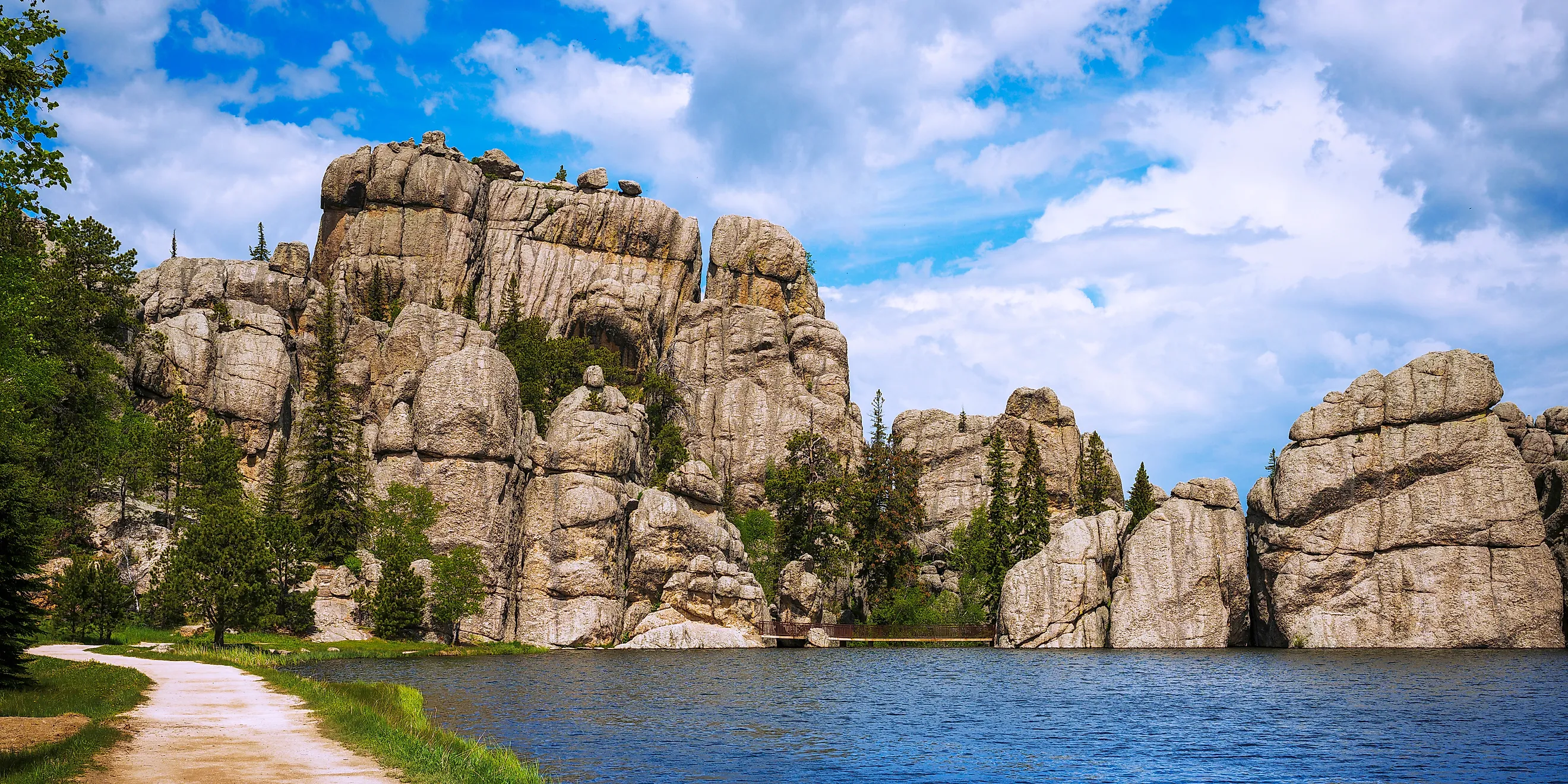
Custer State Park encompasses a massive 71,000 acres in the Black Hills of South Dakota, placing it among the largest state parks in all of the United States. It includes a surprisingly diverse mix of eye-catching granite peaks, narrow canyons, forest-blanketed hills, prairie, and several mountain lakes, creating scenery more commonly associated with national parks found further west.
This parkland is particularly known for its large free-roaming bison herd, which numbers around 1,300 animals and is managed through an annual roundup. Wildlife viewing can also include pronghorn, elk, bighorn sheep, mountain goats, and wild burros.
For a pleasant little drive, the Needles Highway cuts through Custer for 14 miles, passing distinctive granite formations and the famous Needles Eye. Wildlife Loop Road then provides another 18-mile route through the park's grasslands and hills. Be sure to also drop by Sylvan Lake, which sits among a backdrop of towering rock formations at an elevation of about 6,000 feet.
Palo Duro Canyon State Park, Texas

Palo Duro Canyon State Park occupies more than 28,000 acres at the southern end of the Texas Panhandle just south of Amarillo, where the canyon stretches for roughly 120 miles beyond the park boundary. Often called the "Grand Canyon of Texas," Palo Duro reaches depths of about 800 feet and widths of up to 20 miles, forming the second-largest canyon in the United States, in fact.
Its multicolored walls expose layers of sedimentary rock deposited over millions of years, boasting distinctive red and orange formations shaped by erosion from the Prairie Dog Town Fork of the Red River. The terrain is accessible through an extensive network of hiking, biking, and horseback-riding trails that tend to descend downward. One recommendation is the Lighthouse Trail, which leads to the park's most recognizable landmark (the "Lighthouse" rock), while the 16-mile Palo Duro Canyon Loop Drive dips from the rim into the canyon itself.
Watch out for fauna that call the state park home, too, including wild turkeys, mule deer, bobcats, coyotes, and numerous bird species. The canyon also contains exposed fossil-bearing rock layers, and its lower strata date to the Permian period, when much of the region was covered by an inland sea.
Niagara Falls State Park, New York

Niagara Falls State Park protects the American side of Niagara Falls along the Niagara River. Given the fact that it contains one of the world's most recognizable cascades, it comes as a surprise to many that it is not indeed a national park, but run by the state of New York instead.
Established in 1885, it is widely recognized as the oldest state park in the country, containing the American Falls and Bridal Veil Falls, while Horseshoe Falls lies right across the border in Canada. But its geological history extends far beyond the park's 1885 designation, with the gorge recording thousands of years of erosion since the last Ice Age.
Get around via a network of walking paths and overlooks, many of which provide access to several must-see viewpoints and attractions such as Cave of the Winds, bringing you close to the base of the falls. Stroll over to Goat Island, too, a spot that divides the American Falls from Horseshoe Falls and contains several more of the park's principal lookouts.
You'll likely notice that the Niagara River continues to erode the bedrock at the falls, causing the cataracts to gradually migrate upstream, although modern engineering has substantially slowed that process. The park also hosts a part of the Niagara Gorge, where the river has cut through more layers of sedimentary rock left behind by ancient seas and glacial activity.
Appreciate the Wonders These State-Run Parks Have to Offer
State park status should say little about how much you might enjoy a protected landscape. From immense redwood forests and lofty desert canyons to vast Alaskan wilderness and wildlife-rich Black Hills terrain, the above-mentioned places are just a few that oversee nationally significant natural and historical features. Have you been to any of our recommendations? If not, a visit could open your eyes to a sea of new outdoor destinations beyond the federal system.