The Deepest River In The United States
The Hudson River is the deepest river in the United States, reaching 216 feet in New York's Hudson Highlands. New York State places that maximum between West Point and Constitution Island, where the river passes through a narrow, rocky corridor. Glacial ice carved deeply into the valley during the last ice age, and rising seas later flooded the lower Hudson, creating the tidal river found there today. A 2024 peer-reviewed hydrology study also identifies the Hudson as the deepest river in the country. One measurement complicates the record: USGS reports water up to 300 feet deep in the Columbia near The Dalles, Oregon. That section has been heavily changed by dams and impoundment, while the Hudson's 216-foot figure describes its natural river channel. Other major US rivers reach impressive depths of their own, including more than 200 feet on the Mississippi.
Hudson River, New York

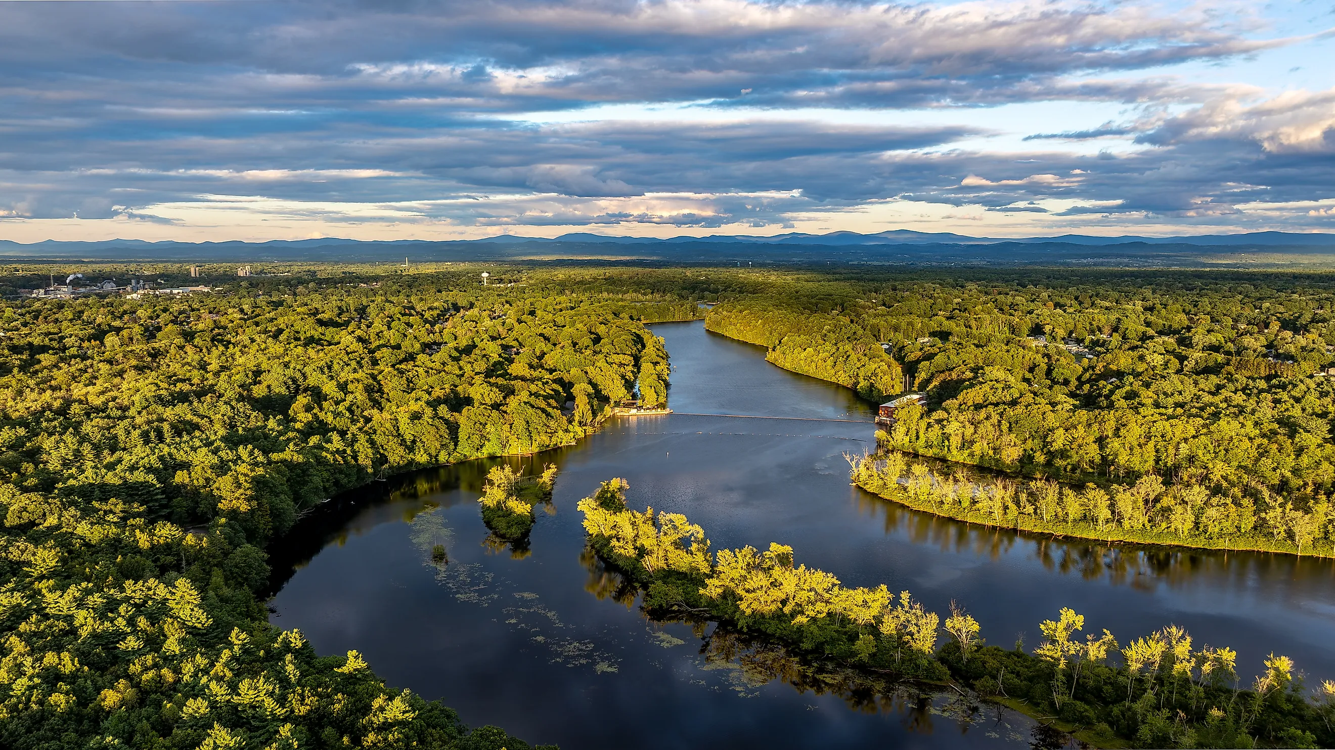
New York State records the Hudson's maximum depth at 216 feet between West Point and Constitution Island. The deepest water lies around World's End in the Hudson Highlands, where the river squeezes between steep slopes before opening into broader reaches farther south. Storm King Mountain rises west of the water, with Breakneck Ridge on the opposite side of the river.
Ice helped shape this channel roughly 20,000 years ago. Glaciers moved through the Highlands and cut into the existing valley and its resistant bedrock. The flooded lower valley later became a tidal estuary as sea levels rose. Ocean tides now travel about 150 miles upriver to the Federal Dam at Troy.
That leaves an unusual scene around West Point. Mountains crowd the shoreline while the riverbed drops more than 200 feet below the surface. New York's Natural Resource Damage Assessment gives 216 feet as the Hudson's maximum, and a 2024 paper in the Journal of Geophysical Research uses approximately 65 meters for the Hudson while identifying it as the deepest U.S. river.
Columbia River, Oregon and Washington

The Columbia River carries an even larger published number near The Dalles, Oregon. A U.S. Geological Survey basin report records depths of up to 300 feet there. The river crosses thick Columbia River basalt in this part of Oregon, and old federal surveys describe water forced through exceptionally narrow rock channels. Before the current dam system existed, a 1932 USGS investigation measured 165 feet at Fivemile Rapid. Historical accounts of The Dalles describe passages only a few hundred feet wide carrying the enormous flow of the Columbia through volcanic rock.
The present river around The Dalles has changed substantially. The Dalles Dam began operating in the 1950s, impounding water upstream, and USGS describes the reach as regulated by numerous large dams. The 300-foot measurement is valid, but it comes from this altered setting. Beneath the water, deep basalt depressions confirm that the underlying rock channel itself is heavily incised. The Columbia therefore belongs in any discussion of extreme U.S. river depths, with the dam-altered nature of its 300-foot measurement stated alongside the number.
Mississippi River, Louisiana

The Mississippi exceeds 200 feet at New Orleans. A federal U.S. Geological Survey bulletin recorded depths of 80 to 208 feet in the city, putting its deepest measured water only eight feet short of the Hudson's maximum. By Louisiana, the river is carrying runoff and sediment collected across a drainage basin of roughly 1.2 million square miles. Sharp bends help create deep pools as fast current scours parts of the bed. One of those bends curls around Algiers Point opposite the French Quarter, inside a reach surveyed closely for commercial navigation. The river here has little in common with the shallow water near its Minnesota headwaters. Beneath ships and ferries crossing the New Orleans waterfront, the deepest federal sounding places the bottom more than 20 stories below the surface.
Potomac River, Maryland

The Potomac River reaches 107 feet near Morgantown, Maryland, according to a U.S. Geological Survey profile of the basin. This deep water sits downstream of Washington, D.C., in the tidal Potomac as the river broadens on its approach to Chesapeake Bay. USGS also records a maintained navigation channel roughly 24 feet deep through much of this lower reach, far shallower than the riverbed at its deepest point.
Great Falls presents a very different stretch of the same river. Upstream of Washington, water rushes through rock ledges inside a gorge with cliffs rising high above the channel. The height of that gorge sometimes creates confusion about the river's depth, but the deepest documented water occurs well downstream near Morgantown. There the Potomac has traded the confined whitewater corridor for a broad tidal channel. Its 107-foot pocket lies below a surface that can appear almost bay-like as the river nears the Chesapeake.
Yukon River, Alaska
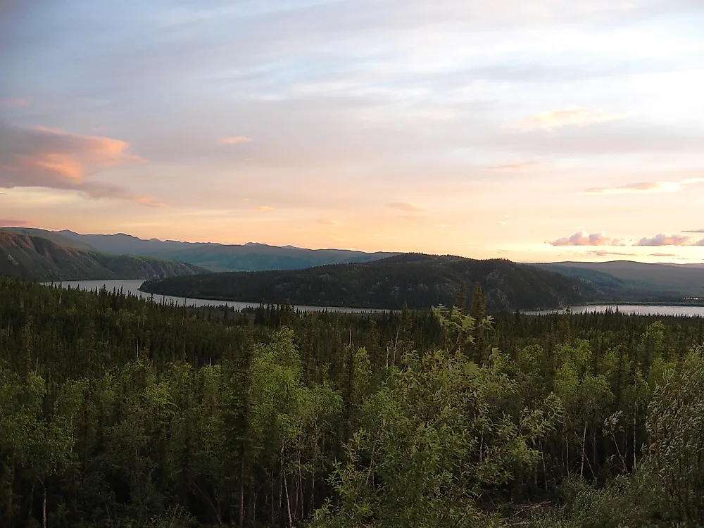
Alaska's Yukon River reaches at least 80 feet at the Alaska Department of Fish and Game's sonar station near Pilot Station, about 123 river miles upstream from its mouth. The agency measures the river at 3,280 feet wide between its two sonar stations, with the deepest point about 650 feet from the right bank. The bottom drops sharply on that side, while a gentler slope leads toward the left bank. These dimensions matter to fisheries biologists because nearly all salmon moving up the lower Yukon pass through this single-channel reach. Sonar equipment tracks those migrations through water loaded with silt, debris, and shifting sediment. The 80-foot measurement does not approach the Hudson or lower Mississippi, but it comes from a broad, free-flowing Alaskan river whose channel remains active enough that crews regularly adjust their equipment as the riverbed moves.
The Hudson Holds The Standard U.S. Record

River depth is less tidy than a lake's maximum sounding. Water level changes, scour reshapes the bed, and dams can add hundreds of feet of water to an existing channel. The Hudson's 216-foot measurement avoids much of that ambiguity and has support from New York State records and modern hydrology research. The Columbia's 300-foot reading remains an important measured depth, but its dam-regulated setting puts it in a different category. The Mississippi reaches 208 feet at New Orleans, while the Potomac and Yukon show how deep pockets can form in rivers with completely different landscapes and flow patterns. In the Hudson Highlands, glacial erosion left the country's standard river-depth record beneath a narrow stretch of water between West Point and Constitution Island.