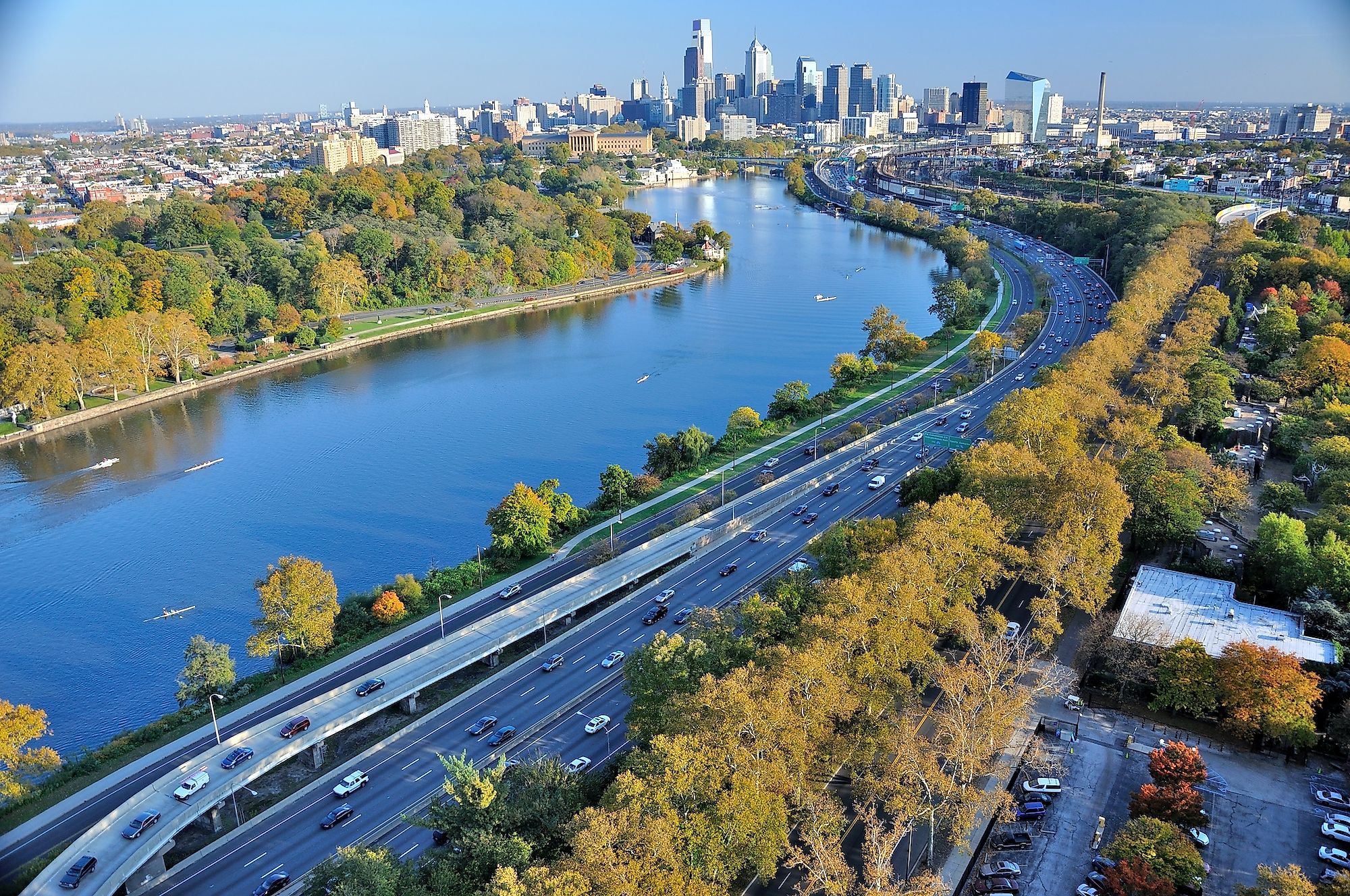
Schuylkill River
Schuylkill River is a 217km long river that flows from the northwest to southeast direction in the eastern portion of the US state of Pennsylvania. The Schuylkill River finally drains into the Delaware River as one of its significant tributaries at the city of Philadelphia. The Schuylkill River flows entirely within Pennsylvania, and as per the Pennsylvania Scenic Rivers Act, the main stem of the Schuylkill River has been designated as a “Pennsylvania Scenic River.” Some of the major communities located along the banks of the Schuylkill River include Conshohocken, Lower Merion, Norristown, Pottsville, Pottstown, Philadelphia, Phoenixville, and Reading.
Course Of The Schuylkill River

The East Branch Schuylkill River rises in an anthracite-coal region close to the town of Tuscarora, in the eastern part of Schuylkill County. The West Branch Schuylkill River rises close to the borough of Minersville in the central part of Schuylkill County. The West Branch Schuylkill River flows southeast through many water gaps in the Ridge-and-Valley Appalachians. The West Branch Schuylkill River meets the East Branch Schuylkill River at the borough of Schuylkill Haven in the southern part of Schuylkill County. The Schuylkill River then combines with the Little Schuylkill River while flowing downstream through a gap in the Blue Mountain at the borough of Port Clinton. Some of the other significant tributaries of the Schuylkill River include French Creek, Maiden Creek, Manatawny Creek, Perkiomen Creek, Tulpehocken Creek, and Wissahickon Creek. The Schuylkill River continues in the southeast direction and finally drains into the Delaware River at the Philadelphia Naval Business Center.
The Schuylkill River’s watershed drains portions of the western side of the Broad Ridge in the Ridge-and-valley Appalachian Mountains in the south-central part of the Coal Regions in the State of Pennsylvania. The Schuylkill River drains an area of 5,180 sq. km and discharges an average of 81.4 cubic meters of water per second. The Schuylkill River Watershed drains five counties: Berks, Chester, Montgomery, Philadelphia, and Schuylkill, and is the most densely-populated region in Pennsylvania, with approximately one-third of the state’s population living within its boundaries.
Recreational Facilities

The Schuylkill River offers several recreational activities for its visitors. The Schuylkill River supports many fishes, including American shad, catfish, trout, smallmouth bass, striped bass, etc. The river is a popular destination for rowing, dragon boating, paddling, water skiing, swimming, and other water sports. The annual Dad Vail Regatta rowing competition is held on the Schuylkill River in addition to two major dragon boat regattas that are held twice a year in June and October. The Schuylkill River Trail is a long multi-use path that runs along the banks of the Schuylkill River and is used for several recreational activities such as rollerblading, bicycling, running, walking, etc.
Brief History

It is believed that the indigenous Leni Lenape people initially inhabited the area along the banks of the Schuylkill River. The Lenape people called the river by various names such as Ganshowahanna, Tool-pay Hanna, Tool-pay Hok Ing, Manayunk, etc. The early European explorers came to the region from various countries like England, Sweden, and the Netherlands. The Swedish explorers referred to the river as “Menejackse kill.” In due course, Arendt Corssen, a Dutch West India Company agent, named the river “Schuylkill,” which referred to its confluence with the Delaware River at the League Island, which was nearly hidden by dense vegetation.

The powerful Susquehannock confederation claimed the area along the banks of the Schuylkill River as a hunting ground. The area’s earliest settlers were mainly farmers who utilized the Schuylkill River to transport crops to the downstream Philadelphia market. A network of interconnecting locks and dams was opened in 1824 to facilitate transport via the Schuylkill Navigation System. The Schuylkill River has been on fire many times. In 1892, oil leaked into the Schuylkill River from Point Breeze Philadelphia and caught fire from a match carelessly tossed into the river. After the discovery of coal in the river’s northern headwaters and the development of railroads in the Schuylkill River Valley, many new Anthracite iron and mining industries were established along the river banks. However, this rapid industrial growth led to the deterioration of the water quality of the Schuylkill River. The channels were choked with sediments that built up behind the dams and clogged the canals. The river was also heavily silted with coal dust and silt from the industries, which often led to fires on different parts of the river. It was estimated that by the beginning of the 20th century, more than 3 million tons of silt had been discharged into the Schuylkill River annually from the upstream coal industries. Efforts for improving the water quality of the Schuylkill River began in the 1940s, with the Desilting Act passed in 1945. The Desilting Act helped excavate 23 impounding basins along the river to receive the dredged silt. A massive cleanup exercise was also led by the then State Governor James Henderson Duff in 1948. Over the years, due to all these cleanup efforts, the quality of the Schuylkill River has significantly improved.


