Alapaha River
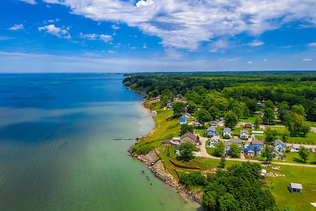
The Alapaha River is 325 km long river, flowing through southern Georgia into northern Florida. It is a tributary of the Suwannee River, whose mouth is at the Gulf of Mexico. Valdosta, Georgia, is the nearest and most prominent town along the river, with a population of about 56,400 people.The Alapaha River is part of the Suwannee River Basin, a region covering 9,950 square miles, including 5,720 square miles in Georgia and 4,230 square miles in Florida. The Alapaha River Watershed is an area covering 1,840 square miles, including 1,726 square miles in Georgia and 114 square miles in Florida. The navigable areas of the river are popular for recreation, including hiking and cycling along the trails near the water. With multiple areas of rapids, the Alapaha is a popular river for kayakers. The Alapaha River Water Trail contains Class 1 rapids and river sinks—areas where the water runs underground. The Alapaha River Water Trail is just over 207 km long, stretching from the Suwannee River to US 82, and includes an area of the watershed with many streams, lakes, and swamps.
Course Of The Alapaha River

The Alapaha River begins at its source in Dooly County and ends at its confluence with the Suwannee River in Hamilton County, Florida. The river flows through Georgia to Florida in a largely southeast direction. It flows into the Suwannee River about 10 miles north of Jasper. Water levels in the upper and middle areas of the river fluctuate significantly throughout the year and from year to year. The river may be navigable by boat or canoe only for a few months, or even weeks in some areas, in some years. Historically, the highest water levels have been recorded from January to the end of April. As the river widens into an area of lakes, it becomes boatable most months of the year.
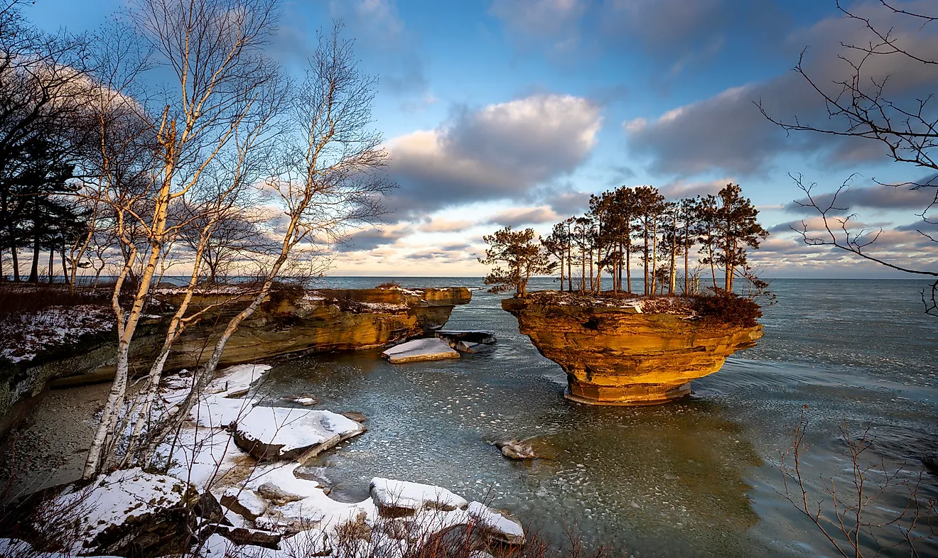
In the area of the Alapaha River Wildlife Management Area (WMA), the river slows and widens into a series of lakes that are connected by floodplains and forests. About 20,000 to 25,000 years ago, during a period of glaciation in the Pleistocene epoch, the area was a dry riverbed. Westerly winds blew across it, amassing quartz sand, which now forms the sandhills that characterize the Alapaha River WMA. The tallest is known as Sand Mountain. As it reaches Willacoochee, Georgia, the Willacoochee River flows into the Alapaha. Later along in Florida, the Alapahoochee River and the short Little Alapaha River add to its flow as it turns southwestward. For its last 29 km or so, the Alapaha is an intermittent river. Just under half a kilometer from Jennings Bluff Launch in Hamilton County, the river disappears into a sinkhole known as the Alapaha Sink—except during periods of very high water flow. At lower water levels, the entire river sinks underground and flows through a system of caves within the Suwannee limestone. Underground, it becomes part of the Floridan aquifer groundwater. About 32 km away, it re-emerges at a place called the Alapaha Rise. The Alapaha Rise Spring, the largest spring in the US, is thought to be a part of the river's flow that diverts underground. It reaches the Suwannee River about half km upstream of the confluence of the rest of the Alapaha River.
The odd-seeming behavior of the Alapaha River is largely caused by a geographical feature called the Cody Scarp or Cody Escarpment, specifically under an area called the Ocala Platform. The Cody Scarp extends through north and north central Florida, a rock feature with a slight slope of 5% to 12% that was formed during the Pleistocene period. It is a karst-type landscape, where the underlying limestone and other rock provide porous drainage and passage for underground streams.The slope causes the river to run underground and occasionally run dry as it is forced to flow uphill.
Climate Of Alapaha River
The climate of the region the river flows through is humid and hot during the summer, with mild winters. Average temperatures typically range from just under 50°F in January-February to 80°F in July and August. During spring and fall, rainfall averages about 4-inches per month. The wettest months of the year are June to August, averaging over 5-inches of rain. Average precipitation ranges from 40 to 55 inches per year. The driest period of the year is October (2-inches) to December (over 2 and 1/2 inches). The most precipitation falls typically falls between February and April. Record highs of more than 23 feet were recorded on April 4, 2014, at Alapaha, Georgia, and more than 30 feet on April 6, 2014, at Statenville, Georgia. During periods of low water flow, the riverbed dries up where it goes underground, leaving a sandy path with some water cover. During periods of higher water flow, only part of the river goes underground, leaving the rest to run into the Suwannee.
Ecology Of Alapaha River
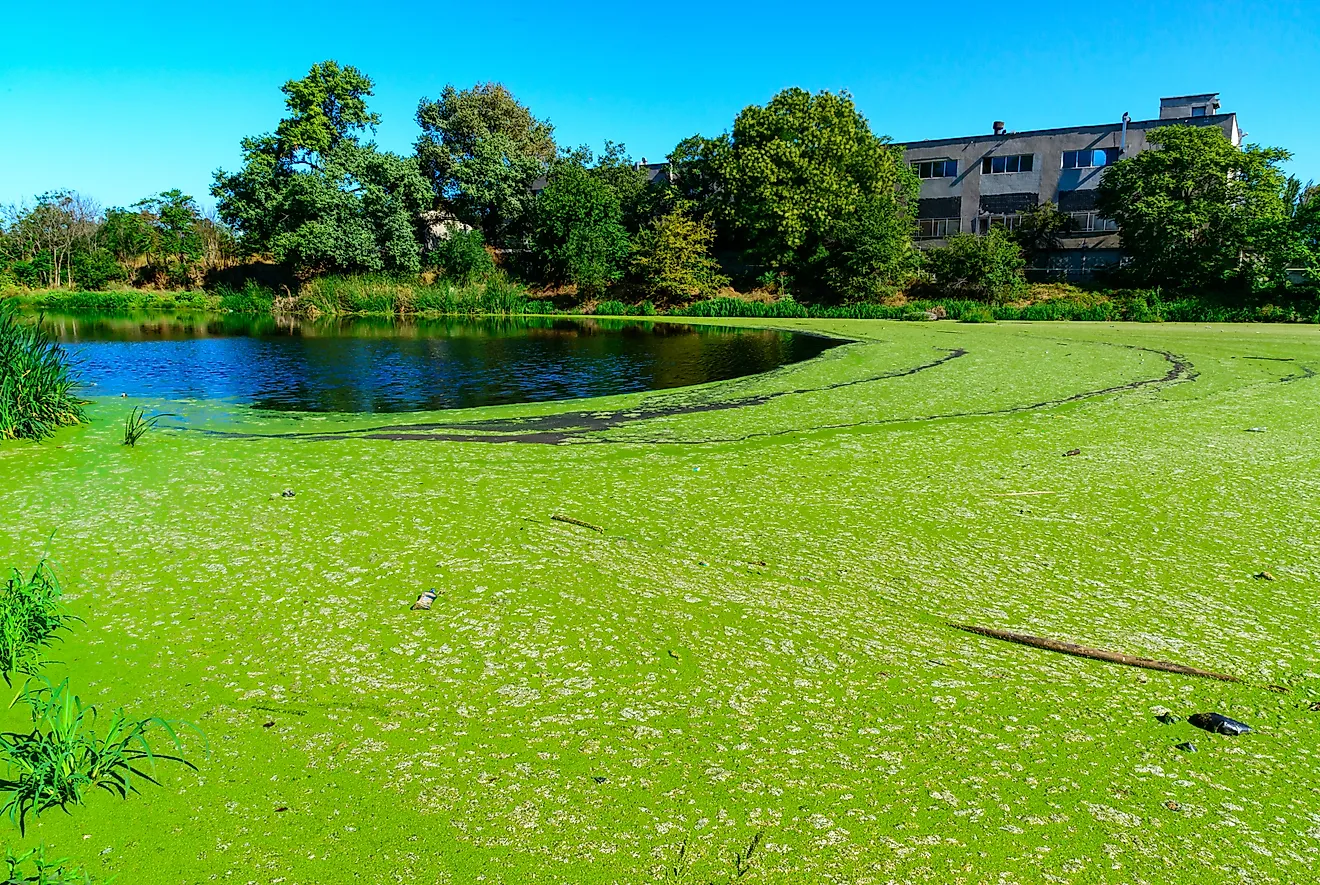
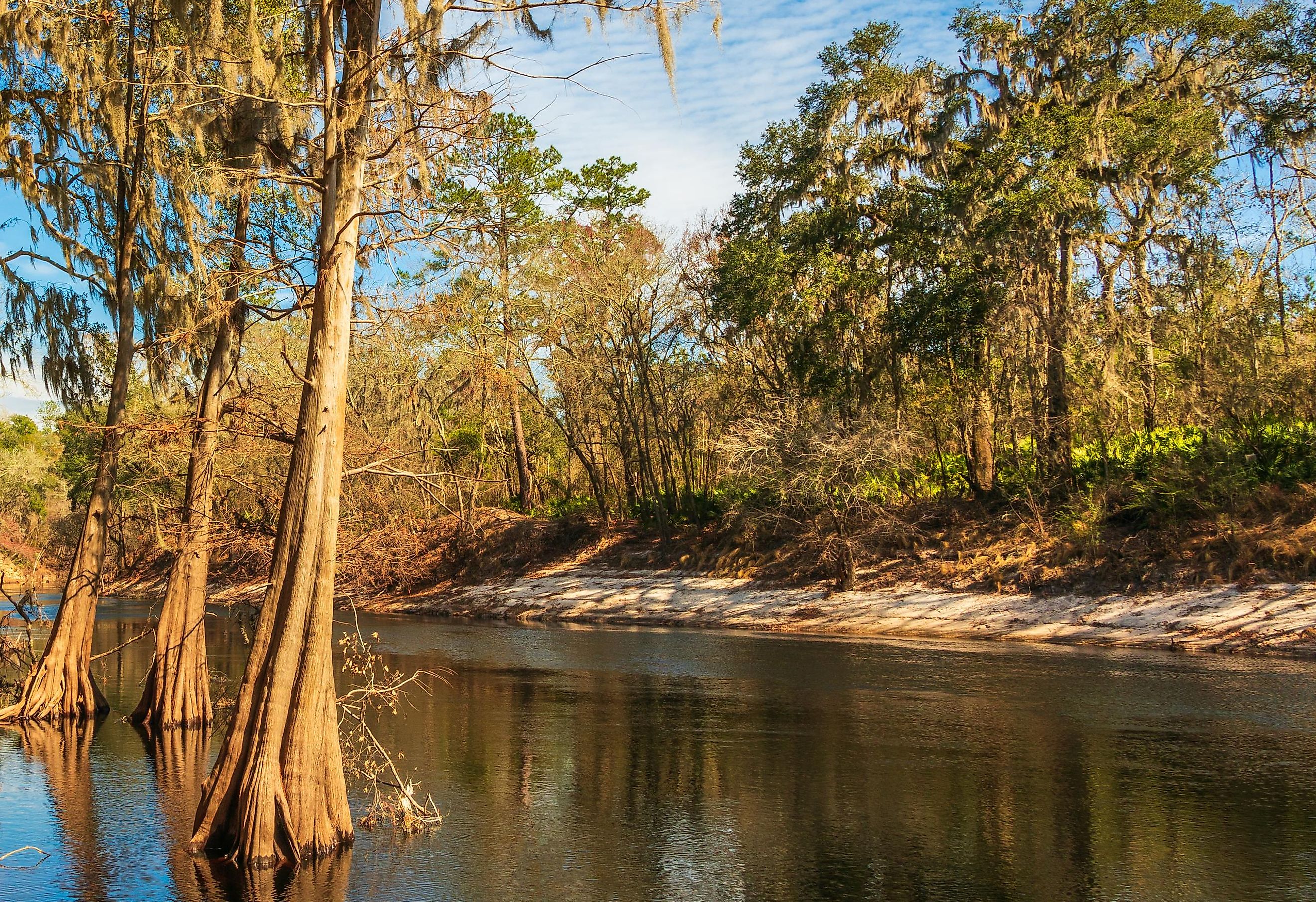
The waters of both the Alapaha and Alapahoochee, one of its tributaries, are the color of tea or tannin, and named as blackwater rivers. The color is the result of the many plants that decay in the water as it runs through marshes and lakes. Cypress and pine trees are common along the banks of the river, as well as the lakes, streams, and other connected bodies of water in the Alapaha River Watershed. Other trees include the bald cypress, longleaf, and slash pines, along with oak trees. In the eastern part of the WMA, where the soil thins out into wetland, the ground cover includes Pine Flatwoods, palmetto, and gallberry.
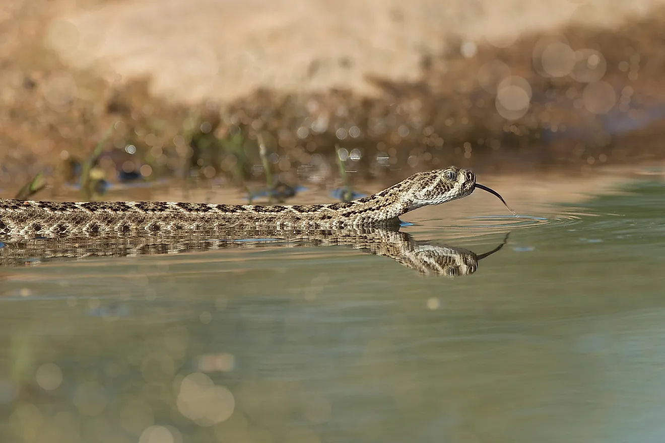
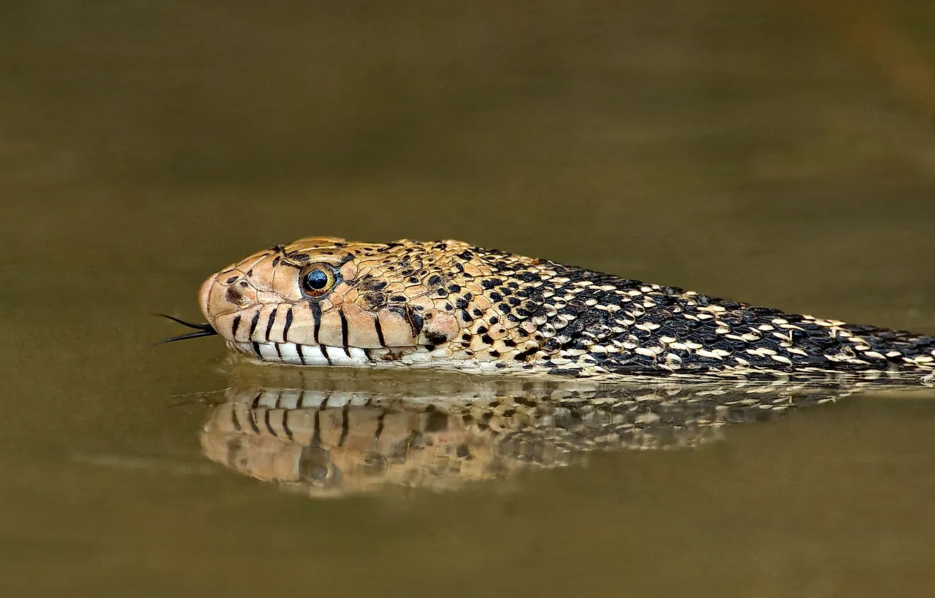
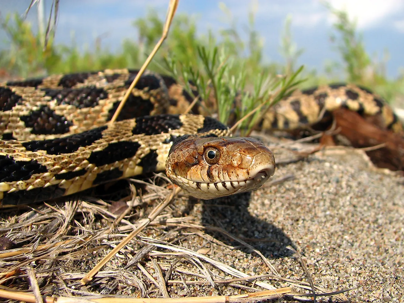
The Alapaha River Wildlife Management Area (WMA) stretches over 6,870 acres of state-owned land in Georgia. The landscape of the WMA includes upload pine forests (4,726 acres) and hardwood forests, creek drains, and wetlands with both cypress and gum trees over about 2,143 acres. Fish species in the Alapaha include bluegill, redbreast, warmouth, crappie, several species of catfish, and pickerel. Great blue herons are one of the more visible bird species along the river, which feed on small fish and frogs. Many rare species are found in the natural preserve, including the eastern indigo snake, Florida pine snake, gopher frog, striped newt, Suwannee alligator snapping turtle, Bachman’s sparrow, pond spice, silky camellia, and Say’s spiketail, among others. There is also a significant population of gopher tortoises.
Brief History Of Alapaha River
The Suwannee River Basin was home to native settlement for thousands of years before the arrival of European colonists. Many archaeological investigations have found numerous sites with shells and other evidence of human occupation. Sites dating back 5,000 years have been found, after the land formed roughly into the configuration it takes today. In the 16th century, Spanish explorer and colonizer Hernando de Soto described a Yupaha village, along with a place called Apalachee. They also referred a place called Atapaha. The resemblance points to the strong possibility they were speaking of the Alapaha River and villages along its banks. German travel writer, Friedrich Gerstäcker used the river as a setting for his novels in the 1840s. The river has been written about by famous authors, including Samuel Taylor Coleridge, who used the Alapaha Sink and Rise as his inspiration in the poem Kubla Khan. During the Civil War, the swamplands became known as places where deserters from the Confederate army would hide. With many variations on record, including Alapa Haw River, and Alloppehaw River, the United States Board on Geographic Names settled on "Alapaha River" as the official name in 1891. The number of rare species in the region added to the pressure that interested parties were able to put in order for the state to purchase the site where the WMA is now located in 2016. The U.S. Forest Service, U.S. Fish and Wildlife Service, Department of Defense and private foundations contributed to its funding.