The Largest Natural Bridges In America
Most man-made bridges are built to get people over water. But natural bridges are a whole other ball of wax. These remarkable geological structures are built by streams or rivers that wear holes through walls of rock and then spend thousands of years widening them.
The largest natural bridges in the United States are found across the country, from the canyons of Utah to the woods of Kentucky and Alabama. We ranked them by span, the distance across the opening, using figures published by whoever owns or manages each one.
Without further ado, here are the largest natural bridges in the US.
1. Rainbow Bridge, Lake Powell, Utah

A boat is still the best way to reach Utah's Rainbow Bridge. Located in a side canyon of Lake Powell, a reservoir on the Colorado River in the southern part of the state, the bridge is 50 miles by water from Wahweap Marina near Page, Arizona, a 100-mile round trip. A round trip takes seven hours, and its 275-foot span and 290-foot height put it among the largest natural bridges in the world.
The only other way in is a backpacking trip of 14 miles each way across the Navajo Nation, which requires a tribal permit. Two guides from the Paiute people led the first exploring parties to the bridge in 1909, and President William Howard Taft made it a national monument the following year. Rainbow Bridge is sacred to the Navajo and neighboring tribes, so visitors are asked not to walk under it.
If you do plan on visiting, it's worth noting that the monument isn't as easy to reach as it once was. Because Lake Powell is shrinking, the monument's dock no longer reaches the shore, so boaters beach and walk through mud and, at times, knee-deep water to get to the mile-long trail that leads to the viewing area.
While the scheduled tour from Wahweap has been suspended, Antelope Point Marina near Page offers a six-hour private trip for up to five people, captain and fuel included. There's no fuel, food, or repair stop on the way, and the only facility at the monument is a restroom on the dock.
2. Sipapu Bridge, Natural Bridges National Monument, Utah

Three natural bridges are situated along nine miles of park road west of Blanding in southeastern Utah, and Sipapu Bridge, in White Canyon, is the largest of them. It has a span of 268 feet and a height of 220 feet, and its name, given by a government surveyor in 1908, is a Hopi people word for the opening through which their ancestors entered this world.
All three belong to Natural Bridges National Monument, which President Theodore Roosevelt proclaimed in 1908. Bridge View Drive, a one-way loop, has an overlook for each bridge, and Sipapu's is the first. The trail to the base is 1.2 miles round trip and descends 500 feet by way of stairs and ladders. A 5.6-mile loop from the same trailhead follows the canyon floor to Kachina Bridge and returns across the mesa, the flat upland above the canyon.
3. Morning Glory Natural Bridge, Moab, Utah

Morning Glory Bridge - Moab, Utah. Credit: Stacy Funderburke/Shutterstock.com
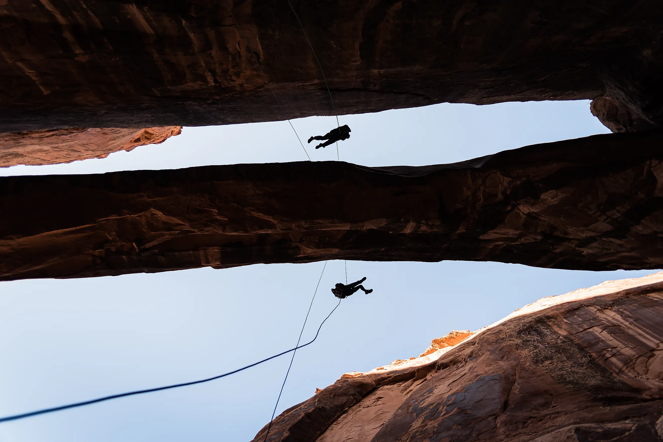
At the head of a side canyon off Grandstaff Canyon near Moab, Utah, Morning Glory Natural Bridge stretches 243 feet, and the 110-foot drop to the canyon floor is a popular rappel for canyoneers. It's a two-mile hike in each way along a trail that follows a year-round stream with several crossings. If you tackle it, allow at least four hours for the round trip.
The canyon is named after William Grandstaff, a Black rancher and prospector (likely born into slavery) in Virginia, who herded cattle here in the 1870s. The trail is now a National Recreation Trail, but the Bureau of Land Management warns that poison ivy grows below the pool under the bridge, so stick to the path.
The Natural Arch and Bridge Society classifies this as a natural arch rather than a natural bridge, but it still follows the classification of being created through water and we'll let it slide since it has "bridge," in the name.
4. Kachina Bridge, Natural Bridges National Monument, Utah

In June 1992, 4,000 tons of sandstone fell from the underside of Kachina Bridge, the middle of the three spans at Utah's Natural Bridges National Monument, and enlarged its opening. The youngest of the three, it has a span of 204 feet, a height of 210 feet, and the stone overhead 93 feet thick.
Surveyor William Douglas named the bridge for the rock art at its base, figures that reminded him of kachinas, the spirit beings represented by masked dancers in the religion of the Hopi people. Ancestral Puebloans, the farming people who lived in these canyons until the late 1200s, left both petroglyphs, which are pecked into the rock, and pictographs, which are painted on it. The trail to the bridge is a 1.4-mile round trip, with a 400-foot descent.
5. Mantle Rock, Smithland, Kentucky

East of the Mississippi, no natural span is longer than Mantle Rock. Located in an upland forest near the Ohio River in Livingston County, Kentucky, this natural sandstone bridge stands just 30 feet high but has a span of 188 feet. Mantle Rock is long and low with room to shelter underneath, and the preserve around it has sandstone bluffs, honeycomb formations (where the rock is pitted with small hollows), and a rock-lined stream.
Mantle Rock is a certified site on the Trail of Tears National Historic Trail, which marks the forced removal of the Cherokee Nation from the Southeast to present-day Oklahoma. In the winter of 1838 and 1839, 1,766 Cherokee camped here for two weeks, waiting for ice on the Ohio River to clear before continuing their journey.
The Nature Conservancy's 367-acre Mantle Rock Nature Preserve is open from sunrise to sunset, and a 2.75-mile loop trail passes the rock and crosses sandstone glades, open rocky clearings where prickly pear cactus and June grass grow.
6. Owachomo Bridge, Natural Bridges National Monument, Utah

At nine feet thick across the middle, Owachomo Bridge is the thinnest and thought to be the oldest of the three spans in Natural Bridges National Monument, Utah. Its span is 180 feet and the height 106 feet, and the stream that cut the bridge no longer runs under it, so frost and seeping water do the work now. Its name comes from the language of the Hopi people and means "rock mound," after the knob of sandstone on its east end.
Owachomo has the shortest hike of the three, with a trail that's just a 0.4-mile round trip. It's also the bridge the National Park Service features in its night-sky photographs, and DarkSky International (then the International Dark-Sky Association), a group that campaigns against light pollution, named Natural Bridges the world's first International Dark Sky Park in 2007.
7. Tonto Natural Bridge, Pine, Arizona

Tonto Natural Bridge, between Payson and Pine in central Arizona, is made of travertine, a type of limestone laid down by mineral springs, and is the largest such bridge in the world. It's actually closer to a tunnel than a span, with Pine Creek traveling 400 feet through an opening 150 feet across at its widest, under a roof that stands 183 feet high.
A Scottish prospector found the bridge in 1877 while hiding from Apache pursuers, spent three days in one of its caves, and later claimed the valley. Goodfellow Lodge, built in 1927, is now the visitor center. Four viewpoints beside the parking lots look down on the bridge, and four steep trails, each under half a mile, lead to the creek.
8. Natural Bridge, Winston County, Alabama

Visitors have paid to walk under the span at Natural Bridge Park in Winston County, Alabama, since 1954. Billed by the park as the longest natural bridge east of the Rockies, it's 148 feet long and 60 feet high, with two openings side by side. Made of a sandstone and iron ore mix, it's believed to have formed 200 million years ago.
Eastern hemlock, a tree of colder climates that has survived here since the Ice Age, grows in the gorge. The park is privately owned and open to the public, but walking on top of it is prohibited. A two-mile trail passes under the bridge and leads to a small waterfall.
It's All Water Under The Bridge
The water that created these natural bridges is still very much at work, and every one of them only exists through quirks of nature. Given time, they'll eventually go the way of Utah's Fallen Monarch, a bridge in Utah's Natural Bridges National Monument which, before it collapsed a few hundred years ago, measured 330 to 360 feet long. For now, all eight of the largest natural bridges in America can still be visited.