The State Parks With Natural Bridges
State parks are bastions of beauty, from mountains and caves to forested trails and rivers, all teeming with native flora and fauna. Many state parks across the United States also boast compelling natural features, including unique geological formations known as natural bridges. Natural arches are openings eroded into rock; in stricter geological usage, a natural bridge is an arch carved across an active or intermittent watercourse.
While the US is home to several national parks and monuments featuring natural bridges, you will also find numerous state parks with natural bridges across the country, such as Natural Bridge State Park in Virginia, Massachusetts, and Wisconsin. Tour remarkable natural bridges in state parks across the US, including sandstone arches, limestone spans, and a rare marble formation.
Natural Bridge State Resort Park, Kentucky

In Natural Bridge State Resort Park, you will discover one of the best-known natural bridges in the country. It is located adjacent to Kentucky's beloved Red River Gorge Geological Area and is easily one of the region's most recognizable natural bridges, which is a bold claim as the Gorge is home to more than 100 documented natural arches.
The state park's eponymous sandstone arch is more than 75 feet long and 65 feet high and was formed over millions of years. To access this natural bridge in Kentucky, lace up your boots and tackle the Original Natural Bridge Trail via the Lake Side Trail, an out-and-back route that, at 2.6 miles, makes for a perfect day hike. For visitors who prefer not to hike uphill, the seasonal Sky Lift provides an alternative ascent, and visitors with mobility needs should confirm loading and route requirements in advance.
Natural Bridge State Park, Virginia

One of Virginia's newer state parks, Natural Bridge State Park, was established in 2016, and its centerpiece is a 215-foot limestone bridge that spans the Cedar Creek gorge. The park rewards a longer visit on its own merits: it's located in Rockbridge County, amid rolling hills with views of the Blue Ridge Mountains.
The park contains six miles of hiking trails, each offering a unique experience in nature. Cedar Creek Trail passes beneath Natural Bridge and continues toward Lace Falls. Reaching it from the visitor center typically requires descending 137 steps, so visitors who need an alternative should contact the park in advance.
Natural Bridge State Park, Wisconsin

Established in 1973, Natural Bridge State Park is a 530-acre hardwood forest in Wisconsin that is home to the largest natural arch in the state. Evidence from the rock shelter beneath the arch indicates human use 10,000 to 12,000 years ago, while glaciers were still melting elsewhere in Wisconsin. This corner of the Driftless Area was never covered by the last ice sheet, which is why the formation survived.
The state park features nearly four miles of beautiful footpaths through the woods, making it easy to explore the entirety of this park in a day. However, please note that climbing on the natural bridge or entering the rock shelter is prohibited in order to protect the park's integrity. For planning a visit, Natural Bridge State Park in Wisconsin is a day-use-only park, and a vehicle admission sticker is required.
Natural Bridge State Park, Massachusetts

Massachusetts is home to an array of state parks that capture the state's natural beauty; however, Natural Bridge State Park is truly an anomaly. Here you will find the only naturally formed white marble bridge in North America, a natural and geological wonder formed by glacial meltwater over 13,000 years ago. Located in the town of North Adams, the park was the site of a commercial white marble quarry from 1810 until 1947. To preserve the unique geological formations here, the site was designated a Massachusetts State Park in 1985.
The park has a short quarry-area walk, but the former chasm staircases and viewing platforms were removed for safety, so check current DCR information for available views and access before visiting.
Samuel H. Boardman State Scenic Corridor, Oregon

Along Highway 101 on the Oregon Coast, Samuel H. Boardman State Scenic Corridor is 12 scenic, shorelined miles of rocky bluffs, rugged beaches, and rock formations, including some genuinely dramatic natural bridges. Follow the short designated trail to one of the best viewpoints in the park: the seven arch rocks and blowholes known as Natural Bridges. Stay behind the guardrails and fences, because the coastal cliffs here are steep and unstable. At the viewpoint, you will also find a memorial to Dr. Samuel Dicken, who first envisioned the Oregon Coast Trail, a route that now runs roughly 360 miles along the state's shoreline.

In addition to the natural bridges, Arch Rock is another formation that is easily accessible from the parking lot. A short, easy footpath leads to an overlook featuring a series of sea stacks and islands.
Head of the Crow State Park, Tennessee

On the Cumberland Plateau in southern Tennessee, Head of the Crow State Park spans more than 4,200 acres of bluffs, hardwood forest, and karst terrain, including a large cave and a sandstone arch. The park is one of Tennessee's newest: it was dedicated in October 2025, when the state divided the sprawling South Cumberland State Park into three separate parks. The 25-foot-high Sewanee Natural Bridge spans 50 feet and looks out over Lost Cove, and a short stair-stepped path from the parking area reaches it. Buggytop Cave is a separate four-mile round-trip hike, while Sherwood Natural Bridge lies along the Sherwood Loop. The approach to Sewanee Natural Bridge and the Sherwood Loop are relatively easy, but trails descending into Lost Cove or leading to Buggytop Cave are longer and more strenuous.
All-terrain wheelchairs can be reserved at participating Tennessee state parks, so check the current program list rather than assuming one is available at Head of the Crow.
Ha Ha Tonka State Park, Missouri

One of Missouri's most beloved state parks, Ha Ha Tonka State Park has it all: sinkholes, caves, bluffs, a natural spring, castle ruins, and, as it were, an enormous natural bridge. This 100-foot-tall natural arch is 70 feet wide and spans 60 feet, and it sits near the park's early 20th-century stone castle ruins and sinkhole. Ha Ha Tonka State Park is a prime example of karst geology, a landscape formed when acidic water dissolves soluble bedrock, and the park's natural bridge is the result of this process. Beyond the natural bridge in Ha Ha Tonka State Park is the Colosseum, an amphitheater-like sinkhole that was formed by the collapse of a giant cavern and measures 500 feet long and 300 feet wide. According to local legend cited by the park, the Colosseum was used for tribal meetings and church revivals.
An accessible overlook is available near the Natural Bridge Picnic Area, but the trail to the more-than-100-foot formation includes steep slopes and narrow stretches, so supervise children closely. Wet weather can make that steep, narrow trail harder still, so check conditions before you go.
Tonto Natural Bridge State Park, Arizona

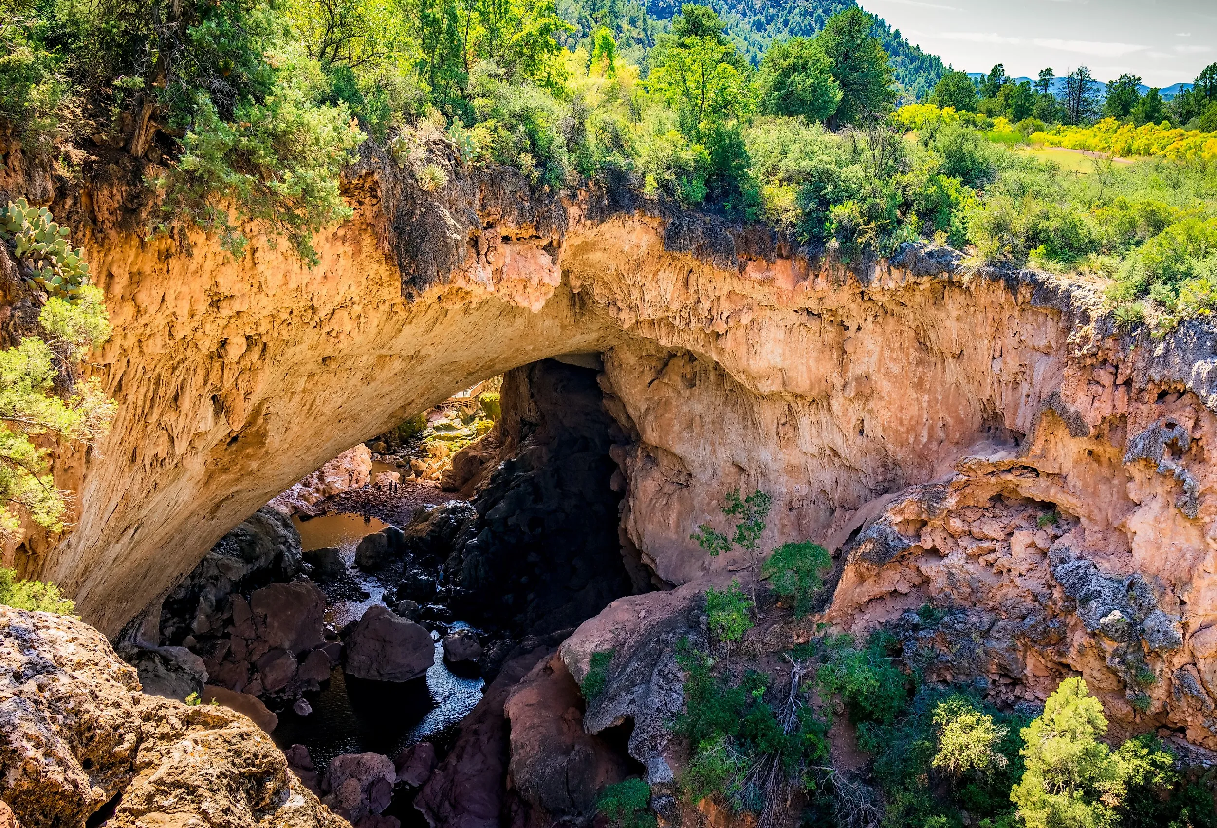
Set in central Arizona's pine-covered rim country, Tonto Natural Bridge State Park protects what may be the world's largest natural travertine bridge. The formation towers 183 feet above Pine Creek and spans a tunnel roughly 400 feet long and 150 feet wide at its widest point. Unlike many of the country's sandstone arches, Tonto Natural Bridge formed as mineral-rich water deposited and gradually reshaped layers of travertine.
Four viewpoints along paved paths provide impressive views from above, so visitors do not need to descend into the canyon to appreciate the bridge. Those seeking a closer look can take the Gowan, Anna Mae, Pine Creek, or Waterfall trails, all of which are less than half a mile long. Do not let those short distances be misleading: Arizona State Parks classifies every trail as steep and strenuous, and rocky or uneven sections require sturdy footwear and plenty of water. The Gowan Trail descends to an observation deck in the creek bottom, while the Pine Creek and Anna Mae trails lead toward the natural bridge itself.
Rock Bridge Memorial State Park, Missouri

Just south of Columbia, Rock Bridge Memorial State Park showcases some of Missouri's most compelling karst terrain, including caves, sinkholes, underground streams, and the formation that gives the park its name. Rock Bridge was separated from a larger cave system when part of the cave roof collapsed, leaving a natural passage through which a stream still flows. The adjoining natural tunnel extends for approximately 125 feet and stands about 63 feet high.
The half-mile Devil's Icebox Trail is the most direct way to experience the bridge. A packed trail and boardwalk lead visitors across several footbridges and over the natural tunnel toward the double sinkhole known as Devil's Icebox. Downstream, the 166-foot-long Connor's Cave is open for self-guided exploration, although visitors should bring flashlights, helmets, and sturdy shoes and expect to get their feet wet. The larger Devil's Icebox Cave upstream remains closed to protect its bat populations. Beyond the bridge, the park offers longer routes through forests, grasslands, and the rugged Gans Creek Wild Area.
Arches, Bridges, and the Water That Shaped Them
Natural bridges are one of Mother Nature's most compelling phenomena. Formed over time by weathering and erosion (and, in the case of true natural bridges, by running water), these formations preserve evidence of long-term landscape change. While there are several national parks and sites where one can experience natural arches, some of the most beautiful natural bridges in the US can be discovered in state parks. From the white marble bridge in Massachusetts to the natural bridges along the Oregon Coast (and the myriad beautiful bridges in the Midwest), you don't have to travel far to discover these geological wonders.