9 Most Scenic Drives in Connecticut
Connecticut offers some of the best scenic drives, featuring beautiful coastlines, dense forests, and historic towns. Merritt Parkway tops the list, stretching 37.5 miles from the New York State line to Stratford over the Housatonic River at Igor I. Sikorsky Memorial Bridge. The Litchfield Hills is another magnificent region, stretching along the Massachusetts border, while the colonial farmsteads and village greens along Route 169 cut through undeveloped landscapes in New England. Off Route 146 is the Henry Whitfield State Museum, a solid reminder of European settler colonialism, and the oldest stone house in Connecticut, built in 1639. Whether it is winter when the snow is covering the coastlines along Guilford or spring when the winds are blowing the cherry blossoms along Route 15, you will love the scenic drives in Connecticut.
Route 15 (Merritt Parkway)

Built in an artistic and futuristic design for a 1930s road, Merritt Parkway has one of the best scenic drives in Connecticut. The Queen of Parkways stretches 37.5 miles from Greenwich to Stratford over the Housatonic River at Igor I. Sikorsky Memorial Bridge, categorizing it among the most beautiful National Scenic Byways. Hailed as "Road of the Future" at the 1939 World's Fair in New York, Merritt Parkway is a visual grandeur that features 66 unique overpasses. Among them is the James Farm Road Bridge, which features two distinct yet visually satisfying angel's wings designed from concrete and white quartz by the famous Edward Ferrari.
The grass median strip runs along Lake Avenue Bridge and Merwin's Lane Bridge, with dense vegetation depicting vast wetlands, cedar trees, and the lush canopy overlooking the rocky and hilly terrain across Fairfield County. Route 15 allows an average speed of 55 mph and bans vehicles over 8 feet, which reduces traffic significantly. To enjoy this scenic drive, it is best to avoid weekday rush hours and capitalize on the weekends. And if you are a leaf peeper, mid-October is the best time to enjoy the vivid gold and orange turns along the narrow lanes and winding curves.
Route 169 (Lisbon to Woodstock)

Running 32 miles from Lisbon to Woodstock, Route 169 is a picturesque road that brings quiet, nostalgia, vibrancy of rural architecture, historic sites, and color. Commissioned as a National Scenic Byway in 1996, this highway cuts across the "Quiet Corner," on the eastern side of Connecticut, at Quinebaug and Shetucket Rivers Valley National Heritage Corridor. The "Quiet Corner" offers breathtaking scenic drives of rural Canterbury and Brooklyn towns that host colonial homes and stonewalls.
For history buffs, Canterbury, Pomfret, and Woodstock host undefiable historic sites with an edge on the past. At Canterbury, the Prudence Crandall Museum stands as a significant archive for black women's history, particularly the first academy operating between 1833 and 1834. At Pomfret, Mashamoquet Brook State Park stands out as a historic site that gives a glimpse of Revolutionary War general Israel Putnam's bravery at Wolf Den Cave. In Woodstock, visit the aesthetically pleasing Roseland Cottage, which shouts from its glaring pink exterior, adorned with the newly fashionable Gothic Revival style of the Victorian Era. The best time to enjoy this scenic drive in Connecticut is between September and October, when sugar maple and red oak trees transform into shades of reddish-brown, yellow, or orange.
Route 7 (Kent to North Canaan)

Though Route 7 is an iconic beacon, the section between Kent and North Canaan overshadows the rest of the highway as it retains the finest scenery of rural towns such as Cornwall, Sharon, and Falls Village. This is a 24-mile stretch along the Housatonic River, featuring the best scenic spots to drive through, such as Kent Falls State Park and Lime Rock Park. The road follows a western bank through an area in the Housatonic State Forest, and crosses ravines through thin gorges where the river cuts rapidly, before linking up into wider meadows of Falls Village.
A short excursion in West Cornwall leads to the West Cornwall Covered Bridge, a wooden red barn bridge built over the Housatonic River in 1864 and one of the three covered bridges still standing in Connecticut. The historic Main Street of Falls Village features Greek Revival, Italianate, and Second Empire architecture from the 19th century. Heading north, Haystack Mountain State Park is in Norfolk, where a 1929 stone tower on the 1,716-foot summit offers extensive views of the Litchfield Hills. There are steep slopes heading towards North Canaan, and they may become icy during winter due to the high grades. Summers and late springs are the best times for an afternoon drive through the lush scenery of the foliage season.
Route 156 (East Haddam to Old Lyme)

Route 156 starts at the Route 82 intersection in East Haddam and heads south through Lyme just before Old Lyme. The state scenic designation applies to the East Haddam and Lyme sections, as it follows the western edge of the Lower Connecticut River valley through forested hills and open river bottomland. Branching off at Lyme is a dramatic detour worth the trouble: Gillette Castle State Park, a 14,000 square-foot castle built in 1914 by the famous actor and playwright William Gillette. With over 300,000 visitors annually, the castle is a monumental site sitting 200 feet above the Connecticut River and surrounded by scenic views of the hilly terrain across the Lower Connecticut River valley and woodlands.
Down south along 156 is the Hamburg Cove, a tidal inlet with water so still that it reflects the sunset and the tree line in a surreal fashion across the horizon. The Florence Griswold Museum in Old Lyme is the natural culmination of the scenic part, right before the route crosses over to I-95. History and heritage lovers will find the museum quite interesting as they delve deeper into the evolution and development of American Impressionism between the 1870s and 1940s, as well as Childe Hassam and Willard Metcalf's extended stays in Old Lyme in 1905 and 1907. It is worth noting that the road is two-lane, with no major grades or curves, and is an all-weather route. Still, fall foliage is at its best from late September to mid-October.
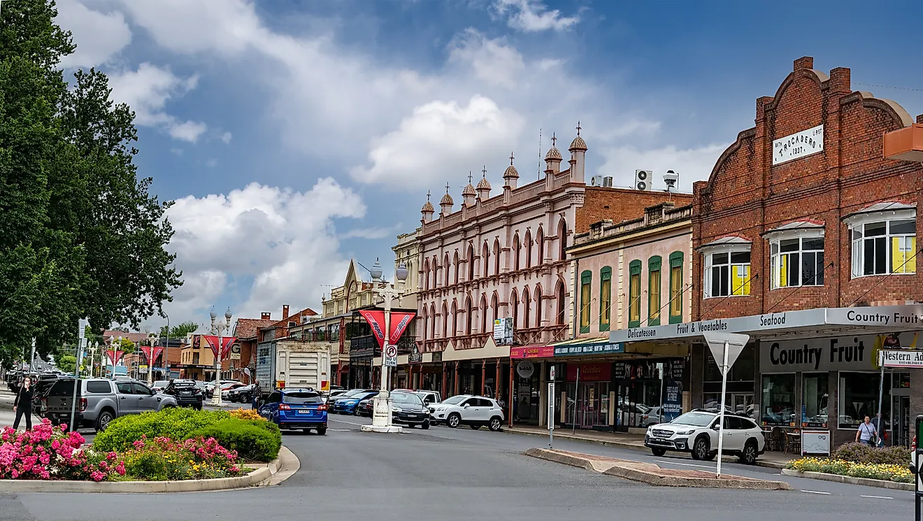
Route 146 (Branford and Guilford)

Route 146 is a 13-mile stretch running from Branford to Guilford. It is a 1990-designated state scenic road and serves as an alternative passage to US Route 1, considering it is much closer to Long Island Sound. Route 146 runs through salt marshes, around tidal ponds, and close to the harbor of Stony Creek in Branford, where the Thimble Islands are scarcely seen jutting into the water. The Thimble Islands are comprised of over 100 granite islets, some too small to hold an average-sized cottage.
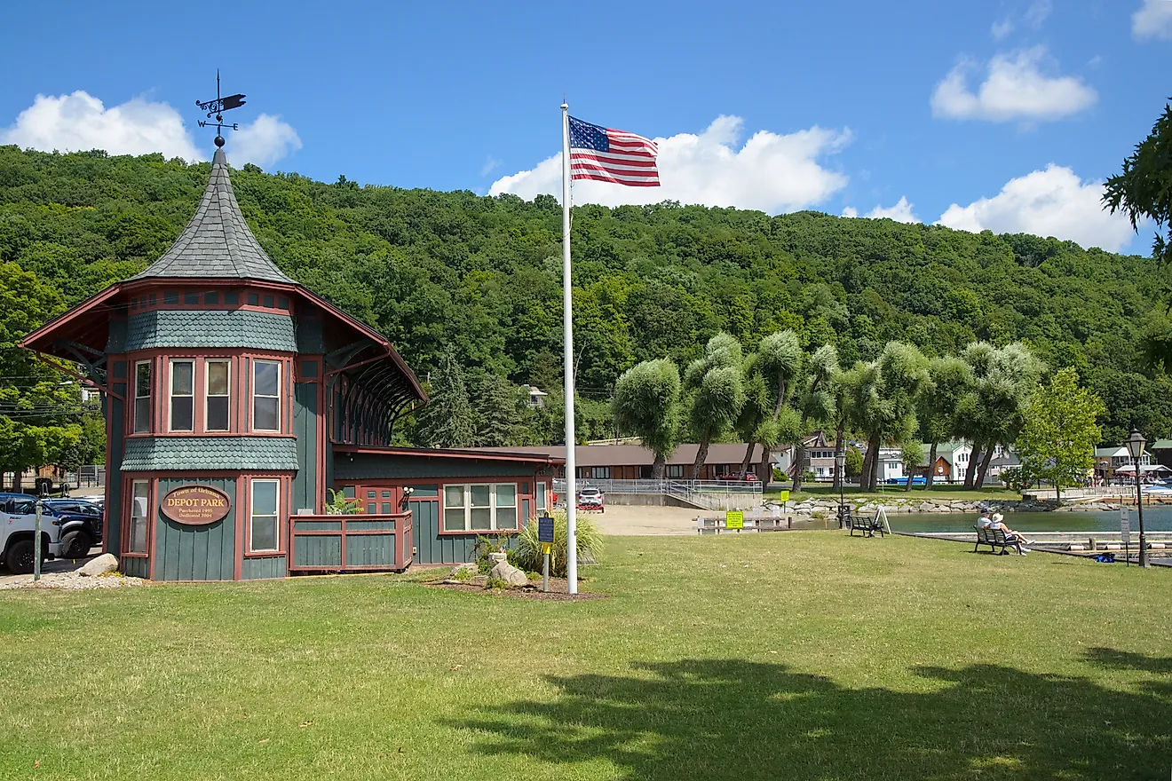
Heading east toward Guilford off Route 146 along 248 Old Whitfield Street is the Henry Whitfield State Museum, built in 1639. This historic remnant, turned museum, is the oldest stone building in Connecticut and New England and serves as a vivid reminder of the Colonial Revival Era between 1880 and 1940. Guilford Town Green, just off Route 146, is an irresistible stopover that showcases raw American history from the historic antiques, churches, shops, and culture through art shows and annual events. Five minutes from the town sits Jacobs Beach, a 25-acre shoreline overlooking Long Island Sound. The beach hosts playgrounds for beach volleyball, a 430-foot shoreline, bathhouses, picnic shelters, and kayak racks for rent, just enough for a solo or group road trip. Large vehicles and semi-trucks are limited to this route due to multiple railway underpasses with a capping of 8 feet and 8 inches. Summer and fall are the best seasons to enjoy this scenic drive in Connecticut.
US Route 1 (New Haven to Stonington)

The section between New Haven and Stonington along US Route 1 stretches 71 miles, and it is one of the special and historic routes that showcase the southern coastlines of Connecticut through colonial landmarks and scenic walkable villages such as Mystic and Saybrook. Drivers have a choice to visit the Ferry Landing State Park and enjoy the scenic views of the Connecticut River along the handicap-accessible boardwalk, or visit Historic Lyme Street. This street is home to historic buildings from the 18th and 19th centuries, and nearby, you will find the Old Lyme Phoebe Griffin Noyes Library, which provides a glimpse of the town's history and genealogy.

Down at Hammonasset Beach State Park, explore nature's gifts at Meigs Point Nature Center, where you can find the saltwater touch tank and other biodiversity and local wildlife, such as turtles and snakes. In Old Saybrook lies Saybrook Point, which overlooks the mouth of the Connecticut River. This road ends at Stonington, a small community consisting of Federal and Greek Revival houses on Water Street and a commercial fishing fleet at the town wharf. Route 1 is an all-weather, all-season highway that attracts drivers who delight in scenic coastal drives. It is easier to enjoy the drive during weekdays than on busy weekends.
Route 44 (Salisbury to North Canaan)

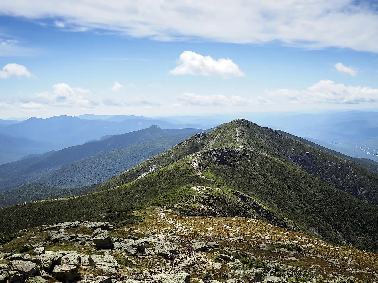
Connecticut's Route 44, stretching between Salisbury and North Canaan along the Litchfield Hills Ridgeline, is a scenic road depicting the Taconic Ranges and part of the Berkshires. The route follows the Canaan Mountain ranges, where rocky outcroppings break the treeline to reveal valleys and ridges covered in dense vegetation. The section between Norfolk and Canaan bears the state scenic designation, comprised of Haystack and Bradford Mountain views, the Housatonic, Blackberry, and Whiting Rivers, Salmon Creek, immaculate forest coverage, and the attractive New England towns. Campbell Falls State Park is another ideal spot to enjoy hiking and epic scenes of waterfalls along the Whiting River. North Canaan is a treasure trove for historical sites such as the Beckley Furnace Industrial Monument, popular for iron forging in the 19th century.
Off Route 44 and heading south along Route 272 is the Norfolk Chamber Music Festival at Yale Summer School of Music inside the historic Ellen Battell Stoeckel Estate, which has been hosting concerts since 1941. The blending of world-class choral, classical, and chamber music provides a unique experience to over 10,000 people annually. Further along Route 44, and east onto 318 is Barkhamsted, which hosts Lake McDonough and Saville Dam to the southwest. Saville Dam is a scenic castle-like stone structure with a unique masonry design where visitors delight in photography while overlooking the beautiful People's State Forest and the American Legion State Forest. Summer and fall bring out the vibrant scenery of the lush green vegetation and fall foliage along the Litchfield hills. Winters demand extra caution on icy roads and sharp curves. Also, drive carefully during the migratory or mating season of black bears and white-tailed deer.
Route 7 South (Brookfield to Kent)

This is the southern section of Route 7, spanning about 20 miles from Brookfield across New Milford, along the Housatonic River, leading into Kent. Within the Litchfield Hills sits the New Milford Town Green, a historic scenic village founded in 1711 as a community hub for events and culture. The village is the heart of the town's social life as locals and tourists visit to shop and dine while enjoying the Aspetuck Hill and the Lover's Leap State Park views.
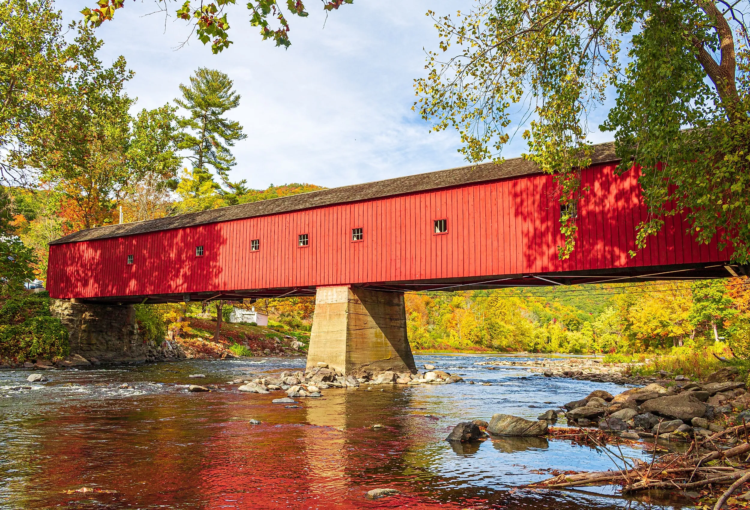
A few yards off Route 7 is the renowned Bull's Bridge, a historical wooden passage built in 1842 along the Housatonic River. Bull's Bridge is a passage in its own right, as it stands as one of the few remaining bridges from the 1800s. It is not surprising that it is one of the most photographed bridges in Connecticut. Approximately 5 miles from Bull's Bridge is the Eric Sloane Museum, a State Archaeology Preserve near Kent known for its collection of antiques such as American farm tools and the iron furnace from 1826.
Routes 49 and 14A (Voluntown to Sterling)

Route 49 starts out at Route 138, in Voluntown, north through the heart of the Pachaug State Forest to join Route 14A in Sterling to provide a natural loop through the most remote driving terrain in eastern Connecticut. Pachaug is the largest state forest in Connecticut, consisting of six towns that collectively span about 26,477 acres, with Routes 49 and 14A traversing through from Voluntown to Sterling. West of Route 49 near Volntown is the Beachdale Pond trailer boat launch, with pitch pine and Atlantic white cedar nearly touching the shoulders of the roadway.
Further down, the road crosses headwater streams of the Pachaug River, which is a Native American word meaning "bend in the river." The Pachaug-Great Meadow Swamp is an established National Natural Landmark with one of the best Atlantic white cedar swamps in Connecticut that can be seen from the roadside in portions. The state flower of Connecticut, also known as mountain laurel, grows in thickets on the side of roads and during the months of May and early June. Route 49 and 14A are two-lane and all-weather roads with relatively high grades and elevations. The period between March and April during the spring mud season may rough up unpaved forest access roads that turn into the main road.
Explore the Best Scenic Drives in Connecticut
Connecticut roads bring together the best of two worlds by combining the coastal towns close to the Long Island Sound and the upcountry roads in Litchfield and Quinebaug valleys. Route 169 and Merritt Parkway remain the only National Scenic Byways in Connecticut, and drivers who take their time get rewarded with the best scenes from the calm and hilly terrain to the sparkling coastal magnificence. Fall foliage, usually at its peak in late September up in the higher Litchfield Hills and through mid-October down and along the coast, provides the most stunning conditions among all nine routes.


