Housatonic River
Housatonic River is a 149-mile-long river that flows from the southern to southeastern direction through the western parts of the US States of Massachusetts and Connecticut. Originating from the Berkshire Mountains close to the city of Pittsfield in Massachusetts, the Housatonic River finally drains into the Long Island Sound between the cities of Stratford and Milford in Connecticut. The name “Housatonic” has been derived from the native Mohican phrase “usi-a-di-en-uk,” which means “beyond the mountain place.” Besides being used for whitewater paddling and fly fishing, the waters of the Housatonic River have been harnessed over the years to generate hydroelectric power for the textiles, paper, and iron industries.
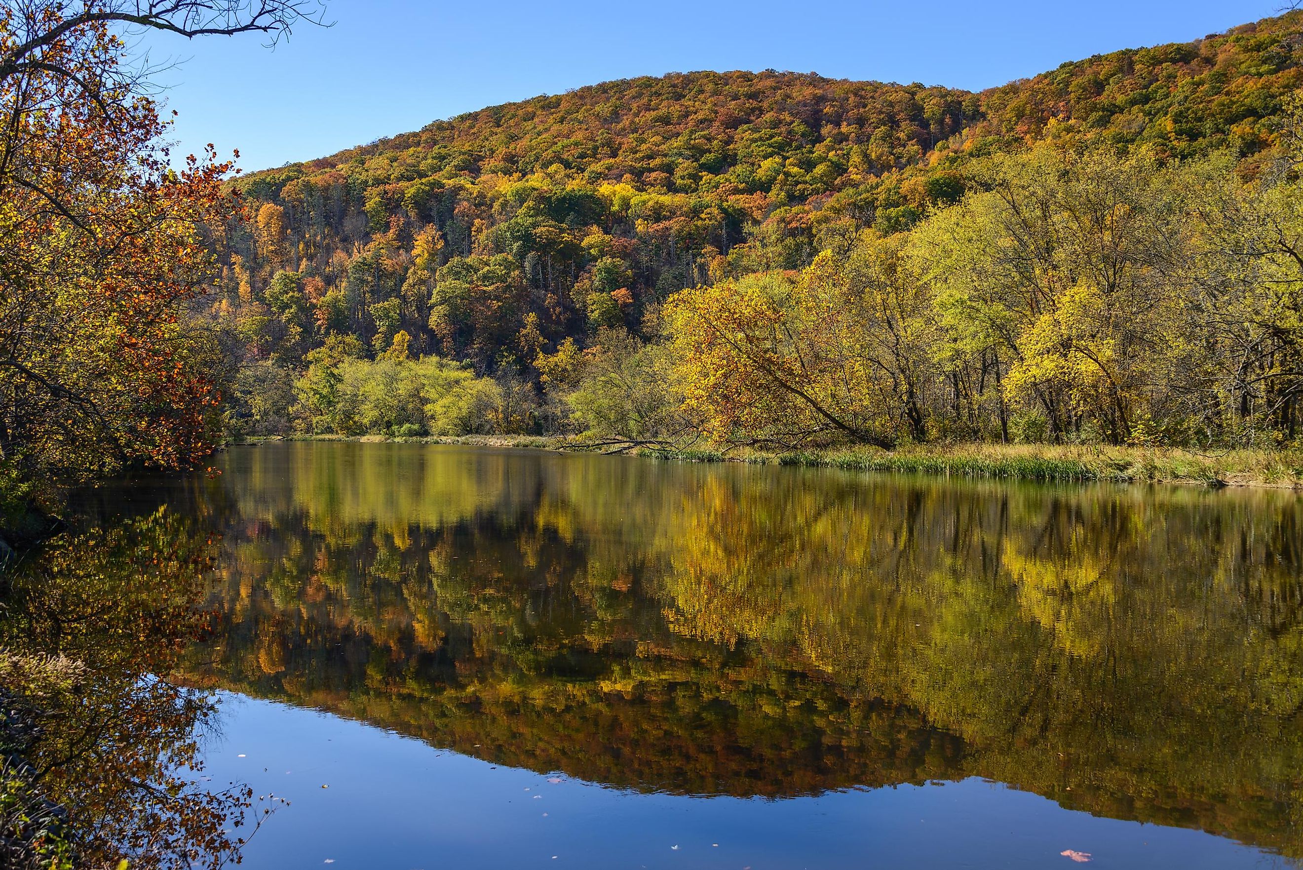
Course Of The Housatonic River

The Housatonic River begins its journey in far southwestern Massachusetts, where the mainstream is formed by the confluence of the East and West Branches of the Housatonic River close to the city of Pittsfield. The 17-mile-long East Branch of the Housatonic River, which rises at Muddy Pond, drops about 480 ft before meeting with the West Branch of the Housatonic River. The 5-mile-long West Branch also drops about 140 ft before it meets the East Branch. The joining of the East and West Branches forms the headwaters of the Housatonic River. The river then flows in a southerly direction through the Berkshire Mountains into western Connecticut.
In Connecticut, five dams, including the Derby Dam, Bulls Bridge, Falls Village, Shepaug Dam, and Stevenson Dam Hydroelectric Plant, impound the Housatonic River. Of these dams, the Derby, Shepaug, and Stevenson Dams form many lakes, such as Lake Housatonic, Lake Lillinonah, and Lake Zoar. Immediately south of the Bulls Bridge power station, waters of the Housatonic River are diverted and pumped uphill via a penstock to Candlewood Lake, which is the largest lake in Connecticut. Forming a boundary between Stratford (Fairfield County) and Milford (New Haven County), the Housatonic River drains into Long Island Sound.
Geography Of The Housatonic River

From its starting point to its ending at the Long Island Sound, the Housatonic River has a total fall of 1,430 ft. Some of the major tributaries include East Branch Housatonic River, Blackberry River, Pomperaug River, Konkapot River, Shepaug River, and Naugatuck River, which are the left tributaries, whereas West Branch Housatonic River, Green River, Ten Mile River, Williams River, Salmon Creek, and Still River are the right tributaries. The Housatonic River watershed drains an area of 1,948 sq. mi, covering the western portions of Massachusetts and Connecticut and the eastern part of New York. Western Connecticut’s Greater Danbury metropolitan area, which covers 430.8 sq. mi, is also called the Housatonic Valley Region. Spread over 848 sq. mi, the Upper Housatonic Valley National Heritage Area in the Upper Housatonic River watershed covers 8 towns in Connecticut and 18 towns in Massachusetts.
History Of The Housatonic River

About 6,000 years ago, indigenous people started utilizing the river area for fishing and hunting activities. By 1600, the native Mohican tribe dominated the area with about 30,000 inhabitants. The river was referred to as “usi-a-di-en-uk” in a deed by which “The Proprietors,” a group of 12 colonists, bought the land called “Ousetonack,” currently a part of Sherman and New Fairfield. The river flows through the land that was originally occupied by the people belonging to the Algonquin lineage. During autumn, these native inhabitants burned the woods along the Housatonic River Valley. In 1725, the first English colonists started settling in the town of Sheffield in the northern Housatonic River Valley. With the advent of industries, the construction of dams began. In due course, the waters of the river began to be harnessed to generate power for the textile, iron, and paper industries.
By 1850, most of the towns along the Housatonic River began using the river both as a water source for the manufacturing and milling industries as well as a dumping ground for their untreated waste materials. This discharge of untreated waste materials, including PCBs and other hazardous substances by the General Electric Company between 1932 and 1977, eventually polluted the waters, causing massive harm to the entire ecosystem of the Housatonic River.
Ecology Of The Housatonic River
Various surveys conducted by MassWildlife have revealed the presence of a number of notable fish species in the Housatonic River. The upper section of the Housatonic River supports fishes like rock bass, white sucker, yellow perch, bluegill, smallmouth bass, brown trout, and largemouth bass. In addition to all the fishes found in the river’s upper section, the lower section of the river supports fishes like rainbow trout, fallfish, longnose dace, creek chub, common shiner, and northern pike. However, due to the long history of river water pollution, there are strict advisories against eating fish caught from the Housatonic River.
Recreation In The Housatonic River

The stretch of the Housatonic River from Connecticut’s Falls Village to Gaylordsville is a well-known whitewater paddling destination. There are many minor and major dams on the river that form lakes like Lake Lillinonah, Lake Zoar, etc, offering a number of water-based recreation activities attracting tourists and residents alike. Some of these lakes are also used by schools and clubs for rowing activities and hosting annual regattas. Moreover, the Housatonic River is a famous fly-fishing destination, with the most popular fly-fishing area located between Falls Village and Cornwall Bridge. The Appalachian Trail also follows the river section from Bulls Bridge to Falls Village.
Flowing through scenic landscapes in the western parts of Massachusetts and Connecticut and offering an array of recreational activities, the Housatonic River is indeed an interesting water body in the United States. However, since the river has been severely polluted due to the dumping of untreated hazardous materials, therefore the concerned authorities must take necessary measures for removing the pollutants and cleaning the Housatonic River.


