9 Great Road Trips to Take in The Rockies
The best driving in the Rockies happens where roads feel slightly out of place, like on switchbacks cut into cliff faces above 3,000 meters (10,000 feet) and highways that cross the Continental Divide for only a few months of the year. Trail Ridge Road carries 18 km (11 miles) of open tundra with no guardrails. Crews on Going-to-the-Sun clear snow across nearly forty avalanche paths before the road can open. The Mirror Lake Highway climbs 1,200 meters (4,000 feet) out of a ranching valley in about 48 km (30 miles). These nine routes cross Alberta, British Columbia, Montana, Wyoming, Idaho, Utah, and Colorado, each one a road trip worthy of the highlight reel.
Icefields Parkway: Lake Louise to Jasper, Alberta

Highway 93 North covers roughly 230 km (143 miles) between Lake Louise and Jasper, a three-hour drive without stopping. Of course, stopping is the point. The parkway follows a corridor between the Continental Divide and a wall of peaks, passing more than a hundred visible glaciers, and it stays open year-round, even though winter services shut down. Heading north from Lake Louise, the first stop is Herbert Lake at 20 km (12 miles), a small roadside pull-off that most drivers pass.
Bow Lake is about 40 km (25 miles) in with views of the Crowfoot and Bow glaciers feeding it. Five kilometers (3 miles) further, Bow Summit at 2,067 meters (6,781 feet) is the highest point on the parkway and the second-highest highway pass in Canada. Park here and walk the 2 km (1.2 miles) round trip to the rebuilt Peyto Lake viewing platform. Mistaya Canyon follows, a short walk down to a footbridge over a limestone slot. Saskatchewan River Crossing at the halfway mark is the only gas, food, and washrooms on the entire route, so filling up is a given. Past it, the road climbs the Big Bend past the Weeping Wall, a cliff on Cirrus Mountain where meltwater streams down the rock face.

The Columbia Icefield lies roughly midway along the drive. The Toe of the Athabasca Glacier trail is 1.8 km (1.1 miles) return and free, while the Ice Explorer tour and Skywalk are paid and operate on timed slots. North of there, Tangle Creek Falls is directly roadside, Sunwapta Falls is at 178 km (111 miles) with a short walk to the viewpoint, and Athabasca Falls at 202 km (126 miles) is the loudest thing on the route. Every stop along this parkway is a pull-off with a walk of under an hour, and the terrain changes constantly through the lake basin, the glacial trough, and the river canyon. The road is open all year, but winter tires are mandatory from November through March. Services close for the season, and storms can shut the highway without warning. Jasper's townsite is still rebuilding after the devastating 2024 fire, so book lodging early.
Going-to-the-Sun Road: West Glacier to St. Mary, Montana

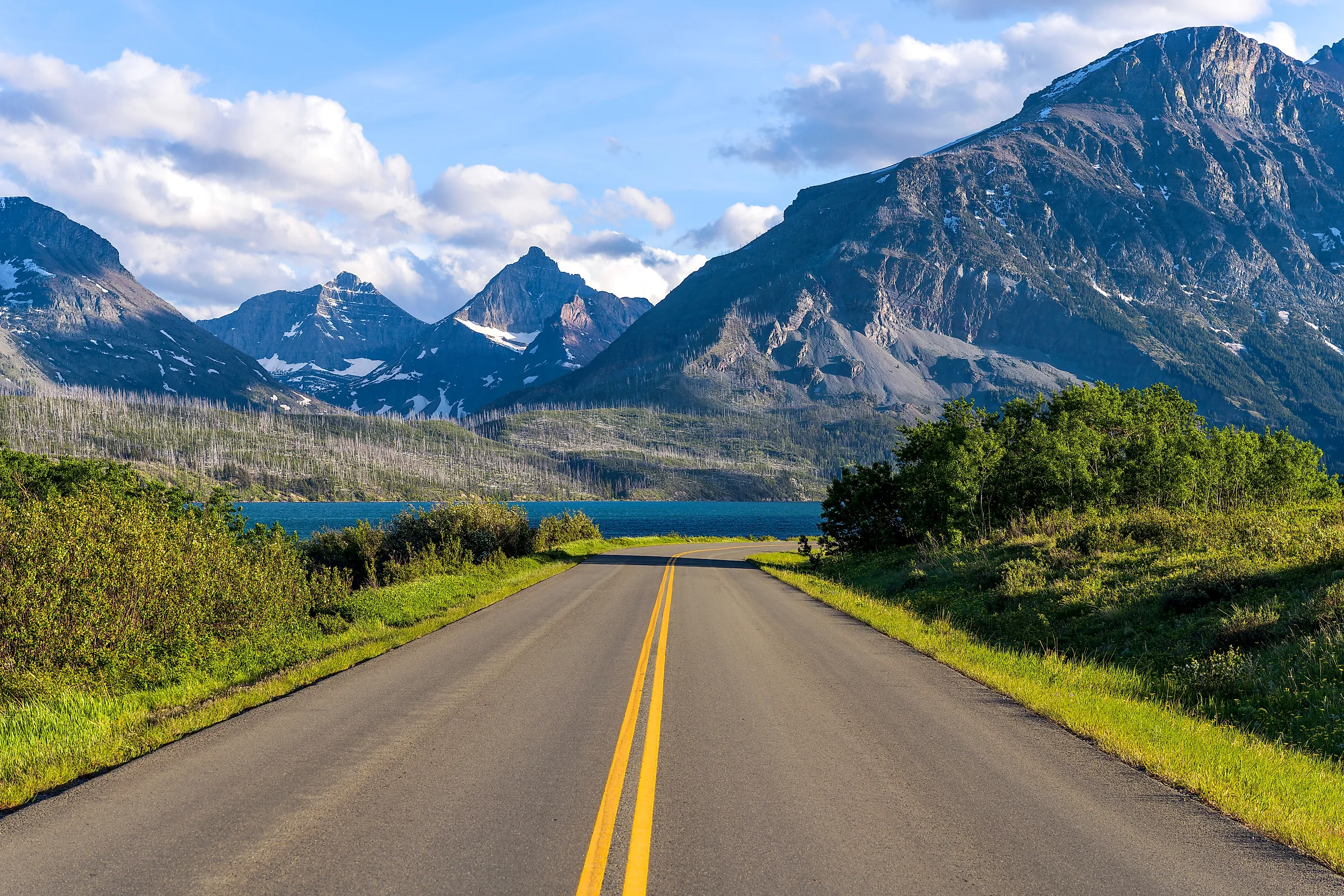
Eighty-four kilometers (52 miles) cross Glacier National Park and the Continental Divide at Logan Pass, which takes about two hours without stops. Crews clear snow across nearly forty avalanche paths every spring, which is why the full road rarely opens before mid-June and sometimes not until early July. From the west entrance, the road follows the shore of Lake McDonald for 16 km (ten miles) through cedar and hemlock, flat and easy, before starting the climb. The Trail of the Cedars and Avalanche Lake trailheads are here. Then the road turns and begins the section it is famous for, cut into the cliff along the Garden Wall, with the valley dropping away and no shoulder to speak of. The Loop is a single hairpin turn that doubles as a shuttle stop and a trailhead for Granite Park Chalet. Logan Pass at 2,026 meters (6,646 feet) is the summit, with a visitor center, restrooms, water, and the Hidden Lake Overlook boardwalk trail.

East of the pass, the road descends past Jackson Glacier Overlook, one of the few places you can see a glacier from the pavement, then follows St. Mary Lake to the east entrance. Pull off at Wild Goose Island Lookout. What makes it work is that it is one road and one crossing, with the whole transition between valley floor and alpine tundra compressed into 80 km (50 miles). Nothing about it feels like a detour. Vehicle reservations were eliminated park-wide for 2026, so you only need an entrance pass. However, parking at Logan Pass is capped at 3 hours between July 1 and September 7. If you want a longer hike from the pass, book a ticketed express shuttle on Recreation.gov.
Beartooth Highway: Red Lodge to Cooke City, Montana and Wyoming

US 212 covers roughly 109 km (68 miles) and crosses Beartooth Pass at 3,337 meters (10,947 feet), taking two to three hours minimum. Construction began in 1932 and finished in June 1936, and Charles Kuralt called it the most beautiful drive in America, a description that has stuck. Driving south from Red Lodge, the highway enters the Custer Gallatin National Forest and immediately begins climbing the Rock Creek switchbacks. The road gains most of its elevation in the first stretch, and the Vista Point overlook near the top of the climb looks back down the entire canyon. Above the switchbacks, the road crosses genuine alpine tundra, past glacial lakes and snowfields that persist into August. Beartooth Basin, at 3,322 meters (10,900 feet) on the state line, is a summer-only ski area that has operated since the mid-1960s and depends entirely on this road for access.

West of the pass, the highway descends toward Cooke City and Silver Gate, with views of Pilot and Index Peaks along the way. Cooke City sits 6 km (four miles) from Yellowstone National Park and its Northeast Entrance. The elevation gain here is relentless and visible. You start in a Montana town and end above treeline, and the whole thing is a continuous climb rather than a series of stops. This is also the most weather-dependent road on the list. It typically opens the Friday of Memorial Day weekend, with recent opening dates falling between May 22 and June 1, and closes between October 5 and 15. Temporary closures happen without notice, even in July, so check the Montana and Wyoming DOT before committing.
Chief Joseph Scenic Byway: Cody to the Beartooth Junction, Wyoming

Wyoming Highway 296 runs 74 km (46 miles) between WY 120 north of Cody and the US 212 junction, taking about two hours to drive. The road follows the route the Nez Perce took in 1877 while being pursued by the US Cavalry, and it is the obvious pairing with the Beartooth. Starting from the Cody end, the byway climbs through the Absaroka Range with Heart Mountain visible behind you. The road works up a series of switchbacks to Dead Indian Pass at 2,460 meters (8,071 feet), where a large paved turnout has interpretive markers and metal sculptures explaining the Nez Perce War. The view from the summit opens in every direction.

Seven switchbacks descend the other side into Sunlight Basin. The Sunlight Creek Bridge spans a gorge roughly 87 meters (285 feet) deep and is the highest bridge in Wyoming. There is a gravel lot and pit toilets, and pedestrian walkways on both sides, letting you look straight down. Just past it, Sunlight Road branches off as a worthwhile gravel detour. From there, the road follows the Clark's Fork of the Yellowstone River to the Beartooth junction. This is the connector that turns the Beartooth into a loop instead of an out-and-back. Drive Cody to Cooke City via 296, return via 212, and you have covered two of the best roads in the Rockies in one day. The byway is open year-round but is not maintained in winter past the Beartooth junction, and when the Beartooth closes, 296 becomes the only route to Cooke City.
San Juan Skyway: Durango Loop, Colorado

The loop covers 375 to 380 km (233 to 236 miles) on US 550, CO 62, CO 145, and US 160, five and a half hours without stopping, and it deserves two days. It was designated an All-American Road in 1996, and it is the only loop on this list. Heading north from Durango on US 550, the road climbs over Coal Bank Pass and Molas Pass, both above 3,000 meters (10,000 feet), with a rest area at Molas worth the stop. Silverton is a National Historic Landmark District and the turnaround point for the Durango & Silverton Narrow Gauge Railroad. North of Silverton, the road becomes the Million Dollar Highway. The name officially applies to the 40 km (25 miles) to Ouray, but the 19 km (12 miles) south of Ouray through the Uncompahgre Gorge are what earn it. Steep drop-offs, narrow lanes, and hairpins carved directly into rock come with no guardrails at all. Red Mountain Pass tops out at 3,376 meters (11,075 feet), and Red Mountain itself is stained by oxidized minerals. The ruins of the Longfellow Mine are visible on the way up from Silverton.

Ouray sits in a box canyon at nearly 2,440 meters (8,000 feet) with hot springs and a waterfall in town. Continue to Ridgway, turn west on CO 62, then south on CO 145 to Telluride. From there, the byway crosses Lizard Head Pass past Mount Wilson and Wilson Peak, follows the Dolores River through Rico to Dolores and McPhee Reservoir, then joins US 160 at Cortez near Mesa Verde. The final leg heads east through the La Plata Mountains back to Durango. The route takes in three separate mountain passes and four historic towns across the San Juan Mountains, and it never repeats a mile. It is open year-round, but Red Mountain Pass is serious in winter, so check conditions. Afternoon thunderstorms are routine in summer.
Trail Ridge Road: Estes Park to Grand Lake, Colorado

US 34 covers 77 km (48 miles) across Rocky Mountain National Park and crests at 3,713 meters (12,183 feet), another drive of about 2 hours straight. It is the highest continuous paved road in the United States, and 18 km (11 miles) of it sits above treeline with no guardrails. From the east side at Deer Ridge Junction, near Estes Park, the road climbs through montane forest into subalpine and then out onto open tundra. Rainbow Curve is the first major overlook, then Forest Canyon Overlook, then Rock Cut, which has restrooms and a short tundra trail with interpretive signs. The Alpine Visitor Center at 3,595 meters (11,796 feet) is the highest facility of its kind in the park system.

West of there, the road crosses Milner Pass on the Continental Divide and descends into the Kawuneeche Valley along the headwaters of the Colorado River toward Grand Lake. For a rougher alternative on the way up, Old Fall River Road opened in 1920 as the park's first high-country route. It is 18 km (11 miles) of one-way gravel at 25 km/h (15 mph) with no guardrails, and it joins Trail Ridge at the Alpine Visitor Center. You drive out of the forest and into the Arctic tundra in under an hour. Elk, bighorn sheep, and marmots are routine sightings, and mid-summer wildflowers cover the tundra. The road closes with snow, typically late October until late May, and timed entry reservations are required 9am to 2pm daily through the summer season. The park also maintains a recorded road status line for updates and closures.
Sawtooth Scenic Byway: Shoshone to Stanley, Idaho

Idaho Highway 75 spans 187 km (116 miles) and can take a full day if you use it properly. The byway starts in the high desert and ends beneath one of the more dramatic mountain ranges in the country, which makes the terrain change the whole point. Out of Shoshone, the road heads north through lava outcroppings and volcanic country on the Snake River Plain before entering the Wood River Valley. Bellevue, Hailey, Ketchum, and Sun Valley all have full services, and Ketchum is the last reliable fuel before Stanley. Eleven kilometers (seven miles) north of Ketchum, the Sawtooth National Recreation Area headquarters has maps and a small natural history museum. From there, the road climbs with the Boulder Mountains on the right and the Smoky Mountains on the left, with grades up to 6 percent. Galena Lodge, 35 km (22 miles) north of Ketchum, is a community-owned day lodge at the center of a trail network.

Galena Summit tops out at 2,652 meters (8,701 feet). The Galena Overlook at 2,560 meters (8,400 feet), just past the true summit, is the essential stop. Interpretive signs sit above a view down into the headwaters of the Salmon River and across the entire Sawtooth Range, which holds 57 peaks over 3,000 meters (10,000 feet). Descending into the Sawtooth Valley, the road follows the young Salmon River north past Smiley Creek to Redfish Lake, 8 km (five miles) south of Stanley on a paved spur. Stanley is the end of the byway, and north of it, Highway 75 becomes the Salmon River Scenic Byway. Three distinct zones span 187 km (116 miles): sagebrush, alpine, and the Sawtooth Valley floor, with public land on both sides for nearly the entire northern half. The byway is open year-round, though snow tires or chains may be needed November through April. There are no public EV fast chargers between Ketchum and Stanley, and cell service is unreliable.
Mirror Lake Highway: Kamas to the Wyoming Line, Utah

State Route 150 covers 68 to 89 km (42 to 55 miles), depending on where you stop, which takes about half a day. The Uintas are one of the few major ranges in North America oriented east to west, and this is the only paved road through the heart of them. Out of Kamas, the byway follows the Provo River upstream as it drops over boulders from its headwaters. Fill up before leaving, because there are no gas stations beyond Kamas. Upper Provo River Falls has an overlook, facilities, and lower pools where you can wade. The road climbs steadily into the Uinta-Wasatch-Cache National Forest past Trial Lake to Bald Mountain Pass at 3,266 meters (10,715 feet), the highest paved road in Utah. The Bald Mountain trailhead sits right at the top. Mirror Lake itself sits just past the pass and is known for the reflection that gave it the name.

Beyond the lake, the road descends past Hayden Peak and Kletting Peak, then follows the Bear River to the Bear River Ranger Station and on toward Evanston. The climb gains 1,200 meters (4,000 feet) between a ranching valley and alpine lake country in about 48 km (30 miles), and alpine lakes are stacked along nearly the whole route. SR-150 is closed in winter between roughly mile 14.6 and 48.6. It typically opens in mid- to late May and closes in mid-fall, when snow gets too deep to plow. Driving straight through is free, but stopping at any recreation area requires a pass, sold at self-service tubes along the road and at shops in Kamas. America the Beautiful passes are honored.
Kootenay Parkway: Castle Junction to Radium Hot Springs, British Columbia

Highway 93 South covers about 105 km (65 miles) between the Trans-Canada in Banff National Park and Radium, a 90-minute drive without stops. It is the quiet alternative to the Icefields Parkway, crossing the Continental Divide and dropping through Kootenay National Park to the Columbia Valley. From Castle Junction, the road climbs to Vermilion Pass at 1,651 meters (5,417 feet) on the divide, marking the Alberta and British Columbia border. The Fireweed Trail here crosses terrain regenerating from the 1968 burn. Marble Canyon is the first major stop, a short interpretive walk over a series of bridges above a deep gorge cut by glacial meltwater through limestone. A few kilometers on, the Paint Pots are ochre-colored mineral springs long used by Ktunaxa people, reached by an easy 1.5 km (0.9 miles) trail.

The highway then follows the Vermilion River and later the Kootenay River south, with the Kootenay Valley Viewpoint giving the widest panorama on the route. The final descent passes through Sinclair Canyon, where the road threads a narrow gap in red limestone walls. Radium Hot Springs, the largest mineral hot springs pool in Canada, sits right in the canyon, with bighorn sheep frequently on the ledges above. The parkway connects the Banff and Lake Louise corridor to the Columbia Valley with almost none of the traffic of the Icefields Parkway, and every stop is a short walk from the pavement. It is open year-round, with winter conditions from October through April, but visitors should note that all water bodies in Kootenay and Yoho national parks are closed to watercraft and angling until March 31, 2027, due to whirling disease.
Plotting a Drive Through the Rockies
Driving the Rockies works best when the plan follows the Continental Divide rather than the state and provincial lines, because several of these routes connect. The Icefields Parkway and the Kootenay Parkway both branch off the same corridor in Alberta, so you can drive north to Jasper and return south through British Columbia without repeating a mile. The Beartooth and Chief Joseph make a natural loop out of Cody or Red Lodge, and both feed into Yellowstone's Northeast Entrance. Going-to-the-Sun is a day on its own, but it is a reasonable drive north of the Yellowstone country. In Colorado, Trail Ridge and the San Juan Skyway sit on opposite ends of the state and each deserves its own trip.