15 Largest Peninsulas In The World
The word peninsula comes from the Latin for almost an island, which is a generous way of describing a piece of land that got most of the way to being surrounded by water and then lost its nerve. The planet's biggest ones are so large that calling them peninsulas feels like an insult. There is a catch worth stating up front: ranking them is genuinely fuzzy, because where you decide the neck ends can change the area by thousands of square miles, and no two sources fully agree. So treat every number here as approximate. The order at the very top is rock solid. The further down you go, the more it shuffles depending on who is holding the ruler.
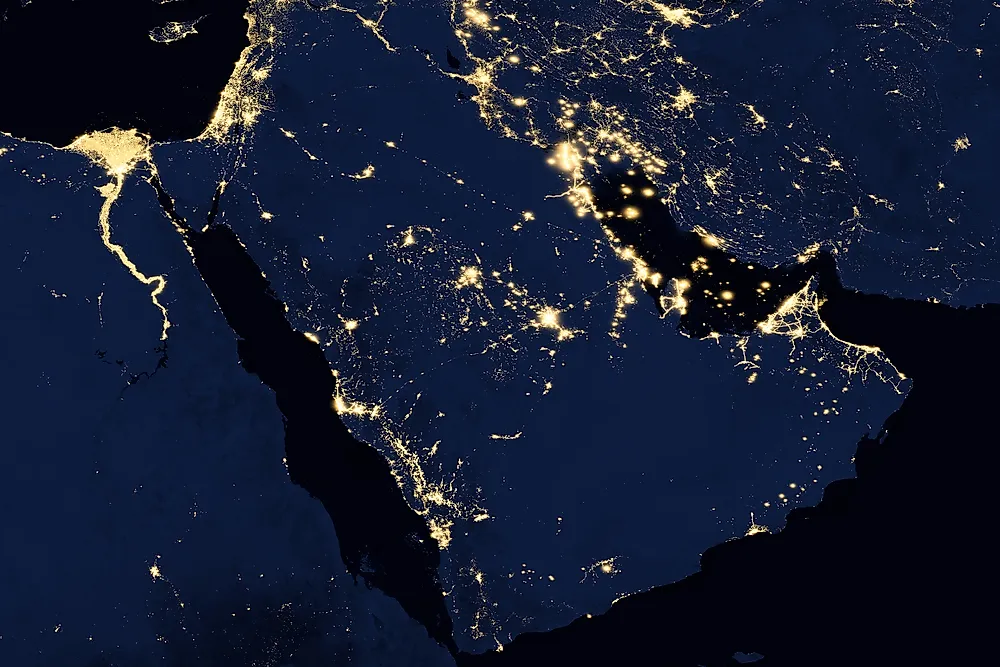
1. Arabian Peninsula

At roughly 1,250,000 square miles, the Arabian Peninsula is not just the largest peninsula on Earth, it is larger than Greenland, the largest island on Earth, which is a polite way of saying it is really a subcontinent that never filed the paperwork. It hangs off southwest Asia, bordered by the Red Sea, the Arabian Sea and the Gulf of Aden, and the Persian Gulf, and it is shared by seven countries including Saudi Arabia. Most of it is desert, including the Rub al Khali, one of the largest continuous sand seas in the world, which is also why it happens to float on a startling amount of oil.
2. Indian (Deccan) Peninsula

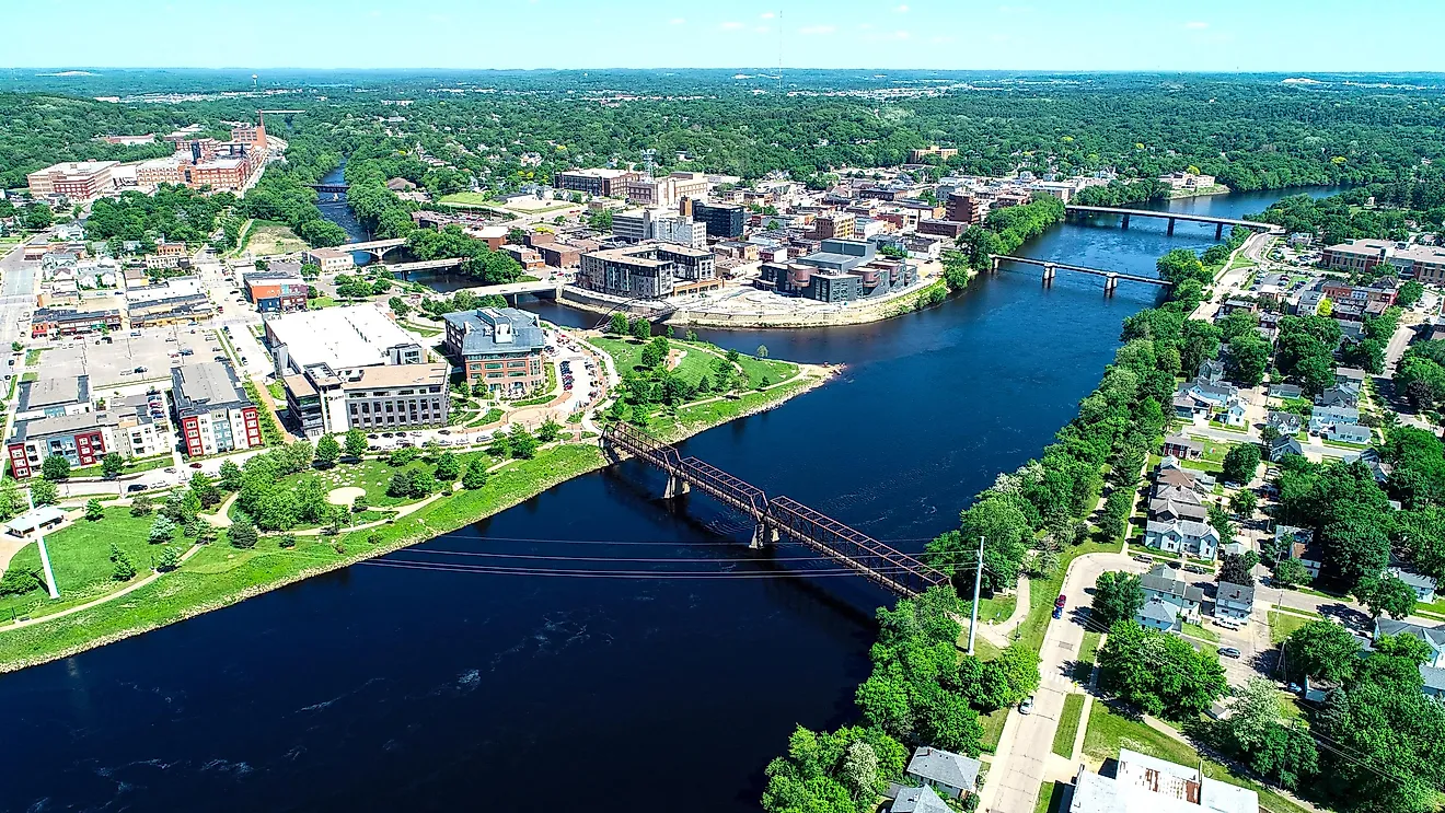
Coming in around 800,000 square miles, the great southern projection of India is properly the Indian Peninsula, with the triangular Deccan Plateau as its core, walled off to the north by the Himalayas and dropping into the Indian Ocean between the Arabian Sea and the Bay of Bengal. The Western and Eastern Ghats run down its two coasts, sheltering tigers, elephants, and a remarkable amount of biodiversity. It also supports well over a billion people, which makes it comfortably the most crowded entry on this list.
3. Indochinese Peninsula

About 748,000 square miles of mainland Southeast Asia, the Indochinese Peninsula carries Myanmar, Thailand, Laos, Cambodia, and Vietnam, with the long Malay Peninsula trailing south off its bottom edge like a dangling thread. The Mekong River runs through the middle of it, and the whole region is one of the most biodiverse on the planet, home to well over a thousand bird species. Ask three geographers exactly where it begins and you will get four answers and one argument.
4. The Horn of Africa

The easternmost jut of Africa, around 727,000 square miles, the Horn pokes into the Indian Ocean right at the mouth of the Red Sea, with the Gulf of Aden along its northern edge. It covers Djibouti, Eritrea, Ethiopia, and Somalia, holds the Ethiopian Highlands often called the Roof of Africa, and has produced some of the oldest known human ancestor fossils anywhere on Earth. It also hosts more endemic reptile species than any comparable region, if that is your thing.
5. Labrador Peninsula

The first of the giants that most people could not point to on a map, Labrador covers roughly 540,000 square miles of eastern Canada, split between Quebec and the province of Newfoundland and Labrador. It is bordered by Hudson Bay, the Hudson Strait, and the Labrador Sea, and it sits on the ancient Canadian Shield, some of the oldest exposed rock on the planet. It is enormous, largely empty, and very, very cold.
6. Anatolia (Asia Minor)

Map of the geographic region of Anatolia. By Golden - Samuel Butler.jpg, CC BY-SA 4.0, https://commons.wikimedia.org/w/index.php?curid=91911818
Here is the one most lists forget. Anatolia, also called Asia Minor, forms the bulk of Turkey, roughly 292,000 square miles bounded by the Black Sea to the north, the Aegean to the west, and the Mediterranean to the south. It is the literal land bridge between Europe and Asia and one of the most fought-over pieces of ground in human history. Leaving it off a ranking of the largest peninsulas is like listing the tallest buildings and skipping the one in the middle of the skyline.
7. Scandinavian Peninsula

Neck and neck with Anatolia at about 290,000 square miles, the Scandinavian Peninsula is the largest in Europe and holds Norway and Sweden, plus a sliver of Finland depending on who is drawing the line. Its western coast has the most elaborate fjord system on Earth, the result of glaciers spending a few million years carving the place into ribbons. The Scandinavian Mountains run down its spine like a seam.
8. The Balkan Peninsula

At roughly 257,000 square miles in southeastern Europe, bordered by the Adriatic, Aegean, and Black seas, the Balkans is the entry that shows up to the party and then has its invitation questioned. A growing number of modern geographers argue it is not a true peninsula at all, because its northern land boundary is too wide and too vague to satisfy the definition. It is here by tradition more than by geometry, which is very on brand for the Balkans.
9. Iberian Peninsula

About 225,000 square miles in southwestern Europe, the Iberian Peninsula is mostly Spain and Portugal, with Andorra and Gibraltar squeezed in. The Pyrenees wall it off from the rest of the continent to the northeast, and at its southern tip it comes within about 14 kilometers of Africa across the Strait of Gibraltar, close enough that on a clear day the two continents can see each other. Gibraltar is also home to the only wild monkeys in Europe, which is the kind of fact that wins bar trivia.
10. Kamchatka Peninsula

The other big one most lists skip, Kamchatka hangs off the far east of Russia at around 104,000 square miles, separating the Sea of Okhotsk from the Pacific. It is one of the most volcanically active places on the planet, with 29 active volcanoes, and across much of it the brown bears comfortably outnumber the people. It feels less like a peninsula and more like a dare.
Rounding Out the Top 15
The back half of the list shrinks fast. The Korean Peninsula (about 85,000 square miles) holds two countries and the heavily fortified strip between them that has accidentally become one of Asia's best wildlife refuges. The Yucatan Peninsula in Mexico (about 76,000 square miles) separates the Gulf of Mexico from the Caribbean, is riddled with flooded sinkholes called cenotes and dotted with Maya ruins, and is where an asteroid ended the dinosaurs roughly 66 million years ago. Florida (about 66,000 square miles) is the most famous peninsula in the United States and essentially a sandbar with excellent marketing. Baja California (about 55,000 square miles) is the long thin finger of Mexico sliced off from the mainland by the Gulf of California. And the Italian Peninsula (about 51,000 square miles) is the boot, the most recognizable peninsula shape on Earth.
Why Alaska Keeps Showing Up by Mistake
Go looking and you will find the Alaska Peninsula on a lot of these lists, usually parked around fifth place at 579,153 square miles. That figure has been handed down through reference books for decades, and it is wrong, or at least badly mislabeled. The actual Alaska Peninsula is the narrow tail of land that runs southwest toward the Aleutian Islands, home to Katmai National Park and the Pavlof Volcano, and it is only a few tens of thousands of square miles. The 579,153 number is really describing the entire Alaska mainland, which you can loosely call a peninsula of North America if you squint, but which is a very different thing from the named feature. It got left off here rather than rank a mislabel.
The Full Ranking
Here is the corrected top 15, with areas rounded because, as every geographer will happily remind you, the exact boundaries are up for debate. Anatolia, Kamchatka, and the Yucatan have been slotted in where the original list had skipped genuinely larger peninsulas in favor of smaller ones.
| Rank | Peninsula | Approximate area (square miles) |
|---|---|---|
| 1 | Arabian | 1,250,000 |
| 2 | Indian (Deccan) | 800,000 |
| 3 | Indochinese | 748,000 |
| 4 | Horn of Africa | 727,000 |
| 5 | Labrador | 540,000 |
| 6 | Anatolia (Asia Minor) | 292,000 |
| 7 | Scandinavian | 290,000 |
| 8 | Balkan | 257,000 |
| 9 | Iberian | 225,000 |
| 10 | Kamchatka | 104,000 |
| 11 | Korean | 85,000 |
| 12 | Yucatan | 76,000 |
| 13 | Florida | 66,000 |
| 14 | Baja California | 55,000 |
| 15 | Italian | 51,000 |
The Bottom Line
Peninsulas are proof that the line between land and water is more of a suggestion than a rule. The Arabian Peninsula is so big it embarrasses the category, the Balkans may not even qualify, and Alaska has been crashing the rankings under a borrowed number for years. The honest summary is this: the top four are giants by any measure, the rest depend on exactly where you set down your ruler, and anyone who quotes you these areas to the nearest single square mile is selling a precision the geography does not support.