How Many Continents Are There?
There are seven continents on our planet: Asia, Africa, North America, South America, Antarctica, Europe, and Australia. These landmasses form the world's geographical structure, each possessing features particular to themselves, biodiversity, culture, and economic significance. A continent is generally defined as a large, continuous, discrete mass of land separated from others by expanses of water. However, defining a continent is not always straightforward due to varying perspectives influenced by cultural and geographical factors.
Differing Models
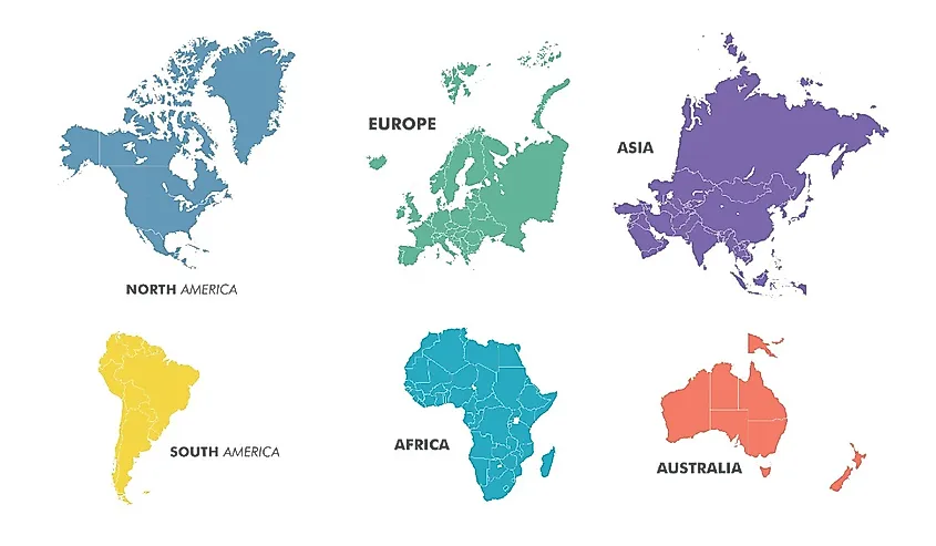
There are usually seven recognized continents, but there are alternative models. As represented by the five Olympic rings, the five-continent model includes Europe, Asia, Africa, America (combining North and South), and Oceania (including Australia). This model is based on the view of continents as inhabited landmasses, leaving out Antarctica.
On the other hand, there are several other continental models that are taught in different regions of the world. For example, there are variants of the six-continent model used widely across Europe. In one model used in Western Europe, the Americas are combined, and Europe and Asia are separate. However, an alternate six-continent model considers Europe and Asia as a single continent and the Americas as separate entities. This version of the six-continent model, which combines Eurasia into one continent, is prevalent in many parts of Eastern Europe and Asia (excluding English-speaking countries, China, India, and Pakistan, which generally accept the seven-continent model).
There is also a four-continent model, which attempts to simplify the world's geographic structure. This model groups North and South America as one continent, combines Europe, Africa, and Asia into another, and maintains Australia as a separate continent — leaving Antarctica as the fourth.
Despite these commonly accepted models, there is an ongoing debate about whether Zealandia, a large landmass mostly submerged in the southwest Pacific, should be classified as an eighth continent. Zealandia fulfills many of the necessary criteria: it is distinct and separate from Australia, and geological evidence suggests it is a continental crust.
Continents and Plate Tectonics
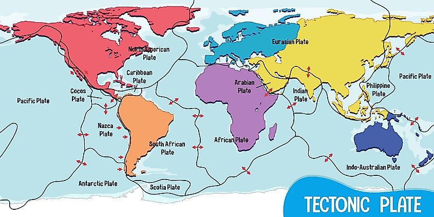
The Earth's crust is divided into multiple tectonic plates—massive, irregularly shaped slabs of solid rock—comprising both continental and oceanic lithosphere. These plates aren't static; instead, they are constantly moving, albeit at a slow pace, due to the heat in the Earth's mantle causing convection currents. This movement leads to the phenomena of continental drift and plate tectonics.
Continents have formed over billions of years due to the movement of these tectonic plates. The supercontinent Pangaea, which existed about 300 million years ago, eventually split and drifted apart to form the current continents. This historical journey of continents is a significant reason behind the world's varied geographical features, ranging from the high mountain ranges formed due to convergent boundaries, such as the Himalayas, to the deep oceanic trenches formed by divergent boundaries.
Moreover, the movement of tectonic plates is linked to seismic activities, leading to earthquakes, volcanic eruptions, and the creation of mountain ranges. It is the continuous movement, interaction, and reformation of these plates that has given rise to the Earth's "personality-rich" landscape.
Asia
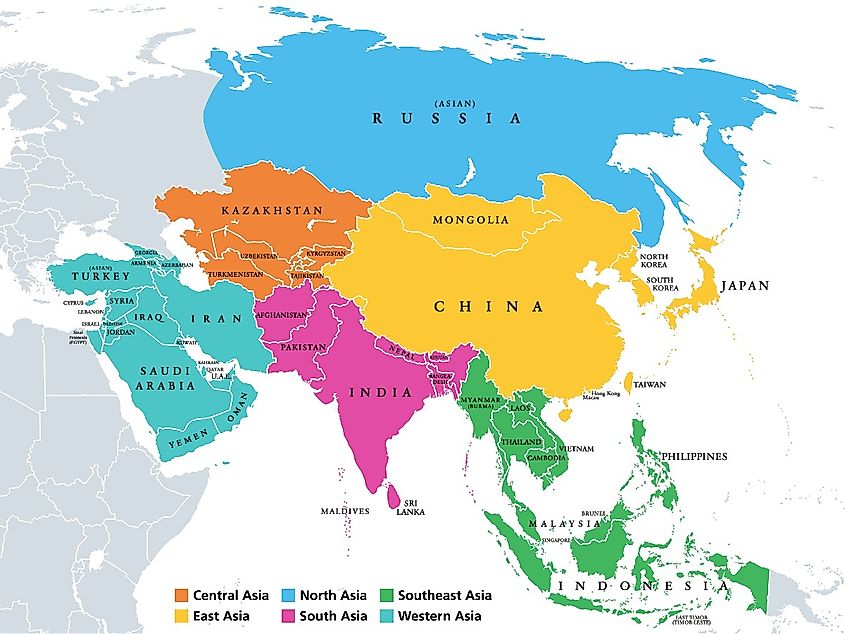
Asia, the largest continent, both in terms of area and population, is a combination of stunning geography (particularly Zhangjiajie National Forest Park), cultural heritage, and significant economic power. Asia spans approximately 30% of Earth's total land area and hosts nearly 60% of the global population.
The continent is home to the world's highest point, Mount Everest, located in the Himalayas, and the lowest point, the Dead Sea. It houses vast deserts like the Gobi and the Arabian Desert and significant water bodies like the Yangtze River and Lake Baikal, the world's deepest freshwater lake.
Last, Asia's diversity is not only geographical but also cultural. It is home to many of the world's oldest civilizations, and various religions, including Hinduism, Buddhism, Islam, and Christianity, originated here. It hosts a range of countries, from the technologically advanced Japan and the fast-growing economy of China to the remarkable history of India.
Africa
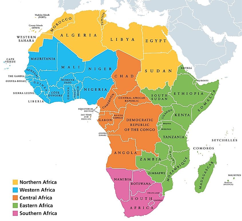
Africa, the second-largest continent, is often referred to as the cradle of humankind due to substantial archaeological evidence suggesting it as the birthplace of Homo sapiens. Spanning over 20% of Earth's total land area, it is home to many ecosystems, ranging from the arid Sahara Desert to the lush rainforests of the Congo Basin.
The continent's geographical features are as varied as its wildlife. It includes the world's longest river, the Nile, and the world's tallest free-standing mountain, Mount Kilimanjaro. The Great Rift Valley, with its volcanoes and lakes, testifies to Africa's active tectonic activity.
Africa is a melting pot of cultures, with over 2000 distinct ethnic groups and more than 2,000 languages spoken. Countries like Egypt, with its ancient pyramids and rich history, and South Africa, with its blend of cultures, showcase the continent's rich heritage.
North America
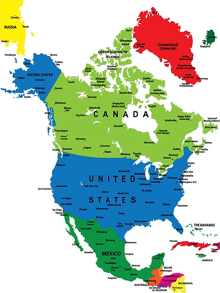
North America, the third-largest continent, is characterized by its diversity. For example, it has arctic tundra in the north yet tropical rainforests in the south. It is home to the world's largest freshwater lake system, the Great Lakes, and houses the Mississippi-Missouri River system, one of the longest in the world.
The continent has extreme landscapes, including the Rocky Mountains, the expansive Great Plains, and the arid Mojave Desert. The Grand Canyon, a steep-sided canyon carved by the Colorado River, is a small example of the continent's geological history.
North America comprises 23 countries, with the largest being Canada, the United States, and Mexico. The region is a blend of cultures and languages, heavily influenced by its history of indigenous peoples, European colonization, and immigration. Its significant global economic influence, particularly in the United States, further accentuates North America's role on the world stage.
South America
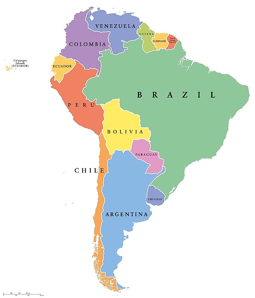
South America, the fourth-largest continent, is home to the Amazon Rainforest, the largest rainforest in the world, which alone houses around 10% of the world's biodiversity.
Geographically, South America features some of the most remarkable landscapes on Earth. The Andes Mountains, the world's longest mountain range, run along its western edge, and the Amazon River, one of the longest rivers in the world, snakes through its heart. At the southern tip lies the windswept plains of Patagonia, known for its stunning landscapes.
The continent's cultural heritage is deeply rooted in its indigenous civilizations, such as the Incas, and later influences from European colonization. Brazil, Argentina, and Colombia, among others, are notable for their mesmerizing cultures and economic influence.
Antarctica
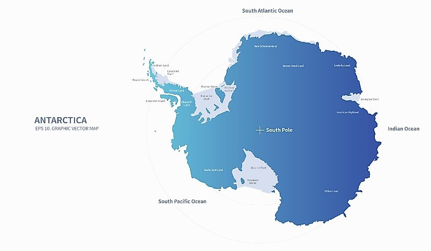
Antarctica is a continent of extremes. Of all the landmasses, it is the most cold, dry, and windy. It also possesses the highest continental elevation. Largely uninhabited, it is governed internationally through the Antarctic Treaty system, which prohibits military activity, mineral mining, nuclear tests, and nuclear waste disposal.
Despite the inhospitable conditions, Antarctica hosts a variety of wildlife adapted to its conditions, including several species of penguins, seals, and a variety of sea birds. It's surrounding Southern Ocean is home to several species of whales and fish.
Antarctica's primary human inhabitants are scientists who live there temporarily, conducting research in a wide range of disciplines, including biology, geology, and climatology. This continent's ice cores paint a picture of the ancient climate record, giving insights into the Earth's atmospheric composition over hundreds of thousands of years.
Europe
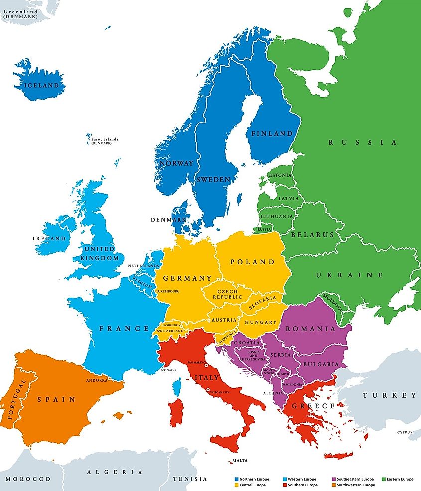
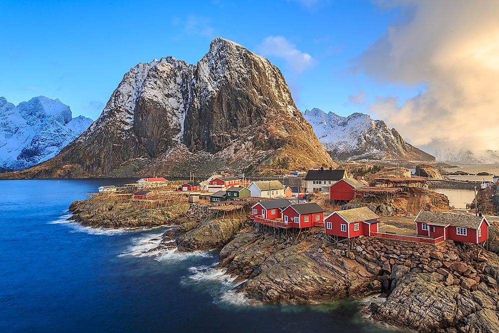
Europe, although second smallest in physical size, features marvels like the Arctic tundra of Scandinavia, the Mediterranean beaches of Greece and Spain, the Alpine mountains, and the expansive Russian steppes.
Historically, Europe is home to some of the world's most ambitious civilizations, including the Ancient Greeks, the Romans, and the British. Later, the Renaissance and the Enlightenment periods played pivotal roles in shaping modern Western society. The continent is also marked by two devastating World Wars that had global repercussions.
Europe is home to roughly 200 distinct languages, which is evidence of its cultural variety. Today, much of Europe is united politically under the banner of the European Union, a political and economic union designed to enhance cooperation and ensure peace among its member states.
Australia
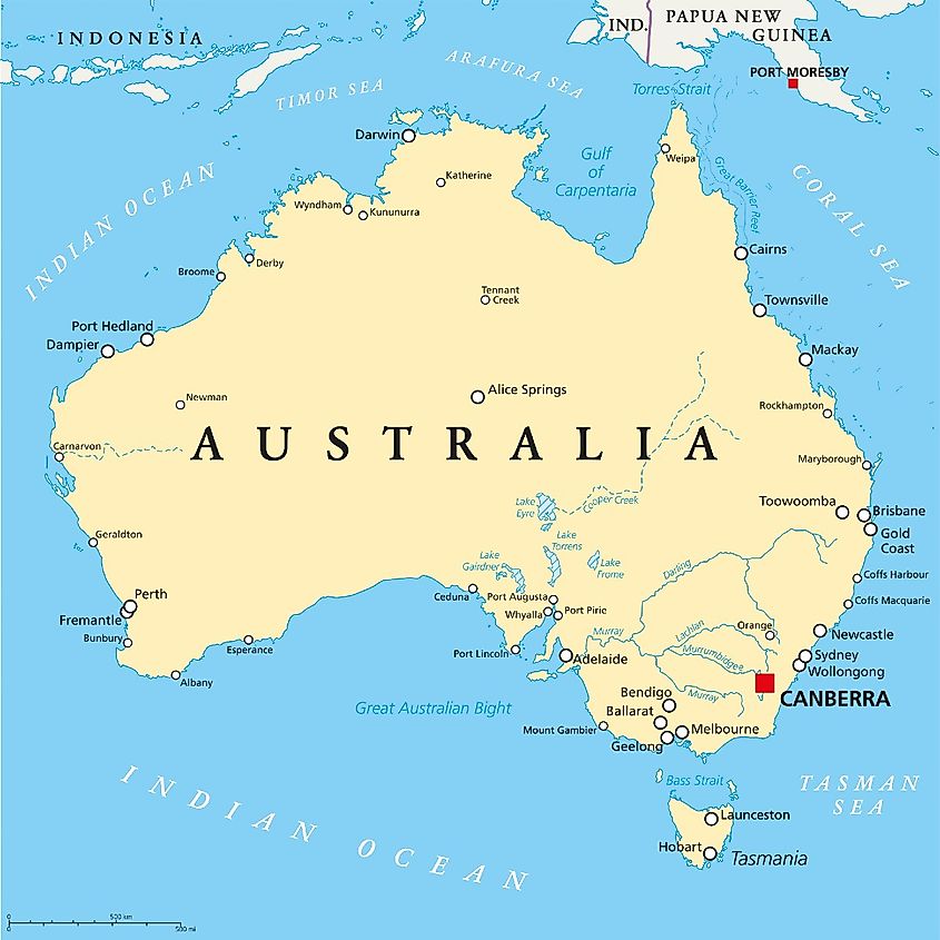
Australia holds the unique position of being the smallest continent and the largest island. Known for its distinct, particularly dangerous, flora and fauna, it is the only continent with only a single country. Its geographical features include the arid outback, tropical rainforests, and coastal regions lined with spectacular beaches.
Australia is home to the Great Barrier Reef, the world's largest coral reef system, and hosts unique animal species like kangaroos, koalas, and numerous types of marsupials and monotremes found nowhere else on Earth.
Culturally, Australia has a rich indigenous heritage with the Aboriginal people, who have inhabited the land for over 60,000 years. Modern Australia is a melting pot of cultures, owing to its history of immigration. The continent's economy is robust, with significant contributions to mining, agriculture, and service sectors.
Understanding the characteristics and unique features of each continent allows one to appreciate the global multiplicity that defines our planet. Each of the seven (or perhaps eight) continents contributes to the story and value of the world. Moving forward, however, facing global challenges such as climate change and inequality are issues that each continent must face internally while addressing together, in good faith cooperation. Thus, one's understanding of continents is not just a matter of geographical interest but also of planetary continuity.
