Which State Has Lost The Most Lakes?
California has lost more large, historically significant lakes than any other US state. A “lost lake” is a natural lake whose normal open-water condition was eliminated by human water development, even if water occasionally returns. These losses can destroy wildlife habitat, reduce groundwater recharge, and expose lakebeds that produce severe dust pollution. Tulare, Buena Vista, Kern, and Owens Lakes largely disappeared after their water was diverted for agriculture and cities.
The Short Answer: California

Tulare, Buena Vista, and Kern Lakes formed an interconnected freshwater system in the southern Central Valley, while Owens Lake was a separate saline terminal lake east of the Sierra Nevada. Agricultural diversions and flood-control works largely eliminated Tulare, Buena Vista, and Kern Lakes, while local irrigation and drought had already severely reduced Owens Lake before Los Angeles began additional diversions in 1913. Mono Lake did not disappear, but diversions caused a 45-foot decline and a 30% reduction in surface area before court rulings and the 1994 State Water Board decision restricted exports. Few other states have a comparable group of large, historically named lakes lost to water development, making California the state with the most lakes lost.
Tulare Lake: The Biggest Loss Of All

At high water, seasonal Tulare Lake could cover as much as about 790 square miles and was commonly described as the largest freshwater lake west of the Mississippi, although its size and depth fluctuated dramatically. Fed by the Kaweah, Kern, Kings, and Tule Rivers flowing down from the Sierra Nevada, the lake supported steamboat traffic and a thriving fishery as recently as the 1870s. As irrigation diversions increasingly intercepted those rivers in the late 19th century, regular inflow declined, and by 1899 the lakebed was dry except for scattered wetlands; later dams further controlled runoff into the basin. It has briefly reappeared during exceptionally wet years, including 1969, 1983, 1997, and most dramatically in 2023, when snowmelt and storms refilled nearly 100,000 acres of the old lakebed before it began drying up again.
Buena Vista Lake And Kern Lake: The Rest Of The Chain

Tulare Lake was not alone. Just south of it sat Buena Vista Lake and Kern Lake, two smaller lakes fed by the Kern River that, together with Tulare Lake, formed a connected chain of wetlands and open water across the southern Central Valley, an area now part of Kern County. Both lakes went the way of Tulare Lake. The Kern River's flow was increasingly claimed for irrigation canals through the late 1800s, and dams and farmland left the lakebeds largely dry by the 1920s. In 2023, Kern River floodwater spread back into part of the old lakebed before receding. Only a limited portion of it can be flooded at all, because a 1964 agreement bars water storage on the largest block of the lakebed, which the J.G. Boswell Company farms. Today, two much smaller reservoirs, Lake Webb and Lake Evans, sit in a portion of the old Buena Vista lakebed as part of the Buena Vista Aquatic Recreation Area. Together, Lake Webb and Lake Evans occupy only part of the former Buena Vista lakebed.
Owens Lake: Drained For Los Angeles

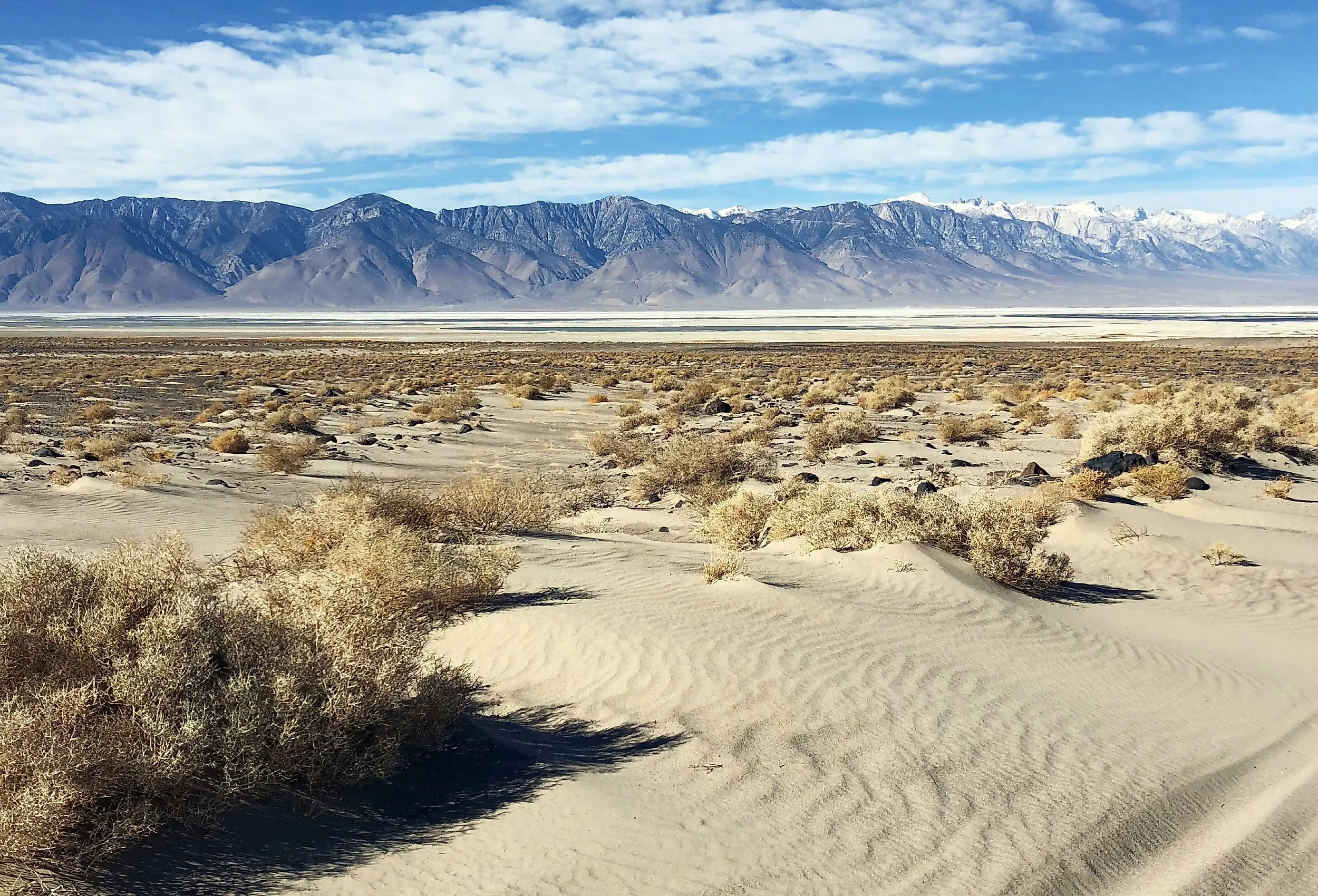
Across the mountains from the Central Valley, Owens Lake met a similar fate for a different reason. The lake once spanned roughly 110 square miles (285 km²) in the Owens Valley, stretching about 17 miles (27 km) long. Local irrigation diversions and drought had already lowered the lake before the aqueduct existed, with valley farmers drawing off its tributaries from the 1880s onward, and the water was judged excessively saline by 1905. Los Angeles Aqueduct diversions beginning in 1913 exposed far more of the lakebed. By 1926, Owens Lake was reduced to a salt flat. The exposed lakebed went on to become the largest single source of PM10 dust pollution in the United States. The Los Angeles Department of Water and Power was forced to spend more than $2.5 billion on dust-control measures, which have cut annual dust emissions by more than 99% since 2000.
Mono Lake: The One That Almost Vanished, Too

Not every California lake on this list disappeared entirely, and Mono Lake is the reason the state's losses were not even worse. In the early 1940s, the Los Angeles Department of Water and Power began diverting the streams that feed Mono Lake, the same way it had already drained Owens Lake to the south. Between 1941 and 1982, the diversions lowered Mono Lake by 45 feet and reduced its surface area by approximately 30%. Unlike Owens Lake, Mono Lake retained substantial open water, while legal and regulatory action prevented its decline from continuing unchecked. A 1994 ruling by the California State Water Resources Control Board, Decision 1631, set a target lake level of 6,392 feet above sea level and limited future diversions to protect the lake's ecosystem; however, the lake still has not fully recovered.
California's Wetlands: A 91% Loss Rate

California's lost-lake problem is really a subset of a much bigger pattern. According to a 1990 US Fish and Wildlife Service report to Congress, "Wetlands Losses in the United States, 1780s to 1980s," California lost an estimated 91% of its original wetland acreage between the 1780s and the 1980s, the single highest percentage loss of any state in the country. That estimate covers many wetland types rather than named lakes and reflects widespread drainage, filling, and agricultural conversion, particularly in the Central Valley; Owens Lake followed a separate history east of the Sierra Nevada. Six other states (Ohio, Iowa, Indiana, Missouri, Illinois, and Kentucky) lost at least 80% of their estimated original wetland acreage over the same period, but none matched California's rate.
The Runners-Up: Florida, Ohio, And The Prairie States

California stands out for the loss of its large, historically named lakes and has the highest estimated percentage of wetlands lost, although Florida lost more wetland acreage overall. Florida lost more wetland acreage than any other state (an estimated 9.3 million acres) through drainage and conversion across the state, including major alterations within the Everglades. In the Midwest, the Great Black Swamp was a vast wetland spanning northwestern Ohio and part of northeastern Indiana that was extensively drained for agriculture beginning in the mid-1800s, but it was not a single lost lake. Iowa and Illinois lost very high proportions of their wetlands to agricultural drainage, but the federal acreage estimates do not establish that either state lost tens of thousands of lakes.
California's Lakes, Then And Now
California's missing lakes are a reminder that a state's map is not fixed. Tulare, Buena Vista, and Kern Lakes once formed an interconnected freshwater and wetland system in the southern Central Valley. Owens Lake and its surrounding wetlands supported important wildlife habitat before diversions drastically reduced the lake, while legal and regulatory action prevented Mono Lake from undergoing a similarly severe decline. Even now, the story is not entirely finished: Tulare Lake keeps returning in wet years before drying out again, and the same water pressures that emptied California's lakes a century ago continue to shape the state's water politics today.