The US Lakes That Will Disappear When Their Dams Come Down
For more than a century, a lake called Pillsbury has sat in the mountains of Northern California. Vacation cabins ring it, anglers fish it, and a concrete wall named Scott Dam holds it all in place. If federal regulators approve the plan now in front of them, the dam will come out and the lake will drain back into the Eel River that made it. Pillsbury is not alone. In Virginia, a 1918 reservoir is slated to become tidal marsh along the James River. In Utah, crews are already draining a mountain reservoir in Ashley National Forest. And in a string of New England mill towns, century-old dams are being pulled from brooks that will run free for the first time in generations. Each of these lakes exists only because a dam holds a river in place, and each now sits on a list of impoundments whose dams are scheduled to come down. When they do, the lakes go with them.
Yellowstone Reservoir, Utah

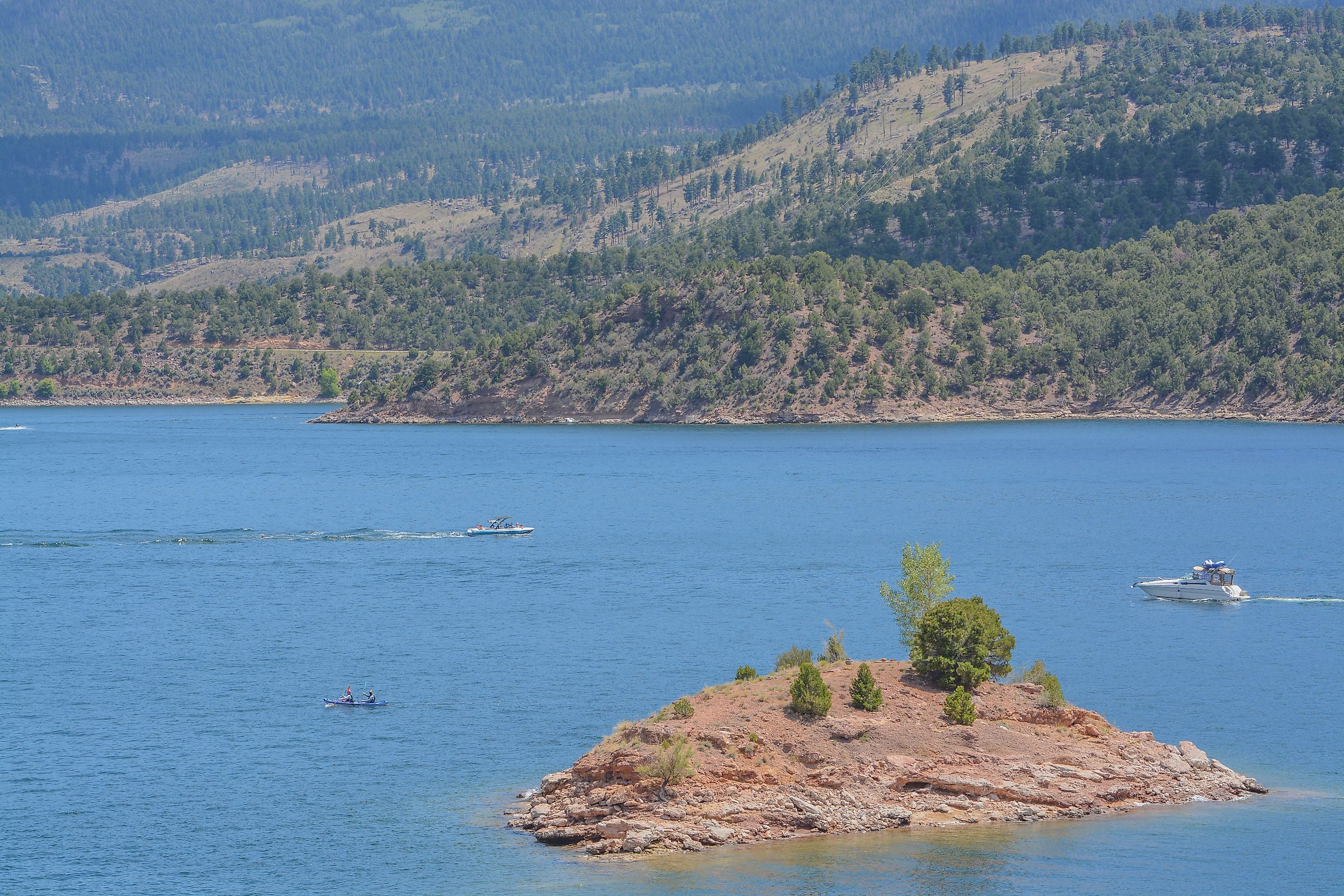
Yellowstone Reservoir in northeastern Utah is already entering the transition away from being a lake. The US Forest Service began the Yellowstone Reservoir Dam Removal and Restoration Project in Ashley National Forest in 2026, putting this reservoir among the most immediate examples of a named impoundment reaching the end of its life.
The work centers on reestablishing natural drainage through ground that has spent decades beneath standing water. As the reservoir level falls, sediment deposited under slow-water conditions becomes exposed and a stream can once again cross the basin. That sediment is not a minor detail. Water moving through freshly uncovered deposits can cut new channels quickly, particularly after storms or snowmelt.
Crews therefore have more to manage than the demolition of the dam itself. A stable drainage route has to develop across the old reservoir floor while disturbed surfaces begin supporting vegetation. What looks today like a mountain lake will eventually become a much narrower watercourse surrounded by restored terrestrial and riparian ground.
Stoddard Reservoir, Connecticut

Stoddard Reservoir in Simsbury is small at about 2.35 acres, but the town's plans offer an unusually clear picture of what happens when an artificial lake loses its dam. Stoddard Reservoir Dam is expected to come out in two phases during the 2027 and 2028 construction seasons, allowing Stratton Brook to cross the site freely again.
Engineers are not simply lowering the water and leaving the reservoir bed untouched. Plans call for a meandering channel through the exposed basin so the brook has a defined course once the impoundment disappears. The existing sheet of open water will be replaced by a considerably narrower stream, with newly uncovered ground forming its banks and surrounding riparian area.
The scale may be modest, but the transformation is complete. Stoddard will stop functioning as a reservoir because the feature responsible for maintaining its water level will no longer exist.
Thousand Acre Reservoir, Massachusetts

Thousand Acre Reservoir in Athol was created by a dam across Thousand Acre Brook, but the structure no longer serves the purpose that once justified keeping it. Massachusetts wildlife officials have moved toward removal as the aging dam deteriorates, pairing demolition with restoration of the stream corridor.
The work reaches beyond the old concrete, masonry, and earthen structure. Sediment accumulated behind the dam has to be managed, a channel must be reestablished, and vegetation will be planted across parts of the exposed reservoir floor. Thousand Acre Brook is recognized as coldwater habitat and supports reproducing brook trout, giving the project an ecological importance that extends downstream toward the Millers River.
Once the artificial water level drops, the brook will occupy only a narrow portion of the area now covered by the reservoir. Low ground may remain wet, while other sections gradually develop into streamside habitat. The familiar lake outline will be gone.
Springfield Reservoir, Vermont

Springfield Reservoir in Weathersfield has progressed beyond the planning stage. Springfield officials awarded a dam-removal contract in February 2026, with construction scheduled for later in the year. The structure dates to the early 20th century, has sustained flood damage, and no longer provides the municipal function that once made maintaining the reservoir worthwhile.
Removing it is a substantial engineering job. Project documents call for sections of the concrete core and earthen embankment to be taken out along with the spillway and related features. Roughly 9,000 cubic yards of accumulated sediment are also expected to be excavated before a stream channel is restored through the former impoundment.
That sediment tells much of the reservoir's history. Material that would normally have continued downstream settled out when the dam slowed the brook it impounds. Once the barrier disappears, flowing water again needs a stable path across ground built up under a century of reservoir conditions.
Poole Reservoir, New Hampshire
Poole Reservoir sits on Mead Brook in Jaffrey, where an aging town-owned dam has become a liability without much useful work left to perform. New Hampshire Fish and Game has identified the structure as being in poor condition and no longer serving its original purpose, while funding has been directed toward removal.
The benefit extends well beyond the reservoir shoreline. Taking out the dam is expected to reconnect several miles of coldwater habitat along Mead Brook, restoring movement between upstream reaches, wetlands, and water farther downstream. A relatively short barrier can fragment far more of a watershed than its dimensions suggest.
The present reservoir depends on the dam holding Mead Brook above its natural level. Once that control is gone, the brook will occupy a much smaller part of the basin. Some ground beside it may remain wet or seasonally flooded, but the continuous artificial pool will disappear.
Upper Reservoir, New Hampshire

Goffstown originally expected to rehabilitate Upper Reservoir Dam. By 2025, that direction had changed. Town officials approved removal over repair, turning what had been a project to preserve the impoundment into one that would eventually eliminate it.
The reversal reflects a problem facing municipalities across the country. Repairing a deteriorating dam does more than solve today's structural problem. It commits the owner to another cycle of inspections, upkeep, emergency planning, and eventual rehabilitation. Removal can end that obligation entirely when the reservoir no longer provides enough benefit to justify it.
Upper Reservoir will lose the elevated water level created by the dam once the structure is taken out. The natural drainage through the basin will then control where water remains, exposing sections of the old bottom and erasing the fixed shoreline maintained by the barrier.
Skiffes Creek Reservoir, Virginia

Skiffes Creek Reservoir in southeastern Virginia faces a more complicated transformation. Newport News Waterworks owns the reservoir and its 1918 dam, but repairing the century-old structure has been estimated at roughly $14 million to $20 million. The reservoir now accounts for less than 4% of the regional system's storage, weakening the case for a costly rebuild.
The proposed alternative is extensive ecological restoration. Once the dam, concrete spillway, and pump station are removed, planners expect the former reservoir floor to become about 39 acres of wetland. A tidal creek would run through the part of the site closest to the James River, while other sections would develop into non-tidal wetland habitat.
Tidal influence makes Skiffes Creek different from most inland dam-removal sites. The exposed lakebed will not simply become a narrow freshwater stream corridor. Water levels downstream will continue influencing portions of the former reservoir, allowing tidal wetland to spread across ground that is currently submerged beneath a relatively stable artificial pool.
Construction could begin in 2027, although permitting may push the start into 2028.
Fern Hill Reservoir, Pennsylvania

Fern Hill Reservoir in West Goshen Township may vanish in stages rather than through a single dramatic draining. Aqua Pennsylvania plans to lower the water by roughly eight to ten feet first, leaving a reduced pool while engineering and permitting work continues.
Later construction, anticipated around 2028 and 2029, would involve partial removal of the dam followed by draining of the remaining reservoir. That distinction is important. Part of the physical dam may survive even after the artificial lake it once maintained has disappeared.
The landscape left behind cannot be mapped perfectly in advance. Groundwater, rainfall, runoff, low areas in the reservoir floor, and the eventual drainage channel will decide which sections remain wet. Some former lakebed could dry enough to support vegetation while depressions and channel margins continue holding water.
Van Arsdale Reservoir, California

Van Arsdale Reservoir lies on the Eel River about 12 miles downstream from Lake Pillsbury. Cape Horn Dam creates the reservoir, which is relatively small but has long played an important role in transferring water from the Eel River watershed toward the Russian River system.
PG&E's application to surrender the Potter Valley Hydroelectric Project proposes dismantling Cape Horn Dam while retaining infrastructure needed for a planned replacement diversion. The proposal also includes rehabilitation of land currently inundated by Van Arsdale Reservoir. If the project proceeds substantially as filed, the reservoir's present form would disappear as the river is allowed to occupy a far narrower corridor.
This case carries more uncertainty than projects already under construction. Federal review is still underway, and future diversion infrastructure could leave some controlled water at the site. Van Arsdale therefore belongs on the list as a reservoir facing formal decommissioning, not one whose disappearance has already been guaranteed.
Colrain Lower Reservoir, Massachusetts

Colrain's Lower Reservoir was built behind a dam on East Brook in 1902 to store water for firefighting. That purpose eventually disappeared after modern pumps made the reservoir unnecessary, yet the old concrete structure remained in place long after its original job had ended.
The town and Connecticut River Conservancy are now working toward removal as part of wider restoration in the North River watershed. More than $224,000 from a Massachusetts settlement has supported design and related work. The dam stands about 15 feet high and has been classified as a significant hazard because a failure could affect the center of Colrain.
The timing is not as firm as at Springfield or Yellowstone. Project partners have discussed removal around 2028 if the remaining design and construction money can be secured. Should that proceed, East Brook would once again become the defining water feature through land now occupied by the reservoir.
Lake Pillsbury, California

Lake Pillsbury is in another league from the smaller reservoirs on this list. Scott Dam blocks the Eel River in Northern California, creating a sizable lake that has occupied the valley for more than a century. Its potential disappearance would represent one of the most consequential reservoir removals now under formal consideration in the United States.
PG&E has applied to surrender the Potter Valley Hydroelectric Project and proposes dismantling Scott Dam. If regulators approve the plan, the Eel River would once again run through a valley now covered by Lake Pillsbury. Portions of the reservoir floor are expected to develop into river habitat, wetlands, riparian vegetation, and upland ground as the artificial water level disappears.
The consequences extend far beyond the existing shoreline. Scott Dam currently blocks fish passage into a large part of the upper Eel River watershed. Removing it would reconnect habitat upstream while also releasing a valley that has spent generations beneath reservoir water.
Its future is not yet settled. Federal and state reviews remain underway, alternatives are still being considered, and opponents continue challenging full removal. Lake Pillsbury is therefore best understood as the largest prominent reservoir that could disappear through the current wave of dam decommissioning, rather than one with a guaranteed demolition date.
What Happens After a Reservoir Drains

A disappearing reservoir does not mean a disappearing river. The dam had spread that river across a wider area by slowing its flow and raising the local water level. Once the obstruction is gone, moving water usually occupies only a fraction of the ground that had been submerged.
Some of the fastest changes happen in sediment. Reservoirs trap sand, silt, gravel, and organic material that would otherwise continue downstream. After drawdown, the current can cut through those deposits, deepen a channel, undermine exposed banks, or carry stored sediment farther along the river. The response depends heavily on the amount of material present and how easily it erodes.
Plants arrive according to conditions on the newly exposed ground. Higher surfaces may dry enough for grasses, shrubs, and eventually trees. Low depressions can stay saturated, while the river margin continues flooding whenever flows rise. Wetland vegetation may spread where groundwater remains close to the surface.
Over several seasons, the old shoreline becomes less obvious. What had looked like a permanent lake can resolve into a river channel, floodplain, marsh, and patches of young vegetation. The water never truly disappeared from the watershed. What vanished was the dam-created shape that had held it in place.