How the Great Lakes Were Formed
The Great Lakes took more than a billion years to carve into their present shape. Their story starts with a continental split that tried to tear North America in two. That rift failed and left a deep scar of soft rock across the interior. Mile-thick ice sheets later ground down that weak rock into five enormous basins. Meltwater flooded the basins as the last glaciers pulled back toward Canada. The land is still rising today where all that ice once pressed it down.
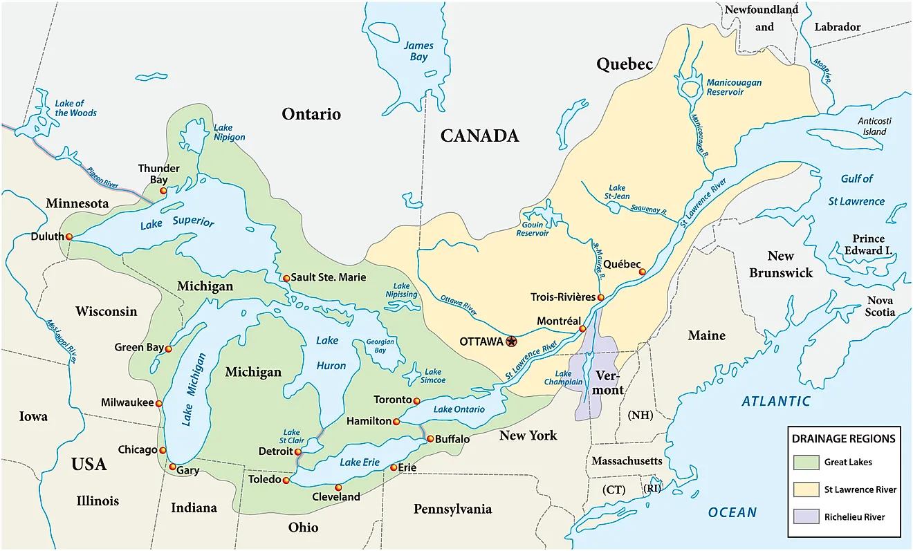
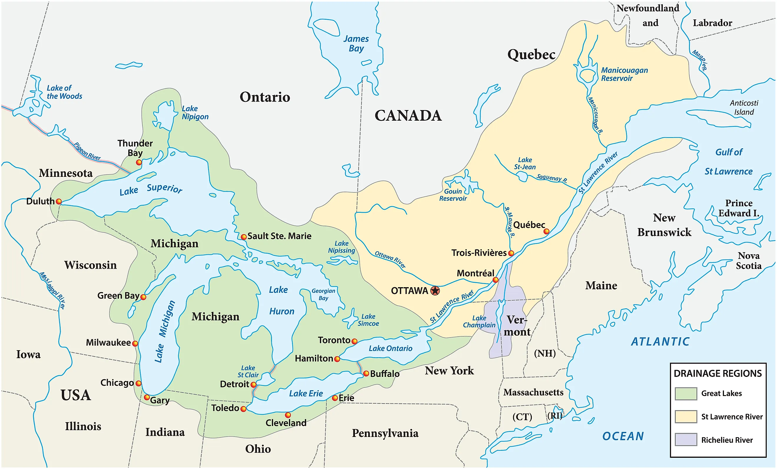
Together, Superior, Michigan, Huron, Erie, and Ontario hold roughly 21 percent of the world's surface fresh water and about 84 percent of North America's. The system covers more than 94,000 square miles, carries around 9,000 miles of coastline, and supplies drinking water to some 40 million people in the United States and Canada. It also supports a vast regional economy and serves as a major biological habitat and shipping corridor.
A violent rift

Nature added the finishing touches to the Great Lakes relatively recently, when the basins filled with meltwater as glaciers receded about 14,000 years ago. The foundation, though, was set long before the Ice Age. Around 1.1 billion years ago, North America began to tear apart along a line that ran beneath the modern lakes, but the process stalled before it could open an ocean. What it left behind is the Midcontinent Rift System (MRS), a buried geological scar that curves for nearly 2,000 miles and stands as the largest failed rift ever identified. The eastern arm of the MRS runs south from the Great Lakes basin through Michigan and reaches toward Alabama. The western arm arcs southwest through Wisconsin, Minnesota, Iowa, and Kansas.
The rifting began when immense tectonic forces pulled at the continent and magma surged up to flood the widening valley with dense volcanic rock. After 15 to 20 million years the forces driving the rupture eased, and the crust settled and healed rather than splitting. The episode left ancient valleys and fractures in the surface, later packed with soft sedimentary rock such as shale and limestone. That fill was far weaker than the surrounding Canadian Shield, which is built from hard igneous and high-grade metamorphic rock.
A dynamic landscape

Over the hundreds of millions of years that followed, the region shifted from a raw rift zone into a low, sediment-filled landscape crossed by rivers and covered at times by shallow, warm tropical seas. Thick layers of soft limestone, dolostone, and shale settled on top of the older, harder Precambrian rock of the Canadian Shield. As the seas withdrew and the land rose, a broad network of pre-glacial rivers developed across the surface. Water follows the path of least resistance, so those rivers cut into the softer sedimentary layers and widened them into the valleys that would later hold the Great Lakes.
Arrival of the ice

Then the ice arrived. Beginning in the Pleistocene Epoch, roughly 2.6 million years ago, ice sheets up to three miles thick spread across the landscape like slow bulldozers. They did not carve the basins from scratch. Instead, they followed the pre-existing river valleys and the soft pockets of shale and limestone already lying in the old rift. Successive advances and retreats of the Laurentide Ice Sheet, over more than two million years, ground away the weak bedrock and gouged out the deep basins that became Superior, Michigan, Huron, Erie, and Ontario. Each advance covered much of the northern interior, reaching as far south as present-day Illinois, Ohio, and Iowa before melting back.
Geologists once divided this stretch of time into four glacial stages, named for the states where their deposits were first studied: the Nebraskan (the oldest), the Kansan, the Illinoian, and the Wisconsinan (the most recent). Newer dating has shown that the record is far more complicated than four clean advances, and the two oldest names have largely been dropped in favor of the broader term "pre-Illinoian." Each glacial advance worked like a reset button, scraping up fractured bedrock and pulverized soil and erasing much of the evidence left by the ice before it. Because of that, the shape of the lakes visible today is essentially the work of the most recent glaciation. Earlier ice sheets would have left the basins with different outlines and depths.
Retreating glaciers

As the climate warmed and the glaciers pulled back for the final time, around 20,000 years ago, they dumped enormous volumes of rock, sand, and clay in ridges called glacial moraines. Those ridges acted as natural dams, trapping meltwater in the freshly gouged basins. The filling was a long, multi-stage process that involved huge temporary lakes, shifting spillways, and rerouted rivers. The land itself then began to lift in a process known as isostatic rebound, rising slowly once the crushing weight of the ice was gone. That rebound tilted the basins, steered the water into its modern eastward drainage toward the St. Lawrence, and brought the lakes close to their present shapes and sizes roughly 3,000 years ago.
Ongoing evolution

The Great Lakes are still changing. They may look fixed, but they keep responding to shifts in temperature, precipitation, evaporation, ice cover, and erosion. The surrounding ecoregion now holds a wide mix of aquatic, forest, marsh, wetland, and dune habitats. That variety of climate, soil, and terrain supports more than 3,500 species of plants and animals, along with fishing, agriculture, recreation, tourism, manufacturing, and shipping for the people who live around the basin. The pressures on the system today are mostly human in origin, including invasive species, pollution, climate change, and habitat loss, and they are reshaping the lakes as surely as the ice once did.