The Lakes Formed by Earthquakes in the United States
In 1811 the ground in northwest Tennessee sank and water rushed in to fill it. That drowned basin became Reelfoot Lake. Only a handful of American lakes began this violent way. Some spread across swampy lowlands studded with dead cypress trunks. Others fill steep canyons a landslide sealed off in seconds. Each lake marks the exact spot where the earth moved.
Reelfoot Lake, Tennessee

Reelfoot Lake is the most famous earthquake-formed lake in the United States, and the one a visitor can most plainly read. It sits in the far northwest corner of Tennessee, in country that was dry forest until the winter of 1811 and 1812. During the New Madrid earthquakes the land here dropped, and water spread across the sunken ground. The subsidence tied to the February 7, 1812 shock lowered parts of the basin by roughly 5 to 20 feet (1.5 to 6 meters).
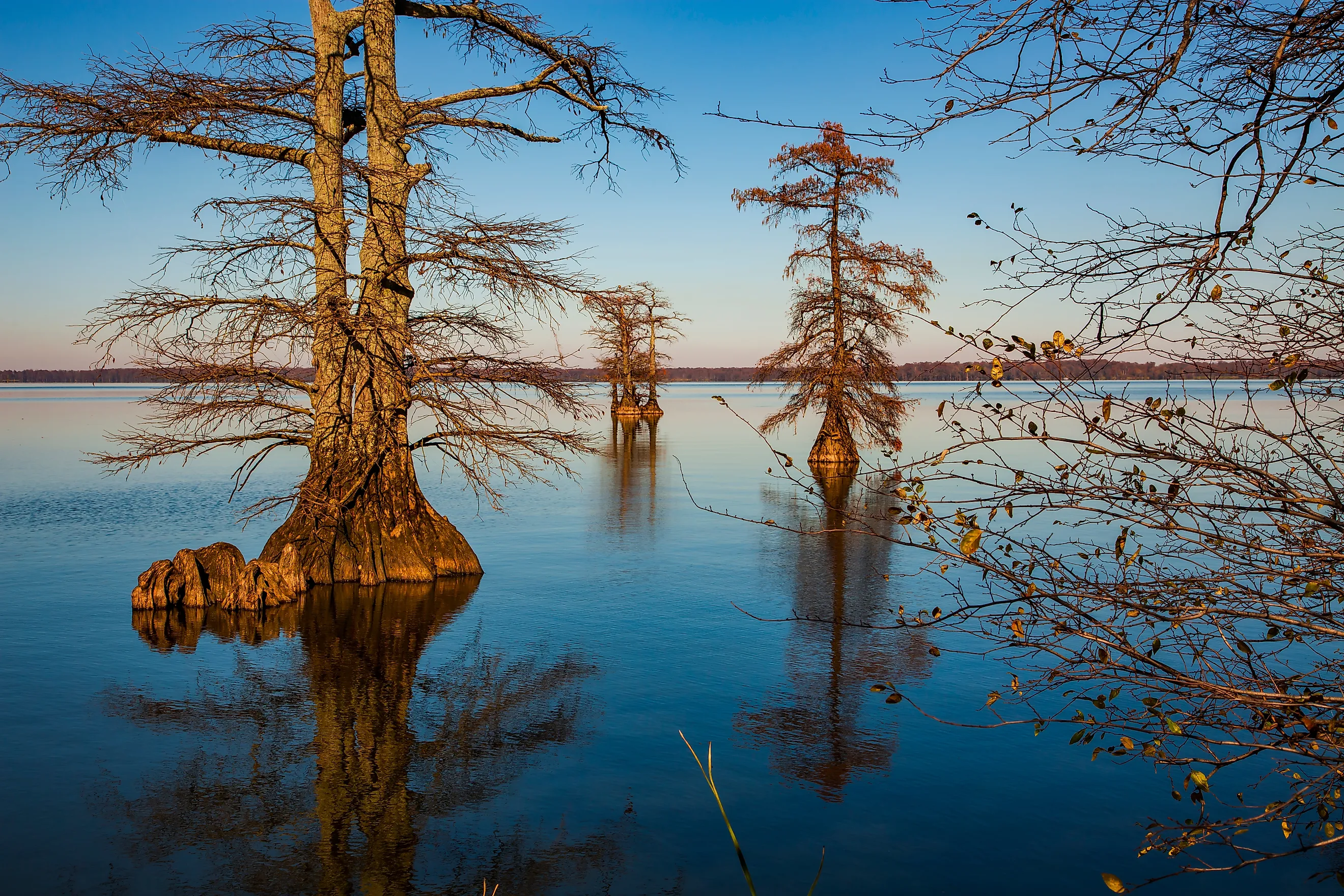
At 10,427 acres, about 16 square miles (42 square kilometers), Reelfoot is the largest natural lake in Tennessee. It is also one of the shallowest of its size. About 68% of it runs 3 feet (0.9 meters) deep or less, and the flooded forest never fully rotted away. Bald cypress still stand in the open water, their knees breaking the surface in wide stump fields. Reelfoot Lake State Park pulls in anglers, paddlers, and, in the cold months, the crowds who come for the bald eagles that hunt over the shallows.
Earthquake Lake, Montana

On the night of August 17, 1959, a magnitude 7.3 earthquake tore through Madison Canyon just west of Yellowstone National Park, and a whole flank of the canyon wall came down. The slide buried a campground, killed 28 people, and piled enough rock across the Madison River to dam it outright. Water backed up behind the debris within hours. By morning there was a new lake where the river had been.
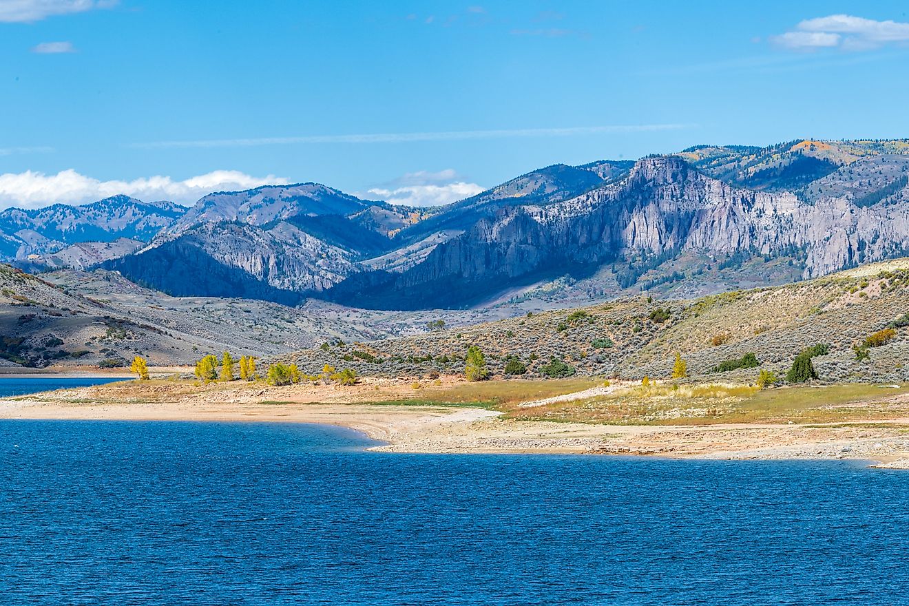
Locals call it Quake Lake. It stretches about 5 miles (8 kilometers) long and reaches around 120 feet (37 meters) deep where the canyon pinches tight. The evidence of that night is all still in plain view. The pale slide scar cuts across the mountain, gray snags of drowned trees poke through the water, and the boulder dam holds the lake in place. The Earthquake Lake Visitor Center sits on top of the slide itself and walks visitors through how the ground gave way.
Big Lake, Arkansas

Before 1811, the Big Lake country of northeastern Arkansas was a working river system with defined channels. The New Madrid earthquakes wrecked that pattern. The ground sagged, the drainage backed up, and open channels gave over to standing water and swamp. What survives is protected today as Big Lake National Wildlife Refuge.
The refuge covers 11,038 acres, about 17 square miles (45 square kilometers) of bottomland forest, cypress swamp, and open water. It is a quieter place than a typical recreation lake. The draw is birds, above all the waterfowl that pack the flooded timber during migration. Hunters, paddlers, and wildlife watchers get most of the refuge to themselves for most of the year.
Lake Crescent, Washington

Lake Crescent is the outlier here, because ice shaped it long before any earthquake touched it. Glaciers gouged out the deep trough it fills, and the water reaches 624 feet (190 meters) down, part of why it holds that famous clarity. The seismic chapter came later. About 7,000 years ago a large landslide split one long glacial lake into two, leaving Lake Crescent on one side and Lake Sutherland on the other.
Geologists tie many of the rockslides around the lake to movement on the Lake Creek-Boundary Creek fault. The setting is the reward: deep blue water under steep forested ridges, the historic Lake Crescent Lodge on the shore, the short Marymere Falls trail nearby, and Highway 101 tracing the southern edge. It is one of the signature stops in Olympic National Park.
Lake Sutherland, Washington

Lake Sutherland is the other half of that split. When the ancient landslide came down, it cut the original glacial basin in two and left Sutherland as Crescent's smaller, lower neighbor. The lake covers 351 acres, about half a square mile (1.4 square kilometers), and sits at 528 feet (161 meters) of elevation.
Sutherland feels more like a lived-in lake than a park showpiece. Houses ring much of the shoreline, and the fishing, paddling, and swimming here are the local kind rather than the postcard kind. The same landslide that made it also reset the valley's drainage and reworked the depth and habitat of both lakes. For travelers already at Lake Crescent, it is a short hop over the ridge.
Lake St. Francis, Arkansas

Lake St. Francis has the murkiest origin of the group. No single earthquake gets clean credit for it. Instead, the New Madrid subsidence that dropped so much of this lowland tipped the St. Francis River country into standing water. By most accounts the lake runs about 40 miles (64 kilometers) long and stays well under a mile (1 kilometer) wide, a thin ribbon following the old river line.
The lake belongs to the broader St. Francis Sunken Lands, a swath of Arkansas and Missouri that the 1811 and 1812 quakes left waterlogged. The mechanism was the same one that built Reelfoot. The ground sank, the water lost its way out, and swamp and lake spread across the low country. That drowned landscape still defines the St. Francis River today.
How Earthquakes Make Lakes
Earthquakes build lakes two main ways. The first is subsidence: the land drops and water fills the low spot. That is how Reelfoot, Big Lake, and the other New Madrid lakes formed. The second is landslide damming, where shaking knocks rock and soil into a valley, plugs a river, and ponds the water behind it. Earthquake Lake is the textbook American case.
A third category sits in between. Some lakes were not born in a quake so much as rearranged by one. Lake Crescent and Lake Sutherland already filled a glacial valley when a landslide, most likely set off by an earthquake, cut them apart. Not every lake in earthquake country owes itself to a quake, and not every landslide-dammed lake has a proven seismic trigger.
The Bottom Line
Only a small set of American lakes can honestly be called earthquake-made, and they fall into two kinds. Reelfoot, Earthquake Lake, and Big Lake are the real thing, water that exists because the ground moved. Lake Crescent, Lake Sutherland, and Lake St. Francis show the softer version, where a quake redrew a lake that was already there. Either way the lesson holds. A big enough earthquake does more than crack roads and topple chimneys. It can sink whole basins, wall off rivers, and leave water standing in the scar for thousands of years.