Why the Great Lakes Are Considered an Inland Sea
Sailors on Lake Superior watch for waves that can top 25 feet. Freighters have gone down in those storms, the Edmund Fitzgerald among them in 1975. Water like that behaves less like a lake and more like open ocean. The five Great Lakes hold about a fifth of the planet's surface freshwater. Each one is larger than several U.S. states. Scientists have a name for a body of water this vast and this fierce. They call it an inland sea.
This article defines what an inland sea actually is and shows how the five Great Lakes, namely Lake Superior, Lake Huron, Lake Michigan, Lake Erie, and Lake Ontario, both fit that idea and complicate it.
Defining inland seas

An inland sea should first be distinguished from an inland-sea basin. Inland-sea basins are fully or partly surrounded by continental crust, but they can still open to the ocean, like the Gulf of Mexico (Gulf of America). Others are leftovers of prehistoric oceans, including the Caspian and Black Seas.
Inland seas, by contrast, are landlocked except for narrow channels that link them to the ocean. They are also called epeiric seas, after the epicontinental regions where they sit. The geologist Joseph Barrell coined the term in 1917 and noted that these seas were shallow. They usually form when rising water levels push marine water through narrow arms of land.
Inland seas are far rarer today than in prehistoric times. The continents now sit at higher elevations, so the ocean rarely spills across them the way it once did.
Two of the clearest examples today are Hudson Bay and the Baltic Sea. Hudson Bay opens to the Atlantic through the Hudson Strait and to the Arctic through the Foxe Channel. Glaciers began carving it roughly 2.4 million years ago, and it stays shallow, reaching about 600 feet at its deepest and just under 420 feet on average.
The Baltic Sea is shallower still, averaging just over 177 feet. It covers about 149,000 square miles and touches Denmark, Sweden, Finland, Russia, Estonia, Latvia, Lithuania, Poland, and Germany. Its water carries little salt because so much freshwater flows into it.
Great Lakes similarities to inland seas

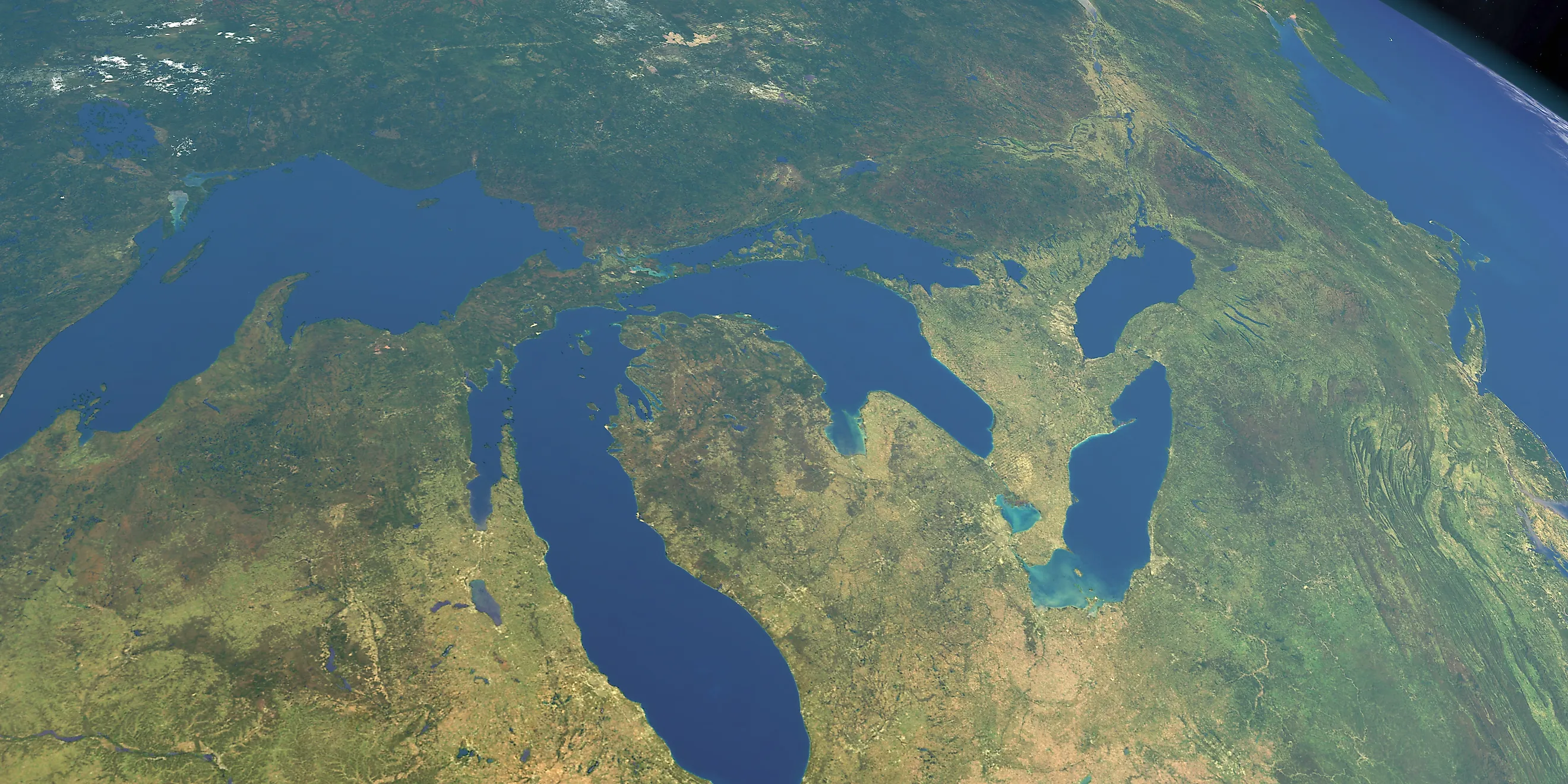
The first thing the Great Lakes share with other inland seas is sheer size. Together they cover more than 94,250 square miles.
Lake Superior is the largest at 31,700 square miles, followed by Lake Huron at 23,000 square miles, Lake Michigan at 22,300 square miles, Lake Erie at 9,910 square miles, and Lake Ontario at 7,340 square miles. They are so large that the Earth's rotation bends their currents, an effect otherwise seen in oceans. That deflection is called the Coriolis effect, and it is the same force that steers ocean currents and weather systems.
The Great Lakes are also shallow relative to their width, another inland-sea trait. Lake Erie is the shallowest of the five, averaging 62 feet, which helps explain its warm water. Lake Huron averages 195 feet, Lake Michigan 279 feet, and Lake Ontario 283 feet. Lake Superior is the deepest, averaging 483 feet and reaching a maximum of 1,332 feet.
Similarity to oceans

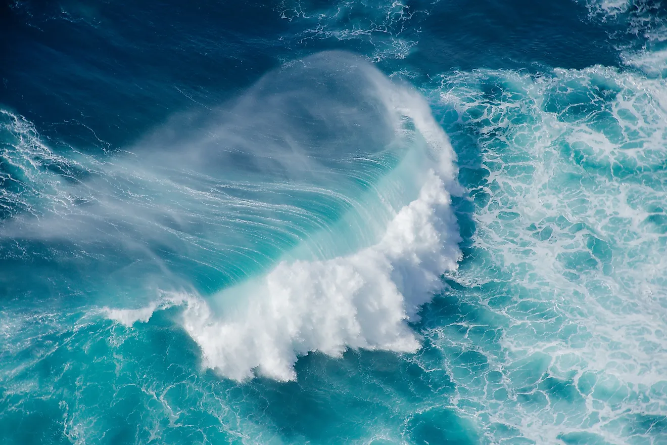
The Great Lakes also throw up waves that rival those of the ocean. In stormy seasons, waves on Lake Superior can reach 26 feet, and even shallow Lake Erie can build waves up to 14 feet. Lake Superior's most dangerous waves tend to arrive in sets of three, striking ships in quick succession. That pattern is often blamed for wrecks like the 1975 sinking of the Edmund Fitzgerald.
Lake Michigan can produce waves up to 23 feet, but its real hazard is its shape. The lake runs on a north-to-south axis, so when storms sweep in from the west, ships struggle to find shelter. Its size also feeds the strength of those storms. Roughly 35% of Great Lakes shipwrecks are thought to have happened in Lake Michigan, which holds the most lighthouses of any of the lakes. Wind adds to the danger, with an average speed of about 21.58 feet per second between November and January.
One striking feature of the Great Lakes is the meteotsunami, a wave caused by rapid changes in air pressure at the surface. In 2018, a meteotsunami hit a beach near Ludington, Michigan, damaging homes and docks.
Because of their size and dangerous currents, the Great Lakes have their own U.S. Coast Guard district set up to patrol and protect the water.
How the Great Lakes are connected to the ocean

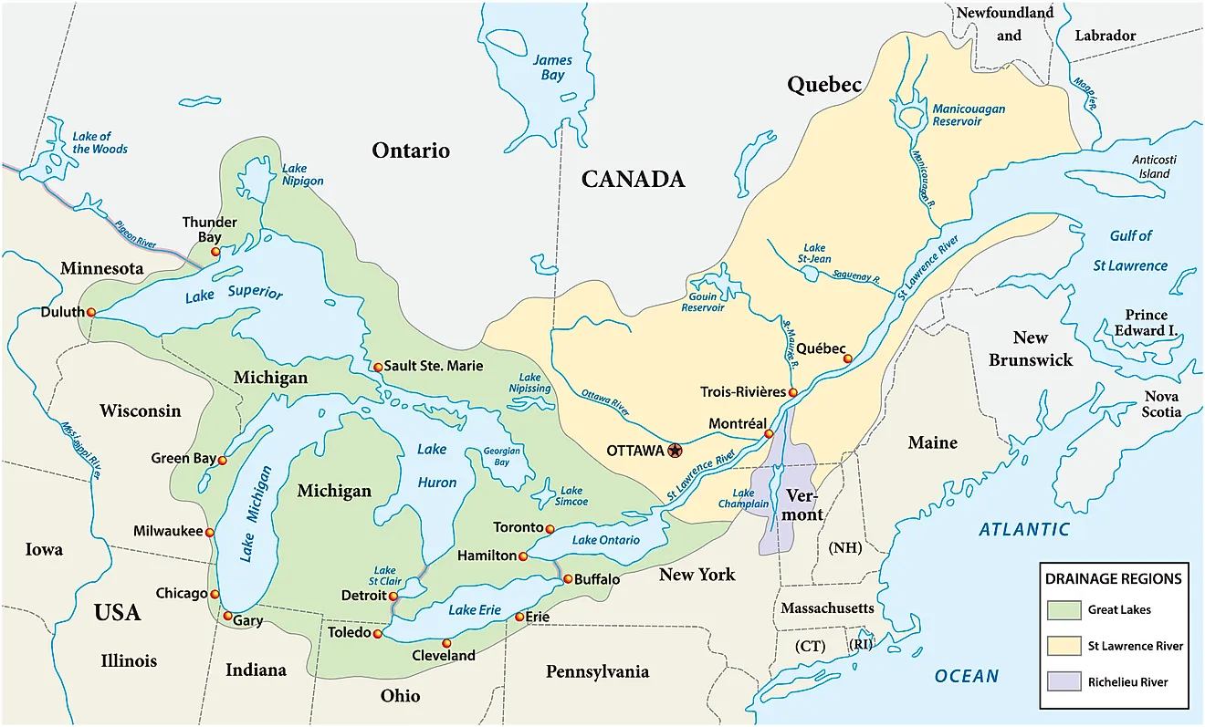
The five lakes are linked to one another by water that runs generally west to east on its way to the Atlantic Ocean. The St. Marys River carries Lake Superior into Lake Huron. Lake Huron and Lake Michigan meet at the Straits of Mackinac and are really one body of water at the same level, and Huron then drains into Lake Erie through the St. Clair River, Lake St. Clair, and the Detroit River.

Lake Erie then empties into Lake Ontario through the Niagara River, which plunges over Niagara Falls, the most powerful waterfall in North America by flow rate. Lake Ontario, the last lake in the chain, drains to the Atlantic through the St. Lawrence River. Lake Erie flushes itself of any salt quickly, thanks to a retention time of just 2.6 years, the shortest of the five.
Differences with inland seas

The Great Lakes do differ from other inland seas in key ways. The biggest is that they are freshwater, and together they hold about 20% of the world's surface freshwater. Most other inland seas are brackish, a mix of salt and fresh water.
The Great Lakes are also shaped more by the land around them than most seas are. Their depth rises and falls with rain and runoff. That runoff can carry pollution into the lakes, such as fertilizer and manure washing off farmland through streams and rivers. Those nutrients can feed algal blooms, which are toxic to wildlife and people alike.
Scientists disagree on the exact label. Some prefer to call the lakes a lake-chain system, while others use inland sea. They also point out that the word sea arrived with Europeans. Native peoples used their own names for these waters, such as gichi-gami, meaning great sea, for Lake Superior.
What's in a name?
In the end, the Great Lakes earn the name inland sea through their size, their ocean-like storms, and the way they connect both to one another and to the Atlantic. They stay distinct through their freshwater and their sensitivity to rain and runoff. Size alone may justify the term, because the word lake does not capture what these bodies of water really are. Many American lakes measure only a few acres, while each Great Lake is larger than some states. To set them apart from ordinary lakes, scientists and everyday people alike have settled on inland sea to describe this North American chain.