How Great Lakes Water Levels Rise And Fall So Dramatically
The Great Lakes can drop low enough to strand boats at their docks, then rise years later until waves are breaking over the same seawalls. Weather drives those swings across a basin of hundreds of thousands of square miles, and a shoreline can take years to show a change already underway. Rain on the open lakes becomes part of them the moment it falls, rain on the land arrives later through rivers and groundwater, and inflow from the lake upstream adds to both. For bodies of water big enough to pass for inland seas, the real surprise is how far, and how fast, the levels move.
The Lakes Rise When Their Water Budget Stays In Surplus

Every long-term rise begins with a basic imbalance: more water enters a lake than leaves it. Hydrologists track precipitation falling on the water, runoff from the surrounding basin, evaporation from the lake surface, and flows through the rivers connecting one lake to another. NOAA often combines precipitation, runoff, and evaporation into a measurement called net basin supply.
The important part is how long an imbalance lasts. A rainy week will not push Lake Superior up several feet, but repeated wet seasons can keep adding water faster than the outlet carries it away. The reverse happens when dry weather reduces runoff while warm conditions favor greater evaporation. The enormous surface area of the lakes makes apparently modest differences matter. Spread a small surplus across tens of thousands of square miles and the extra storage becomes substantial. Keep that surplus going for several years and docks, beaches, dunes, wetlands, and waterfront roads all show the effect.
Rain Reaches The Great Lakes By Two Different Routes

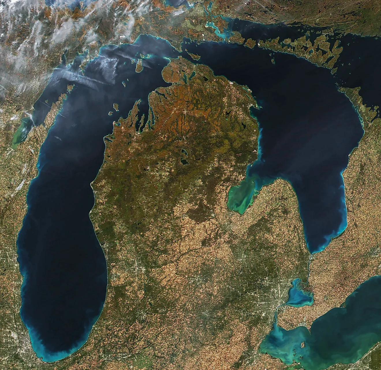
A storm crossing the basin can add water before a single river rises. The five Great Lakes cover roughly 94,000 square miles, so rain falling directly onto their surfaces becomes part of the lakes immediately. Lake Superior alone occupies more than 31,000 square miles, an expanse large enough for widespread rainfall to contribute a remarkable volume.
Farther inland, the same weather works more slowly. Water soaking into forests, farms, towns, wetlands, and soils eventually reaches creeks and rivers. Once the ground is already wet, later storms can send a larger share of rainfall toward the lakes because there is less capacity left on land to absorb it.
That pattern dominated the years leading into the extraordinary highs of 2019 and 2020. NOAA found that the five-year period ending in April 2020 was the wettest five-year stretch across the Great Lakes region since records began in the late nineteenth century. By then the landscape surrounding the lakes had endured one wet season after another, while the lakes themselves had repeatedly received precipitation directly. The result was not a sudden flood filling five giant basins at once, but a sustained accumulation that gradually pushed much of the system toward record territory.
Spring Snowmelt Lifts The Lakes Each Year

Walk the upper Great Lakes shoreline in early spring and much of the water destined for the lakes may still be sitting inland as snow. Winter temporarily stores precipitation across the northern basin. As temperatures rise, that snow begins feeding tributaries at the same time spring rain becomes more frequent. The lakes remain relatively cold, which keeps evaporation lower than it will be later in the year.
Levels usually climb through this period. NOAA places the normal annual seasonal rise across the Great Lakes at roughly 11 to 20 inches, although individual lakes and years vary considerably. The high point generally arrives in summer or early autumn.
Some springs break well outside that familiar rhythm. Lake Ontario rose about 2.5 feet between March 1 and April 30, 2026, amid unusually wet conditions and strong tributary flows. Along the shore, a change of that size is immediately visible around docks, beaches, breakwaters, and low waterfront property. It also shows how much water can be released when a large snow-covered watershed begins draining at the same time that new rain is arriving.
Autumn And Winter Can Send Huge Amounts Of Water Back Into The Atmosphere

The Great Lakes lose water most dramatically through evaporation when cold air begins sweeping across water that still holds summer heat. That makes late autumn and early winter especially important. The contrast between relatively warm lake water and colder, drier air encourages moisture to leave the surface rapidly, sometimes while steam fog or lake-effect clouds make the process visible from shore.
This seasonal loss helps pull levels down after their summer peak, but certain years amplify it. Warm water can remain exposed later into the cold season, extending the period when the atmosphere can draw moisture from the lakes. At the same time, high temperatures on land can reduce runoff by increasing evapotranspiration and drying soils before water reaches tributaries.
The sharp decline around the end of the 1990s is one of the clearest examples. Lakes Michigan-Huron and Erie dropped rapidly between 1997 and 2000, and researchers linked the event closely to unusually high temperatures that increased water losses while suppressing runoff. Rainfall alone could not explain what happened. The temperature of the air, the condition of the watershed, and the heat stored in the lakes changed how much of that precipitation remained available to support water levels.
Michigan-Huron Climbed About Six Feet Between 2013 And 2020

Few shorelines show the Great Lakes' range better than Michigan and Huron. The two are connected through the Straits of Mackinac and behave hydrologically as one body of water. In January 2013, their monthly mean fell to about 576.02 feet above the reference datum, the lowest monthly level in the modern record. Low-water problems spread around marinas and harbors, while some property owners watched broad stretches of exposed shoreline appear.
Then the direction changed with remarkable speed. Wet spring conditions increased runoff in 2013. The following year brought another favorable combination for rising water, including strong precipitation, reduced evaporation, and heavy inflow arriving from Lake Superior. The recovery continued as the basin entered the exceptionally wet second half of the decade.
By July 2020, the Michigan-Huron monthly mean was about 6.2 feet above that January 2013 low. Beaches that had widened during the low-water years were squeezed again, waves reached farther inland, and erosion became a much larger concern around exposed bluffs and developed shorelines. The lakes had covered almost their full recorded range in only seven years, even though no giant engineering project or single storm had transformed them. Years of weather had simply pushed the water balance hard in the opposite direction.
High Water In One Lake Can Keep Feeding The Next

The chain does not reset at each shoreline. Lake Superior drains through the St. Marys River into Michigan-Huron, which sends water onward through the St. Clair and Detroit rivers toward Lake Erie. Erie then flows into Lake Ontario through the Niagara River before the system finally empties into the St. Lawrence.
Lake Ontario depends on that connection more than any other lake because most of its inflow arrives from Lake Erie. The International Joint Commission estimates that roughly 85 percent of Lake Ontario's normal inflow comes from upstream, largely through the Niagara River. Persistent high water in the upper system can therefore continue influencing Ontario even after local weather has begun to change.
During the 2019 flooding, Lake Ontario faced heavy upstream inflow while its own basin was also exceptionally wet. Farther downstream, severe flooding along the Ottawa River complicated releases into the St. Lawrence. Water managers were dealing with conditions stretching across a vast network rather than one overflowing lake. A wet pattern that begins around Superior or Michigan can eventually become part of the water-level story hundreds of miles away.
Wind Can Raise One Shore By Feet In A Matter Of Hours

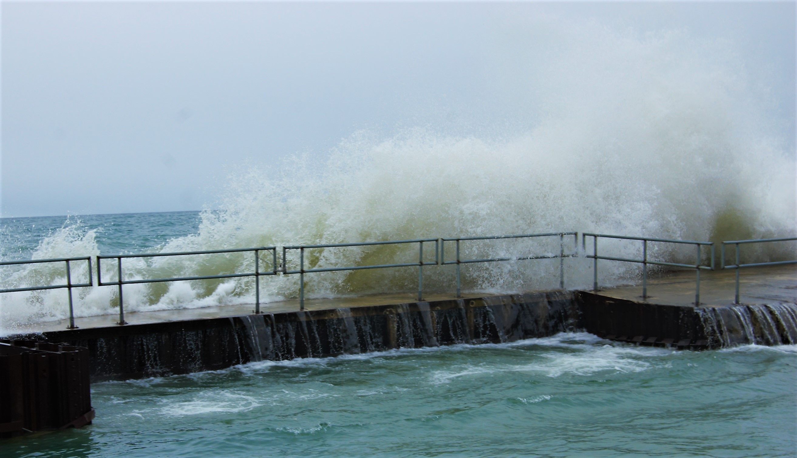
A Great Lakes gauge can jump dramatically even when the lake has gained almost no additional water. Strong, sustained wind pushes surface water toward the downwind end of a basin, raising the level there while drawing it away from the opposite shore. Meteorologists call the effect wind setup or storm surge.
Lake Erie is especially prone to these sudden swings because it is the shallowest of the five Great Lakes. A powerful southwest wind can drive water toward Buffalo while levels drop sharply around Toledo. NOAA notes that severe storms can produce differences of several feet between opposite ends of a lake, with the most extreme events reaching still larger values.
When the wind eases, the water does not always settle immediately. It can slosh back across the basin in a standing-wave motion known as a seiche. Harbors may see water rise, retreat, and return again. Nothing comparable has happened to the lake-wide water budget; the water has been rearranged. For anyone standing beside a suddenly flooded breakwall, however, that distinction can feel remarkably academic.
Dams And Diversions Have Far Less Power Than The Weather

Visitors looking across the Great Lakes' locks, canals, and hydroelectric structures might assume engineers can simply lower a lake when the water gets too high. Their influence is much more limited. Lake Superior's outflow through the St. Marys River is regulated, and Lake Ontario's discharge into the St. Lawrence is managed through the Moses-Saunders system. Michigan-Huron and Erie still drain primarily through natural connecting channels.
During an extreme wet period, the amount arriving from rain, runoff, and upstream lakes can exceed what managers can safely compensate for through altered outflow. The 2019 Lake Ontario flood made that constraint particularly clear. International Joint Commission analysis found that regulation reduced the peak that would have occurred under natural conditions rather than causing it.
Water diversions around the basin also attract attention, including the Chicago diversion out of Lake Michigan and the Long Lac and Ogoki diversions toward Superior. Their long-term impacts are measured in centimeters. Against a swing such as Michigan-Huron's roughly six-foot rise after 2013, their scale is modest. The most powerful controls remain above the shoreline: how much water the atmosphere delivers, how much the watershed passes onward, and how much the lakes return to the air.
A Warmer Climate Can Push Water Levels In Either Direction

The future is unlikely to be a simple march toward permanently higher or lower lakes. Warmer conditions can increase evaporation, particularly when lake surfaces remain ice-free and warm later into the year. That favors falling levels. A warmer atmosphere can also carry more moisture and produce heavier precipitation, adding water directly to the lakes and across their watersheds. That favors rising levels.
Researchers have described the competition as a hydrological tug-of-war, and recent history makes the phrase easy to understand. The same shoreline can pass quickly from concern about shallow harbors to concern about erosion because several climate-sensitive processes can change together.
Inland Seas That Still Answer To The Sky
The Great Lakes are enormous, but they are not slow-moving tubs isolated from the weather. They sit inside one of North America's largest freshwater drainage systems, exposed to every wet spring, warm autumn, deep snowpack, dry summer, and upstream surge that crosses the basin. That is how a lake containing thousands of cubic miles of water can still move several feet within a handful of years.