Gulf of Saint-Malo
Gulfs are defined as parts of a sea or an ocean that extends into the landmass. Varying significantly in shape, size, and depth, gulfs can also be formed by the movement of tectonic plates. Also known as Golfe De Saint-malo in French, the Gulf of Saint-Malo refers to the southwestern portion of the English Channel placed between the Brittany Peninsula, Normandy region, and the Channel Islands. It is believed that the Gulf of Saint-Malo was formed by subsidence and flooding of a continental zone with an area of about 3281.87 square miles. According to the native marine environment managers, the functional boundaries of the Gulf of Saint-Malo are formed by Bréhat Island and Cap de la Hague.
Geography Of The Gulf Of Saint-Malo

Extending from the Bréhat archipelago in the west to the western coast of Normandy’s Cotentin Peninsula in the east, the Gulf of Saint-Malo has a maximum width of about 60 miles from east to west and a total length of about 20 miles from south to north. The Gulf of Saint-Malo includes the bays of Saint-Brieuc, and Mont-Saint-Michel, the latter of which supports the rocky islet of Le Mont-Saint-Michel, which is well-known for its ancient abbeys, towers, and medieval walls. The gulf receives water from rivers like Couesnon, Rance, Sélune, and Trieux. The 64.4-mile-long Rance River forms an estuary between Dinard and Saint-Malo; the Sée and Sélune Rivers form a typical estuary in the Bay of Mont-Saint-Michel; and the Couesnon River also enters the sea via Mont-Saint-Michel.

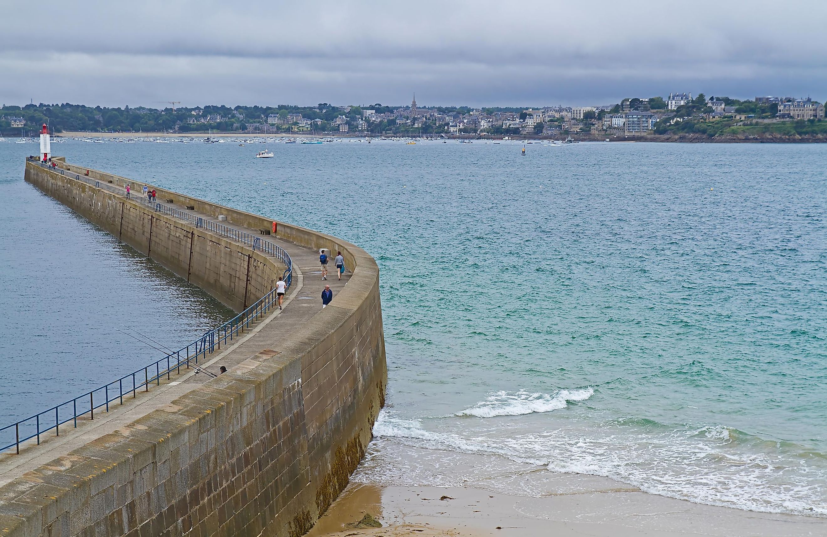
Besides the Bréhat archipelago, the Gulf of Saint-Malo comprises the Channel Islands – Jersey and Guernsey, along with Guernsey’s dependencies, Alderney and Sark; and the Chausey archipelago. Some notable settlements along the Gulf of Saint-Malo include Saint-Brieuc, Saint-Malo, Granville, Les Pieux, Saint Peter Port, Dinard, Le Mont-Saint-Michel, Barneville-Carteret, and Saint Hélier. Three departments of France have coastlines within the Gulf of Saint-Malo: the Cotes d’Armor and Ille-et-Vilaine departments in the Brittany region and the Manche department in the Normandy region. At Saint-Malo, which serves as the principal port of the gulf, the tides rise to about 23 to 26 ft during regular times, while they rise as high as 49 ft during spring and autumn tides.
Some recreational activities that the Gulf of Saint-Malo offers include onshore fishing, shellfish gathering, scuba diving, underwater fishing, light sailing, recreational boating, offshore fishing, canoeing, and kayaking. The gulf shores are lined by small resorts that draw many tourists who come to enjoy the enchanting beauty of the gulf.