How Long America's Rivers Are Compared To The Nile
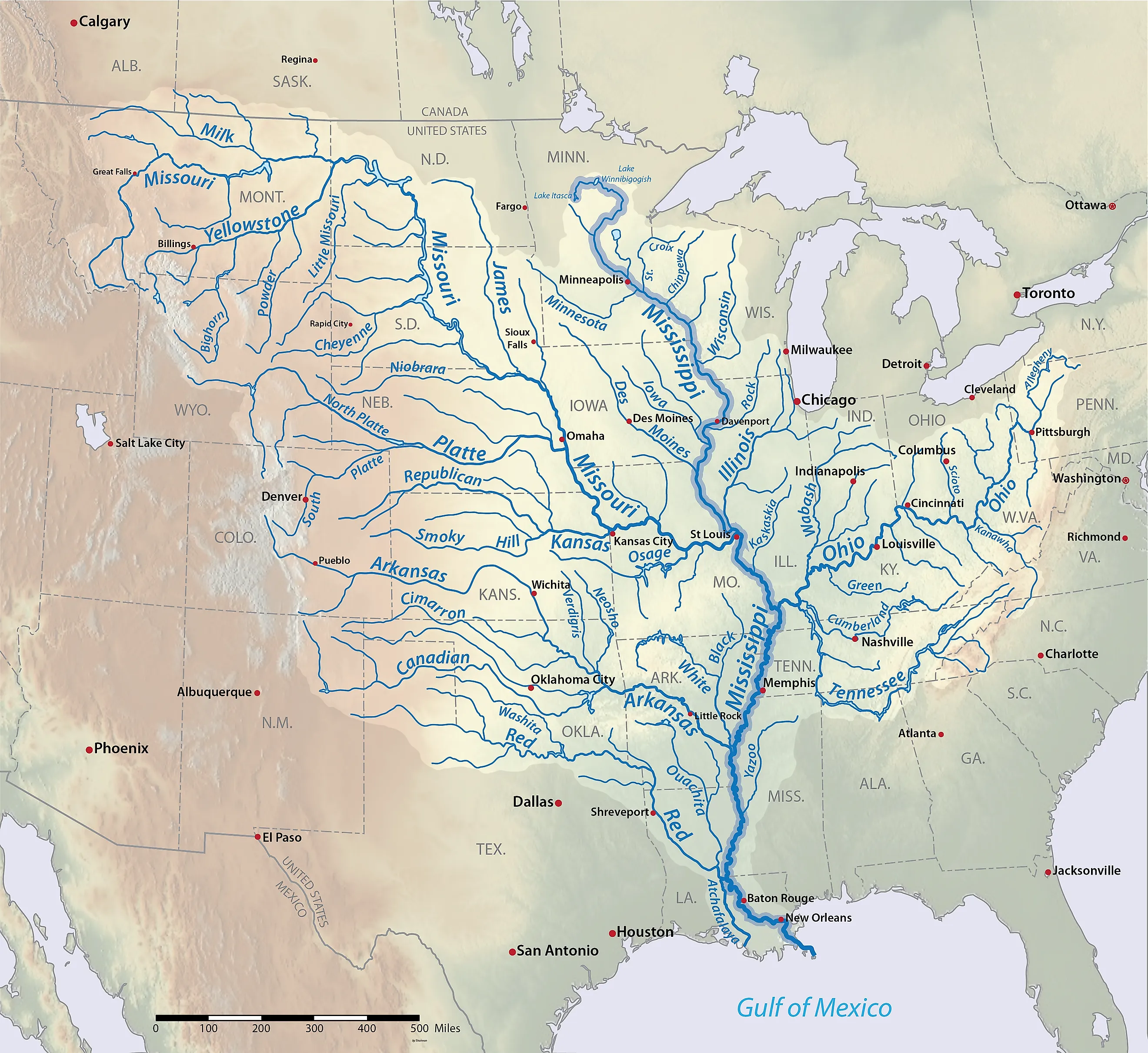
The Mississippi River travels about 2,350 miles before reaching the Gulf, yet that distance is only a little over half the Nile's length. The Nile stretches roughly 4,132 miles, counting headwaters far south of Egypt in East Africa. On the Mississippi, that shorter journey begins at a Minnesota lake where visitors can wade across the channel and ends beyond the shipping traffic of New Orleans.
Other rivers join it along the way, bringing water that began its journey elsewhere. Following those branches upstream changes the comparison considerably, especially when the route reaches into the Rocky Mountains instead of ending at the Mississippi's own source.
The Mississippi River Is About 57% Of The Nile's Length

At Lake Itasca in Minnesota, visitors can wade across the beginning of a river that later carries barges past major cities. The Mississippi starts at the lake's outlet and continues south to the Gulf Coast, a journey of about 2,350 miles. Against the Nile's commonly cited 4,132 miles, that leaves a gap of roughly 1,780 miles. At the Minnesota end, the river measures just 20 to 30 feet across.
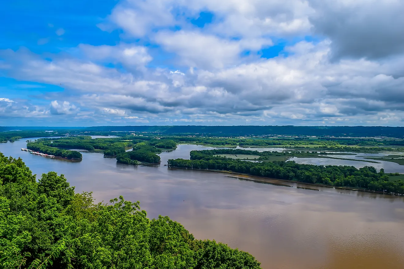
By New Orleans, the narrow stream at Lake Itasca has become a commercial shipping route, enlarged by tributaries along the way. The Missouri joins near St. Louis, and the Ohio arrives at Cairo, Illinois. Those junctions also explain why the Mississippi appears with very different lengths in descriptions of America's rivers. Its own course starts in Minnesota; the longer route through its western tributaries starts in Montana.
The Missouri Brings The Connected Route Much Closer

Take the upstream turn into the Missouri near St. Louis, and the journey extends deep into the northern Rocky Mountains. The Missouri's named course begins at Three Forks, Montana, and runs roughly 2,340 miles to the Mississippi. By itself, it is also only about 57% of the Nile's length.
Follow the Missouri's more distant headwaters and then continue down the lower Mississippi, however, and the connected route measures about 3,710 miles. That is roughly 90% of the Nile, leaving a gap of about 420 miles. The full lengths of the Missouri and Mississippi cannot simply be added together: the Minnesota branch lies upstream of their junction and is outside that continuous route.
This long western approach includes enormous reservoirs. The Army Corps of Engineers operates six mainstem dams on the Missouri, including Fort Peck in Montana and Oahe in South Dakota. Their impoundments converted about one-third of the Missouri's main course into reservoirs.
The Yukon Falls Just Short Of Half A Nile
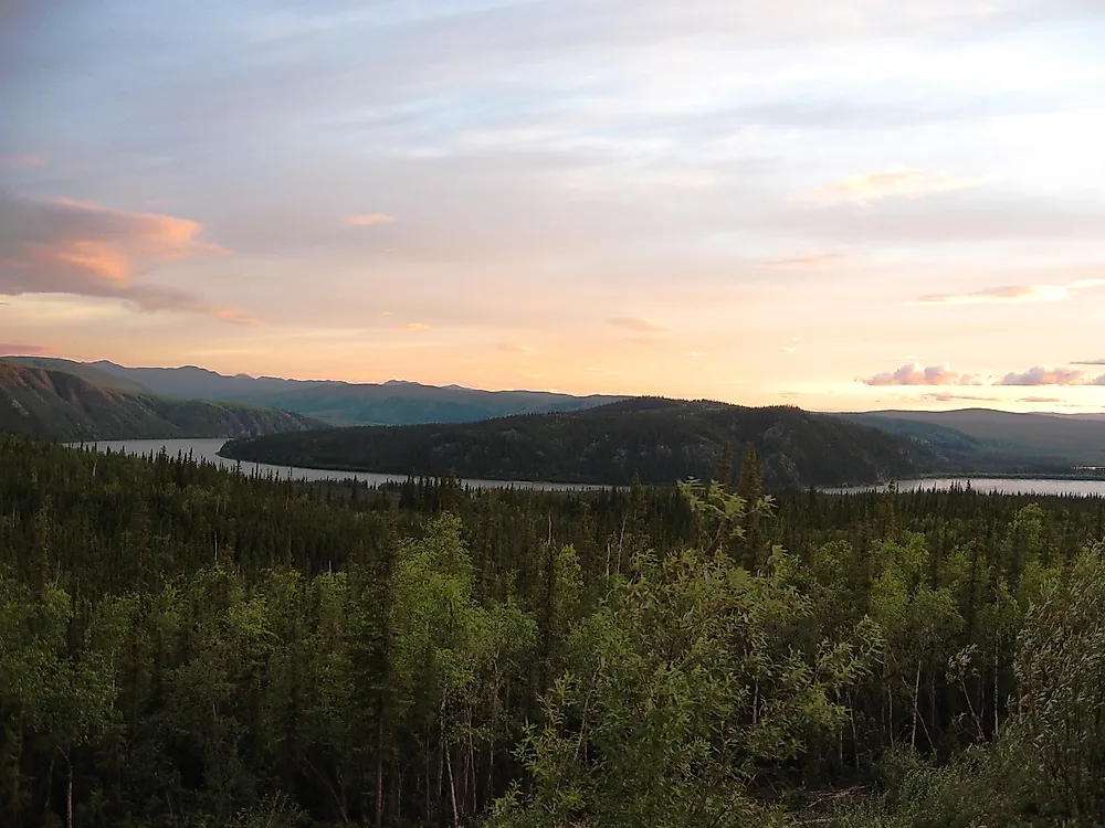
Some Chinook salmon returning through the Yukon basin travel roughly 2,000 miles or farther to their spawning grounds. The journey can take over 60 days, spent swimming upstream through a river system shared by Alaska and Canada. The Yukon itself is about 1,980 miles long, including its Canadian course, or roughly 48% of the Nile. Its arc begins in Canada's coastal mountains and ends at the Bering Sea.
A float trip between Eagle and Circle in Alaska covers 158 miles of that distance. Paddlers moving about 30 miles a day and camping overnight commonly need around five days. Along the way, the Yukon passes through Yukon-Charley Rivers National Preserve, where high bluffs and forested hills border the channel. The entire five-day float covers under 4% of the Nile's length.
The Rio Grande Runs About 46% As Far
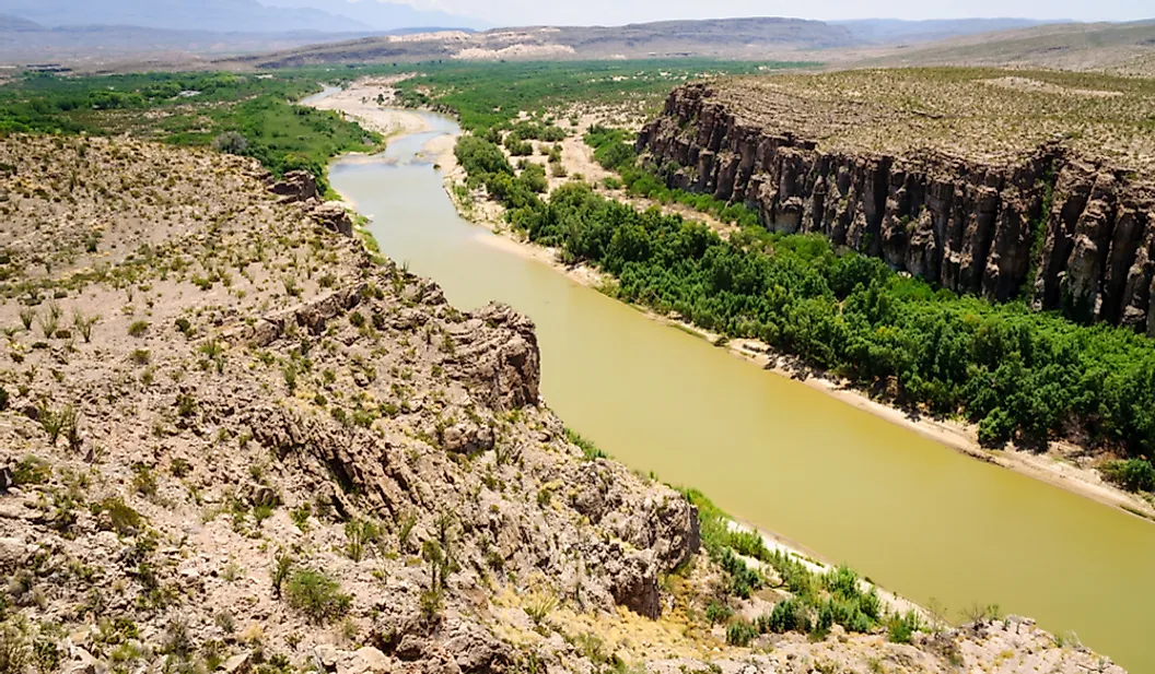
For 118 winding miles, the Rio Grande forms Big Bend National Park's southern boundary. That familiar Texas stretch belongs to a roughly 1,900-mile river beginning in Colorado's southern Rocky Mountains and ending at the Gulf. Its full course amounts to about 46% of the Nile's length. More than 1,000 miles also form the boundary between the United States and Mexico, so much of the distance belongs to both countries. Water does not necessarily flow uninterrupted along all those miles. Below El Paso, diversions can leave stretches of the channel toward Presidio dry. The Rio Conchos enters near Presidio and Ojinaga, supplying much of the water that continues into Big Bend. At Big Bend, the river's southeastward course swings northeast, producing the bend that gave the park its name.
The Colorado Is A Little Over One-Third As Long
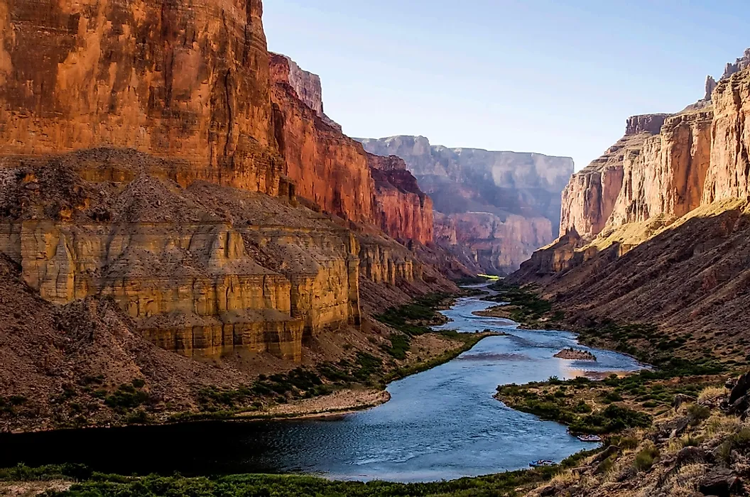
The Grand Canyon accounts for 277 river miles of the Colorado, a little under one-fifth of its roughly 1,450-mile course. Even after adding the river above and below the canyon, its length reaches only about 35% of the Nile's. Nearly three Colorado Rivers would be needed to match the African river.
The Colorado begins in the Rocky Mountains, and its channel extends into Mexico toward the Gulf of California. Within the Grand Canyon alone, it descends about 2,000 feet, carrying rafters through a small portion of its total journey. Farther downstream, heavy water use has broken the regular connection between river and sea. In 2014, a specially arranged release sent water through the delta and into the Gulf of California for the first time in 13 years. That final reach remains part of the river's geographical length even when its channel is dry.
The Columbia Reaches About 30% Of The Nile's Length
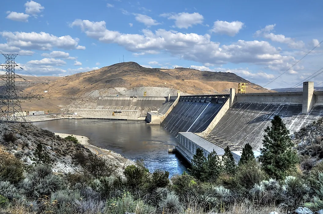
The Columbia travels north for about 200 miles after leaving Columbia Lake in British Columbia, then turns south toward Washington. It crosses Washington and bends west along the Oregon boundary, reaching the Pacific about 10 miles west of Astoria. That circuitous route totals about 1,243 miles, including the Canadian portion. The Nile is more than three times as long.
Along the Columbia, a comparatively short course combines substantial water volume with a large drop in elevation. Its source lake sits about 2,656 feet above sea level. Behind Grand Coulee Dam, a reservoir occupies roughly the first 150 river miles inside the United States. Dams take advantage of that descent, turning the river into a major source of electricity for the Pacific Northwest. The same route carries migrating salmon between the ocean and inland spawning habitat.
Near St. Louis, water arriving through the Missouri joins the Mississippi for the rest of the trip to the Gulf. The Nile has its own major junction at Khartoum, Sudan, where the White Nile meets the shorter Blue Nile. The longer upstream route runs through the equatorial lakes region; the Blue Nile arrives from the Ethiopian highlands. Beyond Khartoum, both branches supply the same river through Sudan and Egypt. Cropland follows its banks in areas where rainfall is too sparse to sustain farming. The Nile's roughly 4,132 miles include that desert passage and a headwater journey extending south of Lake Victoria.