East Germany
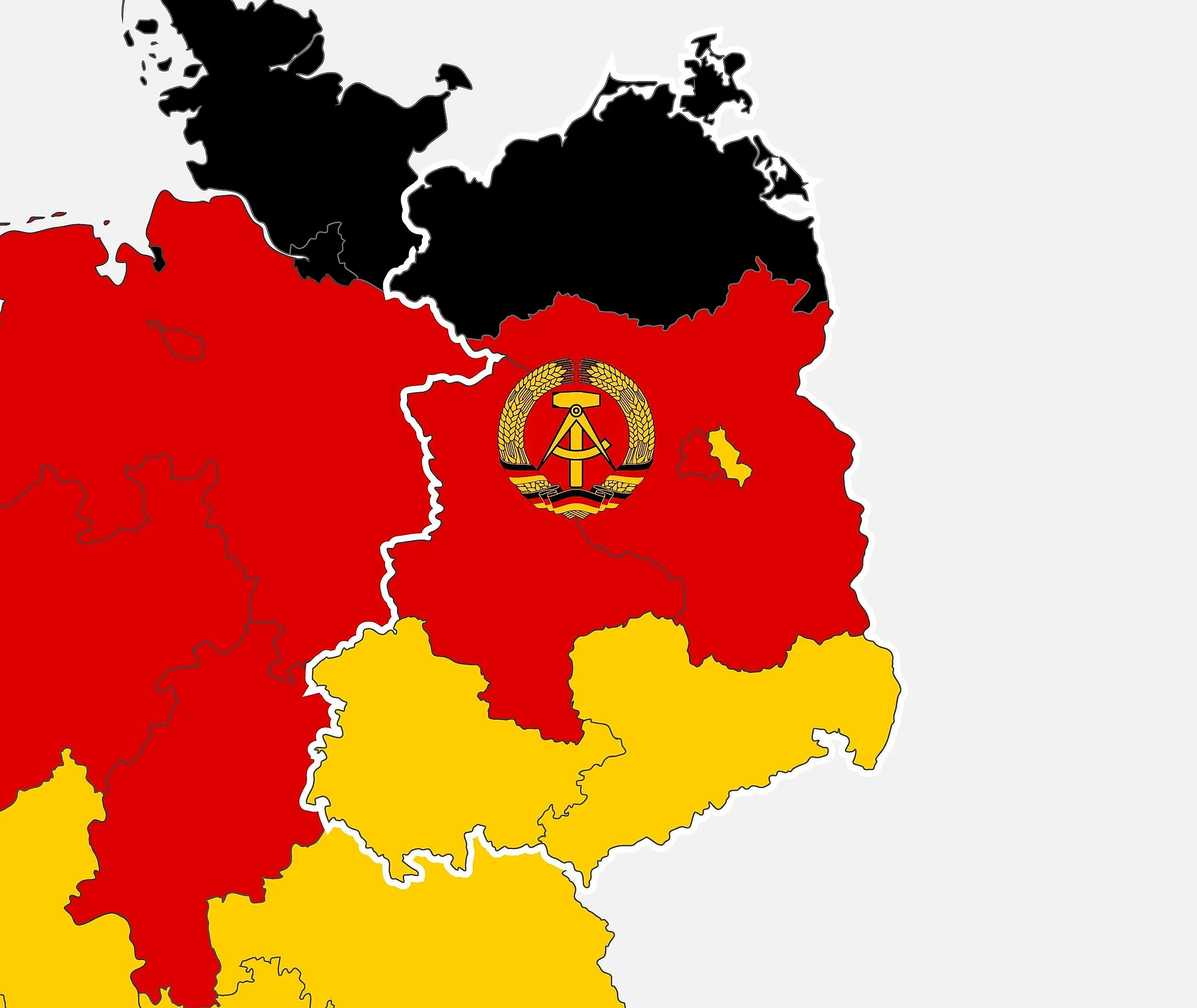
For 41 years, there were two Germanys. The German Democratic Republic, known in the West as East Germany, was founded on October 7, 1949, in the Soviet-occupied zone of defeated Germany, and it ceased to exist on October 3, 1990, when its five states joined the Federal Republic. In between, it packed roughly 16 to 18 million people into 41,828 square miles (108,333 square kilometers), built the most notorious wall of the 20th century, and ran one of the most watchful police states in history. It began as the front line of the Cold War and ended in a single autumn, undone by its own citizens.
Location
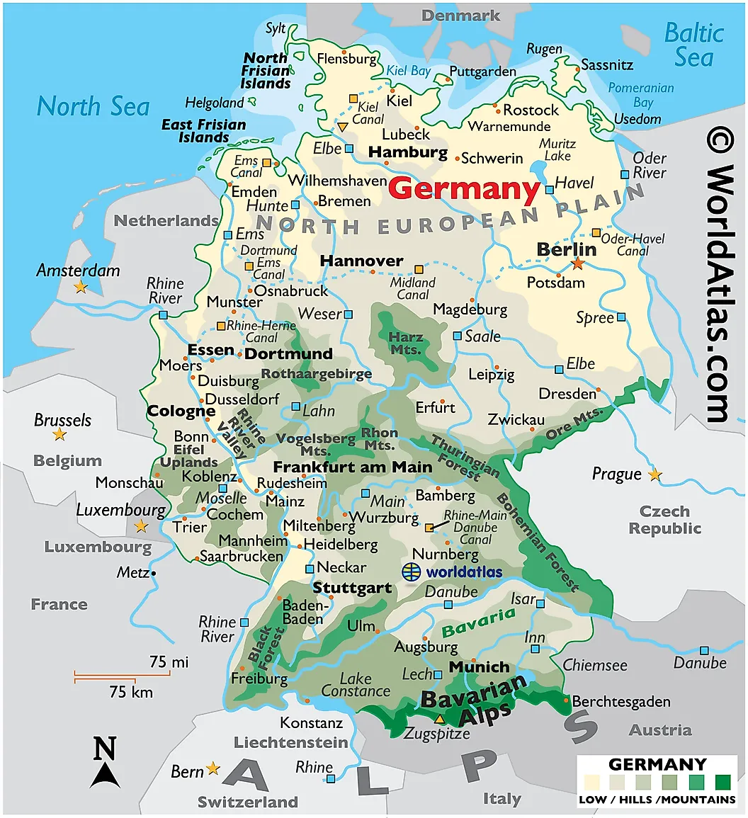
East Germany occupied what is now the northeastern part of the country: the Baltic Sea to the north, Poland to the east along the Oder-Neisse line, Czechoslovakia to the south, and the heavily fortified inner-German border with West Germany running down its western flank. The state was assembled from five historic German regions, Mecklenburg, Brandenburg, Saxony-Anhalt, Saxony, and Thuringia, which the government abolished in 1952 and carved into 14 administrative districts to tighten central control. The same five states were restored in 1990 to rejoin the Federal Republic.
The map came with one famous anomaly. West Berlin, administered by the Western Allies, sat as an island of the West more than 100 miles inside East German territory, and from 1961 the Berlin Wall sealed it off from the eastern half of the city and the country around it. Most of the GDR's terrain is flat or gently rolling, rising only along the southern rim, where the Ore Mountains, the Thuringian Forest, the Elbe Sandstone Mountains, and the Zittau Mountains line the frontier with modern Czechia.
Agriculture

Most of East Germany lies on the North German Plain, a broad lowland running south from the Baltic to the Central Uplands, left flat and fertile by ice age glaciers that deposited only scattered morainic hills. Marshes and post-glacial bogs once dotted the plain, though most were drained for farmland long ago, their water carried off by rivers like the Elbe, the Havel, and the Spree. Cool, damp summers and mild winters near the coast round out a climate built for grain, potatoes, and sugar beets.
The Soviet occupation wasted no time putting the plain to work on socialist terms. A sweeping 1945 land reform expropriated the large estates, breaking up the old landowning class, and collectivization drives through the 1950s pushed farmers into cooperatives known as LPGs. By 1960, nearly all East German farmland had been folded into collective or state farms, and the cooperative remained the face of GDR agriculture until the end.
Population
East Germany's population peaked early and leaked steadily. From about 18.4 million at the state's founding in 1949, the total fell to roughly 16.1 million by 1990, a decline driven less by birth rates than by people voting with their feet: millions fled west before the border slammed shut in 1961. Those who stayed lived in the Eastern Bloc's wealthiest economy, though wealth was relative. The state's signature car, the Trabant, had a body made of Duroplast, a cotton-and-resin composite, and a waiting list that famously stretched past a decade, meaning a family could order a car and receive it when the toddler was in secondary school.
Daily life came with an audience. The Ministry for State Security, the Stasi, employed about 91,000 full-time staff and well over 100,000 unofficial informants by the 1980s, giving the GDR one of the densest surveillance networks any society has known. The East German mark remained the currency until July 1, 1990, when the Deutsche Mark arrived ahead of reunification, swapping out the money three months before the country itself.
Bodies of Water

The region's defining river is the Elbe, which rises in the Czech Giant Mountains and flows northwest across the former GDR, past the sandstone gorges above Dresden and through Magdeburg, before reaching the North Sea beyond Hamburg. The Spree, about 400 kilometers (249 miles) long with three separate sources, one of them the Spreeborn spring near the village of Spreedorf, winds through the canals of the Spreewald, a wetland forest and UNESCO biosphere reserve where locals still travel by flat-bottomed punt, before flowing through Berlin and joining the Havel.
The north belongs to the lakes. The Mecklenburg Lake District holds the Müritz, which at 117 square kilometers (45 square miles) is the largest lake lying entirely within Germany, most of its shoreline protected as parkland and threaded by the roughly 220-kilometer (137-mile) River Elde. Farther west sits Lake Schwerin, about 62 square kilometers (24 square miles), where Schwerin Castle rises from its own island about 100 kilometers (62 miles) east of Hamburg.
History

Occupied Germany was divided into four zones in 1945 among the United States, Britain, France, and the Soviet Union, and by 1949 the temporary lines had hardened into two countries. The Western zones became the Federal Republic in May; the Soviet zone answered with the German Democratic Republic in October, a one-party state run by the Socialist Unity Party, the SED. The system was tested almost immediately: a workers' uprising on June 17, 1953, spread to hundreds of towns before Soviet tanks crushed it. The deeper threat was quieter. So many citizens kept leaving for the West, mostly through Berlin, that the state built the Wall in August 1961 to hold its own population in, and guards at the border operated under orders to shoot; well over a hundred people were killed at the Berlin Wall alone. Even the map bore the ideology: Chemnitz spent 1953 to 1990 renamed Karl-Marx-Stadt, and the new steel town of Eisenhüttenstadt began life as Stalinstadt.
By the 1980s, the GDR was propped up by heavy borrowing from the West while its planned economy stagnated. In 1989 the end came fast: Hungary opened its border, tens of thousands escaped through it, and the Monday demonstrations in Leipzig swelled week after week. On November 9, 1989, a government spokesman botched the announcement of new travel rules at a press conference, crowds surged to the checkpoints that same evening, and the Wall opened without a shot. Less than a year later, on October 3, 1990, East Germany dissolved into the Federal Republic and the two Germanys became one.
What Remains

The GDR's five states live on as Germany's "new states," and the region's cities, Dresden, Leipzig, Potsdam, Rostock, Weimar, and dozens more, have spent three decades rejoining the wider country's economy and drawing visitors to the history left behind. Major cities and towns of the former East Germany include Altenburg, Apolda, Bautzen, Brandenburg an der Havel, Cottbus, Dessau, Dresden, Eberswalde, Eisenach, Eisenhüttenstadt, Erfurt, Frankfurt an der Oder, Freiberg, Gera, Görlitz, Gotha, Greifswald, Halberstadt, Halle, Hoyerswerda, Jena, Chemnitz, Leipzig, Magdeburg, Merseburg, Neubrandenburg, Plauen, Potsdam, Rostock, Schwedt, Schwerin, Stralsund, Suhl, Weimar, Wismar, Wittenberg, Zittau, and Zwickau. A country that existed for 41 years turned out to leave a much longer shadow, visible today in everything from voting patterns to the Trabants still puttering around as collector's items.