What Continent Is New Zealand In?
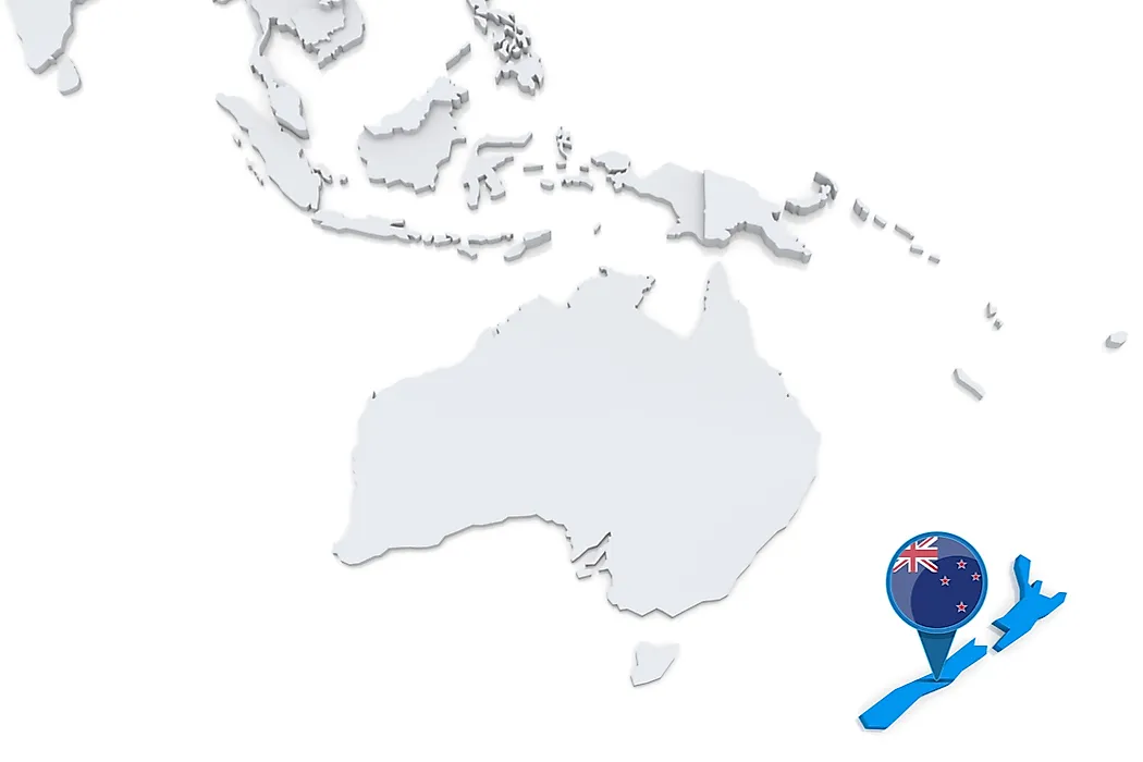
- New Zealand is an island country and one of the many islands that make up Oceania.
- Oceania is a vast region composed of thousands of islands spread throughout the Central and South Pacific Ocean
- It includes the continent of Australia and 13 other countries—Papua New Guinea, New Zealand, Fiji, Solomon Islands, Vanuatu, Samoa, Kiribati, Micronesia, Tonga, Marshall Islands, Palau, Tuvalu, and Nauru.
New Zealand is an island country and one of fourteen sovereign nations that make up Oceania. It sits in the South Pacific Ocean roughly 2,000 km southeast of Australia, separated from the Australian mainland by the Tasman Sea. The country is composed of two main islands (the North Island, or Te Ika-a-Māui, and the South Island, or Te Waipounamu) along with a number of smaller islands including Rakiura/Stewart Island, the Chatham Islands, and various subantarctic groups. New Zealand spans 270,467 square kilometres, an area comparable to the U.S. state of Colorado, and shares maritime borders with Australia, Tonga, and Fiji. Its land area, however, is only a small fraction of the much larger geological feature on which it sits: the submerged continent of Te Riu-a-Māui / Zealandia.

Tectonic Origins: Gondwana and Zealandia
The geological story of New Zealand begins with the supercontinent Gondwana, the southern landmass that formed when the larger supercontinent Pangaea split in the early Jurassic period. Gondwana contained what are now South America, Africa, Madagascar, India, Antarctica, Australia, and a long thin strip of continental crust along its eastern edge that would eventually become Zealandia. This strip lay along the Pacific margin of Gondwana, accumulating sedimentary, volcanic, and metamorphic basement rocks through subduction-accretion processes over hundreds of millions of years, roughly 540 to 105 million years ago.
Around 105 million years ago, the long-lived subduction along Gondwana's eastern margin stopped. The tectonic regime shifted, with compression giving way to extension, and the crust along the future Zealandia began to thin and rift. Between roughly 83 and 79 million years ago, in the Late Cretaceous, Zealandia detached from Gondwana entirely. New oceanic crust formed in the widening Tasman Sea between Zealandia and Australia, and a separate ocean basin opened between Zealandia and West Antarctica. By around 55 million years ago, the rifting had finished and Zealandia stood as a fully separate continent, drifting in isolation in the southwest Pacific.
As Zealandia separated, it also subsided. The continental crust had been stretched and thinned during rifting, leaving it less buoyant than typical continental crust. Over tens of millions of years, the bulk of Zealandia sank below sea level. Today only the ridges and high-elevation portions remain above water as New Zealand, New Caledonia, the Chatham Islands, and several smaller groups.
The Submerged Continent
Te Riu-a-Māui / Zealandia covers approximately 4.9 million square kilometres, about two-thirds the area of Australia. Roughly 94 to 95 percent of it lies underwater, with only about 286,000 square kilometres above sea level. A 2017 paper published in GSA Today by Nick Mortimer and colleagues at GNS Science formally proposed that Zealandia meets the four geological criteria for continental status: elevation above the surrounding ocean floor, a distinctive geology dominated by continental rock types (granite, schist, and greywacke), a well-defined area, and a continental crust significantly thicker than the surrounding oceanic crust. The proposal has been increasingly accepted, and a 2023 GNS expedition completed the first full geological map of the submerged portion of the continent.
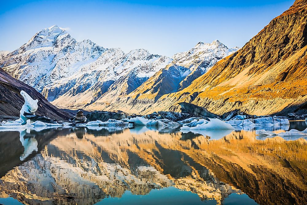
The continent's highest point is Aoraki / Mount Cook in the Southern Alps of the South Island, at 3,724 metres above sea level. The narrowest gap between Australia and Zealandia is the Cato Trough, only 25 kilometres wide, where the Tasman Sea oceanic crust separates the two continents. Beneath Fiordland and Rakiura / Stewart Island, recent research has identified rocks more than one billion years old in the deep crust, a feature shared with the other recognised continents and used to support Zealandia's continental status.
The Modern Plate Boundary
For the last 45 million years, Zealandia has been cut by the boundary between two of the Earth's major tectonic plates: the Pacific Plate and the Australian Plate. This boundary is what makes New Zealand one of the most geologically active places in the world. The character of this boundary varies along its length.
Off the east coast of the North Island, the Hikurangi Subduction Zone marks the boundary where the Pacific Plate dives westward beneath the Australian Plate. This subduction has produced the volcanoes of the Taupō Volcanic Zone, including Mount Ruapehu, Mount Ngauruhoe, Mount Tongariro, and the offshore Whakaari/White Island. South of New Zealand, the geometry reverses: at the Puysegur Subduction Zone off the southwestern tip of the South Island, the Australian Plate descends beneath the Pacific Plate.
Between these two opposing subduction zones, the plate boundary runs through the South Island as the Alpine Fault. The fault stretches roughly 600 km along the western edge of the Southern Alps and is one of the world's most prominent active strike-slip faults. The Pacific and Australian plates currently move past each other at about 37 to 40 mm per year. Most of this is horizontal right-lateral motion (the Pacific Plate sliding northeast relative to the Australian Plate), but a vertical component of about 6 to 10 mm per year is uplifting the Southern Alps. Over the past 12 million years this uplift has raised the range by an estimated 20 kilometres of vertical movement, though erosion has kept pace and the mountains themselves are no longer growing taller.
The Alpine Fault tends to rupture in major earthquakes of approximately magnitude 8, averaging once every 330 years. The most recent major rupture occurred in 1717, which places the fault statistically overdue for the next event. GNS Science currently estimates a 75 percent probability of a major Alpine Fault earthquake within the next 50 years. The 2011 Christchurch earthquake (magnitude 6.3) and the 2016 Kaikōura earthquake (magnitude 7.8) were both shallow events on related faults within the broader plate boundary zone.
How Oceania's Islands Were Formed

The islands of Oceania were not formed by a single process. Four distinct mechanisms have produced the region's diverse island geography over tens of millions of years.
Continental fragments represent pieces of older continental crust that separated from larger landmasses. New Zealand and New Caledonia are the most prominent examples, both being exposed portions of Zealandia. Their geological structure includes ancient metamorphic and granitic basement rocks dating back hundreds of millions of years.
Subduction-arc volcanic islands form where one tectonic plate descends beneath another and the melting of the descending slab produces chains of volcanoes along the overriding plate. The Tonga-Kermadec Arc, Vanuatu (New Hebrides) Arc, Solomon Islands Arc, and the Mariana Arc are all examples. The Tonga Trench, immediately east of Tonga, reaches depths of over 10,800 metres and is the second-deepest oceanic trench in the world after the Mariana Trench, which itself reaches 10,994 metres at the Challenger Deep.
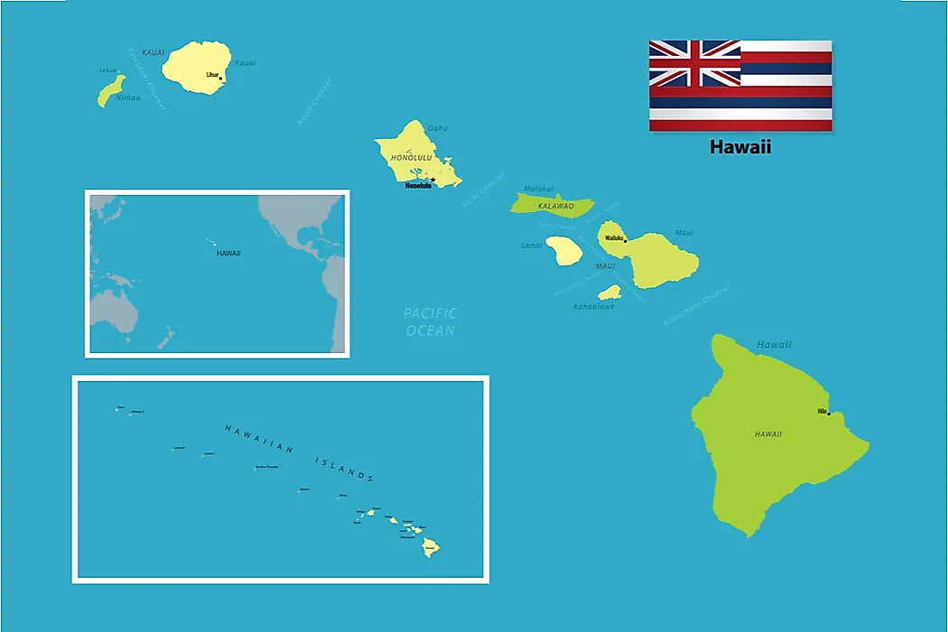
Hotspot volcanoes form over stationary plumes of hot mantle rock that punch through moving tectonic plates. As the plate drifts over the hotspot, a chain of volcanoes forms along its track. The Hawaiian-Emperor seamount chain is the classic example: as the Pacific Plate has moved west-northwest at roughly 7 to 11 cm per year over the past 80 million years, the Hawaiian hotspot has produced a series of progressively older islands stretching from the active volcanoes of the Big Island (Mauna Loa, Kīlauea, and the submarine Kamaʻehuakanaloa) northwest through the older Hawaiian islands and into the Emperor Seamounts, which extend toward the Aleutian Trench. French Polynesia and the Samoa Islands also include hotspot-generated chains.
Coral atolls form when fringing reefs grow upward around subsiding volcanic islands. As the underlying volcanic seamount sinks beneath sea level over millions of years, the living reef continues building upward, leaving a ring of coral around a central lagoon where the volcano once stood. Charles Darwin proposed this model during the voyage of HMS Beagle in 1842, and subsequent deep drilling in the 20th century confirmed his hypothesis. The Marshall Islands, Tuvalu, Kiribati, and the Tuamotu Archipelago are largely composed of atolls.
The Pacific Ring of Fire

Much of Oceania falls within or near the Pacific Ring of Fire, a roughly 40,000-kilometre horseshoe-shaped zone of intense seismic and volcanic activity tracing the boundaries of the Pacific Plate. The Ring of Fire contains approximately 75 percent of the world's active and dormant volcanoes and is the location of about 90 percent of the world's earthquakes. New Zealand, Tonga, Vanuatu, the Solomon Islands, Papua New Guinea, and Indonesia all sit on the western arc of the Ring. The Hawaiian Islands and the Galápagos, by contrast, sit well inside the Pacific Plate and represent intraplate hotspot volcanism rather than plate-boundary activity.
More About Oceania
Oceania is a vast geographic region composed of thousands of islands spread throughout the central and south Pacific Ocean. Some geographers treat it as a continent (with Australia at its core), while others classify it as a region containing the continent of Australia plus 13 other sovereign countries: Papua New Guinea, New Zealand, Fiji, the Solomon Islands, Vanuatu, Samoa, Kiribati, the Federated States of Micronesia, Tonga, the Marshall Islands, Palau, Tuvalu, and Nauru. The region lies between Asia and the Americas, with Australia as its dominant landmass.
Oceania was traditionally divided into four subregions by the French explorer Jules Dumont d'Urville, who coined the term "Oceania" in 1831: Australasia (Australia and New Zealand), Melanesia, Micronesia, and Polynesia. The four-way division remains in common usage even though modern geographers and geologists generally recognise that the categories blur at the edges.
Regional climate spans tropical and subtropical zones, with conditions varying between humid year-round and seasonally dry. Because most of Oceania's islands have never been connected by land to other continents, the islands' native flora and fauna largely arrived by sea or air over millions of years and then adapted to local conditions in isolation. New Zealand in particular evolved an unusual fauna dominated by birds, with no native land mammals other than two bat species and the marine seals and sea lions of its coasts.
Migration to Oceania

Archaeological evidence indicates that humans first reached Oceania around 65,000 years ago, when the ancestors of Aboriginal Australians and Papuans crossed from southeast Asia into Sahul, the combined landmass of Australia and New Guinea that existed when sea levels were lower during the last glacial period. A second major migration, the Austronesian expansion, began roughly 5,000 years ago from Taiwan and spread through island Melanesia and into the wider Pacific. The descendants of these Austronesian voyagers, sometimes called the Lapita people, eventually reached as far as Hawaii (around 1,200 years ago), Rapa Nui / Easter Island (around 800 to 1,300 years ago), and Aotearoa New Zealand (around 1300 CE), becoming the ancestors of today's Māori, Polynesians, and many Melanesian and Micronesian peoples.
Migration into Oceania continues. The United Nations Regional Fact Sheet on the region reports that international migrants now constitute around 15 percent of Oceania's total population, well above the global average. They fill significant portions of the workforce in healthcare, technology, agriculture, and manufacturing and are a major driver of population growth in countries including Australia and New Zealand.
An Island Country on a Hidden Continent
New Zealand sits at the intersection of two stories. The first is a deep geological history that begins with the breakup of Gondwana, runs through the formation and subsidence of Te Riu-a-Māui / Zealandia, and continues today through the active strike-slip motion of the Alpine Fault and the subduction zones at both ends of the country. The second is a human history that begins with the arrival of Polynesian voyagers around 1300 CE and continues through the European arrival from the 17th century onward. Both stories are still being written. The Pacific and Australian plates continue to grind past each other at roughly 40 mm per year, and the Southern Alps continue to rise. Aoraki / Mount Cook, the highest point on the visible part of a mostly submerged continent, was a little taller this year than it was last.