Maps of Kyrgyzstan

Kyrgyzstan, a landlocked country in Central Asia, shares its borders with Kazakhstan to the north, Uzbekistan to the west, Tajikistan to the south, and China to the east. The country's total area spans approximately 199,45 km2 (77,199 mi2). Almost 35% of the country's land is higher than 9,842 ft. (3,000 m) above sea level.
The Northern Tian Shan mountain range, which extends into China and other Central Asian countries. This region is characterized by its high mountain peaks and deep valleys. The highest point in Kyrgyzstan, and indeed in the entire Tian Shan range, is Jengish Chokusu, also known as Victory Peak, standing at an elevation of 7,439 meters (24,406 feet). These mountains are significant for their extensive snowfields and glaciers, which are sources of the numerous rivers flowing through the country.
Central Kyrgyzstan is marked by the Fergana Valley, a fertile and densely populated area shared with Uzbekistan and Tajikistan. This region's geography contrasts starkly with the high mountains, featuring a relatively flat landscape that is conducive to agriculture. The valley is an important agricultural center, known for its production of various crops and fruits, thanks to the moderate climate and abundant water resources provided by the surrounding mountains. The country's lowest point, at 132 meters (433 feet), is located in the Kara-Daryya (Qara Darya) basin in the southwestern part of the Fergana Valley.
The Tian Shan System toward the west is home to the Chatkal and Talas ranges. These ranges are characterized by rugged terrain, with numerous valleys and gorges, and are less populated than other regions. The Talas River, originating from the Talas Province in this region, is one of the major rivers of the country, historically significant as a route for the Silk Road.
The Issyk-Kul Region, in the east, is named after Lake Issyk-Kul, the second-largest saline lake in the world and the tenth largest lake by volume. The lake, which never freezes despite being surrounded by snow-capped mountains, lies at an altitude of 1,607 meters (5,272 feet).
The Alay Valley and the Pamir Mountains, in the south, mark the convergence of the Tian Shan with the Pamir range. The Alay Valley, situated between these two major mountain systems, is a high mountain valley known for its alpine meadows and pastoral nomadic traditions. This region also includes the Trans-Alay Range, which forms the border with Tajikistan.
Major bodies of water, apart from Lake Issyk-Kul, include Lake Song-Köl in the Naryn Province, which is the second-largest lake in Kyrgyzstan. The Naryn River, the country's longest river, flows through the Central Highlands and is another critical water source for the region. Its waters eventually contribute to the Syr Darya, a major river in Central Asia.
Regions of Kyrgyzstan Map

Kyrgyzstan (officially, The Kyrgyz Republic) is a sovereign country divided into 7 administrative regions (sing. oblast; plur. oblasttar) and two independent cities (shaar). In alphabetical order, the regions are: Batken, Chuy, Issyk-kul, Jalal-Abad, Naryn, Osh and Talas. Bishkek city and Osh city are the two independent cities. Each region is further subdivided into districts (raion).
Bishkek, the capital and largest city of Kyrgyzstan, is located in the northern part of the country. The ancient city of Osh, located in the Fergana Valley is the second largest city of Kyrgyzstan.
Where is Kyrgyzstan?

Kyrgyzstan is a landlocked mountainous country in Central Asia. It is located in the Northern and Eastern hemispheres of the Earth. It is bordered by four nations; Kazakhstan in the north, Uzbekistan in the west and southwest, Tajikistan in the southwest and China in the east. Kyrgyzstan is occasionally referred as “the Switzerland of Central Asia” as the beautiful ‘Tian Shan Mountains’ covers major part of the country.
Kyrgyzstan Bordering Countries: Kazakhstan, China, Tajikistan, Uzbekistan.
Regional Maps: Map of Asia
Outline Map of Kyrgyzstan

The outline map above represents Kyrgyzstan. The country is located in Central Asia. The map maybe downloaded, printed, and used for map-pointing or coloring activities.

The outline map above represents the Central Asia country of Kyrgyzstan. It is a landlocked and highly mountainous country.
Key Facts
| Legal Name | Kyrgyz Republic |
|---|---|
| Flag |
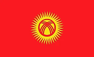
|
| Capital City | Bishkek |
| 42 52 N, 74 36 E | |
| Total Area | 199,951.00 km2 |
| Land Area | 191,801.00 km2 |
| Water Area | 8,150.00 km2 |
| Population | 6,456,900 |
| Largest City |
Bishkek (1,104,742) |
| Currency | Soms (KGS) |
| GDP | $8.45 Billion |
| GDP Per Capita | $1,309.39 |
This page was last updated on November 13, 2023