Maps of Bhutan

The Kingdom of Bhutan covers an area of 38,394 sq. km at the eastern limits of the Himalayas. The length of the country is only slightly larger than the width giving it a compact shape. One of the lesser-known nations in the world, Bhutan is incredibly isolated geographically and politically. Travel here is strictly limited and tourism is heavily regulated. No one goes to Bhutan on a whim and gets in without jumping through dozens of hoops first. Bhutan is landlocked and sandwiched between the powerful nations of India and China. Sitting directly along the Himalayan range, Bhutan is incredibly mountainous and rugged.
The Himalayas peaks in Bhutan can reach as high as 7,000 m along the country's northern border with China. As observed on the physical map of Bhutan above, the tallest point in the country is the Kula Kangri. However, there is a lot of dispute regarding the location of this peak as some authorities claim it is part of Tibet. Instead, the 7,570 meters (24,840 ft) tall Gangkhar Puensum is often regarded as Bhutan's tallest peak. The latter is the world's tallest unclimbed mountain.
The Himalayan foothills are the most low-lying part of Bhutan. These can be found along the southern border with India and are often heavily forested. The lowest point in Bhutan at 97 m (318 ft) above sea level is located in the Drangme Chhu river system. The central parts of Bhutan feature the mountains of the lesser or the lower Himalayas.
Various rivers flow through Bhutan giving it vital access to clean drinking water. Some of these waterways are used for transportation but generally speaking, these rivers are filled with areas of intense rapids and cascades that make commercial travel next to impossible. These numerous small rivers drain the land, including the Dangme, Mangde, Sankosh, and Torsa.
Districts of Bhutan Map

Bhutan (officially, The Kingdom of Bhutan) is divided into 20 districts (dzongkhags). In alphabetical order, these districts are: Bumthang, Chhukha, Dagana, Gasa, Haa, Lhuentse, Mongar, Paro, Pemagatshel, Punakha, Samdrup Jongkhar, Samtse, Sarpang, Thimphu, Trashigang, Trashi Yangtse, Trongsa, Tsirang, Wangdue Phodrang and Zhemgang.
With a population of around 754,388, Bhutan is the second-least populated nation in South Asia. Located in the west-central part of the country, surrounding the Thimphu River Valley is Thimphu city – the capital and the largest city of Bhutan. Situated at an altitude of 2,320m, Thimphu is the 5th highest capital in the world. Thimphu also serves as the administrative and economic center of Bhutan. Phuntsholing – located in the southern part of the country, near the India-Bhutan border, serves as the financial center of Bhutan.
Where is Bhutan?

Bhutan is a small landlocked country situated in Southern Asia, on the southern slopes of the Eastern Himalayas. It is located both in the Northern and Eastern hemispheres of the Earth. Bhutan is bordered by two Asian nations: The Tibet Autonomous Region (China) to the north; the Chumbi valley of Tibet and the Indian states of Sikkim and West Bengal in the west; along with the Indian states of West Bengal and Assam in the south; and Arunachal Pradesh in the east.
Bhutan Bordering Countries: India, China.
Regional Maps: Map of Asia
Outline Map of Bhutan

The above map represents Bhutan, a small landlocked country situated in Southern Asia, on the southern slopes of the Eastern Himalayas. It is a very compact nation with the length being only slightly larger than the width. The map may be downloaded, printed, and used for education purpose.

The outline map represents the small Himalayan Kingdom of Bhutan located to the north of the Indian subcontinent.
Key Facts
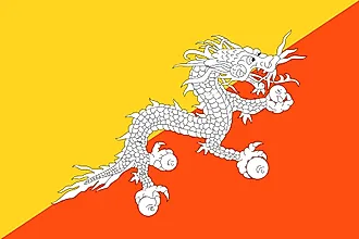
| Legal Name | Kingdom of Bhutan |
|---|---|
| Flag |
|
| Capital City | Thimphu |
| 27 28 N, 89 38 E | |
| Total Area | 38,394.00 km2 |
| Land Area | 38,394.00 km2 |
| Water Area | N/A |
| Population | 763,092 |
| Currency | Ngultrum (BTN) |
| GDP | $2.45 Billion |
| GDP Per Capita | $3,243.23 |
This page was last updated on December 28, 2023