Maps of New Jersey

New Jersey, also known as the “Garden State”, is a state in the northeastern United States, forming part of the Mid-Atlantic region. It shares its northern border with New York, its southern border with Delaware, and its western border with Pennsylvania. Its eastern coast meets the Atlantic Ocean.
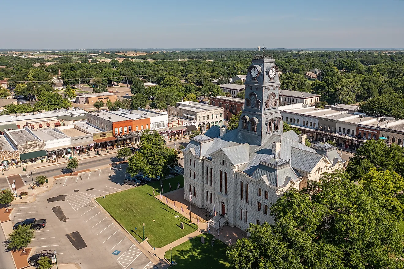
Trenton, located in western New Jersey, serves as the state's capital, while Newark, situated in the northeast, is the most populous city with around 311,000 residents.
The first European settlers to colonize the area were Dutch, followed by Sweden, during the early 17th century. During the later part of the century, the English took control of the territory. Following the Revolutionary War, New Jersey officially became the third state in 1787 after ratifying the US Constitution.
Area
New Jersey's total land area is 8,723 square miles (22592 square kilometers), making it the fourth smallest US state. It is just slightly bigger than Israel. Compared to other U.S. states, New Jersey is roughly the same size as New Hampshire and eight times smaller than Oklahoma.
Bodies of Water
New Jersey boasts over 1,900 lakes and 9,400 ponds. Of these, approximately 60 to 70 are believed to be naturally occurring. The northern part of the state has a higher concentration of lakes as a result of historical glacial activity. Key rivers in New Jersey include the Manasquan River in the central region, the Maurice River in the south, which flows into the Delaware Bay, and the Mullica River, which also flows through southern New Jersey before reaching the Great Bay.
Geographical Regions
Four geographical regions define New Jersey’s landscape: The Atlantic Coastal Plain, Piedmont, New England Upland, and the Appalachian Ridge and Valley Region.
Atlantic Coastal Plain
The Atlantic Coastal Plain represents the southern three-fifths of the state, featuring low, gentle hills, salt marshes, and pine forests. Creeping closer to the coast, marshes, meadows, and lagoons become more frequent. The state’s resort areas sprinkle the coastline as well, including Atlantic City, Cape May, and Ocean City.
Piedmont
Piedmont is located northeast of the Atlantic Coastal Plain and is only roughly 20 miles wide, representing just ⅕ of New Jersey. Narrow valleys, rivers, and gentle hills span across the area, with many of the state’s major cities situated here, such as Newark, Jersey City, Elizabeth, and Patterson.
New York–New Jersey Highlands
Also known simply as the Highlands, the New York–New Jersey Highlands lies west of Piedmont. It boasts an abundance of rocky flat-top ridges, with lakes often nestled within the ridges. This region, in addition to its presence in New Jersey, also extends into New York and Pennsylvania.
Appalachian Ridge and Valley Region
In the northwest corner of New Jersey, the Appalachian Ridge and Valley region creates a mountainous landscape featuring the Kittatinny Mountains and the Delaware Water Gap, where the Delaware River cuts through the mountains. This region also includes the Appalachian Valley, known for its apple orchards and dairy farms.
Counties Map

The State of New Jersey is divided into 21 counties. In alphabetical order, these counties are: Atlantic, Bergen, Burlington, Camden, Cape May, Cumberland, Essex, Gloucester, Hudson, Hunterdon, Mercer, Middlesex, Monmouth, Morris, Ocean, Passaic, Salem, Somerset, Sussex, Union, Warren.
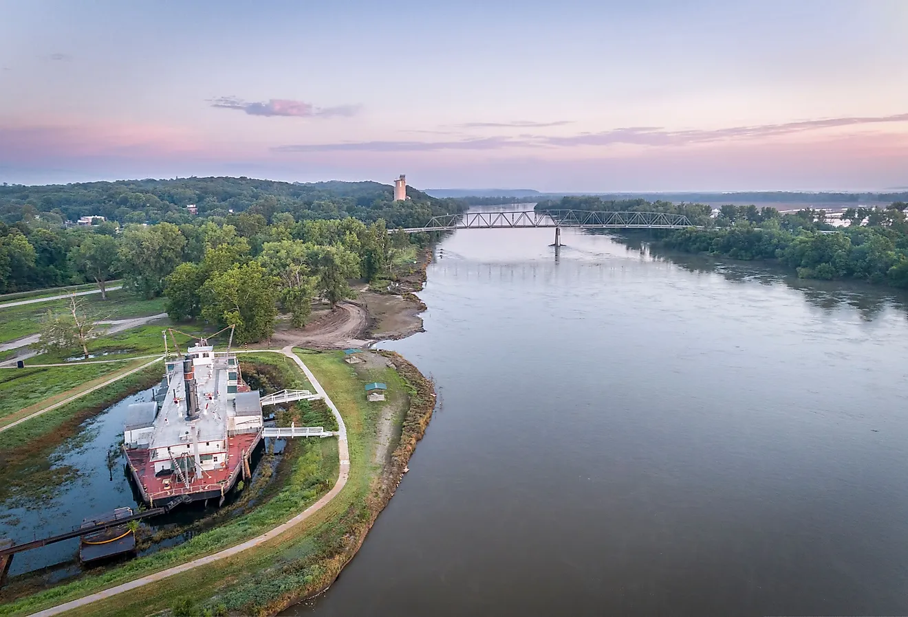
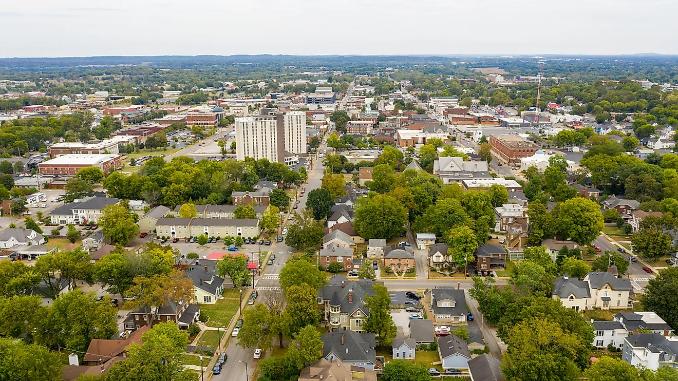
With an area of 22,591.38 sq. km, New Jersey is the 4th smallest and the 11th most populous state in the USA. Located on the Delaware River is Trenton – the capital city of New Jersey. It is among the seven state capitals situated in the Piedmont Plateau. Trenton serves as a manufacturing hub for automobile parts, rubber, plastics, electrical, glass, and textile industries. Situated in the northeastern part of the state, on the west bank of the Passaic River is Newark – the largest and the most populous city in New Jersey. It serves as the chief shipping, air, and rail hub of the USA. The Newark seaport also functions as the chief transportation and distributing center, and is one of the busiest seaports on the East Coast of the United States.
Where is New Jersey?

The State of New Jersey is located in the Mid-Atlantic region of the United States. New Jersey is bordered by the Hudson River and the state of New York in the north and northeast, by the Atlantic Ocean in the east and southeast, by the Delaware River and the state of Pennsylvania in the west, and by the Delaware Bay and the state of Delaware in the south and southwest.
Regional Maps: Map of North America
Outline Map of New Jersey

The above blank map represents the State of New Jersey, located in the Mid-Atlantic region of the United States. The above map can be downloaded, printed and used for geography education purposes like map-pointing and coloring activities.

The above outline map represents the State of New Jersey, located in the Mid-Atlantic region of the United States. New Jersey has been nicknamed as the "Garden State".
Key Facts
| Legal Name | State of New Jersey |
|---|---|
| ISO 3166 Code | US-NJ |
| Capital City | Trenton |
| Largest City |
Trenton (335,858) |
This page was last updated on July 29, 2024