Maps of Maine
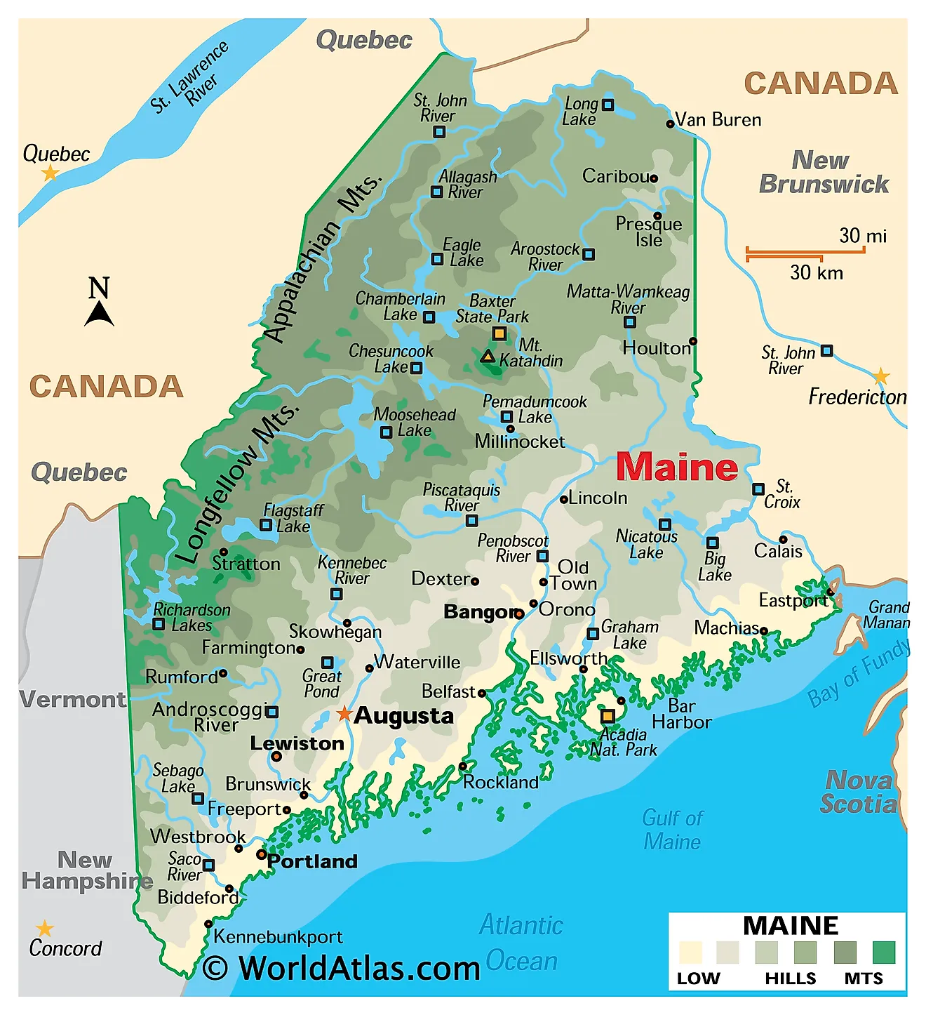
Maine is the northeasternmost New England state in the United States. It is bordered by the Canadian provinces of Quebec to the northwest and New Brunswick to the northeast, the Atlantic Ocean to the southeast, and the state of New Hampshire to the southwest. It covers a total area of 35,385 square miles (91,646 square kilometers), making it the 39th largest state — and the largest in New England, nearly as big as the other five combined.

Maine is a study in two extremes. It is the most forested state in the country, with roughly 89% tree cover, and the least densely populated east of the Mississippi — its northern half contains millions of acres of unorganised territory with no municipal government at all. Yet its coast is among the most intricate anywhere. In a straight line the shore measures only about 228 miles, but follow every inlet, cove, and island and it runs to roughly 3,478 miles, more tidal shoreline than California. That contrast between vast interior forest and endlessly folded coast defines the state.
Where Is Maine?

Maine occupies the far northeastern corner of the country, projecting so far north and east that it is the only state bordering exactly one other state. More of its boundary is shared with Canada than with the United States. West Quoddy Head in Lubec is the easternmost point in the contiguous United States.
The entire state was buried beneath the Laurentide Ice Sheet, and almost every feature reflects it. The ice scoured the interior down to bedrock, gouged out thousands of lake basins, and depressed the crust so far that when it melted, the sea flooded the lower river valleys. That drowned coastline — a ria coast — is why Maine's shore is a maze of peninsulas and islands rather than a smooth arc of beach.
With roughly 1.4 million residents, Maine is the 42nd most populous state. It is divided into 16 counties.
Aroostook County

Maine's northernmost region is simply called The County. Aroostook is the largest county east of the Mississippi, covering about 6,828 square miles — roughly the size of Connecticut and Rhode Island combined — and larger than each of three US states.
Its landscape is gentler than the highlands to the south: rolling hills over slate and limestone, with deep, stone-free soils in the northeast that support the potato farming the region is known for. The Aroostook River drains much of it, flowing northeast into the Saint John River, which forms the international boundary with New Brunswick.

Mars Hill, rising 1,748 feet (533 meters) directly above the New Brunswick border, is the region's most conspicuous landmark — its prominence of 1,210 feet makes it the most prominent mountain in the county, and Katahdin is visible from the summit 85 miles away. It is worth noting, though, that Mars Hill is not Aroostook's highest point: that distinction belongs to Peaked Mountain, at about 2,230 feet in the county's remote southwest. Mars Hill is also the first place in the United States to see sunrise for part of the summer, a title that rotates seasonally with West Quoddy Head and Cadillac Mountain.
The Maine Highlands

The central interior holds Maine's mountain country, the northern end of the Appalachian chain. Granite intrusions and metamorphic rock, sculpted by ice, produce the state's highest and wildest terrain.
Mount Katahdin, in Baxter State Park, is the highest point in Maine at 5,269 feet (1,606 meters). Its Baxter Peak marks the northern terminus of the Appalachian Trail, 2,190 miles from Springer Mountain in Georgia. The mountain is a textbook glacial landform: ice carved cirques into its flanks and left the Knife Edge, a mile-long arête barely three feet wide in places with drops of nearly a thousand feet on both sides.

Baxter State Park protects over 200,000 acres, donated to the state by Governor Percival Baxter with the condition that it remain "forever wild." The Penobscot and Piscataquis rivers drain this region southward, and the surrounding North Maine Woods form the largest contiguous undeveloped forest east of the Mississippi.
Kennebec and Moose River Valley

The Kennebec River rises at Moosehead Lake and runs about 170 miles south to the Atlantic at Popham Beach. Between the lake and Bingham it drops through Kennebec Gorge, one of the steepest river sections in New England.
The valley itself is a corridor of rolling hills descending from the highlands, and it has long been the state's main north-south route. The lower Kennebec is tidal for roughly 45 miles inland, and its estuary joins the Androscoggin at Merrymeeting Bay — an unusual inland tidal bay fed by six rivers, and one of the most important waterfowl staging areas on the Atlantic flyway. The Moose River, to the northwest, drains toward Moosehead through a chain of ponds known as the Bow Trip.
Maine Lakes and Mountains

Western Maine, along the New Hampshire line, is a landscape of glacial lakes set among the eastern outliers of the White Mountains. Old Speck, Saddleback, and Sugarloaf all exceed 4,000 feet, and Grafton Notch and Evans Notch are classic glacial troughs.
Sebago Lake, covering about 28,771 acres, is Maine's second largest lake by area and its deepest at roughly 316 feet — deep enough that its bottom lies well below sea level. It supplies drinking water to Greater Portland, unfiltered, one of only a handful of such surface supplies in the country. The Rangeley Lakes and Bigelow Preserve lie further north in the same belt.
The Maine Beaches

Fort Williams Park in Cape Elizabeth, Maine.
Maine's southern coast, from Kittery to Cape Elizabeth, is the one stretch that looks like a conventional Atlantic shoreline. Long sandy beaches backed by dunes and salt marsh run almost continuously, broken only occasionally by rocky outcrops and tidal inlets.
The sand exists because rivers draining the White Mountains — chiefly the Saco — delivered enormous volumes of glacial outwash to this corner of the coast. North and east of Cape Elizabeth the supply runs out, the bedrock reaches the sea, and beaches become pocket-sized rarities. Nearly all of Maine's sandy shoreline is concentrated in these few dozen miles.
Casco Bay

Casco Bay marks the transition from sandy south to rocky northeast. The bay is studded with long, narrow, parallel islands, all aligned northeast to southwest — these are the crests of drowned bedrock ridges, submerged as sea level rose after the ice retreated.
They are traditionally called the Calendar Islands, from a colonial claim that there was one for every day of the year. The true count is closer to 200, but the impression of an inexhaustible archipelago is fair enough, and the outer islands shelter the inner bay from Atlantic swell.
Mid-Coast

From Casco Bay northeast to Penobscot Bay, the coast breaks into a series of long, finger-like peninsulas separated by deep tidal rivers. The pattern follows the underlying rock: bands of resistant and softer bedrock run northeast-southwest, and glaciers carved out the softer bands, leaving the hard ones standing as headlands.
The wave-scoured ledges at Pemaquid Point display metamorphic rock folded into dramatic bands — among the most photographed geology in the state. Penobscot Bay, at the region's northern edge, is the largest bay on the Maine coast and holds Vinalhaven, North Haven, and Isle au Haut.
Downeast and Acadia

East of Penobscot Bay the coast turns wilder and less settled. Mount Desert Island is the centrepiece — the largest island off the Maine coast and, after Long Island, the second largest on the US East Coast. A granite pluton intruded here some 420 million years ago, and glaciers later carved it into a range of low rounded summits separated by U-shaped valleys. Somes Sound, cutting deep into the island, is often described as the only fjard on the eastern seaboard.

Acadia National Park, established in 1919, was the first national park east of the Mississippi. Cadillac Mountain, its high point at 1,530 feet (466 meters), is the highest point along the North Atlantic seaboard — more precisely, the highest within 25 miles of the Atlantic shoreline between the Cape Breton Highlands in Nova Scotia and peaks in Mexico. It is not the tallest mountain on the whole US Atlantic seaboard; Mount Mitchell in North Carolina is more than four times higher.
Further east, the Bold Coast runs to the Canadian border with 100-foot cliffs, and tides funnelled from the Bay of Fundy exceed 20 feet at Cobscook Bay — the largest tidal range in the contiguous United States.
Islands, Lakes, and Rivers

Maine's coast includes roughly 4,613 islands, from bare ledges to Mount Desert's 108 square miles. Only about fifteen still support year-round communities.
Inland, the state holds more than 6,000 lakes and ponds, nearly all glacial. Moosehead Lake, at about 74,890 acres, is the largest and the biggest lake contained entirely within a single New England state. Mount Kineo rises 700 feet straight out of its water — a cliff of rhyolite that Indigenous peoples quarried for tools and traded across the Northeast for thousands of years.

Maine's major rivers all run roughly south to the sea. The Saint John is the longest associated with the state at about 418 miles, though it flows north and east into New Brunswick. The Penobscot, at roughly 264 miles including its branches, is the longest entirely within Maine and drains the largest basin. The Kennebec and Androscoggin converge at Merrymeeting Bay, and the Saco drains the southwest.
Climate

Maine has a humid continental climate, cool in the south and genuinely cold in the north, where the far northwest edges toward subarctic. Coastal areas are moderated by the sea: Portland averages about 46 °F annually while Caribou, 300 miles north, averages closer to 39 °F, with a growing season roughly six weeks shorter.
Precipitation runs 40 to 46 inches a year, evenly spread. Snowfall varies enormously — around 60 inches on the southern coast, over 100 inches in the interior north, and more still in the western mountains, enough to support the state's ski industry.
Nor'easters are the dominant storm type, bringing the heaviest snow and worst coastal flooding. The cold Labrador Current keeps summer sea temperatures low and generates the persistent fog that gives the Downeast coast its character, with some stretches averaging more than 50 foggy days a year.
Maine Geography at a Glance
| Feature | Detail |
|---|---|
| Total area | 35,385 sq mi (91,646 sq km) — 39th largest state, largest in New England |
| Highest point | Mount Katahdin, 5,269 ft (1,606 m) — Baxter State Park |
| Lowest point | Atlantic Ocean, sea level |
| Bordering states | New Hampshire only — the sole US state bordering just one other |
| International border | Quebec and New Brunswick, Canada |
| Coastline | Approx. 228 mi general; approx. 3,478 mi tidal shoreline |
| Coastal islands | Approx. 4,613 |
| Highest coastal point | Cadillac Mountain, 1,530 ft — highest on the North Atlantic seaboard |
| Largest lake | Moosehead Lake, approx. 74,890 acres |
| Deepest lake | Sebago Lake, approx. 316 ft |
| Forest cover | About 89% — the most forested state |
| Counties | 16 |
Counties Map
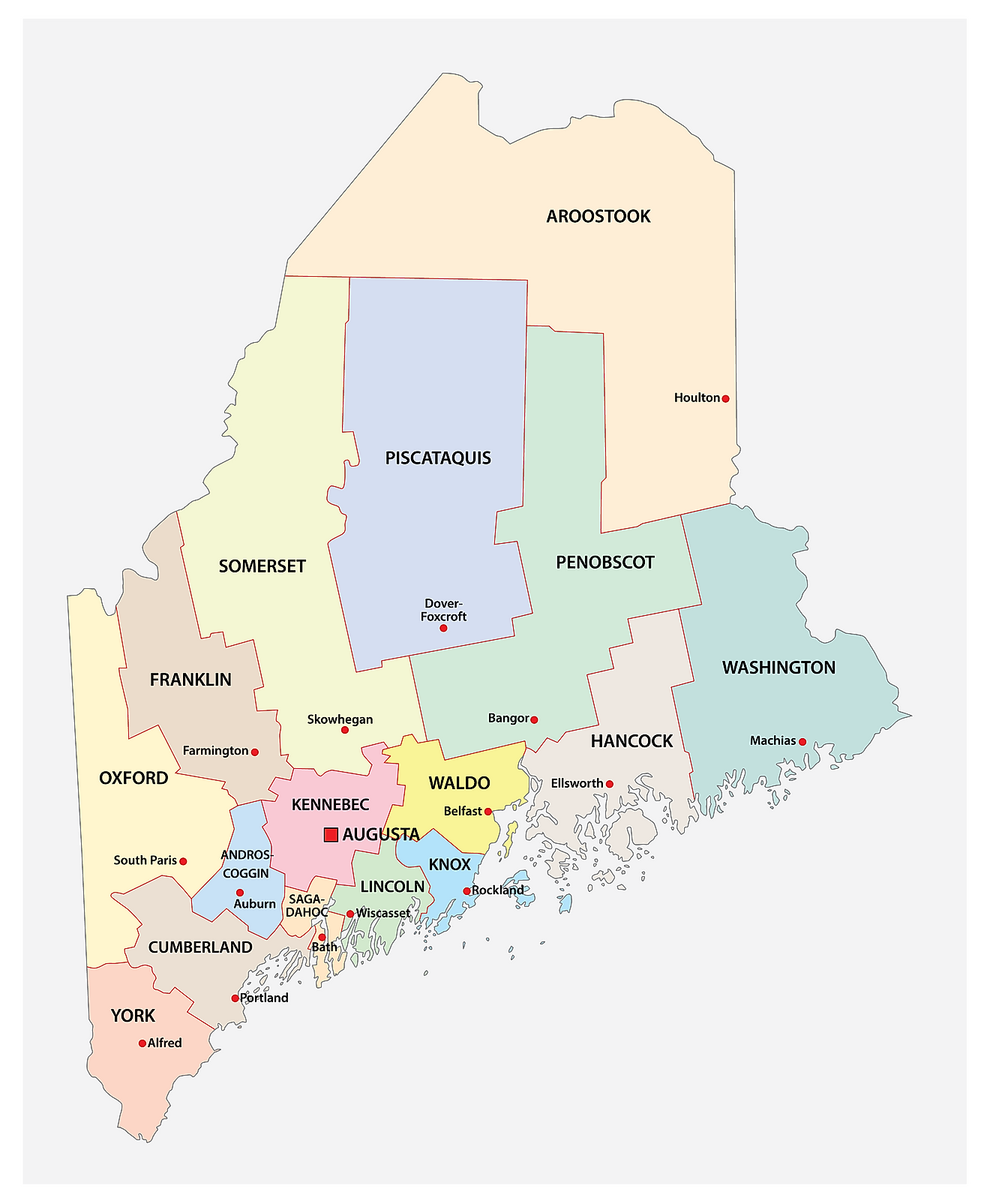
The State of Maine is divided into 16 counties. In alphabetical order, these counties are: Androscoggin, Aroostook, Cumberland, Franklin, Hancock, Kennebec, Knox, Lincoln, Oxford, Penobscot, Piscataquis, Sagadahoc, Somerset, Waldo, Washington, and York.
With an area of 91,646 sq. km, Maine is the 12th smallest and the 9th least populous state in the USA. Located in Kennebec County is Augusta – the capital city of Maine. It is also the third least populated state capital in the US, after Montpelier, Vermont and Pierre, South Dakota. Situated in Cumberland County is Portland – the most populous city in Maine. It also serves as an important economic center of the state, and the Port of Portland is the second-largest tonnage seaport in New England and the primary American port of call for the Icelandic shipping line Eimskip.
Where is Maine?
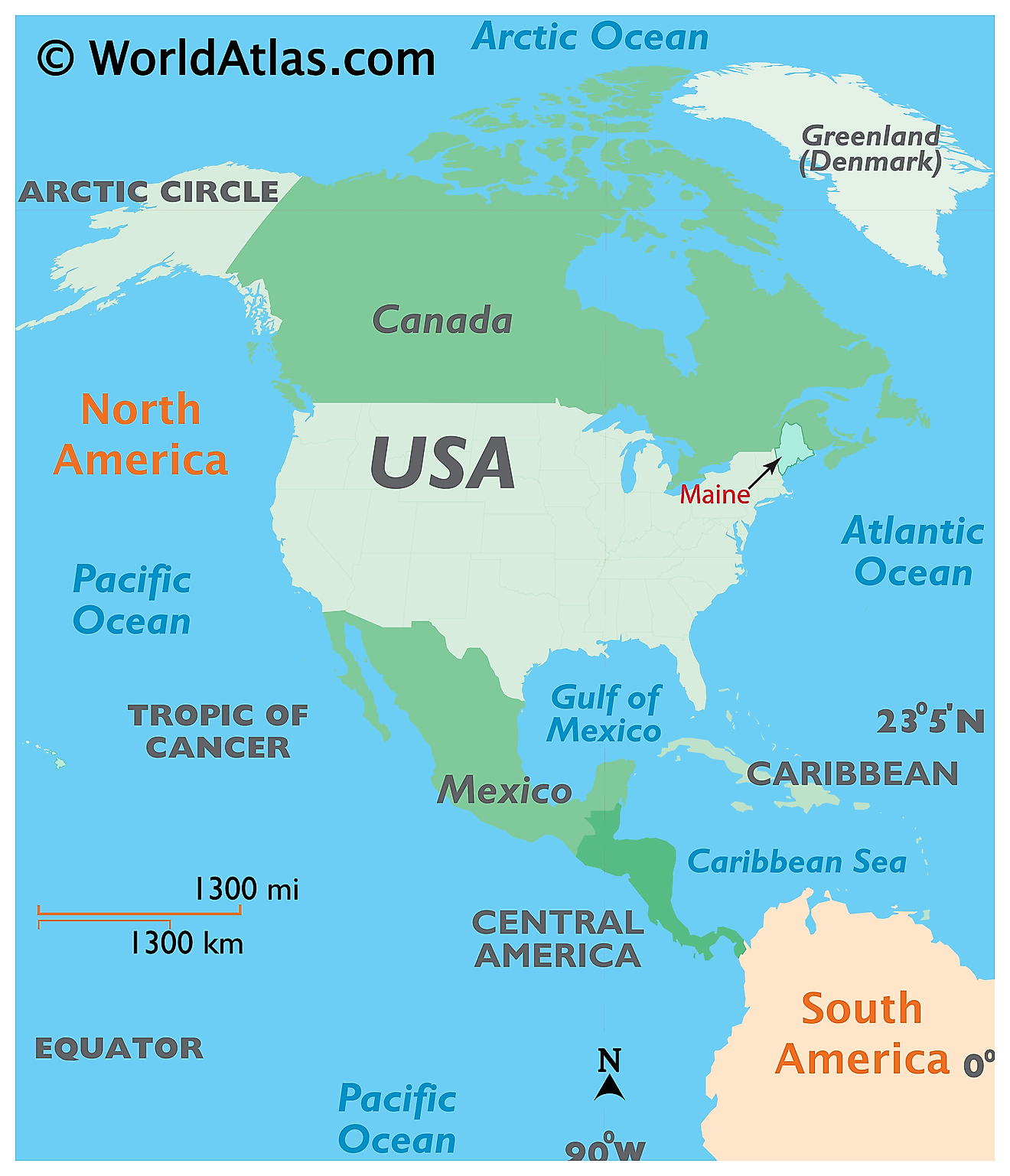
The State of Maine is located in the north-eastern (New England) region of the United States. Maine is bordered by the state of New Hampshire in the west; by the Atlantic Ocean in the southeast and by the Canadian provinces of New Brunswick in the northeast and by Quebec in the northwest.
Regional Maps: Map of North America
Outline Map of Maine
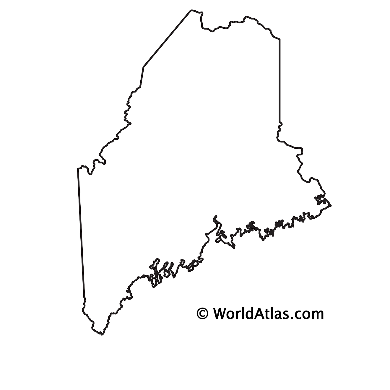
The above blank map represents the State of Maine, located in the north-eastern (New England) region of the United States. The above map can be downloaded, printed and used for geography education purposes like map-pointing and coloring activities.
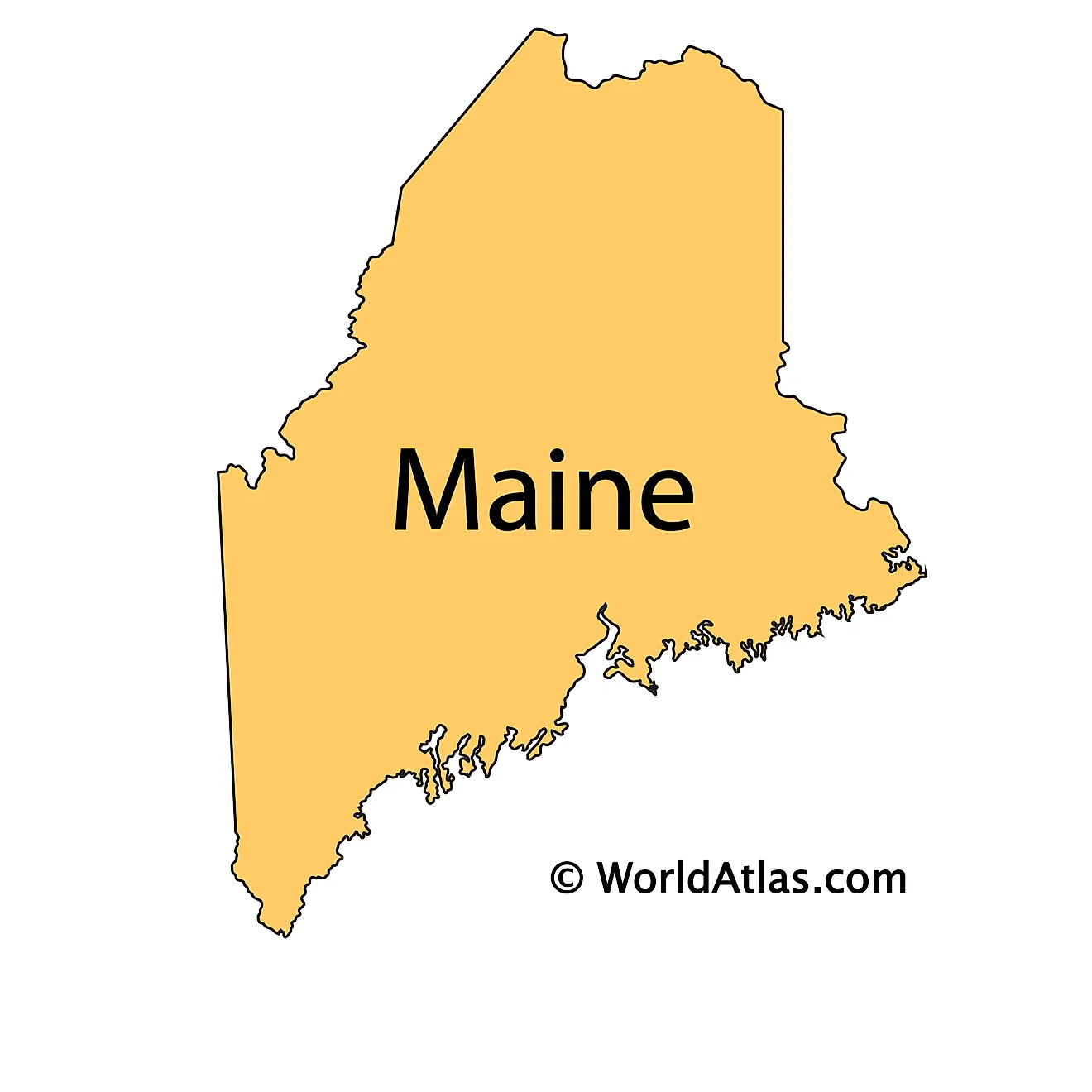
The above outline map represents the State of Maine, located in the north-eastern (New England) region of the United States. It is colloquially known as the "Pine Tree State", as about 90% of the state's total land area is covered by forests.
Key Facts
| Legal Name | State of Maine |
|---|---|
| ISO 3166 Code | US-ME |
| Capital City | Augusta |
This page was last updated on September 19, 2026