La Pérouse Strait
La Pérouse Strait is a strait separating the waterways of Russia and Japan. The waterway borders the southern part of the Russian island of Sakhalin and the Japanese island of Hokkaido and flows into the Sea of Okhotsk. The name of La Pérouse Strait comes from the French explorer Jean-François de Galaup who first discovered the strait. Historically, societies have used the strait for travel and have used it to connect individuals to different waterways.
Geography

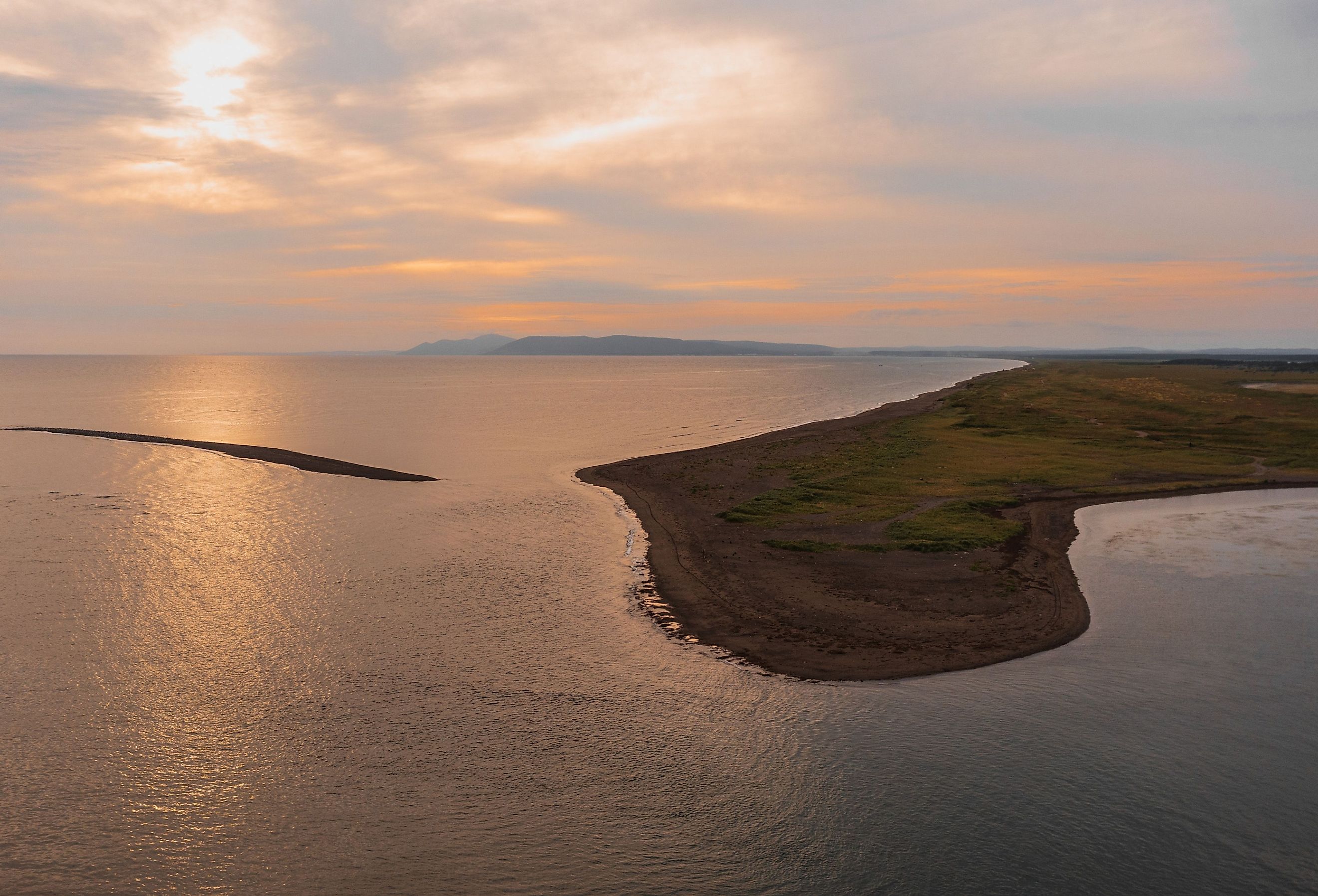
La Pérouse Strait is the Russian name for a waterway separating two islands from two different countries. The waterway separates the southern part of the Russian island of Sakhalin, and the Japanese island of Hokkaido. In Japan, the waterway has a different name, the Soya Strait.
The strait connects the Sea of Japan on the west side and the Sea of Okhotsk on the east side. Warm, subtropical water flows from La Pérouse Strait into the Okhotsk Sea. The channel's narrowest part is between Sakhalin and Hokkaido is 27 miles wide. The depth of the strait varies from 167 to 387 feet deep.
Sakhalin Island

Sakhalin Island is one of the islands bordering on La Pérouse Strait. It is an island in eastern Russia, in the Sea of Okhotsk, just north of the Japanese island of Hokkaido. The island was first settled by Japanese fishermen in the 19th century, however, in 1853, Russians started going to the island. A couple of years later, in 1855, Russia and Japan entered an agreement in which they shared the island. In 1875, this agreement became void and Russia gained complete control of the island in exchange for the Kuril Islands.
Islands In The Strait

La Pérouse Strait borders on other islands besides Sakhalin. On the northwestern part of the straight, there is a small, rocky island named Kamen Opasnosti. This is Russian for "Rocks of Danger." Kamen Opasnosti is 14km southeast of the southern point of Sakhalin Island. The island is 150m long and 50m wide. There is little life on the island and is essentially a group of bare rocks with no plants. The island caused challenges for people traveling in La Pérouse Strait, particularly when there was fog that made it hard to see the island.
Near the Japanese shore of the strait, there is another island called Bentenjima. This island is smaller than Kamen Opasnosti, with a perimeter of 500m. However, it is an important spot for wildlife, such as sea urchins and seabirds.
History

While La Pérouse Strait is between Japan and Russia, the strait gets its name from the French explorer Jean-François de Galaup. Jean-François de Galaup was a French naval officer and navigator from the 16th century. In the second half of the 1780s, his exploration of the Pacific Ocean made him well known. La Pérouse Strait was the waterway named after him because of his exploration and discovery.
After its discovery, La Pérouse Strait became an important route for whale hunting in the 19th century. From 1848 to 1892 Americans used the strait in spring and summer to get to different waters. They would travel to the Sea of Japan and to the Sea of Okhotsk to hunt.
Climate and Ecology

La Pérouse Strait has marine life from the Sea of Okhotsk. The Sea of Okhotsk joins many different waterways that are favorable to marine life. Some of the plants that thrive in the waters include algae and seaweed. There is also fauna in the waterways, including crayfish, sea mussels, crabs, sea urchins, polyps, salmon, and herring. Other marine mammals found in the strait include whales, seals, and sea lions.
La Pérouse Strait is also part of the same water basin as the Sea of Okhotsk, which is the coldest sea in East Asia. The winters in the sea are similar to the winters in Arctic regions. From October to April the area experiences frigid temperatures and a thin layer of ice covers the strait. During this time there is very little precipitation. The annual average for precipitation is 41 inches. January and February are the coldest months in the area and the average monthly air temperature in February is -4 Fahrenheit. The warmest months are July and August and the average temperature in August is 54 Fahrenheit.
With such cold waters, La Pérouse Strait is not an ideal travel destination. There are no sandy beaches or places to swim. However, La Pérouse Strait does make traveling to neighboring bodies of water more convenient. Testament to its significance, the strait is still used today as a passageway for travel.