The State Parks With The Clearest Water In America
At Rubicon Point in D.L. Bliss State Park, the granite floor of Lake Tahoe drops away in full view, visible far down through water that UC Davis researchers measured at a lake-wide average clarity of about 69 feet in 2025. Nine other state parks make a similar case. No federal agency ranks water clarity across all 50 states the way the National Park Service tallies visitation, for example, so what follows is not a scientific ranking. It is a look at 10 state parks where the water itself is the reason the land was protected in the first place, and where visitors can experience some of the country's most pristine lakes, rivers, and springs. One protects a Florida spring run that holds a temperature of 72°F in every season; another surrounds a West Texas pool where roughly 15 million gallons a day surface from a natural aquifer deep beneath the Chihuahuan Desert. Read on to discover which state parks boast the clearest waters in the US.
Ichetucknee Springs State Park, Florida

Fed by eight major springs, the Ichetucknee River at Ichetucknee Springs State Park stays a constant 72°F all year. The water runs close to swimming-pool clear, and snorkelers regularly report visibility of 30 feet or more. The park's centerpiece is Blue Hole Spring, known to the cave-diving community as Jug Spring. Cave-certified divers descend into it while tubers float the river overhead, and it is the only first-magnitude spring inside the park boundary. The 2,669-acre park protects 15 distinct natural communities along the way, and paddlers heading downstream pass through cypress-lined stretches where gar, softshell turtles, limpkins, and the occasional manatee are visible against the white limestone bottom. Tubing is the park's best-known activity, but snorkeling near the head springs gives a clearer look at the underwater grasses and karst formations that make the Ichetucknee's water so transparent in the first place. An entrance fee applies, and tube and kayak rentals are available at the park's concession near the south entrance. Arrive early on summer weekends and holidays: once the park reaches capacity, it closes to everyone, including visitors holding rental reservations or digital day passes.
Rainbow Springs State Park, Florida

Rainbow Springs carries the fourth-highest flow of any spring in Florida, discharging hundreds of millions of gallons of 72°F water a day into the Rainbow River. The swimming area at the headsprings runs 10 to 18 feet deep in the main basin, and the bottom stays in view across it. The spring is fed by rainfall percolating through a 770-square-mile springshed before it resurfaces here. Once a private 1930s tourist attraction with glass-bottom boat tours, the 1,459-acre park still keeps the old ornamental gardens and three human-made waterfalls from that era, now shaded by mossy hammocks along several miles of trail. Manatees move into the warmer spring water between November and March. Since late April 2026, every visitor entering through the main headsprings entrance needs a day-use reservation. That includes annual pass holders. Bookings open 60 days out through the Florida State Parks system.
Balmorhea State Park, Texas

Divers have reported visibility of up to 70 feet at San Solomon Springs, which surfaces in the middle of the Chihuahuan Desert. Roughly 15 million gallons a day move through Balmorhea's 1.3-acre pool. Built by the Civilian Conservation Corps in the 1930s, the V-shaped pool reaches a maximum depth of 25 feet and stays between 72 and 76°F year-round, which makes it a working site for open-water scuba certification even in winter. The pool doubles as habitat for federally endangered fish, including the Pecos gambusia and the Comanche Springs pupfish. The pupfish survives nowhere else on Earth. Beyond the pool, the park's restored desert wetlands draw flocks of migrating birds. Camping is available at 34 hookup sites, and a per-person entrance fee applies to day visitors 13 and older. Day-use capacity is held to 650 people, so passes are worth buying in advance. The pool also closes for about a week each spring for its annual cleaning.
Custer State Park, South Dakota

Sylvan Lake sits at 6,145 feet in the Black Hills, ringed by granite spires along the Needles Highway. The lake itself is human-made, formed in 1881 when a dam went in across Sunday Gulch, and its water is clear enough in the deeper sections to show the granite lakebed. It is worth getting out into that deeper water, because the shallows near the swimming beach can go weedy by late summer. A mile-long trail circles the shoreline, and the granite formations known as the Needles rise directly from the water on the lake's north side, popular with rock climbers. Sylvan Lake Lodge, a short walk from the campground, has a full-service restaurant and rents kayaks and paddleboards in season. Diving or jumping from the rocks is prohibited. At 71,000 acres, Custer State Park ranks among the largest state parks in the country and carries a free-roaming bison herd, so wildlife sightings come as a routine bonus.
Minnewaska State Park Preserve, New York

The Shawangunk Ridge holds a genuine geological rarity: five "sky lakes" fed only by rainwater and filtered through quartz conglomerate bedrock. That combination leaves the water slightly acidic, essentially free of algae, and startlingly clear for a lake in the Northeast. Four of the five sit inside Minnewaska State Park Preserve, alongside some of the other clearest water in upstate New York. The most reliably clear of them is Lake Awosting, reached by a roughly 3.5-mile hike or bike ride from the main entrance to a remote, lifeguarded "slab rock" beach. Lake Minnewaska itself sits closer to the visitor center and is far easier to reach. It has also lost much of its transparency since 2008, when non-native golden shiners appeared in the lake and set off an algae increase. That is worth knowing if a see-through lake is the point of the trip. Beyond swimming, the roughly 24,000-acre preserve carries 35 miles of carriage roads and 50 miles of footpaths. The 60-foot Awosting Falls is an easy walk from the parking area.
Priest Lake State Park, Idaho

Nicknamed Idaho's "Crown Jewel," Priest Lake stretches 19 miles through the Selkirk Mountains about 30 miles south of the Canadian border. Its water comes largely from mountain streams rather than surface runoff, which keeps it clean and clear even at the height of summer. Priest Lake State Park is split into three units: Dickensheet, Indian Creek, and Lionhead. The Indian Creek Unit carries the park's main swimming beach and boat launch. The lake reaches depths of around 300 feet, and a two-mile passage called the Thoroughfare connects it to the smaller, more remote Upper Priest Lake. Black bear and moose move through the surrounding cedar and tamarack forest, and bald eagles work the shoreline. Single-day entry runs $7 to $14 per vehicle, and reservations for campsites and cabins go through Idaho State Parks.
Flathead Lake State Park, Montana

At nearly 200 square miles, Flathead Lake is the largest natural freshwater lake west of the Mississippi in the lower 48, and its water ranks consistently among the cleanest in the country. Flathead Lake State Park manages the shoreline through six units: Big Arm, Finley Point, Wayfarers, West Shore, Yellow Bay, and Wild Horse Island. That last one is a 2,165-acre unit reachable only by boat, where bighorn sheep roam free and camping is not permitted. The lake reaches depths of nearly 370 feet off Yellow Bay. Most of the shoreline is rocky rather than sandy; Yellow Bay holds one of the system's few sand beaches. The southern half of the lake sits within the Flathead Reservation, and anglers fishing those waters need a Confederated Salish and Kootenai Tribes license in addition to a Montana state fishing license. Reservations for the busier units, Big Arm and Wayfarers among them, are worth locking in two to four weeks ahead for summer weekends.
D.L. Bliss State Park, California

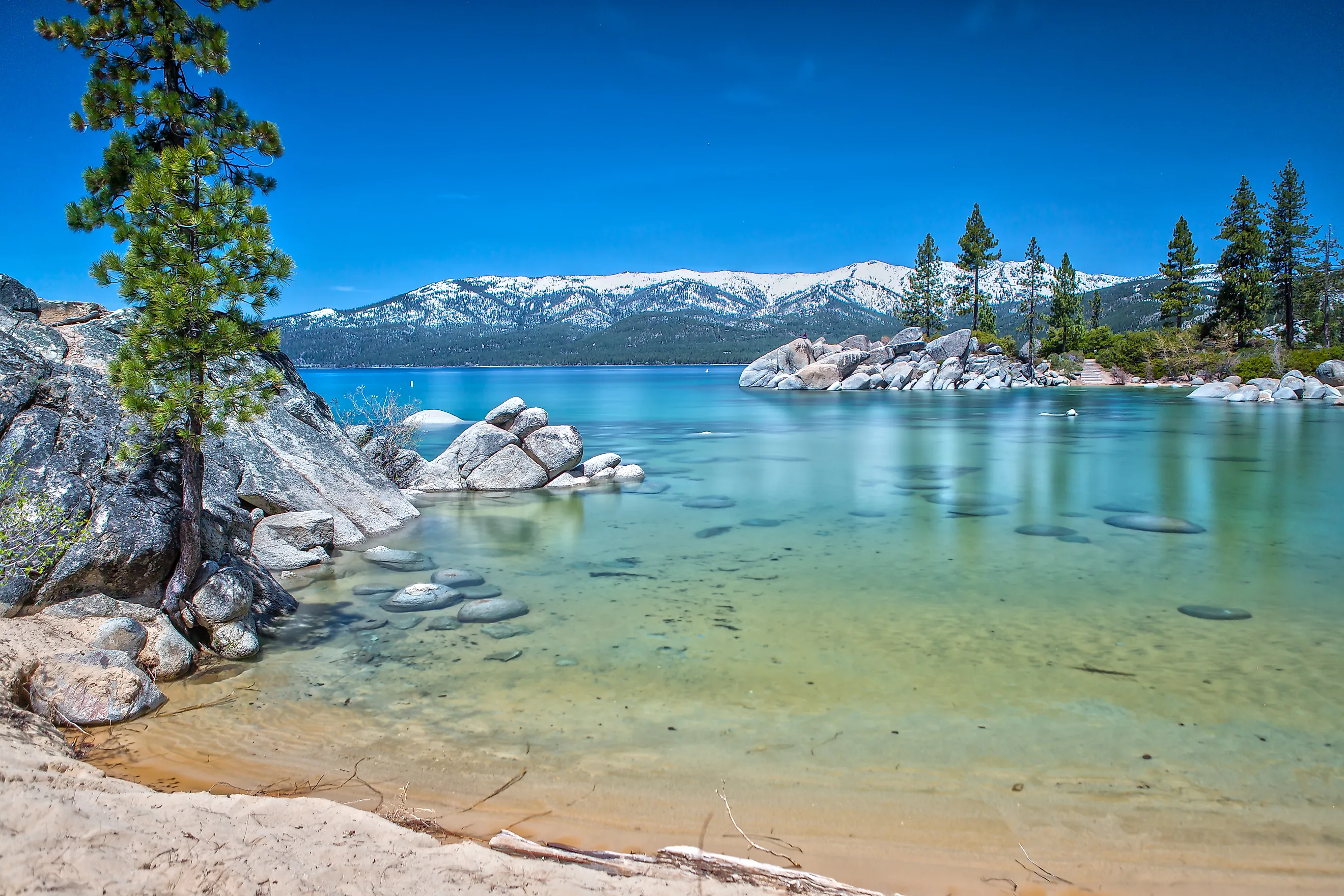
Lake Tahoe's clarity is legendary, and nowhere in the basin shows it off better than Calawee Cove and Rubicon Point inside D.L. Bliss State Park. The bottom shelves away steeply here, so the granite stays in view well down into the water column even though the lake's measured average clarity now sits near 69 feet, well short of the 97-foot baseline recorded in the late 1960s. The family of timber and railroad magnate Duane Leroy Bliss donated the 2,149 acres to the state in 1929. The park reopened on May 21, 2026, after a closure that began in June 2023 for a $5 million waterline replacement. The Rubicon Trail runs roughly 4.5 miles along the cliffs to neighboring Emerald Bay State Park, with repeated views down into the turquoise water. The route passes Rubicon Point Light, which held the title of highest-elevation lighthouse in the country when it was lit in 1916. Colorado's Dillon Reservoir light, some 2,700 feet higher, has since claimed that distinction. Day-use entry is $10 per vehicle, hours run sunrise to sunset, and camping reservations open six months out through ReserveCalifornia. Parking at Calawee Cove fills early on summer weekends.
Emerald Lake State Park, Vermont

Emerald Lake covers just 20 acres, and it takes its name from the deep green its water shows when viewed from above. The lake is deep and clear enough that the color shifts with the light through the day. Emerald Lake State Park occupies 430 acres on a heavily wooded ridge above the water, between Manchester and Rutland, with trails on Dorset Mountain and both the Long Trail and the Appalachian Trail nearby. A sandy beach and snack bar sit at the north end, where a boulder-strewn shoreline drops off quickly into deep water. Only non-motorized watercraft are permitted, which keeps things calm for swimmers and paddlers alike. Anglers fish for smallmouth bass, yellow perch, northern pike, and other warm-water species. The park runs seasonally from late May into October, with 66 campsites and 37 lean-tos.
Lake Chelan State Park, Washington

Lake Chelan is the third-deepest lake in the United States at 1,486 feet. That depth is a large part of why the water stays so clear: with little shallow area to warm and stir up sediment, visibility commonly reaches 30 feet or more on calm days. Lake Chelan State Park sits on the lake's forested south shore, with a long sandy beach, a calm swimming lagoon, and 6,000 feet of shoreline framed by the North Cascades. The lake itself runs more than 50 miles up into the mountains and ends at Stehekin. No road reaches the village. Access is by boat, float plane, or trail. Waterskiing and windsurfing draw crowds to the open water, while the park's protected lagoon suits families and casual swimmers. A boat launch permit runs $7 per day, and campsite reservations go through Washington State Parks up to nine months ahead.
What Clear Water Actually Means
What connects a 72-degree Florida spring to a 1,486-foot-deep Cascade lake is that clear water is almost always clean water, though the mechanism behind it changes at every stop. Constant spring flow does the work at Ichetucknee and Balmorhea, sheer depth does it at Chelan, and at Minnewaska it comes down to bedrock chemistry that gives algae nothing to grow on. That also makes clarity more fragile than depth or flow: Lake Minnewaska lost much of its transparency to a single introduced minnow, and Tahoe's average has sat roughly 30 feet below its late-1960s baseline for decades. The parks still delivering the view are, not coincidentally, the ones now counting who comes through the gate.