The State Parks With Ancient Rock Art
When one thinks of ancient art, the famous Lascaux Caves in France might come to mind. The United States also has Indigenous rock art on federal/state, tribal, and private lands, including several notable sites protected in state parks. Different types of stone are the backdrop for pictographs (images painted on rocks) and petroglyphs (images carved on rocks). Rock shelters and cliff faces preserve images made by Indigenous peoples for varied purposes, many of which remain uncertain and culturally significant to descendant communities. At state parks like Valley of Fire in Nevada and Hueco Tanks in Texas, visitors can see Indigenous rock art ranging from a few centuries to several thousand years old, although access rules vary by site.
Seminole Canyon State Park and Historic Site, Texas

This state park is over 2,000 acres near Comstock, Texas, and borders Mexico's Coahuila state. Seminole Canyon contains roughly 4,000-year-old Pecos River Style murals, while more than 200 pictograph sites are documented across the broader Lower Pecos River Country. The art is in several colors from different minerals and uses animal fat as a binder. The pictographs are the "Pecos River style," a style found only in the canyonlands around the confluence of the Pecos River and the Rio Grande.

The pictographs on the canyon's walls can only be viewed with a guide and a fee. The challenging, day-long Presa Day Hike and the half-day Upper Canyon Hike are offered on selected dates during fall, winter, and spring. As a bonus, tourists on both hikes get to see the landscapes and rock formations of Presa and Seminole canyons.
The Fate Bell Shelter Tour is about an hour and a half and runs Wednesday through Sunday year-round, with start times adjusted for summertime heat. The Fate Bell and Fate Bell Annex rock shelters have pictographs between about 1,500 and 5,000 years old, along with partially buried woven artifacts. Panther Cave is accessible only by boat, but it is not included on the park's current list of regularly offered public tours. The shelter takes its name from one giant feline figure at the far end of the panel. The panel includes anthropomorphs, or humanlike figures; zoomorphs, or animal-like figures; and enigmatic forms whose identities remain uncertain.

The illustrations represent the prehistoric people who lived in the canyon and the others who passed through. Researchers have proposed that Pecos River Style murals express religious or cosmological ideas, but the precise meanings and identities of their figures remain uncertain. The state park has 46 campsites and offers visitors more activities, like hiking and mountain biking. The Rio Grande cuts through a rocky canyon landscape that supports cacti and wildlife such as deer, armadillos, foxes, and bobcats.
Fremont Indian State Park and Museum, Utah

This state park in central Utah sits in Clear Creek Canyon and is surrounded by Fishlake National Forest. The park is named for the Fremont culture, which lived in Utah between about 300 and 1300 CE. Construction of Interstate 70 uncovered the largest known Fremont village at Five Finger Ridge, and the park preserves artifacts excavated there. The museum exhibits are closed for renovations, with the park expecting them to reopen in fall 2026, while the visitor center and outdoor areas remain open. The Parade of Rock Art trail is behind the museum and just over a quarter of a mile long. The petroglyphs seen on this trail show hunting scenes, human figures, and possible maps of the area.

Clear Creek Canyon has over 500 more panels of pictographs and petroglyphs. Some trails through the canyon have educational boards that share the history of the Fremont people and assist with interpreting the rock art. There are additional hiking trails without the rock art that have canyon views, spring wildflowers, unique rock formations, and sandstones colored orange, red, and purple. Visitors will also enjoy spotting the local wildlife that includes elk, mule deer, and raptors such as golden eagles. Sam Stowe Campground is open year-round and has 10 full-hookup sites, a tent group area, one modernized pithouse, and two cabins. The state park is also a certified International Dark Sky Park, so it is an excellent way to see stars and the Milky Way galaxy.
Columbia Hills Historical State Park, Washington

Farther northwest, Columbia Hills Historical State Park protects Indigenous rock art near Lyle, Washington. This park is 3,300 acres and sits on the Columbia River bordering Oregon. Near Horsethief Lake are Native American pictographs and petroglyphs. The rock art can be associated with some of the tribes from over 300 years ago, but could also be connected to the Chinookan and Sahaptian peoples who lived for thousands of years along the Columbia River's banks. From April through October, visitors may view relocated petroglyphs along the park road without a guide, but access to the in-situ panels and Tsagaglalal requires a reserved guided tour. The pictographs were made with red ochre, an iron-rich mineral pigment, and depict geometric forms, animals, and human figures.

The reservation-only Tsagaglalal ("She Who Watches") tour takes place at 9 a.m. on Fridays and Saturdays during April through October. The tour will take visitors to see a large piece of rock art created by the Wishram people of Chinookan-speaking tribes of the area around the river. The illustration is a combination of a carving and red ochre paint on a basalt cliff above the river. According to a Wishram oral tradition, Coyote transformed a woman chief into Tsagaglalal so that she would continue watching over the people and the river.
The state park also offers plenty of space to hike, bike, and horseback ride. It is popular in the spring for the wildflowers lining the trails that weave through rolling green hills and valleys. There are brilliant views of Mount Hood and Mount Jefferson, along with dramatic rock formations that sometimes reveal small waterfalls. Kayaks and other boats are allowed on the Columbia River and Horsethief Lake, while campsites and picnic tables offer a chance to sit and take in the views.
Thousand Hills State Park, Missouri

Head to the Midwest to find ancient rock art in northern Missouri. The petroglyphs in Thousand Hills State Park are more than 1,500 years old and were left by Native Americans. They are in the park's Petroglyph Shelter, which has walkways overlooking the rocks bearing the carvings. The depictions of birds, four-legged animals, snakes, and a spiral-tailed animal that may symbolize a water spirit may have been communicating the history and stories of the Indigenous people who left them. The petroglyph shelter is conveniently open year-round during daytime hours.
Come for the ancient rock art, but stay to enjoy over 3,000 acres of Thousand Hills State Park. It encloses Forest Lake and its 17 miles of shoreline, where visitors can swim, boat, and fish. Paved trails curve along the water, and unpaved trails through the forests take visitors by gentle flowing creeks and allow for plenty of deer-spotting.
Roche-A-Cri State Park, Wisconsin

The Midwest has more ancient rock art in central Wisconsin at Roche-A-Cri State Park. The park is named after Roche-A-Cri, the 300-foot-high sandstone outcrop sitting on a rocky island that was once in a glacial lake. The name comes from French and is usually translated as "screaming rock." The Ho-Chunk lived in the area when French explorers and traders came through it. Roche-A-Cri has petroglyphs that predate 900 CE and pictographs from 400-500 years ago from the Ho-Chunk's ancestors. The carvings include birds and crescents that may represent the moon, while the paintings include a lightning bolt next to a horned creature. It is the only interpreted rock art site in Wisconsin.

Display boards explain the history of the carvings and paintings, and drawings of the ancient rock art help locate the illustrations on the rock. The rock art is viewed from an accessible observation deck west of the park office, while official hiking routes include the Mound, Acorn, Spring Peeper, Turkey Vulture, Chickadee Rock, and Eagle Ridge trails. There are also many restored prairies with different prairie grasses. A visit during autumn should bring pleasant temperatures, colorful trees, and clearer air for the views from the top of Roche-A-Cri.
Sanilac Petroglyphs Historic State Park, Michigan

This state park in eastern Michigan is about 240 acres and has petroglyphs made between 300 and 1,000 years ago by the Anishinabek people, the Native Americans who lived in the Great Lakes region and still do today. The carvings are called Ezhibiigaadek Asin, meaning "written on stone" or "knowledge written on stone" in Anishinaabemowin. A quarter-mile accessible trail leads to the roofed enclosure, but the petroglyph viewing area is open only for guided tours Wednesday through Sunday from late May through early September. Some of the images carved on the sandstone are of a man with a bow and arrow, an eagle man, and a water panther. Other shapes are of handprints, swirls, and lines. They represent stories from the Native American tribes who lived in this area.
Sanilac Petroglyphs Historic State Park is also a great way to see the area's nature. A one-mile interpretive hiking loop crosses a branch of the Cass River and passes the remains of a 19th-century logging camp. Visitors will be able to view panels that share history and nature information about the park. Deer, turkeys, and other birds also live in the landscape.
Valley of Fire State Park, Nevada

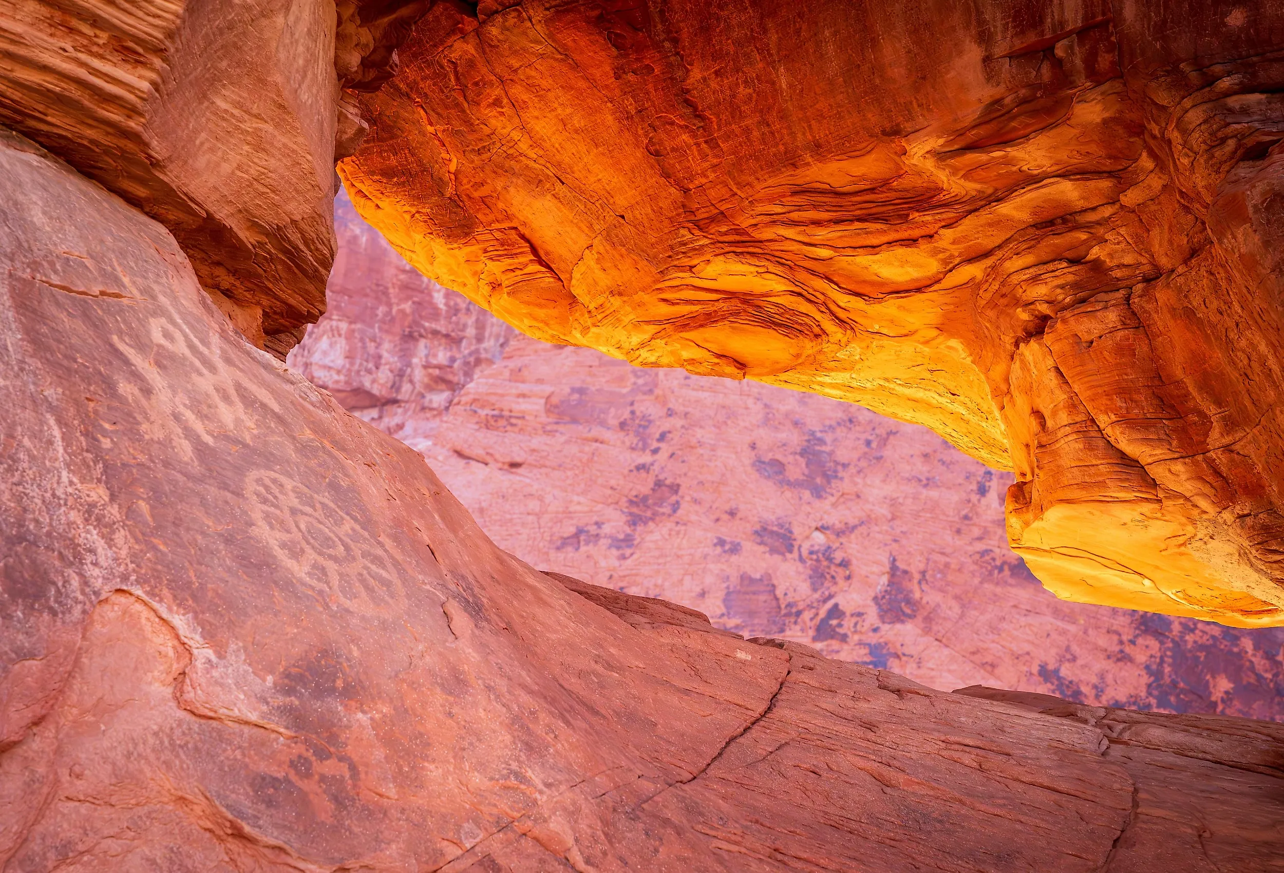
Valley of Fire State Park covers more than 40,000 acres of red sandstone formations near Overton, Nevada. People have traveled through this part of the Mojave Desert for thousands of years. The park's most visible evidence of early life is its petroglyphs, some of which were carved by people of the Basketmaker culture about 2,500 years ago. Early Pueblo peoples added other images later. The carvings include human figures, animals, geometric patterns, and designs whose meanings are not fully understood.
Visitors can climb a metal staircase at Atlatl Rock for a close view of petroglyphs carved high on a sandstone face. Mouse's Tank Trail follows a sandy canyon past another large collection of carvings. The visitor center provides exhibits about the park's archaeology, geology, and ecology. Beyond the rock art, Valley of Fire has scenic drives, hiking trails, picnic areas, and 72 campsites among its red and tan formations. Many trails close annually from May 15 through September 30 because of extreme heat, and the entire park closes for maintenance from December 1 through December 14.
Hueco Tanks State Park and Historic Site, Texas

Hueco Tanks State Park and Historic Site protects 860 acres of rocky hills in the Chihuahuan Desert near El Paso. Its name comes from the natural basins, or huecos, that collect rainwater and have drawn people to the site for thousands of years. Archaeologists estimate that the park contains between 3,000 and 6,000 pictographs, along with petroglyphs and other archaeological remains. More than 200 painted masks or face-like figures have been identified, making this the largest known concentration of such images in North America.

Many of the best-known paintings are associated with the Jornada Mogollon people, who farmed near the rock hills roughly 550 to 1,800 years ago. Other images reflect visits by Apache, Kiowa, Comanche, Tigua, and Pueblo peoples, several of whom still consider Hueco Tanks an important part of their heritage. The park is both a National Historic Landmark and a State Archeological Landmark.
Access is limited to protect the fragile images. Self-guided permits allow no more than 70 people into the North Mountain area each day, while other sections can be entered only on guided tours reserved in advance. Visitors can also hike, bird-watch, stargaze, camp, and climb on designated routes. Hueco Tanks is especially renowned for rock climbing, but its ancient imagery remains its most culturally significant attraction.
What The Rock Art Still Holds
State parks in the US are often known for their hiking, camping, and other activities. Yet there are several that hold rock art hundreds to thousands of years old. The images represent something important to the people who once lived there. Some of the art may still be a mystery, which adds to the fascination of the ancient depictions. Whether visiting the South, West, Pacific Northwest, or Midwest, travelers can find state parks that protect and interpret Indigenous rock art.