The State Parks Where The Tides Can Trap You
Millions of people visit state parks across the United States each year for beautiful beaches and rugged coastlines. But along some shores, the landscape can change surprisingly fast. A beach that is easy to cross at low tide can become an impassable stretch of water just hours later. California State Parks says its lifeguards perform approximately 10,000 water rescues each year, although that systemwide figure covers many aquatic hazards besides tide entrapment.
The danger isn't always crashing waves. Sometimes, it's the tide creeping in behind you. At Hug Point and Ecola State Park in Oregon, rising water has stranded visitors along rocky stretches. Popham Beach State Park in Maine and Silver Sands State Park in Connecticut have seen people caught when sandbars disappear beneath the tide. The following state-managed coastal destinations include formal state parks and two Oregon state recreation sites, all with routes that can be cut off by rising water.
Arcadia Beach State Recreation Site

It's easy to lose track of time at Arcadia Beach State Recreation Site on the Oregon Coast. The park sits about a mile south of Cannon Beach, and its beach runs more than a mile between two headlands. Humbug Point closes it off to the north, with Lion Rock standing just offshore, and Hug Point closes it off to the south. Tide pools, offshore rocks, and sandstone bluffs pull people out when the water draws back and uncovers parts of the coast that are normally underwater.
That disappearing coastline comes with a catch. Oregon State Parks warns that both headlands can be passed only at low tide, so anyone rounding them needs to know whether the tide is coming in or going out. The agency also warns that an incoming tide can easily leave beachgoers stranded away from shore, especially around tide pools and secluded beaches. That is the documented hazard here. The route around Humbug and Hug points is open only at low water, and it becomes impassable as the ocean fills back in.
Hug Point State Recreation Site

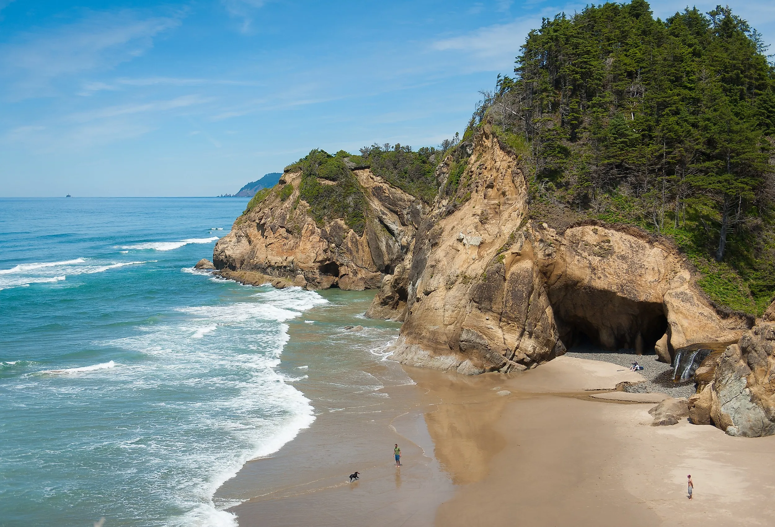
Five miles south of Cannon Beach, Hug Point State Recreation Site packs a lot of scenery into a small stretch of the Oregon Coast. A sandy cove sits below hills of Sitka spruce, salal, and ferns. The rocky headland holds sandstone caves, tide pools, and a seasonal waterfall. At low tide, visitors can walk the remnants of the old stagecoach road carved into the rock. Before Highway 101 was built, travelers had to "hug" the point to get around the headland.
That same landscape comes with a warning from Oregon State Parks that it can be dangerous when the tide comes in. Visitors can become stranded once the water covers the route around the headland and cuts off the beach.
In April 2017, a Coast Guard helicopter crew hoisted a man off a rock ledge at Hug Point after high tide pinned him there. The pilot said the man was clinging to a rope and being splashed by incoming waves when the aircrew arrived. The following July, another hiker was lifted from about 100 feet up the cliffside after a rising tide blocked his route, and officials said he was one of five hikers rescued in the Pacific Northwest that day after being stranded by high tides. The Coast Guard has described this stretch as a well-known problem area for tide entrapment, with rescues in most years.
Ecola State Park

Ecola State Park stretches along nine miles of Oregon's northern coastline, wrapping around Tillamook Head between Seaside and Cannon Beach. Forested headlands, grassy cliffs, sandy beaches, and huge sea stacks make up the shore. The tide pools, beach, and trails at Indian Beach are the park's favorite place to explore.
The tide is the thing to watch here. Parts of the shoreline that are easy to cross when the water is low can disappear quickly as it rises, leaving no easy way back. That has led to some serious rescues. In July 2014, a Coast Guard aircrew hoisted a hiker off the Ecola cliffs after the incoming tide trapped her and flew her to the airport at Seaside.
In another case, an aircrew lifted out three men who became stranded while fishing in the Indian Beach tide pools. In May 2019, a couple was caught by the incoming tide on the south side of Indian Beach. A helicopter crew reached the woman as waves broke over her, then hoisted her boyfriend, who had climbed onto the rocks trying to help.
Andrew Molera State Park

With nearly 5,000 acres of mostly undeveloped coastal terrain, Andrew Molera State Park along Big Sur feels wonderfully wild. The park has grassy meadows, redwood and oak groves, coastal bluffs, and the mouth of the Big Sur River. Trails lead to a long, scenic beach.
The beach comes with a warning that's easy to overlook. California State Parks says most of the two-mile beach hike between the mouth of the Big Sur River and Cooper Point is accessible only at low tide, and it specifically tells visitors to check tide tables to avoid being trapped or carried out to sea. Rocky ground along the shoreline can make some sections impossible to pass once the water rises.
The park's own warning is unusually direct. There are no lifeguards on this beach, and the park cautions that ocean conditions can be hazardous, so the tide is not something visitors should take lightly.
Popham Beach State Park

Popham Beach State Park is one of the most beautiful stretches of coastline in Maine. The wide beach has dunes, salt marshes, and views of the islands offshore. The park is also Maine's busiest state park beach, and its shoreline constantly changes as the wind, waves, and tides move the sand around.
Visitors at Popham Beach State Park should be careful not to wander too far at low tide. Maine's Bureau of Parks and Lands warns that people heading toward Fox Island can become marooned as the tide rises, and the sandbars are usually covered by cold, fast-moving water within two hours of low tide. Shifting sand has made that walk harder than it once was. The route now involves crossing the mouth of the Morse River, and the state discourages the trip.
There are real rescue stories to back up the warning. In March 2011, two women were stranded on Fox Island by a rising tide in heavy fog. Phippsburg's police chief waded out in a survival suit to reach them, and it took firefighters, a game warden, and Marine Patrol to get everyone back to shore. In June 2020, a Popham Beach lifeguard rescued three teenagers who became stranded on a rock off Wood Island after the tide covered the sandbar they had walked out on. Patrick McKenna brought them in one at a time on his rescue board, paddling roughly 1,800 yards in total through 54-degree water to an island about 300 yards from shore.
Harstine Island State Park

Harstine Island State Park in the South Puget Sound of Washington is a peaceful spot. Its roughly 300 acres hold miles of forest trails, old-growth stands, rocky beach, wetlands, and water views. The beach trail drops through the forest toward the shoreline, where visitors can watch birds and walk out onto quiet tide flats.
The real adventure begins when the tide goes out. At low tide, a sand bar creates a temporary trail between Harstine Island and tiny McMicken Island Marine State Park, which is otherwise reachable only by boat. It's an exciting way to explore the coast, but the window to cross back doesn't last long. Washington State Parks tells visitors not to begin the hike during an incoming tide and to leave McMicken before the sand bar becomes inaccessible.
The disappearing land bridge is what catches visitors off guard. Once the tide submerges the tombolo, wading or swimming across it is not an option. Anyone caught on the far side has to wait for safe low-tide access or leave by boat. The Washington Trails Association also cautions hikers to keep track of the time and the incoming tide so they don't get trapped.
Leadbetter Point State Park

At the northern tip of the Long Beach Peninsula in Washington, Leadbetter Point State Park gathers sandy beaches, shifting dunes, coastal forest, wetlands, and tidal flats into one place. The Pacific Ocean is on one side and Willapa Bay on the other. The park draws hikers, birdwatchers, beachcombers, and people who simply want to watch a shoreline that never looks the same twice.
Washington State Parks describes Leadbetter Point as a place where ocean currents, tidal flows, and fresh water meet and constantly reshape the coast. That also makes it tricky to get around, because the park's trails and shoreline change with the tide. The Washington Trails Association recommends bringing a tide table and visiting at low tide, since some areas become difficult to navigate once the water rises.
In December 2019, a Coast Guard helicopter crew hoisted two women out of Leadbetter Point State Park after the incoming tide surrounded them. They were flown to the airport at Ilwaco, where a state park ranger drove them back to their vehicle at the far end of the peninsula. With water on both sides and trails that shift with the tide, this is another park where conditions are worth checking before setting out.
Silver Sands State Park

In Connecticut, Silver Sands State Park covers nearly 300 acres of shoreline on Long Island Sound. The park is best known for the sand bar that surfaces at low tide and links the mainland to Charles Island. Geologists call that kind of bar a tombolo, and this one runs out to a 14-acre bird sanctuary about half a mile offshore. Connecticut DEEP prohibits walking on any part of the tombolo while water covers it, and no crossing to the island is allowed between May 1 and September 9, when it is managed as a natural area preserve for nesting herons and egrets.
As the tide comes back in, the sand bar disappears quickly and regularly traps visitors who start back too late. In June 2011, Milford firefighters and passing boaters pulled three teenagers out of deeper water after they were swept off the bar. Weeks later, on the Fourth of July, a 34-year-old man drowned in the same spot after the incoming tide knocked him off his feet. A passing jet skier reached the nine-year-old boy who was walking with him.
In June 2026, Milford firefighters rescued five people from the incoming tide near the sand bar, and two were taken to a hospital with signs of hypothermia. Two people walking toward Charles Island were suddenly surrounded by water, and three others who rushed in to help also needed rescuing. A Milford Fire Department battalion chief said the department handles several rescues a year involving people trying to reach the island. State signs at the tombolo call the crossing extremely dangerous, and the safer choice is to view the island from shore rather than treating a tide check as permission to walk out.
Enjoy the Coast, But Respect the Tide
There is something irresistible about exploring a beach when the tide pulls back, revealing rocky coves, tide pools, sandbars, and stretches of shoreline that disappear beneath the water a few hours later. But that is also what makes these state parks so easy to underestimate. A route that looks perfectly safe on the way out may not be there when it's time to return. Before using a low-tide route, check local tide predictions, weather conditions, and park alerts. Allow a generous turnaround margin and never attempt to cross once water begins covering the route. The ocean may be part of the adventure, but it should never be the part that catches you by surprise.