The State Parks That Feel Like The Grand Canyon
Palo Duro Canyon State Park is known as the Grand Canyon of Texas, while New York's Letchworth State Park is considered the Grand Canyon of the East. These parks, along with others ranging from the East Coast to the Pacific, share features akin to the geologic formations and landforms found in the Grand Canyon.
Nature enthusiasts seeking a more compact or less crowded alternative to the 1,218,375-acre Grand Canyon National Park can enjoy scenic views of layered cliffs, red rocks, and river-carved canyons.
Like the Grand Canyon, several are designated International Dark Sky Parks, including California's Anza-Borrego Desert State Park and Utah's Goosenecks State Park.
Waimea Canyon State Park combines deep gorges and layered rock with the lush vegetation and rainforests of the Hawaiian Islands. These nine state parks bring Arizona's characteristics to life through entrenched rivers, copper-colored canyons, and deep gorges.
Waimea Canyon State Park

Waimea Canyon State Park, on the Hawaiian island of Kaua'i, preserves a steep, walled gorge with layered rock formations marked by horizontal bands of red and orange rock. Often called the "Grand Canyon of the Pacific," the canyon stretches about 14 miles long, one mile wide, and 3,600 feet deep, shaped by volcanic activity, a fault line collapse, and heavy river erosion.
Like the Grand Canyon's South Rim, visitors can travel the canyon rim and stop at scenic overlooks such as Pu'u Hinahina and Waimea Canyon Lookout. Several hiking trails, including the Canyon Trail and Cliff Trail, provide access to the park's terrain and views of Waipo'o Falls, which drops approximately 800 feet.
In contrast to the Grand Canyon's desert landscape, the 1,866-acre Waimea Canyon is surrounded by tropical vegetation from the region's abundant rainfall.
Smith Rock State Park

Located in the High Desert region of central Oregon, Smith Rock State Park's sheer-walled river canyon was carved by the Crooked River. It has the same arid desert environment, rock formations, and scenic views, making it quite different from the typical forest environments found in the Pacific Northwest.
Massive cliffs and spires, some as much as 600 feet high, were formed from welded tuff and basalt, volcanic ash deposited about 30 million years ago. Significantly smaller than the Grand Canyon, the park has between 1,500 and 2,000 rock climbing routes spread across 650 acres, compared to around 150 in the 1.2-million-acre Grand Canyon.
Recreational opportunities include fishing in the Crooked River, viewing prairie falcons and eagles, and hiking on a large trail network.
Anza-Borrego Desert State Park

Known for slot canyons, expansive desert landscapes, and badlands, Anza-Borrego Desert State Park covers about 600,000 acres and is one of California's largest state parks. In Southern California's Colorado Desert, it shares geology and history with the Grand Canyon, shaped by water erosion over millions of years.
The Colorado River originally washed some of the sediment down from the Grand Canyon region. It is also an International Dark Sky Park. More than 100 miles of hiking trails and scenic viewpoints include Font's Point, nicknamed "California's Grand Canyon" for its sand-colored hills, badlands, and arroyos, or dry creek beds. In spring, the desert landscape becomes a mass of color as wildflowers bloom.
Dead Horse Point State Park

Dead Horse Point State Park sits on a high plateau about 2,000 feet above a bend in the Colorado River, overlooking Canyonlands National Park in Utah. The 5,326-acre park is more compact but offers dramatic views and rim trails similar to the Grand Canyon.
Like the Grand Canyon, the Colorado River carved its deep gorge over millions of years, and the desert landscape has sheer drop cliffs and copper-colored canyons that rival those of the Grand Canyon.
The park is also a designated International Dark Sky Park. The canyon was used for the final cliff scene in the 1991 movie Thelma and Louise.
Goosenecks State Park

At approximately ten acres, Goosenecks State Park packs a substantial amount of scenery into a compact footprint. Located in southeastern Utah, the park offers scenic views of the San Juan River and its winding twists and turns, known as goosenecks, in a less crowded setting than the Grand Canyon. Multi-layered rock, marked by bands of limestone, shale, and sandstone, forms a colorful exterior.
The 1,000-foot-deep canyon formed as the Colorado Plateau uplifted, forcing the San Juan River to carve deep curves into rock walls that record some 300 million years of deposition. Landforms include the volcanic Alhambra Rock, Mexican Hat, and the spires and buttes of Monument Valley.

The park is an excellent example of an entrenched river, a waterway flowing through a deep trench or canyon rather than flat land, like the Colorado River as it flows through the Grand Canyon. Opened in 1962, Goosenecks is a designated International Dark Sky Park, making it possible to enjoy stargazing without the light pollution of a populated area.
The canyon rim has a parking area and an observation area. Visitors cannot drive through the park itself. Additionally, the park has no hiking or bicycling trails, though Honaker Trail is located nearby.
Valley of Fire State Park

Located in the Mojave Desert, Valley of Fire State Park is Nevada's oldest state park. At 40,000 acres, it has red Aztec sandstone formations with striped rock waves in gray and tan limestone. Wind and water erosion carved slot canyons and cliffs, while multiple short trails lead to scenic rock formations and petrified trees.
Canyon landscapes highlight 2,000 to 3,000-year-old petroglyphs carved by Indigenous cultures at Atlatl Rock and Mouse's Tank Trail. Visitors can drive scenic loops and park near trailheads to hike and possibly view big horn sheep. Highlights include Arch Rock, Elephant Rock, and Fire Wave, with white and red zebra stripes.
The unique Martian-like landscape has been a filming site for movies such as Total Recall, Star Trek: Generations, and Transformers.
Palo Duro Canyon State Park

Palo Duro Canyon State Park, called the Grand Canyon of Texas, holds the second-largest canyon system in the US, behind the Grand Canyon. Carved by the Prairie Dog Town Fork of the Red River, the Texas park has 800- to 1,000-foot red rock cliffs with multicolored layers, hoodoos, and steep mesa walls, formed by millions of years of wind and water erosion.
The gorge is about 120 miles long and up to 20 miles wide. More than 30 miles of bicycling and hiking trails include the Lighthouse Trail that leads to the 300-foot Lighthouse Rock, the most recognizable landmark.
Visitors can explore by bicycle, on horseback, or by driving on a paved 16-mile road down to the canyon floor, unlike the Grand Canyon, which must be hiked into.
Letchworth State Park

Letchworth State Park combines the river-carved gorges of the Grand Canyon with the forests, fall foliage, and winter scenes of Western New York. Known as the Grand Canyon of the East, the 14,350-acre park has more than 66 miles of hiking, bicycling, and cross-country skiing trails.
The Genesee River flows through a 17-mile gorge, framed by 600-foot-high cliffs and waterfalls ranging from 70 to 107 feet high. In addition to fishing and whitewater rafting, recreational activities include hiking the Gorge Trail, which runs along the gorge and offers access to scenic overlooks and the waterfalls. You can also reach scenic overlooks by vehicle.
Providence Canyon State Park

Geological formations, deep gorges, and colorful canyon walls have earned Georgia's Providence Canyon State Park the nickname "Georgia's Little Grand Canyon." The park has 16 canyons, some reaching up to 150 feet deep with rim overlooks. The gorges began forming in the early 1800s because of forest clearing, erosion, and farming practices.
Erosion is continuous because of the soft clay and sand, shaped by rain and other elements. Established as a state park in 1971, the property spans 2,706 acres in southwest Georgia.

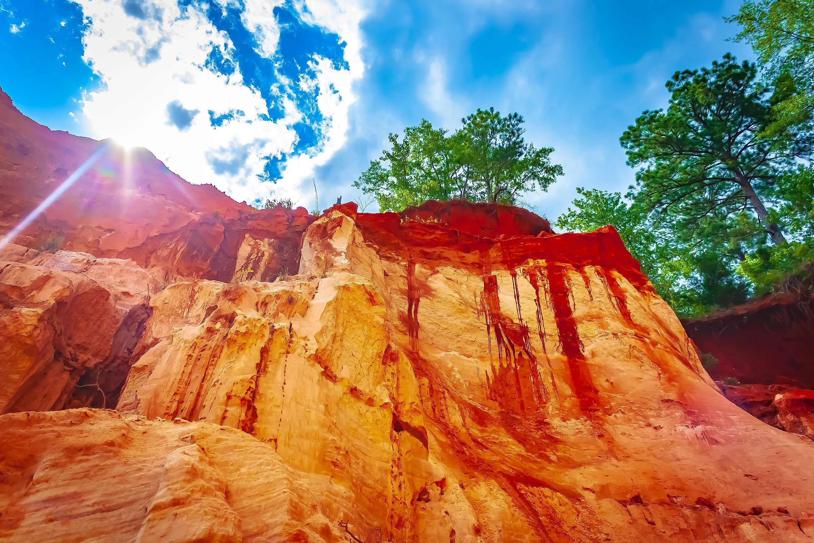
The canyon's steep walls expose layers of sand and clay sediments in shades of orange, red, and white, creating a landscape like that of the Southwest's Grand Canyon. Unlike canyons carved into solidified rock, like the Grand Canyon, Providence Canyon consists of eroded soil and loose sediment.
Visitors can hike the Rim Trail and into the canyon floor, including a challenging seven mile Backcountry Trail and a 2.5-mile Canyon Loop Trail featuring layers of orange, red, and purple soil and nine canyons.
State Parks That Feel Like The Grand Canyon
These state parks share similarities with Arizona's Grand Canyon through colorful formations and diverse terrain. The Colorado River formed the Grand Canyon over millions of years, eroding the landscape and creating steep inclines and layered sedimentary rock gorges.
Similar natural processes formed these canyon environments, creating the views and recreational opportunities found today. The Prairie Dog Town Fork of the Red River spent millions of years carving Palo Duro Canyon State Park into its current state.
Likewise, the Colorado River eroded Dead Horse Point State Park over the same time span. In contrast, Providence Canyon State Park formed more recently, during the 1800s, and consists of loose sediment, while the Genesee River carved gorges into Letchworth State Park over thousands of years.
Despite different origins, these places highlight landscapes and geologic formations similar to those in the Grand Canyon, but in more compact and accessible locations with fewer crowds.