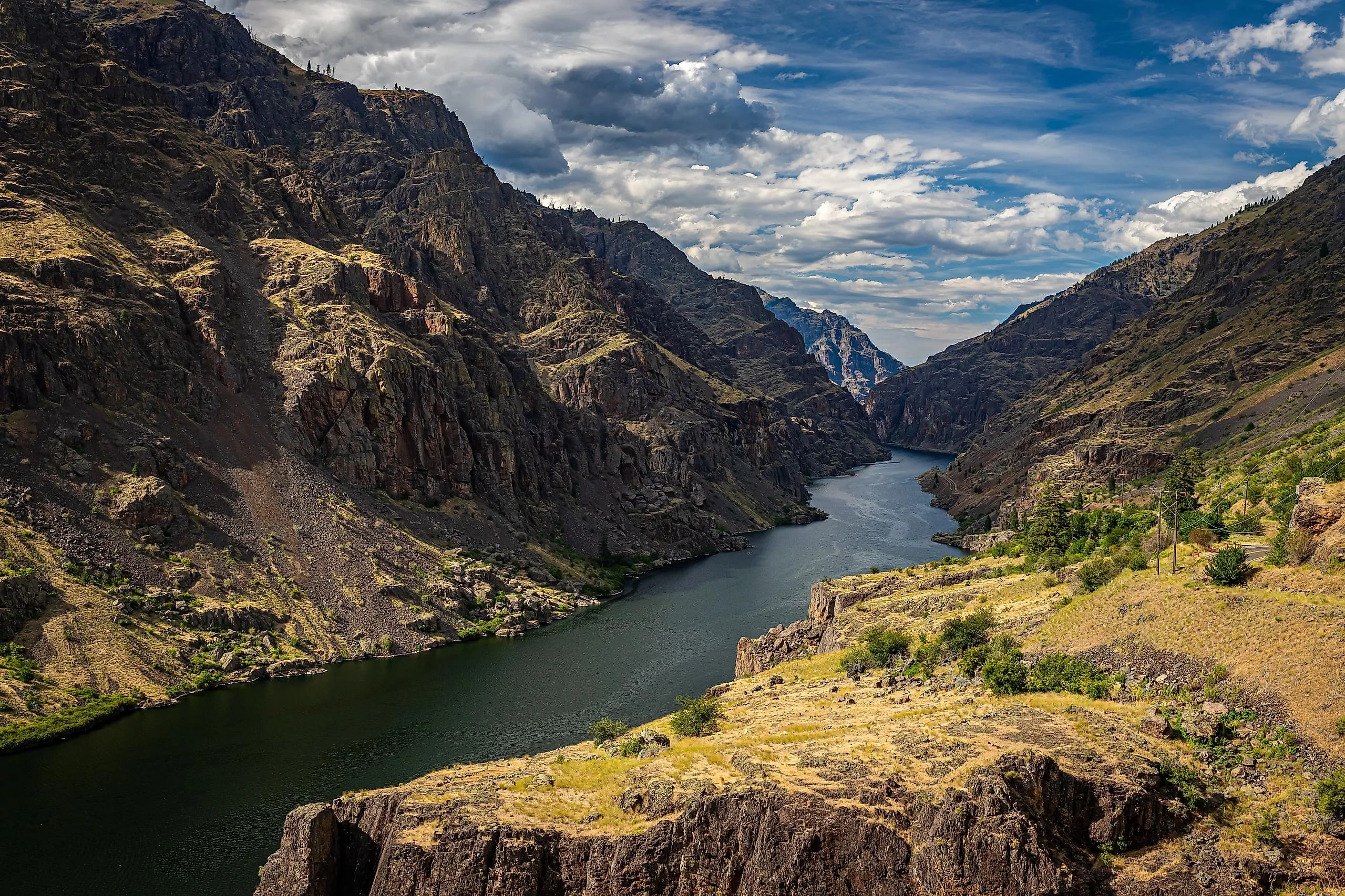
The Deepest River Gorge In America
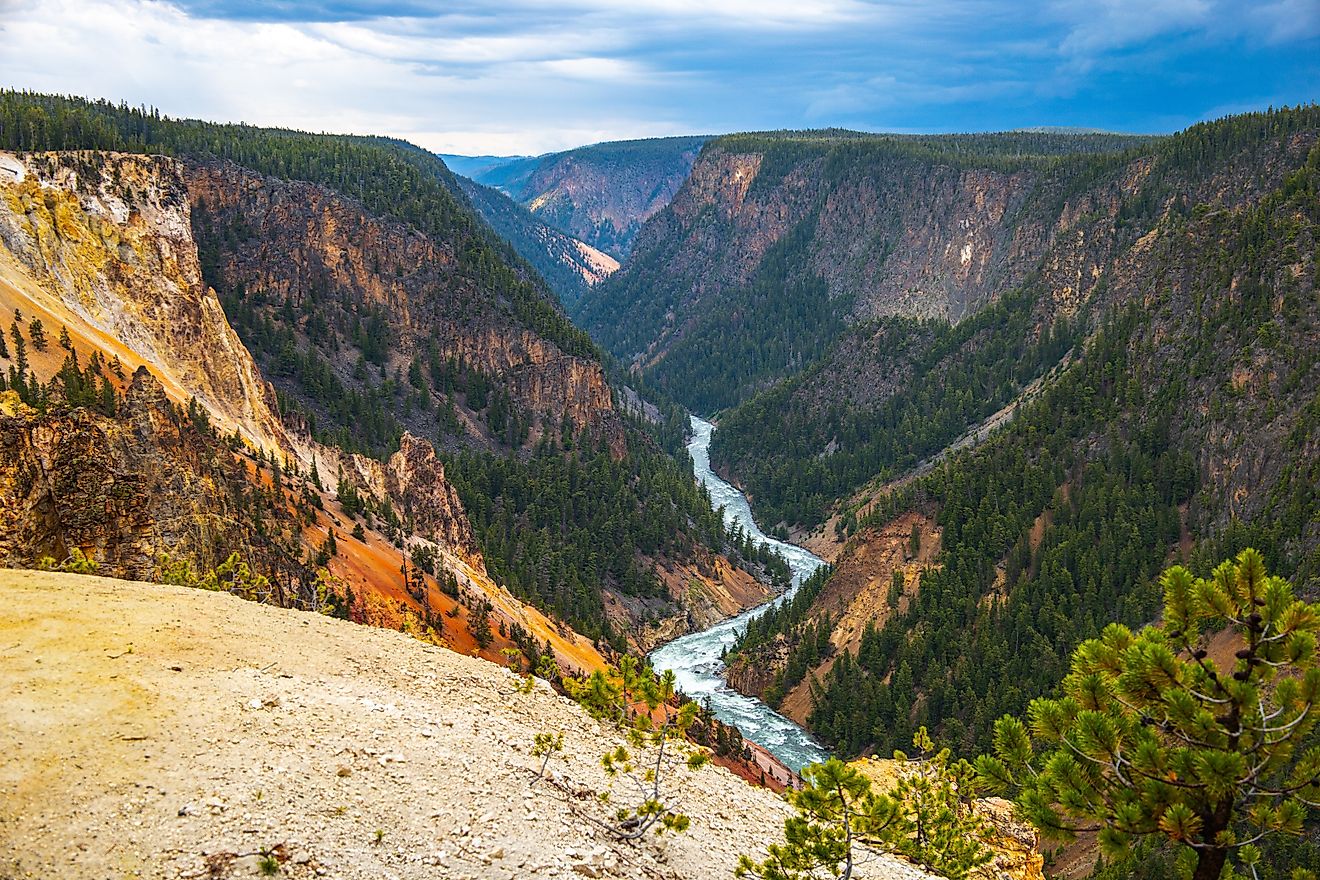
The deepest river gorge in America is Hells Canyon, carved by the Snake River along the border between Idaho and Oregon. The US Forest Service measures it at 7,913 feet deep, a vertical drop between Idaho's Seven Devils Mountains and the river below them. That is roughly 2,000 feet more than the deepest point in the Grand Canyon.
The two rims of Hells Canyon sit at very different heights. The Seven Devils on the Idaho side climb to 9,393 feet at He Devil, while the Oregon rim reaches 6,982 feet at Hat Point, so most of the record belongs to one wall. Today, subalpine forest grows within sight of a river running through dry grassland about 1,500 feet above sea level, creating one of the most dramatic changes in elevation and climate found anywhere in the American West.
Where the 7,913 Feet Are Measured

He Devil, the highest of the Seven Devils, is the summit behind the record. It rises to 9,393 feet on the Idaho side. At the mouth of Granite Creek, approximately seven miles downstream from Hells Canyon Dam, the Snake River sits at 1,480 feet. The difference between those elevations is 7,913 feet. Depth in a canyon is vertical relief, the height of the surrounding land above the river. The record belongs to the place where the highest ground stands farthest above the water, which in Hells Canyon is the stretch below the Seven Devils.
The Oregon side gives up more than 2,000 feet of that. Hat Point, a lookout on the Oregon rim, stands at about 6,982 feet, making the vertical difference between the rim and the river roughly 5,500 feet. The whole canyon runs about 125 miles, and the record number belongs to the Idaho wall along its deepest section.
Deeper Than the Grand Canyon by About 2,000 Feet

The Grand Canyon averages about a mile deep, and the National Park Service puts its deepest point at about 6,000 feet. Hells Canyon spans up to 10 miles rim to rim, about the Grand Canyon's average width, so it reaches greater depth without being any broader. The US Forest Service identifies Hells Canyon as the deepest river-carved gorge in North America.
The closest challenger is in California. Just outside Kings Canyon National Park, the South and Middle forks of the Kings River meet at 2,260 feet, near 10,051-foot Spanish Peak. Set against each other, those two points are about 7,800 feet apart in elevation, and the National Park Service describes the spot as arguably the deepest canyon in North America for a short distance. Hells Canyon's measured river-gorge depth is slightly greater.
A River That Kept Cutting Through the Landscape

Geologists have debated how Hells Canyon formed for more than a century. A 2025 study in the Proceedings of the National Academy of Sciences tied rapid erosion to a drainage-capture event about 2.1 million years ago, while a 2026 study argued the incision began as a barrier damming Lake Idaho eroded. Both place rapid canyon deepening around two million years ago.
The rock is far older than the canyon. The dark volcanic stone on the lower walls formed in Pacific island volcanoes active between about 300 and 130 million years ago, and Columbia River basalt flows from about 17 to 15 million years ago form the cliffs higher up. About 15,000 years ago, the Bonneville Flood rushed through, but the canyon's depth came from much older incision.
Snow at the Top, Desert at the Bottom

At the top of the canyon, above 9,000 feet in the Seven Devils, open subalpine forest and high grassland cover the ridges. Many of the high trails stay under snow until late summer, and snow returns in late October. On the benches farther down, above the Snake and Imnaha rivers, elk graze with their young calves and black bears move through the berry patches.
Bighorn sheep once lived in the canyon by the thousands. About 1,200 roamed the Hells Canyon area as of late 2022 after decades of restocking, and pneumonia carried by a bacterium called Mycoplasma ovipneumoniae still kills them, with no vaccine or treatment available. Lower still, on slopes between 2,000 and 3,000 feet, grow plant communities found only in this canyon, and the Forest Service counts nine plant species endemic to the recreation area. Macfarlane's four-o'clock, a threatened flower, also occurs in the canyon.

Summers here are very hot, rattlesnakes are most common at these low elevations, and in winter chukar bunch up on the grassy slopes. The Snake itself, at about 1,500 feet, is home to white sturgeon that can pass 10 feet long and 500 pounds. Idaho has required anglers to release them since 1970, yet a survey finished in the fall of 2025 found the population down by a third over 10 years, with the number of young fish falling since the 1970s.
More Than 7,000 Years of People Below the Rim

People have lived at the bottom of Hells Canyon for more than 7,000 years, drawn by its relatively mild winters. The Nez Perce lived in the canyon and crossed the Snake at Dug Bar, a relatively safe spot in late summer after the water had dropped. In 1877, General Oliver O. Howard gave Chief Joseph's band 30 days to leave their homeland in Oregon's Wallowa country and move to the Nez Perce Reservation near Lapwai, Idaho. The band reached Dug Bar on May 31, with the river running high and fast from spring runoff. Women, children, and elders crossed on horsehide rafts pulled by swimming horses, and a large number of horses and cattle followed, with considerable losses.
The canyon walls hold older evidence of that long presence. The Hells Canyon Archaeological District had 384 recorded prehistoric sites when it was listed on the National Register in 1984, with pictographs in about 100 rock shelters, and a large Nez Perce band once wintered in pit house villages, homes dug partly into the ground, along the Imnaha River. Rock art can still be seen at the Pittsburg Landing interpretive site. Later arrivals left a rougher record. In May 1887, as many as 34 Chinese gold miners were ambushed and murdered on the Oregon bank, at a site officially named Chinese Massacre Cove in 2005. Homesteaders came with cattle and sheep, but by 1918 fewer than 5 percent remained on their claims. One of their places, Kirkwood Ranch, is now a museum reached by boat, trail, or horseback, and the mail boat calls there on Wednesdays.
Three Dams Hold the Upper End

Salmon and steelhead swimming up the Snake stop at Hells Canyon Dam, the lowest of three Idaho Power dams at the upstream end of the canyon. All three lack fish ladders. Brownlee Dam, 420 feet tall, began filling in 1958, Oxbow Dam followed in 1961, and the 330-foot Hells Canyon Dam opened in 1967. The dams have run on year-to-year federal licenses since the original license expired in 2005. Idaho Power expects a new long-term license in 2027, and tribes have asked that it include terms to rebuild salmon and steelhead runs above the dams.
A fourth dam was licensed farther downstream. The 670-foot High Mountain Sheep project, planned about a mile above the mouth of the Salmon River, won a federal license in 1964, and the Supreme Court sent that license back for reconsideration in June 1967. In 1975, Congress created the Hells Canyon National Recreation Area and barred federal licensing of any new dam inside it. The recreation area now covers 652,488 acres and includes about 71 miles of the Snake below Hells Canyon Dam. The first 31.5 miles carry the wild classification, the strictest category in the federal Wild and Scenic Rivers system, followed by a 36-mile scenic stretch.
Three Rim Viewpoints, One Paved

Hat Point is the rim view that takes the most effort. The gravel road climbs about 23 miles out of Imnaha, Oregon, and includes a steep, narrow single-lane stretch of about 7 miles that wide vehicles cannot pass. Snow usually keeps it closed until late June or July. At the top, the lookout sits on a ridge about 5,500 feet above the Snake. For an easier look, the Hells Canyon Overlook, about 33 miles north of Halfway, just off the 218-mile Hells Canyon Scenic Byway on Forest Road 3965, is the only paved viewpoint into the canyon.
The highest view on the Idaho side is Heavens Gate, at 8,429 feet, reached from Riggins on steep, winding Forest Road 517. That puts it close to 7,000 feet above the river, and on a clear day the view takes in parts of Idaho, Oregon, Washington, and Montana.
A Free-Running River Below the Last Dam
The record depth of Hells Canyon reflects millions of years of geological change, including a period of rapid river incision around two million years ago. The Snake River now runs through it in two very different stretches. Above Hells Canyon Dam, three reservoirs built between 1958 and 1967 hold back the Snake, and salmon and steelhead have had no way past them since. Below the dam, the 1975 law that closed the recreation area to new dams, passed eight years after the Supreme Court sent back the High Mountain Sheep license, keeps the deepest stretch running free beneath the Seven Devils. The first 31.5 miles below the dam run wild, on a river where fish coming up from the Pacific can go no farther than the concrete just upstream.