The Busiest Cargo Rivers In America
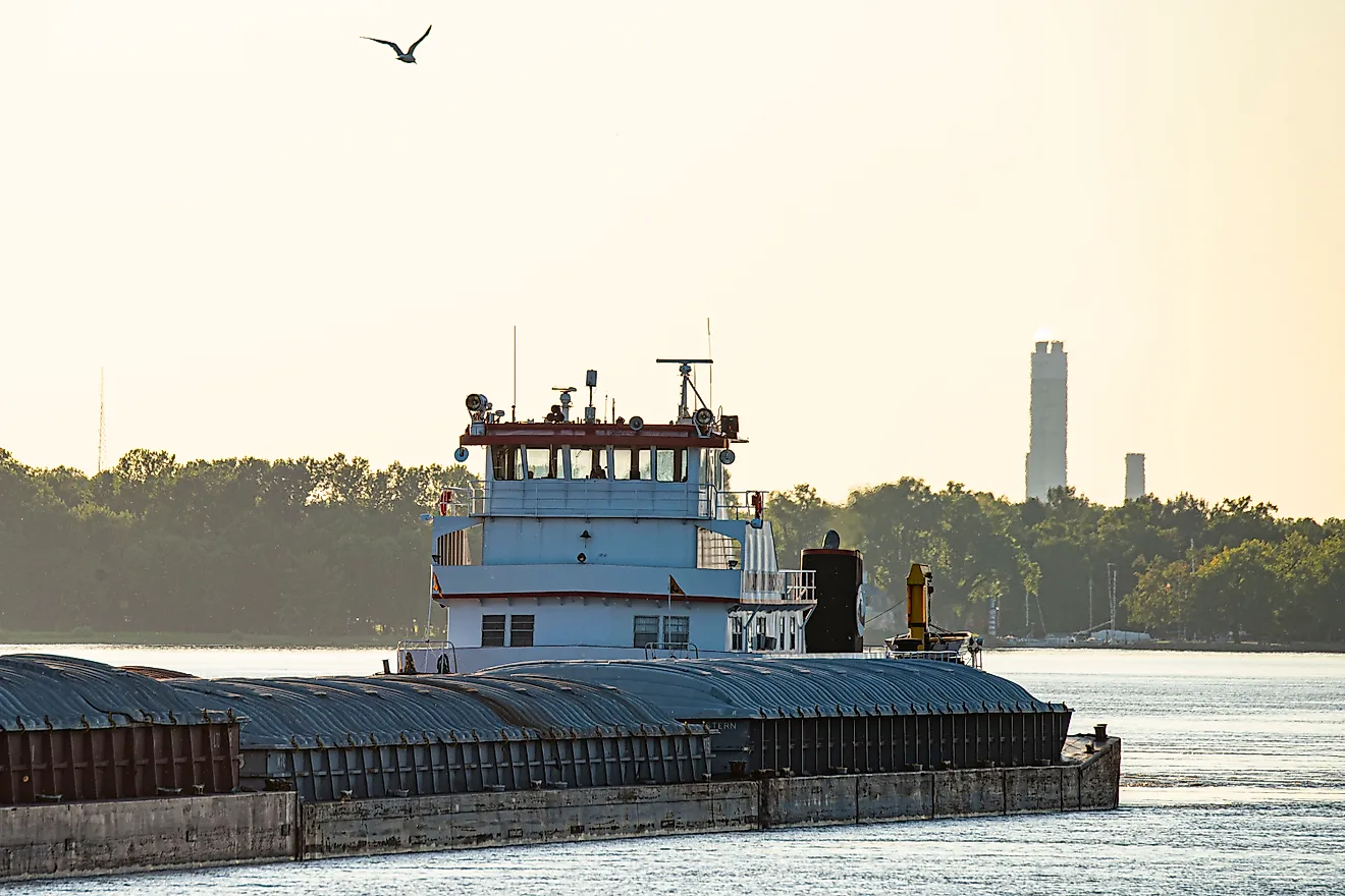
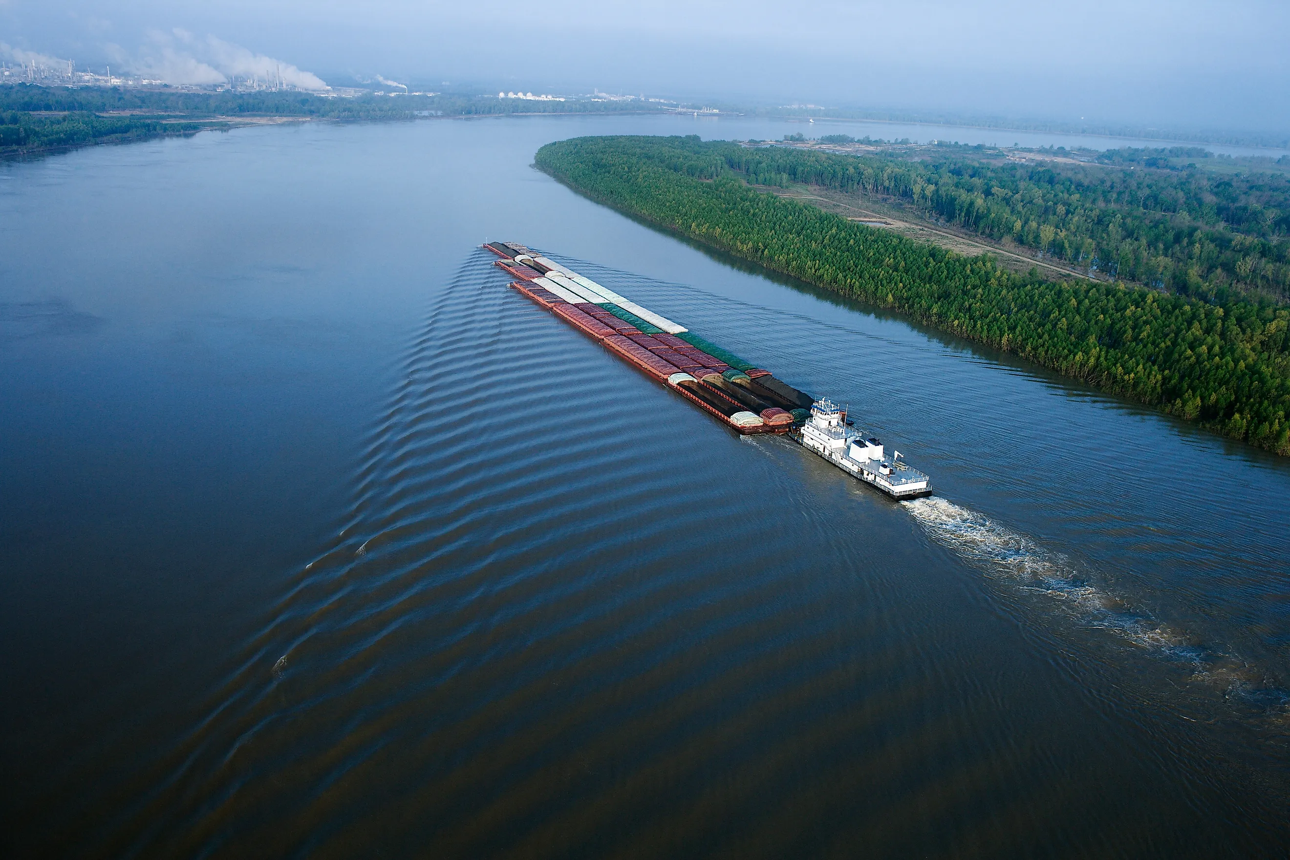
The Mississippi River carries nearly half of all the grain America exports. A load goes into a barge at a riverbank elevator in the Midwest, floats downstream for a week or more, and is scooped straight into an ocean-going ship in Louisiana without touching a road.
The Ohio and the Illinois flow into that same channel, and together the three rivers move coal, fertilizer and grain by the hundreds of millions of tons each year. Coastal rivers make the list by a different route. The San Jacinto at Houston and the Savannah in Georgia are short, dredged deep for tankers and container ships, and that is where the tonnage figures get startling.
Mississippi River

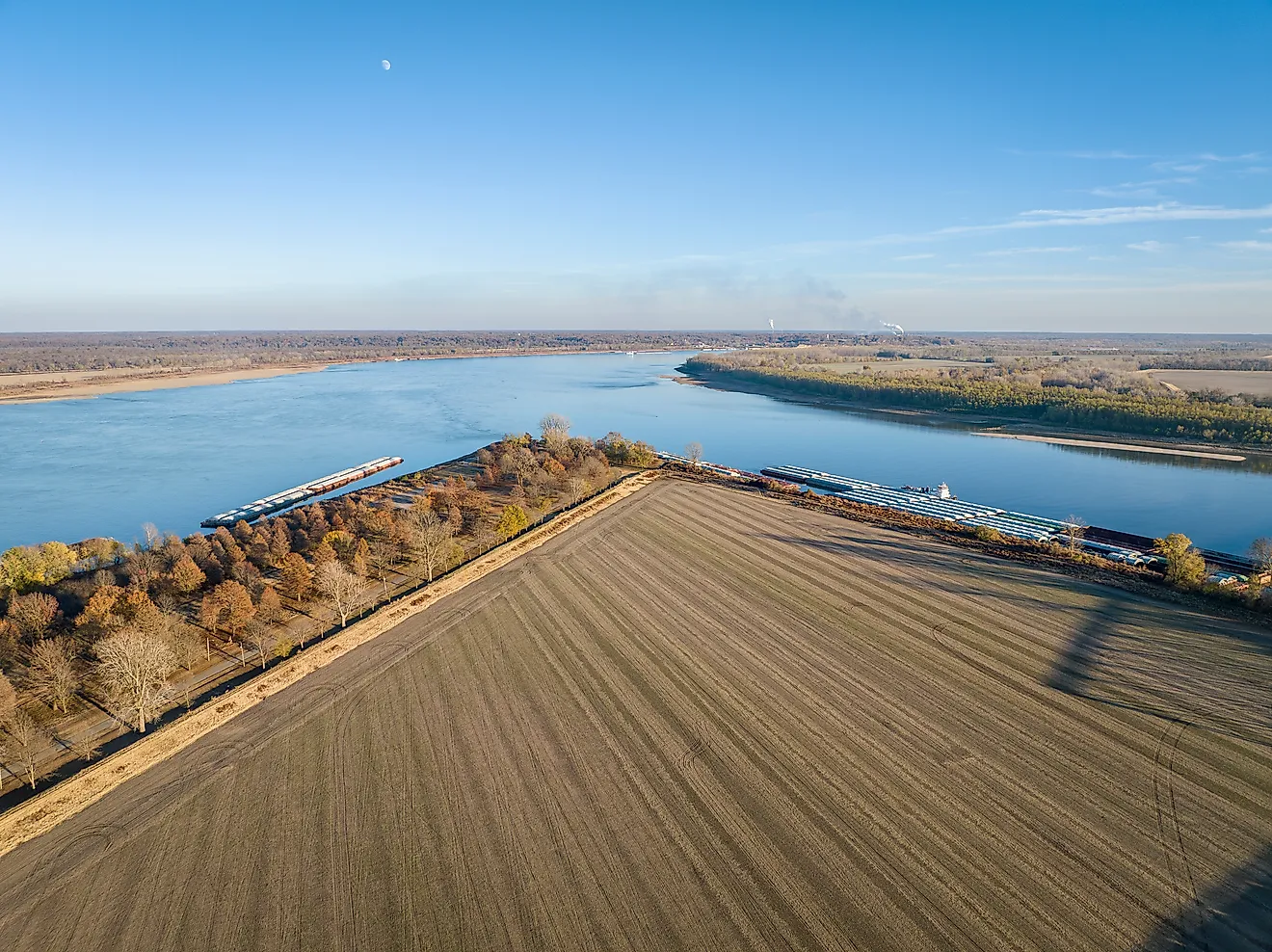
Below St. Louis, barges continue toward the Gulf without passing through another navigation lock on the Mississippi's main channel. Farther upstream, locks and dams maintain the depth needed for commercial traffic.
The Mississippi carried 260.1 million short tons of domestic cargo in 2024, before adding its international trade. Its tributaries connect agricultural loading points with the grain terminals of southern Louisiana. Near Baton Rouge, the navigation route becomes a deep-draft channel that ocean-going ships can use, continuing past New Orleans toward the sea.
At export terminals, cargo arriving through the interior can be transferred for an overseas voyage. Keeping that route open requires dredging: sediment deposited in the channel can reduce the depth available to a loaded vessel.
Ohio River

The Ohio begins where the Allegheny and Monongahela meet at Pittsburgh, then runs 981 miles to the Mississippi at Cairo. Along that route, it passes industrial waterfronts and cities whose docks can receive heavy cargo directly by water. Its 150.8 million short tons of domestic freight in 2024 put it among the country's largest river shipping routes. Coal and industrial materials make up much of the traffic. Navigation dams divide the river into pools, with locks allowing vessels to pass between their different water levels. At the lower end, Olmsted Locks and Dam sits close to the Mississippi junction, downstream of the Tennessee River's entrance at Paducah. Cargo arriving through both rivers uses this final stretch. A barge leaving the Monongahela's working waterfront enters the Ohio at Pittsburgh and can continue toward Louisiana without putting its load onto a truck.
Illinois River

Corn and soybeans accounted for roughly 30 percent of Illinois Waterway tonnage during 2015 through 2019. The Illinois River passes through a farming state where bulk crops can be loaded onto barges for the journey to the Mississippi. After passing Peoria, the river continues southwest to its Mississippi junction near Grafton. The larger Illinois Waterway, which includes connecting channels toward Chicago, carried 26.5 million short tons of domestic cargo in 2024. Eight locks along the waterway maintain a commercial route linking the Mississippi system with Lake Michigan.
At Peoria Lock and Dam, the structure's effect changes with the river level. During low and moderate flows, raised wicket gates hold enough water for the nine-foot navigation channel. When conditions allow the gates to be lowered, vessels can pass over the submerged dam.
Tennessee River

Muscle Shoals in northern Alabama once made river travel difficult, with rocky shallows interrupting the route through the Tennessee Valley. Dams and locks built by the Tennessee Valley Authority replaced those obstacles with a navigable chain of reservoirs. By 1945, the main navigation channel was essentially complete.
Today, the commercial route extends 652 miles between the Knoxville area and the Ohio River at Paducah, Kentucky. The Tennessee carried 27.2 million short tons of domestic freight in 2024. East Tennessee receives fertilizer and road-building materials by barge, while unusually large industrial equipment can use the same waterway. Power-plant steam generators and even rocket boosters have traveled by barge here. Near the river's mouth, Kentucky Lock handles the system's heaviest traffic.
Columbia River
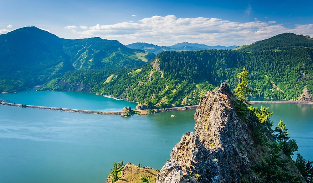
The Columbia's cargo route continues through the Cascade Range and connects with the Snake River, giving barges access to Lewiston, Idaho. That inland port lies about 465 navigation miles from the Pacific. Grain grown in the interior can travel through a series of locks before reaching the lower river's export terminals.
In 2023, the Columbia moved more than 51 million metric tons of cargo, foreign and domestic combined. Its lower shipping channel is 43 feet deep, allowing ocean-going vessels to reach terminals along the Oregon-Washington border. Portland's docks connect through the lower Willamette River. Upstream, the navigation system changes to locks and barge traffic; downstream, grain can be loaded aboard ships for the Pacific crossing. The Columbia-Snake system is the nation's largest wheat export gateway.
San Jacinto River And Buffalo Bayou

Houston's cargo waterfront begins well inland of the open coast. The Houston Ship Channel follows Buffalo Bayou and the lower San Jacinto River, connecting industrial docks with Galveston Bay and the Gulf. In 2024, the Houston Ship Channel port complex handled 306.2 million short tons of cargo, the country's largest port total.
Refineries and chemical plants occupy much of the surrounding waterfront. Tank barges use the channel alongside large ships, and nearby fleeting areas provide places to assemble or hold barges between movements. Port Houston operates eight public terminals, while more than 200 private terminals belong to the wider channel complex. On the San Jacinto north of the channel, a barge fleeting facility near the Interstate 10 bridge occupies more than 190 acres. Towboats move barges between these holding areas and the docks where their cargo is handled.
Sabine And Neches Rivers

At Beaumont, ocean-going ships can reach docks on the Neches River. Farther toward the coast, the shared Sabine-Neches Waterway connects that river with terminals around Port Arthur and the Sabine River at Orange. The waterway recorded 135.3 million tons of commercial cargo in 2023.
Energy cargo is a major part of this southeast Texas traffic. Tankers serving the refineries and liquefied natural gas plants need a deep route through the low coastal landscape to reach the terminals where cargo is loaded or discharged. Beaumont also handles military cargo, giving the inland end of the route a role beyond the surrounding energy industry.
Dredging crews are deepening the waterway's channel to 48 feet; the current depth is 40 feet. Additional depth lets larger vessels use the route and can allow ships to carry heavier loads. The improvement project also extends the channel farther into the Gulf, lengthening the approach available to deep-draft shipping.
Calcasieu River

The Calcasieu Ship Channel handled an estimated 65 million tons of cargo in 2024. International trade accounted for more than half of that traffic. Along this southwestern Louisiana route, liquefied natural gas has become a major outbound cargo. Cameron LNG is one of the facilities using the channel. Beginning in the 1920s, channel work straightened and deepened the Calcasieu River to give Lake Charles dependable access to the Gulf. The resulting commercial waterway extends about 68 miles, with a channel generally 400 feet wide and 40 feet deep. Its public terminals also handle grain and petroleum coke, a by-product of refining. Wind-energy equipment moves through the port too. For a large cargo ship, reaching those docks means following a maintained channel through a landscape where sediment keeps accumulating. The Port of Lake Charles provides disposal areas for material removed during dredging.
Mobile River

The Alabama and Tombigbee rivers join north of Mobile, forming the Mobile River as it continues through the delta toward the bay. This short lower river connects an extensive inland barge network with an ocean port. Mobile handled 53.2 million short tons of cargo in 2023, according to US Army Corps of Engineers port figures. Upstream connections include the Black Warrior-Tombigbee route, which extends toward Birmingham's industrial region. The Tennessee-Tombigbee Waterway provides another connection, allowing barges to travel between the Tennessee River system and Mobile. At the coast, ocean ships use a maintained channel through Mobile Bay to reach the port's waterfront.
The harbor's shipping channel reached a depth of 50 feet in October 2025. The Sakizawa Power, already at McDuffie Coal Terminal, took on additional cargo and departed with a draft of 48.4 feet. It was the first vessel to use the newly available depth.
Savannah River

Container ships pass Savannah's historic waterfront on their way to terminals farther upriver. The river forms the Georgia-South Carolina boundary, with Garden City Terminal occupying the Georgia bank. In 2025, the Port of Savannah handled nearly 5.7 million twenty-foot equivalent units, a measure of container volume.
The Savannah Harbor Expansion Project deepened the federal navigation channel to 47 feet below mean lower low water, allowing larger and more heavily loaded vessels to reach the harbor with fewer tidal delays. That reference level matters on a river where tides change the available water depth. The shipping channel continues inland through the estuary to the terminal waterfront. Container cranes stand beside the berths, and rail connections carry cargo onward after unloading. The port's Mason Mega Rail facility occupies 85 acres at Garden City Terminal.
Delaware River

Much of the fruit reaching the East Coast enters through the Delaware River's port complex. Wilmington is a major banana-importing port, and terminals across the region receive South American produce. In 2024, the complex imported 34.9 million metric tons of goods.
Philadelphia's cargo berths sit upriver of Delaware Bay, alongside a river whose tidal reach extends north to Trenton. The main shipping channel is 45 feet deep. Docking facilities occupy both sides of the river, with terminals in Pennsylvania and New Jersey as well as Delaware.
Imported perishables pass through cold-storage warehouses on this waterfront and must be distributed before they spoil. Steel and forest products use the river too. Beyond the terminals, the same tidal water supports migratory fish, including American shad and Atlantic sturgeon. Their habitat overlaps a heavily used approach for commercial vessels.
When The Water Drops
The Mississippi's cargo capacity can shrink even while its terminals remain open. In the fall of 2025, low water on the Mississippi and Ohio brought draft restrictions that cut the load each barge could carry. Removing cargo makes a barge float higher, leaving more clearance above the riverbed. That adjustment affects the grain journey all the way to Louisiana: each lightly loaded barge delivers less to the export terminals. Farmers may need more barges or another means of moving the crop, adding transportation costs. A typical barge carrying 1,500 tons at a 12-foot draft may carry only about 900 tons at nine feet. At Cairo, each lightly loaded vessel carries less of the inland harvest toward Louisiana.