Illinois River
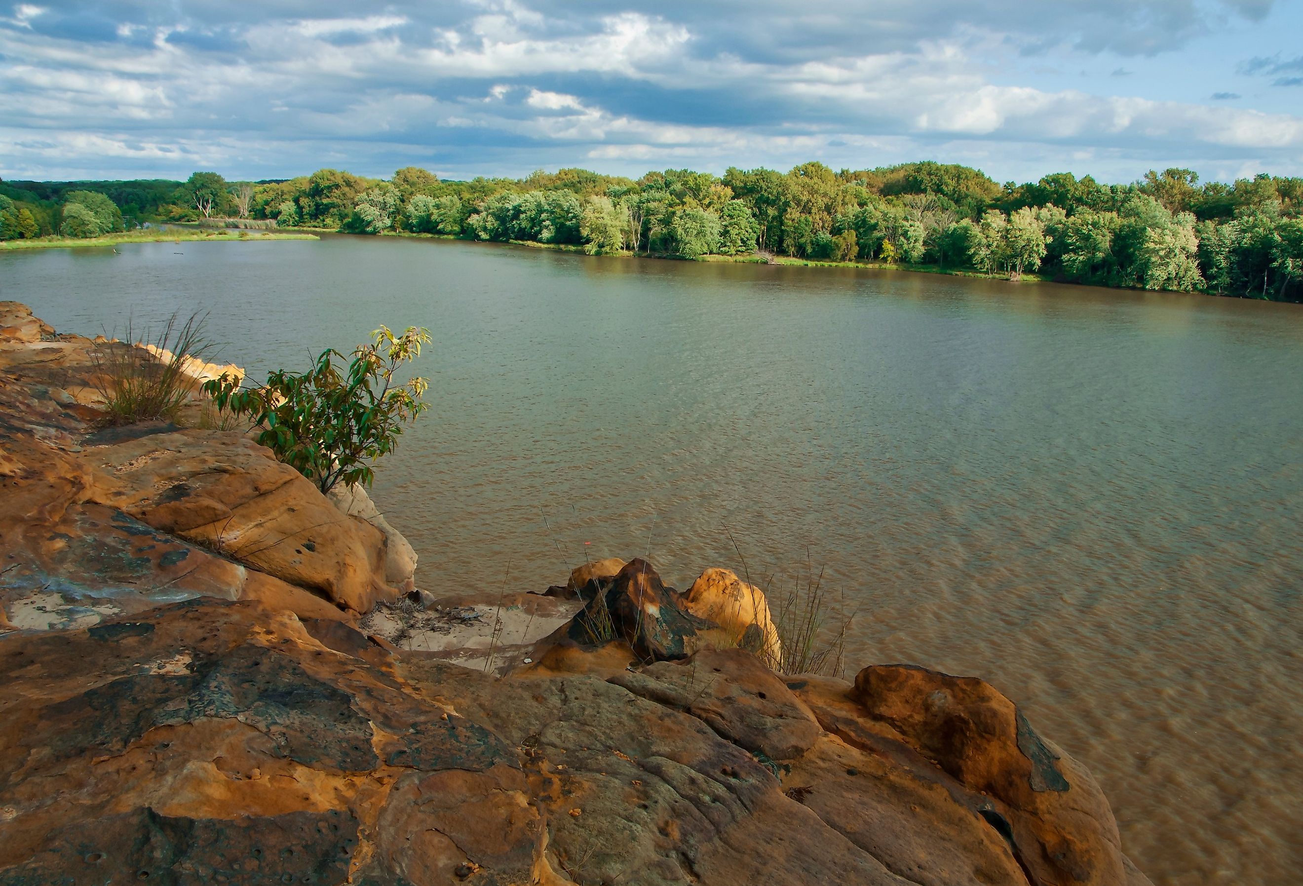
The Illinois River is the most significant river in the state of Illinois. Formed by the Des Plaines and Kankakee River junction, the Illinois River traverses west from Joliet toward Hennepin. Then, it changes course and flows southward until it joins the Mississippi River at Grafton. Historically, the river contributed to the economy and represented ecological convergence between the plains in the south and the Ozark Mountains. It is the only body of water that connects the Great Lakes to the Mississippi River and, in doing so, to the Gulf of Mexico.
Geography Of The Illinois River

Northeastern Illinois is the starting point of the Illinois River. The water flows past Peoria, the largest city on the riverbank. It then converges with the Mississippi River about 40 kilometers north of Saint Louis in Missouri. The river is 273 miles long and covers a drainage area of 28,906 square miles.The massive Illinois River Basin makes up 44% of the state of Illinois, with 90% of the state’s population living in the counties within or partially within the basin.The drainage basin stretches into the southeastern region of Wisconsin, the northwestern region of Indiana, and a tiny part of southwestern Michigan.
The Illinois River Basin surface is between 600 and 800 feet above sea level. The Illinois River Valley experiences the greatest topographic relief, with its altitude ranging between 200 and 400 feet. The major characteristics of the Illinois River Basin are its glacial features which date to the Pleistocene Epoch.
Hydrology Of The Illinois River Basin

The Illinois River watershed has a drainage area of 18,500,000 acres. The basin floods every year between March and May, and often floods during the fall as well. Between August and October, the river level is at its lowest.
Before human intervention, the basin comprised a flood storage area of about 1,813 square kilometers. When the floods came, the water would stand several meters deep. The basin also comprises a shallow slope which slows down the flow of floodwater. Sometimes, leaves and pieces of wood that accumulate in the river water also slow down floodwaters.
Ecosystem Of The Illinois River

The backwaters, along with the river itself, provide 87,000 surface acres of aquatic resources. This forms a habitat for several fish species, including white bass, channel catfish, crappie, green sunfish, and bluegill. The lower section of the river teems with rainbow and brown trout, while walleye and striped bass also thrive here. Bobwhite quail, turkeys, and white-tailed deer make the riverbanks their habitat, while bald eagles frequent the area.
History Of The Illinois River Valley

The Illinois River Valley served as a major transportation route for several civilizations throughout history. The ports between the Chicago and Des Plaines Rivers, as well as the Kankakee and St. Joseph Rivers, provided access between the Great Lakes and the Mississippi basin. Native Americans and Europeans frequently traveled here and were later joined by Americans.
The first Jesuit mission in Illinois was founded on the banks of the river by Father Jacques Marquette in 1675. The mission stood across from the Starved Rock at the Grand Village of Illinois. Maquette noted that he had never seen soil as fertile as that of the Illinois River and wrote down a list of animals he came across along its shores. These animals included: wildcats, paroquets, beavers, elk, deer, swans, and more.
The first fort in Illinois stood at Starved Rock in 1680, and was later relocated to Creve Coeur, close to Peoria. Peoria was the only significant settlement on the Illinois River before the construction of the Illinois and Michigan Canal. Once completed, several cities sprung up along the riverbanks. Its residents depended on river fishing to grow the economy and later created a tourism industry that touted duck hunting in addition to fishing activities.
The Illinois River Today

Five dams on the Illinois River control the flow of the water. The river is also an essential water route between the Great Lakes and the Mississippi River, and fishing continues to provide an income for those who live in the area.
Conservation of the Illinois River is receiving a big push in modern times because it ranks 12th on the list of most polluted waterways in the US. This is mainly because several sewers empty into the river, and untreated water and chemicals from factories also end up in the river.
Conclusion
The Illinois River Conservation Reserve Enhancement Program aims to reduce the amount of sediment and silt in the river by 20%. It also wants to reduce chemicals by 10% and increase fish stocks in the lower parts of the river by 10%. It will be interesting to see how that may impact the Illinois River in the future.