The American Rivers With The Most Waterfalls
One good waterfall is enough to put a river on the map. The rivers here stack five or six into a couple of miles. North Carolina's Horsepasture drops over five major falls in two miles, with enough spray at Rainbow Falls to keep a wetland alive. The Genesee splits six between Letchworth State Park and downtown Rochester. At Georgia's Tallulah Gorge the flow runs on a dam release schedule, so the falls get turned up on command. Bring good shoes and count for yourself.
Horsepasture River, North Carolina

Nobody stays dry near Rainbow Falls. The spray drifts far enough past the river to keep a wetland alive, so grasses and other soft-stemmed plants grow within reach of the falling water, and the gorge around it collects mosses and ferns you will not find in the average backyard. Five major falls in two miles sounds like plenty, and smaller cascades fill every gap between the big ones anyway, so the official count feels low.
Turtleback Falls is where the shape-shifting is easiest to watch. Water slides across a wide curved slab, like a sheet pulled over a giant shell, then drops into the pool below. Downstream, Rainbow Falls does the opposite, dropping over a much steeper face. The mist rising off it is where the rainbows come from, given the right angle of sun.
Getting there is a workout. The Rainbow Falls hike is a strenuous three-mile round trip that starts in Gorges State Park and crosses into Pisgah National Forest. Turtleback Falls is farther upstream on the same trail, so plan on extra miles if you want both. Your legs will file a complaint.
Whitewater River, North Carolina And South Carolina

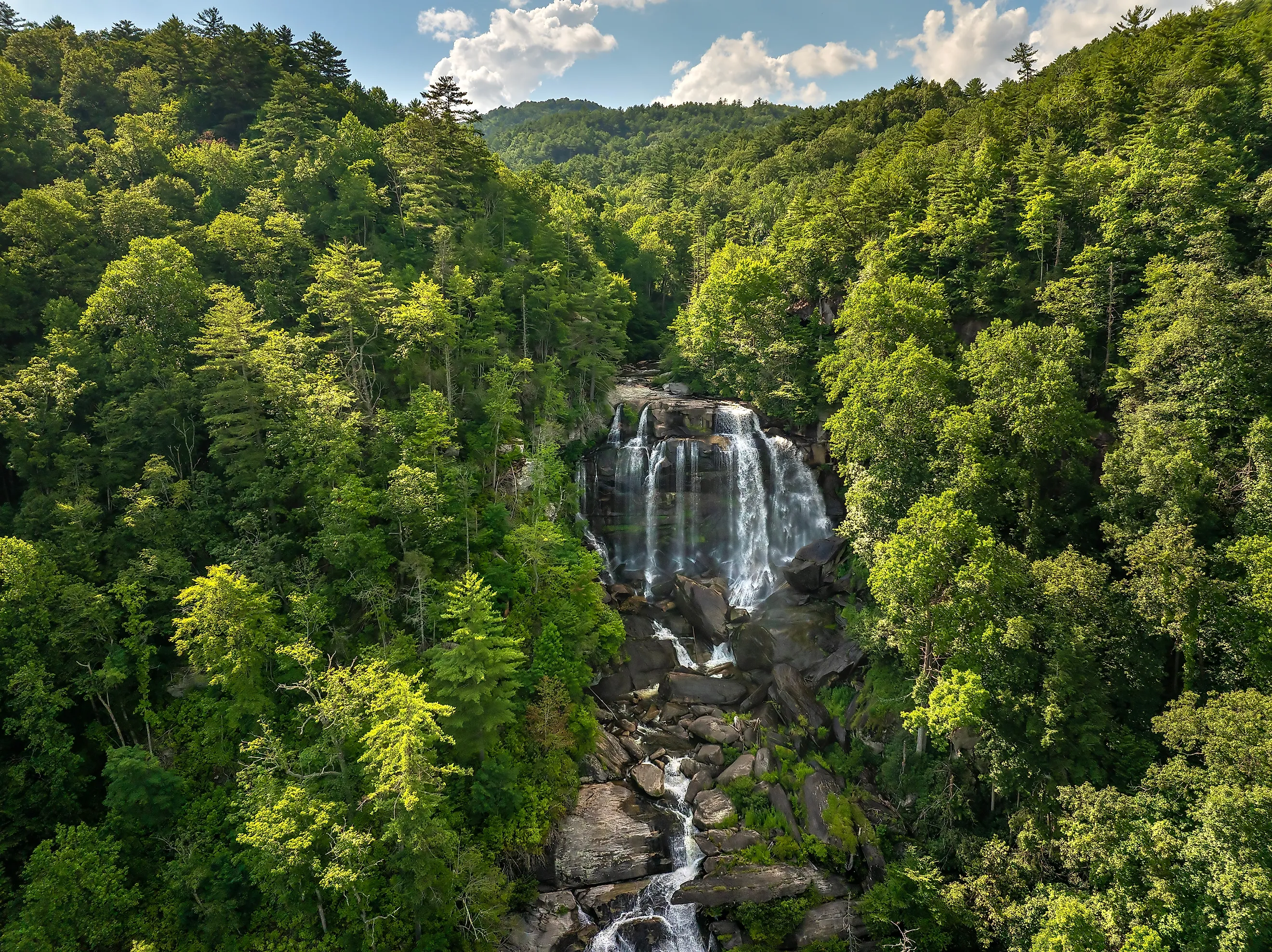
Next door, the Whitewater River runs its six-waterfall chain straight across a state line, so both Carolinas get to claim it. Upper Whitewater Falls drops through North Carolina's Nantahala National Forest in one long run of steps, with forest right up to the edges. A paved walkway gets you to the upper overlook with almost no effort. The lower platform costs 154 wooden steps down and, more to the point, 154 steps back up. Both platforms face the North Carolina half of the show.
Lower Whitewater Falls is downstream in South Carolina, where the river heads for Lake Jocassee. There is no shortcut from the upper falls. You start over through the Bad Creek access area, cross the Whitewater River on foot, and walk roughly two miles to an overlook that looks straight across the gorge at the falls.
Tallulah River, Georgia

At Tallulah Gorge, how much water goes over the falls depends on a calendar. A dam completed in 1913 began diverting water for electricity, which changed a river that had already made this Georgia town a tourist destination. Six named waterfalls step down through the gorge, between walls that reach nearly 1,000 feet in places.
Scheduled releases send extra water down the line. On an ordinary day the gorge runs at about 35 to 40 cubic feet per second, which is respectable but not dramatic. Aesthetic releases push that to 200, and the falls go from pleasant to loud. The bigger whitewater releases are when the skilled kayakers show up and the rest of us watch from somewhere dry.
Rim overlooks work fine. The suspension bridge works better, hanging 80 feet above the rocky bottom. If you want the gorge floor itself you need a permit, and on release days the answer is simply no.
Genesee River, New York

Most downtowns have a fountain. Rochester has a 96-foot waterfall. High Falls is one of the reasons the city exists, since mill owners followed its power here and built raceways to carry river water into their factories. Some of those buildings still stand beside the gorge. High Falls is one of six major waterfalls on the Genesee, three inside Rochester and three upstream in Letchworth State Park.
The Letchworth falls sit in a wooded canyon with cliffs of about 600 feet. Upper Falls is the one under the railroad bridge. Middle Falls spreads out across a broad ledge just downstream, and Lower Falls finishes the park's main set. From there the river heads north to Rochester, where High Falls is best seen from the Pont de Rennes pedestrian bridge. Farther down, Rochester's own Lower Falls drops about 85 feet.
Black River, Michigan

At Great Conglomerate Falls, a big lump of rock splits Michigan's Black River into separate channels. Downstream at Gorge Falls, the whole river has to fit through a slot. Both are part of the five-waterfall run along the Black River National Forest Scenic Byway near Ironwood, in the western Upper Peninsula. Potawatomi Falls sits between them, and Sandstone Falls and Rainbow Falls carry the sequence on toward Lake Superior.
Sandstone Falls spreads across uneven ledges. The byway follows the river north through Ottawa National Forest and ends at Black River Harbor, where a suspension bridge crosses near the mouth, just past the last waterfall at Rainbow Falls. One catch. Trail and overlook repairs that began in May 2026 are expected to run through fall 2027, so expect temporary closures along the waterfall corridor and the occasional detour.
Gooseberry River, Minnesota

Highway 61 crosses the Gooseberry River right beside a five-waterfall run in Gooseberry Falls State Park, which makes this the easiest stop on the list. The river drops 240 feet over its three miles through the park before reaching Lake Superior. Below Lower Falls, migrating trout show up in spring and salmon in fall, visible near the footbridge or in the pool under the drop. The ledges themselves are old lava flows with bubbly tops. Those bubble-rich upper layers wear away faster than the dense rock underneath, and that mismatch is what builds the steps. Accessible paths reach Upper and Middle Falls near the highway, and a two-mile loop runs upstream to Fifth Falls for anyone who wants the full set. At Middle Falls, the rock island beside the viewing platform shows both layers of an old lava flow side by side.
Cascade River, Minnesota

Farther up Minnesota's North Shore, five small waterfalls called the Cascades crowd into the Cascade River's twisting gorge, with Cascade Falls close by. The half-mile Lower Loop covers both, so this is the shortest walk here for the most waterfalls. The whole cluster sits near the end of a 17-mile river whose lower gorge drops 120 feet on the way into Lake Superior.
The basalt around it came from lava more than a billion years ago, and spruce and cedar grow above the water now. Overlooks along the Lower Loop look straight into the gorge, with hills and bare rock between stops. Past the lower falls, longer riverside trails follow a channel that keeps switching between tight gorges and wider stretches. A loop on both banks crosses the river at County Road 45.
The Genesee's waterfalls also explain where Rochester's anglers end up. Lake Ontario's trout and salmon run into the lower river each season, and the Seth Green fishing access puts people on the water below Lower Falls. Steelhead come through in spring. Chinook and coho salmon arrive for the fall spawn. They swim up through a wooded gorge inside a busy city, then stop. Upstream are the falls that once ran Rochester's mills, and far beyond those is Letchworth's canyon, and fish from the lake reach none of it. Rochester's Lower Falls is a natural barrier about six and a half river miles up from Lake Ontario.