11 Best Attractions To Visit In California's Sierra Nevada
The best attractions in California's Sierra Nevada show off nearly every side of the range, including granite viewpoints, giant sequoias, alpine lakes, and old mining sites. At Tunnel View in Yosemite National Park, the whole valley opens up at once, with El Capitan on one side and Bridalveil Fall on the other, and no hiking is required. In Sequoia National Park, the General Sherman Tree is the largest known living single-stem tree on the planet by volume. Mount Whitney stands at 14,505 feet, the highest point in the contiguous United States. You can drive the switchbacks of Whitney Portal Road without attempting the summit. Columbia State Historic Park has the largest collection of Gold Rush buildings in California, and its car-free Main Street is easily explored on foot.
Tunnel View, Yosemite National Park

Tunnel View is one of the most recognized viewpoints in the American West, and it requires no hiking. It sits at the east end of the Wawona Tunnel on Highway 41, which opened to traffic in 1933, and after nearly a mile of darkness inside the tunnel, the valley opens all at once. El Capitan rises 3000 feet on the left, while Bridalveil Fall sits on the right beside the Cathedral Rocks, with Sentinel Rock and Half Dome also in view. Just up the slope is Artist Point, where Thomas Ayres is said to have drawn the first picture of the valley in 1855. Parking is available at two lots, and from either one visitors can walk to the wall. Late afternoon into sunset is the best time to see the valley without too much shadow, and the viewpoint stays open year-round, though it is often most crowded in summer.
Mariposa Grove of Giant Sequoias, Yosemite National Park

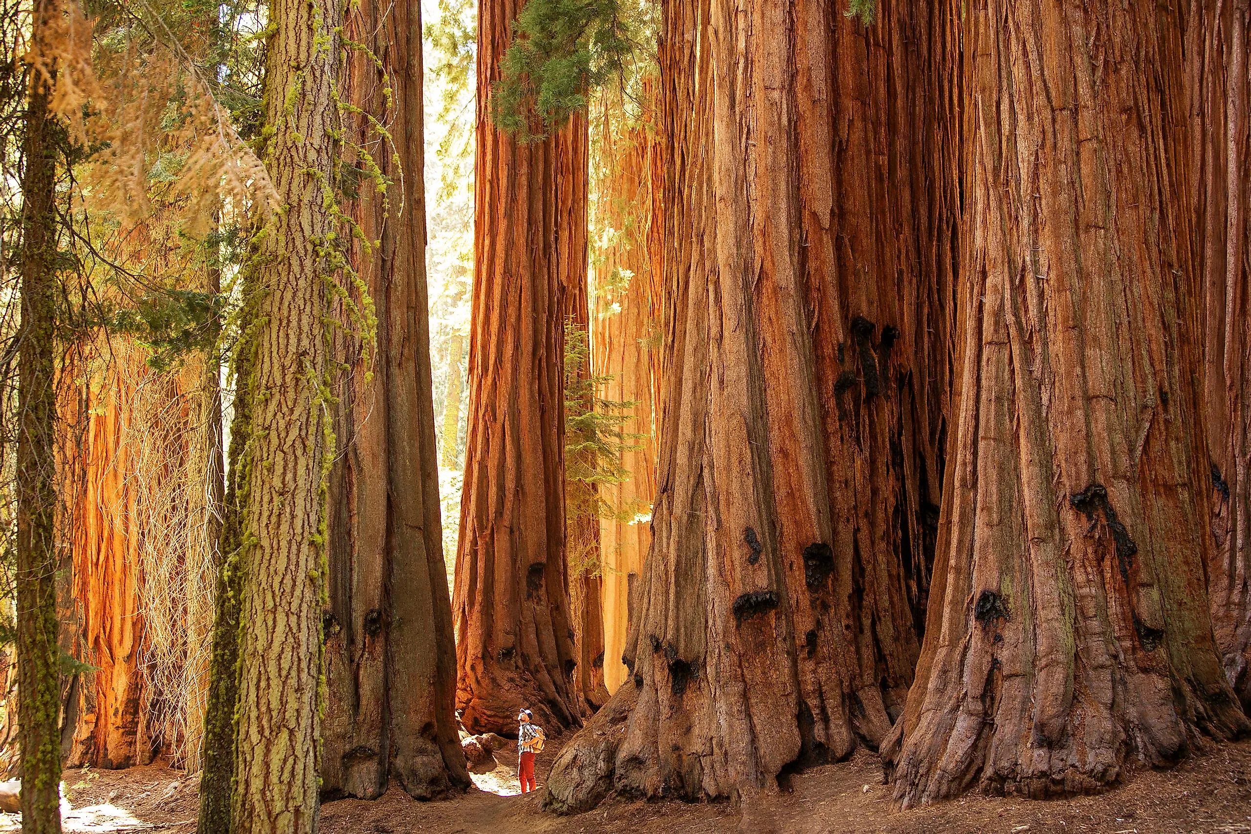
Farther south along Highway 41, near the park's south entrance, Mariposa Grove is Yosemite's largest sequoia grove, with more than 500 mature trees. Two of them rank among the thirty largest giant sequoias in the world, and about a million people come to see the grove each year. Several loops wind through it, starting with the Grizzly Giant Loop past the Bachelor and Three Graces. The Grizzly Giant itself is roughly 3,000 years old and so thick that its lower branches are larger than those of most full-grown trees elsewhere. The Big Trees Loop is the shortest and most accessible, while the upper grove offers two options: the Guardians Loop, with the Telescope Tree and the fallen Wawona Tunnel Tree, and the Mariposa Grove Trail, which passes the Clothespin Tree on the way up to Wawona Point.
Most visitors arrive on the free shuttle, which runs between spring and November and takes vehicle traffic off the grove, though you can also walk the Washburn Trail from the Mariposa Grove Welcome Plaza. There's no food service at the plaza or in the grove, but drinking water is available year-round at the Welcome Plaza. In winter, access becomes limited, and the route turns into a snowshoe and cross-country ski trail.
The General Sherman Tree, Sequoia National Park

An even larger sequoia stands to the south in Sequoia National Park. The General Sherman is not the tallest, widest, or oldest tree, but by volume of wood in the trunk, it is the largest known living single-stem tree on the planet. It stands about 275 feet tall, with a ground circumference of nearly 103 feet and a trunk weighing nearly 1,400 tons.
The tree is over 2,000 years old and was declared the largest in the world in 1931, when measurements showed it outranked the General Grant Tree in Kings Canyon. It sits at the north end of the Giant Forest, the largest unlogged sequoia grove, and from the tree visitors can continue along the Congress Trail past the House and Senate groups for a route of about 3 miles. Free shuttles serve the area in summer. In winter, the main parking lot closes once snow builds up, so visitors park at the smaller lot on the Generals Highway instead. Because the trail ices over, traction devices are strongly encouraged.
Kings Canyon Scenic Byway, Kings Canyon National Park

Next door in Kings Canyon National Park, Highway 180 runs from the Sierra foothills near Fresno up into Grant Grove before dropping into one of the deepest canyons in North America, carved by the South Fork of the Kings River. A good first stop is the General Grant Tree, the second largest tree in the world after the General Sherman, which was declared the nation's official Christmas tree in 1926. The nearby Centennial Stump is the remains of a sequoia that was cut, sectioned, and reassembled at the 1876 Philadelphia World's Fair, where East Coast visitors refused to believe a tree could be that big and called it the California Hoax. From Grant Grove, the byway continues past Junction View and follows the river to Cedar Grove, with Roaring River Falls a short walk from the road.
Zumwalt Meadow offers another walk, though flooding in 2019 washed away sections of the trail, and it is no longer a loop. The trail now starts east of Cedar Grove Village, crosses the Kings River, and passes through woods and talus slopes to meadow views. Past the meadow, it merges with the Kanawyer Loop and continues to Road's End and Muir Rock. The road itself ends at Road's End, the trailhead for the Rae Lakes Loop and much of the park's backcountry. Plan around the seasons, since Cedar Grove is usually open from May to early or mid-November, while Grant Grove stays open year-round.
Emerald Bay and Vikingsholm, Lake Tahoe

Far to the north, Emerald Bay is a glacier-carved inlet on Tahoe's west shore that was designated a National Natural Landmark in 1969 and is home to the lake's only island. On its shoreline stands Vikingsholm, a 38-room mansion built in 1929 by Lora Josephine Knight, which draws on Scandinavian architecture dating back to the 11th century. It's complete with hand-forged ironwork, intricate carvings throughout, and a sod roof planted with living grass, and it's considered one of the finest examples of Scandinavian architecture in the Western Hemisphere. Guided tours run during the summer, with a visitor center at the bottom of the trail. Reaching the mansion, however, requires walking the one-mile trail from the Harvey West lot, since there is no vehicle access to the shoreline.
From the bay, hikers can also take the Rubicon Trail, which wraps around the bay for 7.4 miles between Eagle Point Campground and D.L. Bliss State Park. Out on the water, Fannette Island features a stone tea house reachable only by boat, kayak, or paddleboard. It closes from February through mid-June for nesting geese, and swimming to the island isn't allowed due to boat traffic. Below the surface, California's first maritime heritage underwater trail preserves historic boats and barges. Parking is far more difficult in summer, and highway shoulder parking is strictly forbidden, but a seasonal shuttle runs.
Donner Memorial State Park, Donner Pass

Not far from Lake Tahoe, below Donner Pass, snow killed almost half a party of emigrants in the winter of 1846-47. The Pioneer Monument stands at the site where the Breen family cabin sheltered part of the Donner Party, on a pedestal 22 feet tall, the recorded depth of the snow that trapped them and led to deaths from starvation and exposure. The Donner Memorial Visitor Center, however, spans far more than one winter. Its exhibits trace crossings of the Sierra from the Washoe people onward, through the emigrant era, to the Chinese crews who built the transcontinental railroad over Donner Summit, and on to the early motorists on the pass.
Outside, a nature trail passes the site of the Murphy Cabin, and Donner Lake sits at the park's edge with a beach and picnic area. In winter, the trails become cross-country ski and snowshoe routes. Above the park, the old Donner Pass Road climbs to the summit past the railroad snowsheds and the China Wall, a granite retaining wall built without mortar by Chinese laborers in 1867.
Mount Whitney and Whitney Portal

On the range's eastern side, Mount Whitney stands at 14,505 feet, the highest point in the contiguous United States, and the eastern escarpment below rises as a sheer granite wall. Whitney Portal, the mountain's trailhead, sits at 8,300 feet in the mountains above Lone Pine, and you don't have to climb to enjoy it, as the drive up Whitney Portal Road passes switchbacks, granite walls, and a waterfall near the top. A store, a small cafe, and picnic tables wait at the portal. For those who do want the summit, the Mount Whitney Trail is 22 miles round trip and gains over 6,200 feet of elevation, crossing from Inyo National Forest into Sequoia National Park.
The summit is also the southern terminus of the John Muir Trail, which continues for more than 200 miles north to Happy Isles in Yosemite Valley. Permits are required every day of the year, and peak-season permits between May 1 and November 1 are awarded by lottery. Applications open from February 1 to March 1, with results posted on March 15 and unclaimed dates released on April 22. Outside peak season, permits are first come, first served, though snow and ice make conditions more variable. For a view without a permit, visitors can drive to the Alabama Hills west of Lone Pine, where rock formations frame the Whitney crest.
Devils Postpile National Monument

Farther north along the eastern Sierra, near Mammoth Lakes, Devils Postpile is a wall of basalt columns up to 60 feet high, protected by presidential proclamation since 1911. The columns formed when a lava flow less than 100,000 years old cooled and cracked, and glaciers later sheared off one face, exposing them in cross-section. A short trail climbs to the top, where you can walk across the polished column tops that glacier ice scoured into a tiled surface.
From the ranger station, a 2.5-mile walk leads to Rainbow Falls, where the Middle Fork of the San Joaquin River drops 101 feet, and in midday sun the spray produces the rainbows the falls are named for. To reach both, a mandatory shuttle serves the monument and the Reds Meadow Valley, typically from mid-June through early September, with private vehicles restricted to overnight guests at the resort and campgrounds. The road closes in winter.
Empire Mine State Historic Park, Grass Valley
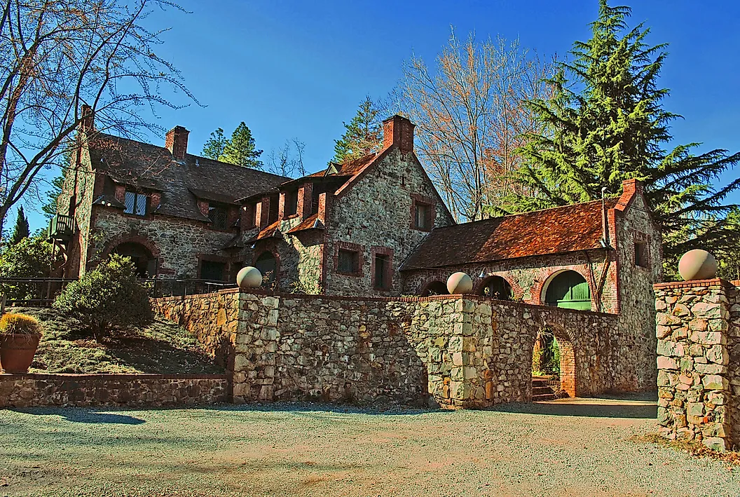
Back on the western slope in Gold Country, the Empire Mine in Grass Valley is one of the oldest, deepest, and richest gold mines in California and one of the best-preserved hard-rock mining operations in the region. Between 1850 and its closure in 1956, the Empire produced 5.8 million ounces of gold from 367 miles of underground passages. Visitors can walk to the mouth of the main shaft and look down the incline where miners rode carts into the dark, though the shafts below are now flooded. To see the full extent of those workings, the Visitor Center houses the "Secret Room," named for its blacked-out windows, with a scale model of the entire underground network.
Above ground, the Empire Cottage, designed by Willis Polk in 1897 and built for mine owner William Bourn Jr., sits amid restored grounds, a reflecting pool, fountains, and greenhouses that look almost the same as they did when the mine was running. Guided tours of the mine yard and cottage run about 45 minutes each. The park spans 856 acres and features 14 miles of trails, with the Union Hill section across the Colfax Highway offering quieter hiking. The trails are free, though there is an entrance fee for the historic grounds.
Columbia State Historic Park

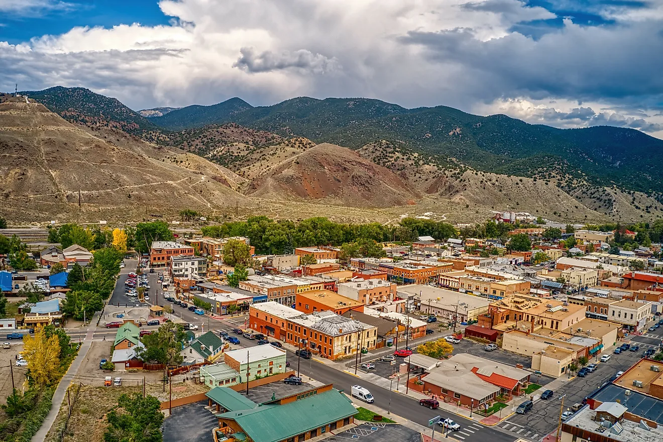
Farther south in Gold Country, Columbia State Historic Park features the largest collection of Gold Rush buildings in California, and unlike most surviving mining camps, Columbia never became a ghost town or got modernized. The town produced enormous quantities of placer gold in the 1850s and became one of the largest in the southern mines. Fires in 1854 and 1857 burned much of it, but the town learned from the losses and rebuilt in brick. Columbia shrank over time but never emptied, and the state took over the historic commercial district in 1945.
Today, businesses still operate on Main Street, including saloons and a blacksmith shop, alongside restored buildings such as the Wells Fargo Express office. The Columbia Schoolhouse sits up the hill, and the City Hotel restaurant serves lunch and dinner. Main Street is also closed to cars, which adds to its historic feel.
Palisades Tahoe Aerial Tram

The last stop returns to the Tahoe area, where the Palisades Tahoe Aerial Tram is a mile and a half long, carries 110 passengers per car, and climbs 2,000 vertical feet from the Village at 6,200 feet to High Camp at 8,200. It opened in 1968, and the ride takes about ten minutes, with the valley opening up beneath and Lake Tahoe visible in the distance. The tram runs year-round and is dog-friendly in summer, with advance booking available for peak season; in winter, the morning skier rush is worth avoiding.
That valley, now called Olympic Valley, hosted the 1960 Winter Games, the first Olympics televised live in the United States. At High Camp, the Olympic Museum traces that history with memorabilia, news articles, and archival films, and admission is free with a tram ticket. High Camp also features an exhibit on the Washoe Tribe and their presence in the Tahoe Basin, along with an outdoor ice rink in winter that becomes a roller rink in summer.
Landscapes And Living History In The Sierra Nevada
Taken together, the places on this list fall into a few distinct groups. Devils Postpile, Emerald Bay, Kings Canyon, Tunnel View and Mount Whitney are about the landscape itself, featuring volcanic rock, glaciers and the highest peak in the lower 48. Mariposa Grove and the Giant Forest are where you go to see the sequoias. The rest are about the people who came through the range. Donner tells the emigrants' story, Empire Mine and Columbia document the gold-mining era, and the China Wall near Donner Summit is a reminder of the Chinese crews who built the railroad. The Palisades tram is the only commercial stop, but it combines Olympic history, a Washoe exhibit and a view of Lake Tahoe in one trip. Choose based on what interests you most, and check permit and access requirements before you go.