Why The Great Lakes Are Called Inland Seas
A storm on Lake Superior can generate waves higher than a two-story house. Wind speeds can reach hurricane force, and severe conditions can keep ships in port for days. At this scale, the physical conditions on the Great Lakes resemble those found at sea. That is why the Great Lakes are often called inland seas.
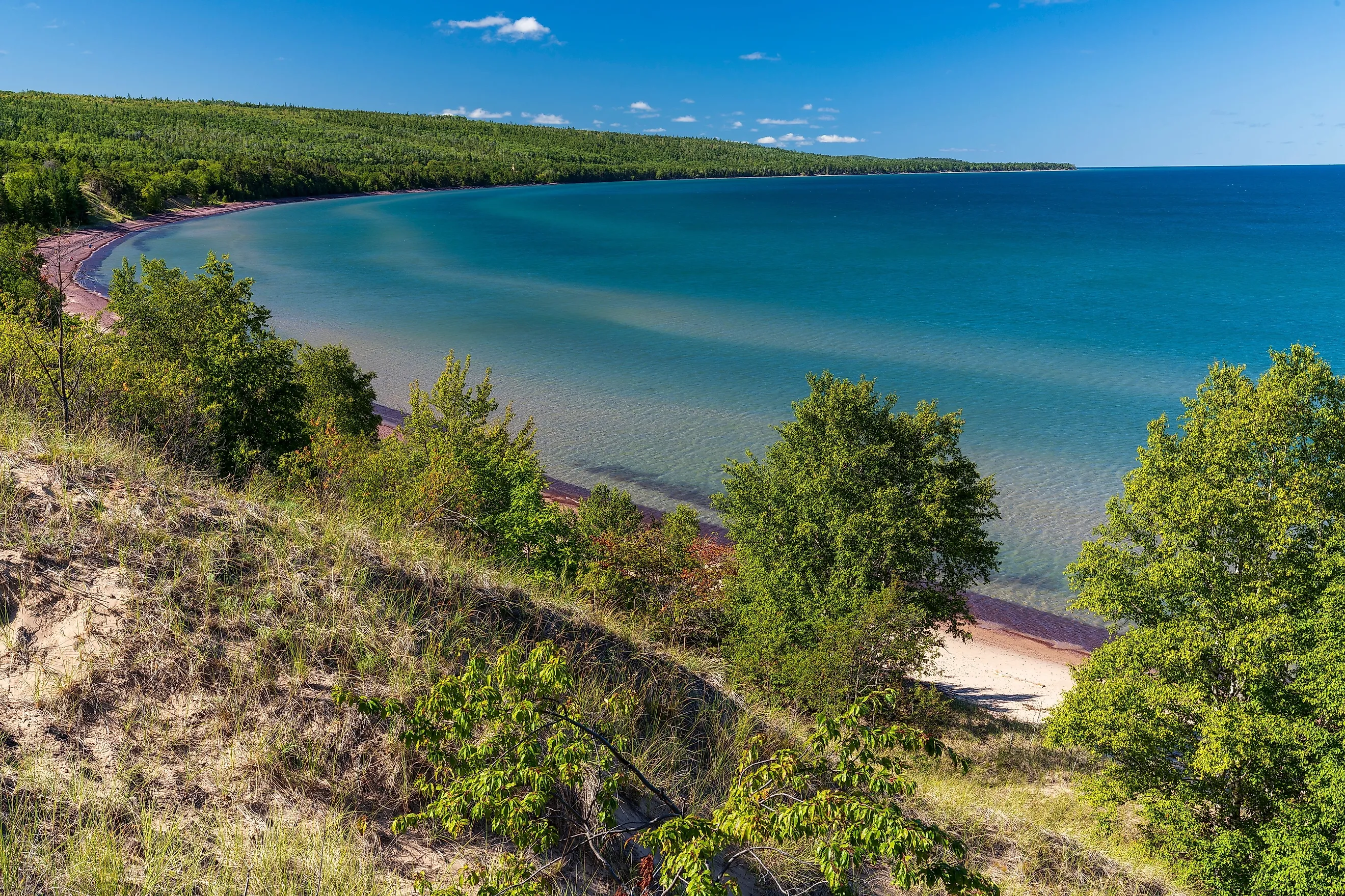
Lakes Superior, Michigan, Huron, Erie and Ontario cover about 244,106 km2 (94,250 mi2) and contain roughly 22,671 km3 of water. They hold about 21% of the world's surface freshwater. Their designation as inland seas is therefore more than poetic.
Large-scale circulation, wind-generated waves, and coastal currents all occur at scales normally associated with seas.
Seasonal stratification, seiches, and exchanges of heat and moisture with the atmosphere occur at those scales as well. Researchers studying large lakes have explicitly noted that they experience ocean-like physical processes, including strong currents and upwelling.
Their Enormous Size Changes Water Conditions

Size is the fundamental reason the Great Lakes differ from ordinary lakes. The five lakes have a combined water surface of approximately 94,250 square miles. Their shoreline extends for about 10,210 miles, counting islands and connecting channels. Lake Superior alone covers approximately 31,700 square miles and reaches a maximum depth of 1,332 feet (406 meters). Lake Michigan reaches 925 feet, Lake Huron 750 feet, and Lake Ontario 802 feet.
These dimensions provide hundreds of kilometers of open water across which wind can transfer energy to the surface. This distance, known as fetch, allows large waves to develop. In smaller lakes, the shoreline limits wave development over relatively short distances. Across Superior, Michigan, or Huron, sufficiently strong winds can operate over much longer distances, producing conditions comparable with those of marine environments.
They Produce Sea-Like Waves and Storm Conditions

Perhaps the most visible evidence of the Great Lakes' sea-like character is the occurrence of large, dangerous waves. During an intense October 2010 storm, for example, the National Weather Service recorded winds reaching hurricane force over Lake Superior. Waves reached approximately 27 feet in northern Lake Superior, with waves around 20 feet across other parts of the lake. A monitoring buoy recorded a significant wave height of 18.7 feet.
Such conditions are not merely historical anomalies. The National Weather Service issues dedicated open-lake marine forecasts, including gale warnings, storm warnings, wave forecasts, and freezing-spray warnings much like those issued for coastal marine waters. NOAA consequently operates sophisticated wave-prediction systems for all five Great Lakes. Its current Great Lakes Wave Model uses WAVEWATCH III, a numerical system also used in ocean wave forecasting.
The important point is not simply that the Great Lakes occasionally become rough. Their dimensions allow fully developed wind-wave systems to form, making storms an important factor in shoreline erosion, navigation, sediment movement, and vertical mixing.
The Lakes Have Large-Scale Currents

Water within the Great Lakes is in continuous circulation. Wind stress, temperature differences, basin geometry, atmospheric pressure, and Earth's rotation contribute to organized current systems. NOAA measurements in Lake Superior, for example, have identified a broad counterclockwise circulation covering much of the lake, with strong currents running approximately parallel to the shoreline.
Lake Erie likewise contains complex circulation gyres and return currents beneath wind-driven surface flows. Measurements have demonstrated that strong winds can substantially alter both current patterns and the lake's vertical temperature structure.
At sufficiently large scales, Earth's rotation becomes important to lake circulation. Research published in the Journal of Great Lakes Research shows how Coriolis forces can influence wind-driven circulation, upwelling, and downwelling in large lakes. These processes are much more characteristic of oceanography than of the comparatively simple circulation found in many small inland lakes. This is one reason scientists often study the Great Lakes using techniques and models derived from physical oceanography.
They Develop Stratification, Thermoclines, and Seasonal Turnover
Another similarity to seas is their complex vertical structure. During summer, the deeper Great Lakes generally become thermally stratified. Solar heating produces a relatively warm, low-density surface layer, while colder, denser water remains below it. Between these layers is a zone of rapid temperature change known as a thermocline.
NOAA's long-term measurements in southern Lake Michigan clearly record this seasonal cycle. Stratification develops during warmer months, followed by autumn cooling and turnover, when decreasing surface temperatures allow wind-driven mixing to redistribute water vertically.
Lake Erie demonstrates the biological importance of this process. The EPA explains that stratification affects physical, chemical, and biological conditions and can strongly influence dissolved oxygen concentrations in bottom waters.
Wind and waves therefore affect more than surface conditions. They contribute to the vertical distribution of heat, oxygen, nutrients, sediments, and organisms within the water column. EPA monitoring programs consequently measure parameters such as temperature, wind speed, wave height, light penetration, dissolved oxygen, and barometric pressure together.
They Experience Seiches Rather Than Significant Ocean Tides
The Great Lakes also undergo large-scale oscillations in water level. True astronomical tides do occur, but they are extremely small. NOAA reports that even the largest spring tides in the Great Lakes are less than five centimeters, meaning that their effects are overwhelmed by water-level changes caused by wind and atmospheric pressure. The Great Lakes are consequently considered essentially non-tidal.
Much more important are seiches. Strong winds can move large volumes of water toward one side of a lake, producing a temporary difference in water level across the basin. After the wind weakens, the displaced water moves back across the lake, producing a continuing oscillation. NOAA reports that Great Lakes seiches can reach several feet, with periods commonly ranging from roughly four to seven hours.
The lakes can also experience meteotsunamis, which are traveling waves generated by rapid atmospheric-pressure disturbances associated with storms. NOAA confirms that meteotsunamis occur in the Great Lakes, and research using long-term water-level records has found potentially dangerous events exceeding 0.3 meters occurring regularly across the system.
Thus, although the lakes lack meaningful astronomical tides, substantial water-level changes can still occur across entire basins over short periods.
The Lakes Affect Regional Weather
The Great Lakes are large enough to produce measurable effects on atmospheric conditions above and around them. This is another reason the term inland sea is appropriate. Water has a much greater heat-storage capacity than the surrounding land. During autumn and early winter, lake temperatures often remain relatively high after air temperatures have fallen. When cold, dry air passes over the warmer water, heat and water vapor are transferred from the lake surface into the lower atmosphere. The resulting instability can produce dense cloud formation and heavy snowfall downwind.
This process produces the well-known Great Lakes lake-effect snow. NOAA explains that cold air passing over relatively warm lake water receives additional heat and moisture before heavy snowfall develops along downwind shores.
The exchange occurs in both directions. Atmospheric conditions affect waves, circulation, mixing, evaporation, and water levels, while heat and moisture transferred from the lakes can alter local temperature, humidity, cloud formation, and precipitation. NOAA researchers therefore increasingly use coupled lake-atmosphere models, noting explicitly that the Great Lakes have physical characteristics more comparable with inland seas than with conventional small lakes.
They Function as a Maritime Transportation System

The comparison with seas also has a practical dimension. The lakes have supported large-scale maritime navigation for centuries. Today they form part of the Great Lakes-St. Lawrence Seaway, which provides a navigable connection between the interior of North America and the Atlantic Ocean. Ocean-going vessels known as "salties" routinely enter the system, while specialized "lakers" carry cargo between Great Lakes ports.
The broader Great Lakes-St. Lawrence transportation system includes more than 100 commercial ports and docks and carries large volumes of iron ore, grain, stone, cement, coal, and manufactured products.
This maritime character is historically important to the phrase "inland seas." Modern scholarship on Great Lakes history describes a regional transportation system based on lighthouses, harbors, navigational aids, ports, specialized vessels, and other infrastructure similar to that found along ocean coasts.
The Great Lakes Are Not Literally Seas
The Great Lakes are not marine seas in the hydrological sense. They are freshwater lakes occupying continental drainage basins. Water passes from one lake to another through rivers and connecting channels before eventually leaving Lake Ontario through the St. Lawrence River and reaching the Atlantic Ocean. They also lack one of the defining characteristics of most marine environments, namely high salinity. Their approximately 21% share of global surface freshwater is precisely what makes them globally exceptional.
Nor are they substantially tidal like most ocean coastlines. Their short-term water-level changes result much more strongly from atmospheric pressure, wind, seiches, precipitation, evaporation, and runoff. Therefore, describing the Great Lakes as inland seas does not mean that scientists have reclassified them as oceans. Rather, the term reflects the increasing similarity between lake and marine physical processes at very large spatial scales.
The Line Between a Lake and a Sea
The term inland seas is fundamentally a description of scale. At the dimensions of the Great Lakes, many physical processes normally associated with oceans also occur in freshwater. Long stretches of open water allow the development of large wind-generated waves. Basin-wide current systems form under the combined effects of wind, temperature, basin geometry, and Earth's rotation. Large exchanges of heat and moisture also occur between the water surface and the atmosphere. The Great Lakes remain freshwater bodies within continental basins, but many of their physical processes closely resemble those measured in marine environments.