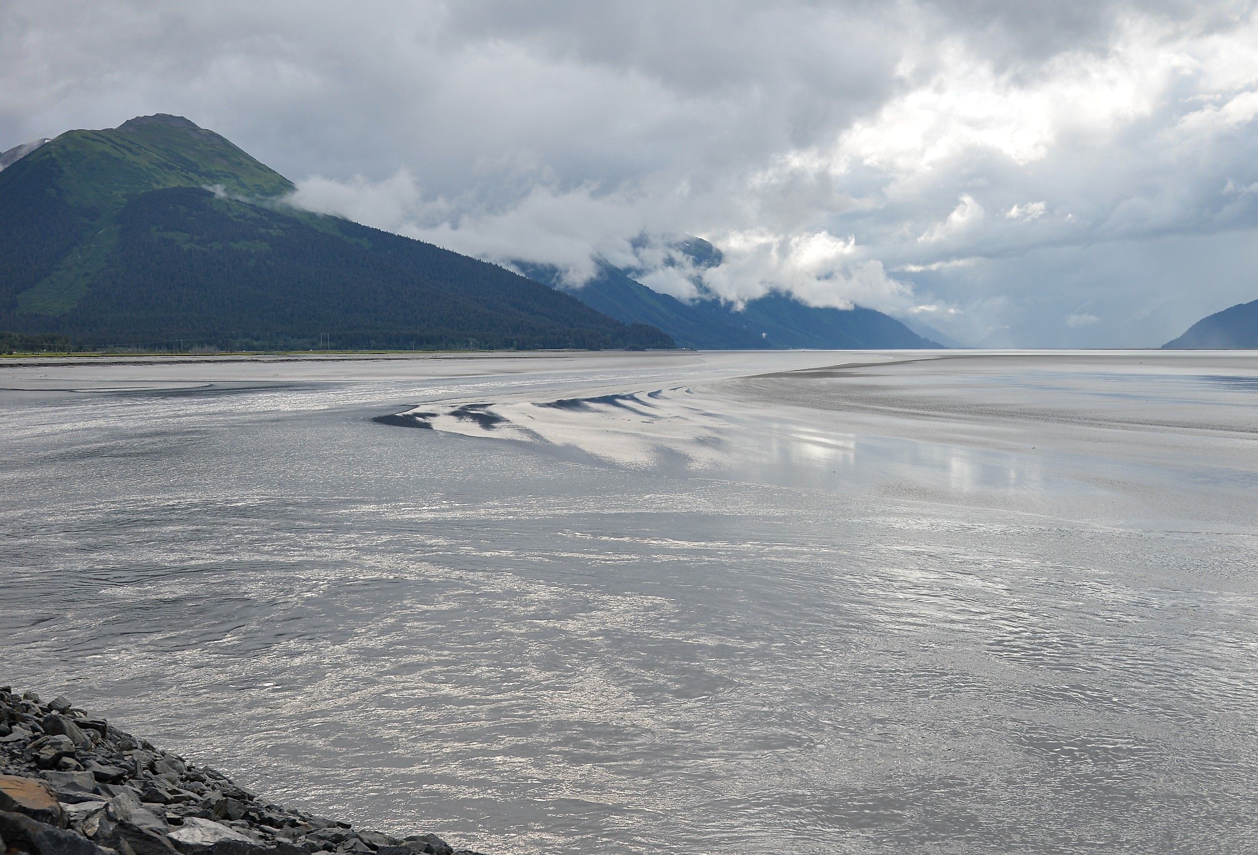
The US Coast With The Biggest Tides
America's most extreme tides live along Alaska's Cook Inlet, and they put on a show. When conditions align, a wall of water up to 6 feet tall races up Turnagain Arm at 10 to 15 mph, fast enough that harbor seals surf it like regulars. A few hours later that same water vanishes, leaving miles of glassy mudflat that has swallowed people whole. This is Cook Inlet, the Pacific's deep cut into south-central Alaska, and its tides dwarf everything else in the country. NOAA puts the average range near 30 feet. Hawaii gets the killer surf, sure, but its tide barely shifts 2 feet. Cook Inlet moves mountains of water twice a day. Here is what makes it the most dramatic coastline in America, and where to catch it yourself.
Turnagain Arm: The Wave That Set The National Record

Sunrise is a historic spot along Turnagain Arm, about 90 minutes southeast of Anchorage. NOAA lists Sunrise's average tidal range (the average difference between high and low water) at 30.3 feet (9.2 m), the largest in the United States. The reason is simple geometry: Turnagain Arm is a long, narrowing funnel. As millions of gallons of Pacific seawater get squeezed into an increasingly tight channel, the tide has nowhere to go but up. While searching for the Northwest Passage in 1778, James Cook found the channel impassable farther inland and named it "River Turnagain"; it later became known as Turnagain Arm, while the larger inlet was named for Cook. Today, the Seward Highway traces about 40 miles of Turnagain Arm's north shore, making it one of the only places in the world where a visitor can watch an extreme tidal event without leaving the car. Under suitable low-tide and weather conditions, the leading edge of the incoming tide forms a bore that can move faster than a person can run; on other tides, it may be much less pronounced.
Beluga Point: Front-Row Seats To The Bore Tide

Beluga Point is one convenient bore-tide viewpoint, and Bird Point and several other highway pullouts also provide established viewing locations. Twice a day, when conditions line up, a tidal bore surges up the arm and passes directly below the viewpoint. On most tides, the bore is a modest line of chop. On exceptional ones, it can reach about 6 feet (1.8 m) high, and the timing shifts with the viewpoint, the wind, and water conditions. Harbor seals have reportedly been observed swimming or "surfing" in the bore, although sightings are not guaranteed. Beluga Point is named for the Cook Inlet belugas historically seen moving through this part of the arm, especially when salmon are running. Other popular viewing pullouts along the same stretch include Bird Point and Windy Corner, both also known for Dall sheep sightings on the cliffs above the road. The tide is dramatic enough that the small town of Girdwood, near the arm's far end, had to relocate its original townsite after it sank during the 1964 Good Friday earthquake. Check a current bore-tide schedule before visiting: at Bird Point, visible bores may follow Anchorage low tides of 4 feet or less, while the largest generally occur after minus tides of about 2 to 5.5 feet.
The Mudflats: Cook Inlet's Deadly Beauty

The same tide that produces the spectacular bore also exposes one of Alaska's most dangerous natural surfaces. Twice a day, Turnagain Arm's retreating water leaves behind vast expanses of saturated glacial silt so fine that it behaves like quicksand. People who step onto the flats have become trapped up to the waist within seconds, unable to free themselves before the tide returns. Alaska emergency crews have had to perform technical rescues using pressurized water hoses to free stuck hikers, sometimes without success. Multiple deaths have been recorded on these mudflats over the past several decades. The danger is real enough that warning signs line the pullouts along the Seward Highway, and search-and-rescue officials advise never walking onto exposed tidal flats anywhere in Cook Inlet, regardless of how solid the surface looks. It is a stark reminder that the same tide drawing photographers and whale-watchers to this coastline is also one of its biggest hazards.
Knik Arm and Anchorage: A City Built On A 26-Foot Tide

While Turnagain Arm holds the national record, the other arm of Cook Inlet, Knik Arm, is home to the country's second-largest tide: 26.2 feet (8 m) at Anchorage, per NOAA. That makes Alaska's largest city the only major American metro area built directly on a tide of this scale. The Don Young Port of Alaska handles about half of Alaska's inbound fuel and freight, which is distributed statewide and consumed by communities containing roughly 90 percent of the state's population. At low tide, the water can retreat far enough to expose wide mudflats visible from downtown. Between mean low and high water, Anchorage's water level changes by about 26 feet, flooding broad areas that sit bare a few hours earlier. Even Ship Creek, the small waterway running through downtown Anchorage and a popular spot for salmon fishing right in the city, rises and falls with the tide. Anglers plan their trips around the tide tables, just as boaters do farther out in the inlet. Here is a major US downtown where checking the tide chart is as routine as checking the weather.
Kachemak Bay and Homer: Where Boats Live By The Tide Book

At the southern end of Cook Inlet, on the Kenai Peninsula, Kachemak Bay still produces a mean tidal range of about 15.5 feet (4.7 m), with recorded extremes topping 25 feet (7.6 m) at the Seldovia tide station. That is smaller than Anchorage's tide, and even smaller than Maine's Eastport and Cobscook Bay area at roughly 20 feet, but still far larger than most of the US coastline. The town of Homer, known locally as the "Halibut Fishing Capital of the World," sits right on the bay. Its famous landmark, the Homer Spit, a 4.5-mile finger of sand and gravel reaching into the water, looks dramatically different at low tide than at high tide. Local charter captains and boaters treat the tide book the way pilots treat a flight plan, since a boat anchored in shallow water at low tide can find itself floating nearly 20 feet higher just six hours later. Much of the surrounding shoreline falls within Kachemak Bay State Park, Alaska's first state park, where hiking trails and tidepools alike are shaped by the same daily extremes.
Cook Inlet's Beluga Whales: Riding The Tide To Survive

Cook Inlet supports a genetically distinct, endangered beluga population. NOAA's most recent abundance estimate, drawn from aerial surveys in 2021 and 2022, is a median of 331 whales. These whales have adapted to use the inlet's extreme tides as a hunting strategy. They commonly move farther into Turnagain Arm with the rising tide, forage near river mouths around high water, and move down-arm as the tide falls. The Seward Highway pullouts offer an unusual chance to see endangered Cook Inlet belugas traveling and, at times, foraging in Turnagain Arm. The population has declined sharply since the 1990s, and NOAA recommends remaining at least 100 yards from whales and avoiding any action that approaches, pursues, or disturbs them. Their survival is now closely tied to the same tidal rhythm that makes this coastline so extreme in the first place.
Experience Alaska's Biggest Tide For Yourself
Cook Inlet is not just home to the biggest tides in the United States. It is a coastline where the daily rise and fall of the water shapes almost everything, from where a whale hunts to where a city builds its port to where a hiker should never set foot. Nowhere else in the country does the ocean move quite like this, twice a day, right alongside a major highway. Turnagain Arm offers a rare roadside view of the tidal system with the largest average range in the United States.