10 Major Mountain Ranges of Africa
Mountain ranges refer to a sequence of hills or mountains laid out in a line and linked together by high ground. Various geological processes lead to the formation of mountain ranges, but a majority of the significant mountain ranges are formed as a result of plate tectonics. The second-largest and the second-most populous continent in the world, Africa is one of the most geographically diverse places on the Blue Planet. Its wide range of natural resources, beautiful savanna grasslands, magnificent mountain ranges, and huge biodiversity are a testament to the continent’s geographical diversity. From the Atlas Mountains to Magaliesberg, these major mountain ranges of Africa are indeed a great source of economically essential minerals and natural beauty.
Atlas Mountains

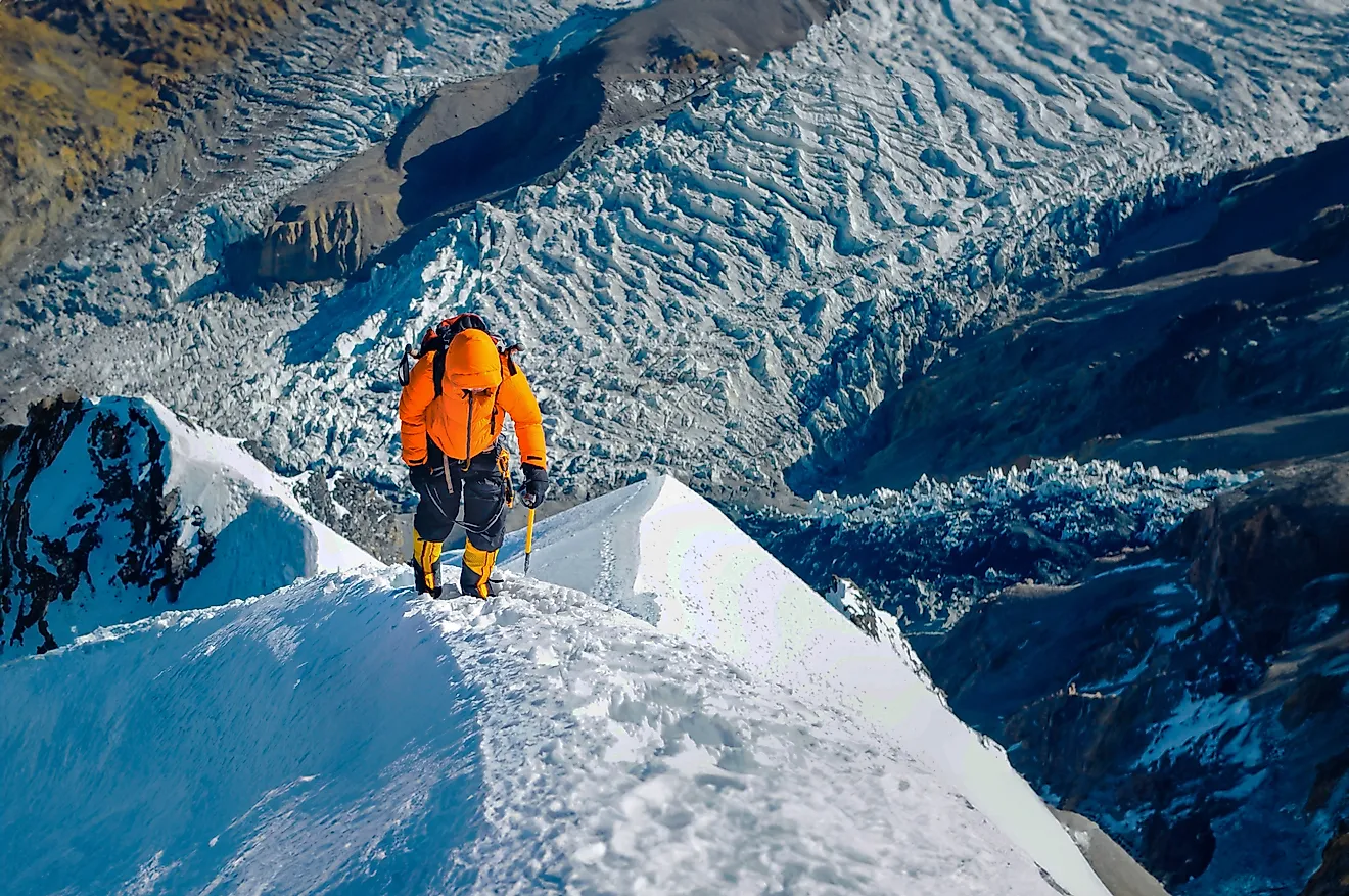
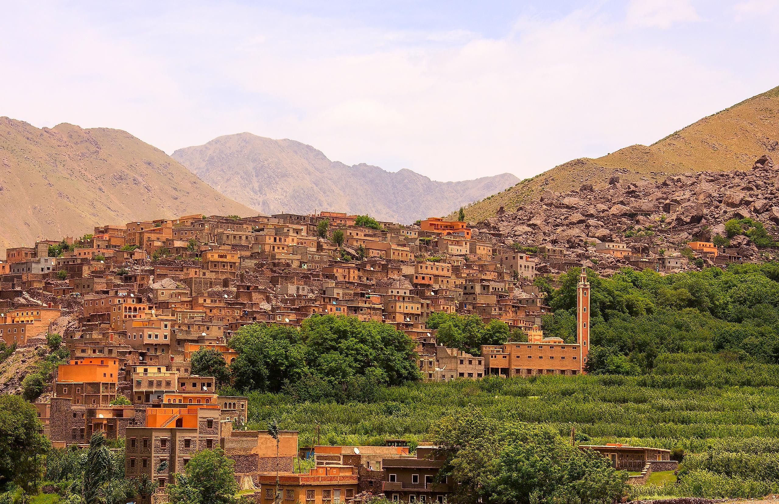
Atlas Mountains are a chain of mountain ranges extending for over 1,200 miles from the southwest to the northeast direction in the northwestern part of Africa. This mountain range serves as the geologic backbone of three countries in the Maghreb region: Algeria, Morocco, and Tunisia. Located in southwestern Morocco’s Toubkal National Park, Mount Toubkal, which rises to an elevation of 13,671 ft, is the range’s highest peak. The Atlas Mountain Range can be further divided into many subranges like Anti-Atlas, High Atlas, Middle Atlas, Tell Atlas, Aures Mountains, and Saharan Atlas.
Primarily inhabited by the indigenous Berber people, the Atlas Mountains separate the Atlantic Ocean and the Mediterranean Sea from the Sahara Desert. The mountain range is home to a diverse array of floral and faunal species. Some notable animals found in the mountain range include the Barbary macaque, Atlas Mountain badger, Barbary leopard, Cuvier’s gazelle, Algerian nuthatch, Atlas Mountain viper, and many more.
Drakensberg Mountains

The eastern section of the Great Escarpment, the Drakensberg Mountains, extends roughly from the northeast to the southwest direction for over 700 miles parallel to South Africa’s southeastern coast. The mountain range separates the high central plateaus in the interior of Southern Africa from the coastal lowlands. In southern and eastern Lesotho, the most elevated section of the Drakensberg Mountains is characterized by a sandstone base capped by eroded basalt. The tallest peak of this mountain range is Thabana Ntlenyana, which rises to an elevation of 11,424 ft, making it the highest mountain in Southern Africa. As South Africa’s principal watershed, the Drakensberg Mountain is the Orange River’s source. The mountains also host the Tugela Falls, the second-highest waterfall in the world, with a drop of 3,107 ft.
The Drakensberg Mountain Range is home to many important plant and animal species. Of the total 2,153 floral species found here, 119 species are listed as globally endangered, while 98 species are considered endemic or near-endemic. Over 299 avian species are found in the Drakensberg Range, some of which include the mountain pipit, cape vulture, Drakensberg siskin, Drakensberg rockjumper, etc. In addition, there are more than 24 snake species in the Drakensberg Range, of which two species are highly venomous.
Rwenzori Mountains

Situated in eastern equatorial Africa, this mountain range is placed on the boundary between the Democratic Republic of Congo and Uganda. The mountain range extends south-to-north between Lake Albert and Lake Edward for about 75 miles and has a maximum breadth of about 40 miles. One of the world’s highest non-orogenic and non-volcanic mountains, Rwenzori is a collection of six separated glaciated massifs: Mount Stanley, Mount Baker, Mount Gessi, Mount Speke, Mount Emin, and Mount Luigi di Savoia. Mount Stanley is the highest peak in the Rwenzori Mountain Range, which reaches an elevation of 16,762 ft.
As the upper reaches of the mountain range are permanently covered with snow, the Rwenzori Mountains have often been identified as the “Mountains of the Moon” and the source of the River Nile during Classical Antiquity. The Rwenzori Mountains are well-known for their diverse flora, and a significant portion of the mountain range is jointly covered by Uganda’s Rwenzori Mountains National Park and Congo’s Virunga National Park. The mountains also contain deposits of economically important minerals like copper and cobalt, which are mined at Uganda’s Kilembe mines.
Ethiopian Highlands

Occasionally called the Roof of Africa, this rugged mountain mass forms the continent’s most extensive continuous elevation area, with the summits reaching up to 14,930 ft. Located in Northeastern Africa, a significant portion of the Ethiopian Highlands are in Ethiopia’s central and northern parts, while its northernmost parts reach Eritrea. The Ethiopian Rift Valley separates the highlands into a northwestern part called the Abyssinian Massif and a southeastern part called the Harar Massif. The Simien Mountains are a part of the Abyssinian Massif and contain the 14,930 ft high Ras Dashen, which is Ethiopia’s highest peak. The Bale Zone in the Oromia Region of Ethiopia includes the highest peaks of the Harar Massif.
Based on their elevations, the Ethiopian Highlands are divided into three different ecoregions: the Ethiopian montane forests, the Ethiopian montane grasslands and woodlands, and the Ethiopian montane moorlands. Several floral species like Acacia, Terminalia, Boswelia, Juniperus procera, Hagenia abyssinica, Olea africana, Astropanax, and Afrocarpus falcatus dominate these ecoregions. The mountain slopes are home to many endemic wildlife, including Walia ibex, gelada baboon, mountain nyala, Ethiopian wolf, big-headed mole rat, etc. Many avian species, like the blue-winged goose, white-winged flufftail, Ankober serin, Rueppell’s chat, Eurasian wigeon, common greenshank, etc., are also observed here.
Virunga Mountains

Also referred to as Mufumbiro, the Virunga Mountains range comprises eight major volcanoes stretching 50 miles along the northern boundaries of Uganda, Rwanda, and the Democratic Republic of Congo in the east-central portion of Africa. Situated between Lake Kivu and Lake Edward, the Virunga Mountains range is a branch of the Albertine Rift, which is the western branch of the East African Rift. Most of these volcanoes are dormant, except the 11,358 ft high Mount Nyiragongo and the 10,049 ft tall Mount Nyamuragira, both of which are located in the Democratic Republic of Congo. Placed on the boundary between the Democratic Republic of Congo and Rwanda is Mount Karisimbi, which rises to an elevation of 14,787 ft and is the highest peak of the Virunga Mountain range. The region’s most famous residents are the critically endangered mountain gorillas which live on the forested slopes of the volcanoes.
Marrah Mountains

This range of rugged volcanic peaks stretches over 100 miles at the heart of Sudan’s Darfur region on the boundary between South Darfur and Central Darfur states. The highest point in the Marrah Mountains is the Deriba Caldera which rises to an elevation of 9,980 ft and is the most well-known feature of the expansive Jebel Marra volcanic field. The upper reaches of the massif comprise a small area that experiences a temperate climate with heavy rainfall and permanent water springs that are placed above the dry savanna and scrub of the Sahel region. Some seasonal tributaries of the Al-Arab River originate on the southern flanks of the Marrah Mountains.
Simien Mountains

Forming a portion of the Ethiopian Highlands, the Simien Mountains are located in the Amhara region, northeast of the city of Gondar in northern Ethiopia. A World Heritage Site, the Simien Mountains comprises plateaus separated by deep valleys and include the Simien Mountains National Park. The highest peak in this mountain range is Ras Dejen or Ras Dashen, which reaches an elevation of 14,930 ft. Formed before the creation of Ethiopia’s Great Rift Valley during the Oligocene period, the Simien Mountains are pretty unique. The steep cliffs and cool climate of the Simien Mountains National Park support many endemic species like the Walia ibex, Simien fox, Ethiopian wolf, Gelada baboon, caracal, and several avian species.
Nuba Mountains

Also known as the Nuba Hills, the Nuba Mountains stretch for around 19,000 sq. mi in the South Kordofan wilayat of Sudan. Having a length of about 90 miles and a width of 40 miles, the Nuba Mountains are home to the indigenous Nuba people. The Nuba Mountain rocks form a part of the Arabian-Nubian Shield’s southwestern fringe and are composed mainly of metamorphic and igneous rocks that belong to the Precambrian, Paleozoic, and Neoproterozoic Ages. The mountains also contain deposits of economically important minerals like phosphate, phosphorus, vanadium, and uranium. From mid-May to mid-October, the rainfall allows seasonal agriculture and grazing animals in the lush green Nuba Mountain area.
Swartberg

This mountain range extends for about 140 miles in South Africa’s Western Cape province from the southern portion of Laingsburg in the west to between Uniondale and Willowmore in the east. The Swartberg mountain range serves as a barrier between the two semi-arid areas, Little Karoo and Great Karoo. Forming a part of the Cape Fold Belt, this mountain range comprises two named ranges: the Smaller Swartberg or Klein Swartberge and the Greater Swartberg or Groot Swartberge. Located in the west, the Smaller Swartberg Mountains include the province’s highest peak named, Seweweekspoortpiek, which reaches an elevation of 7,628 ft. In contrast, the Greater Swartberg range is home to the Cango Caves, which are one of South Africa’s most well-known subterranean systems. Mountain passes such as Meiringspoort, Seweweekspoort, and Swartberg Pass cut through the Swartberg Range.
Magaliesberg

Historically referred to as the Cashan Mountains, Magaliesberg is a 75-mile-long mountain range situated in the northern portion of South Africa. Forming a natural barrier between the Bushveld region of low grass in the north and the Highveld region of grasslands in the south, this prominent mountain range extends from the eastern part of Pretoria in the Gauteng province to the western part of Rustenburg in the North West province. The Magaliesberg range reaches its highest point at the Nootigedacht Glacial Pavements, about an elevation of 6,076 ft.
Considered one of the Earth’s oldest mountain ranges, the Magaliesberg Mountain Range was formed by extensive upwelling of molten magma about 2 billion years ago. It is believed that the earliest hominin species lived in and around the Sterkfontein Caves at the Cradle of Humankind paleoanthropological site near the South African town of Magaliesberg. The Magaliesberg Mountains are a major tourism destination, offering excellent year-round rock-climbing opportunities for its visitors. Located at the Hartbeespoort Dam, a cableway that reaches the top of the mountain range provides panoramic views of Magaliesberg and its surrounding region.
The above article discusses in detail the 10 Major Mountain ranges in the African continent. These mountain ranges are considered one of Africa’s most spectacular and unique wonders. For many, mountains are storehouses of natural resources, crucial habitats for biodiversity, sources of livelihood, beacons of ancient cultural and spiritual practices, and a dream travel destination. So, next time on a trip to the African continent, do not miss an opportunity to visit these mountain ranges and enjoy their stunning views.