Lake Albert, Africa
Lake Albert, also known as Lake Nyanza and formerly called Lake Mobutu Sese Seko or Lake Mwitanzige, is Africa’s 7th largest lake and the northernmost of the African Great Lakes. The lake is located in east-central Africa on the Democratic Republic of the Congo-Uganda border and forms part of the complicated upper Nile system. Lake Albert, formed over 10 million years ago, has a surface area of approximately 5,300 square kilometers. Its primary sources are the Semliki River from Lake Edward and Victoria Nile from Lake Victoria. In 1864, Samuel Baker became the first European to visit the lake while investigating the source of the River Nile. He named the lake for Prince Albert.
Location And Naming Of Lake Albert

Lake Albert is the second-largest lake in Uganda after Lake Victoria and Africa’s 7th largest lake, spanning 5,300 square kilometers. It is shared between DR Congo (54%) and Uganda (46%). The lake is located on Uganda’s western border and bordered on the south by Nebbi and Nwoya Districts, northeast by Buliisa, southeast by Hoima, and south by Kibaale and Ntoroko Districts. In DR Congo, Lake Albert is part of the northeastern border and administratively in Ituri Province. The lake is bordered by several other African Great Lakes, including Lake Edward (south), Lake Victoria (southeast), and Lake Kyoga (east).
The Batooro and Banyoro people referred to Lake Albert as “Mwitanzige” (locust killer) because several locusts (nzige) died while trying to cross the lake. In 1864, Samuel Baker renamed it “Lake Albert” after Prince Albert. However, the DRC’s President Mobutu Sese Seko changed the lake’s name to his name in the 1970s
Geography Of Lake Albert

Lake Albert is 160 kilometers long, 30 kilometers wide, and covers 5,300 square kilometers, or less than one-tenth the size of Lake Victoria. About 2,862 square kilometers (or 54% of the total surface area) is DR Congo’s territory, while the rest is in Uganda. The lake's shoreline is about 508 kilometers. Lake Albert is a shallow water body, with an average depth of 25 meters and is 51 meters deep at the deepest part. It is located at an elevation of 619 meters above sea level. The lake is flanked by the Blue Mountains on the northwest and Ruwenzori Mountains on the south.
The White Nile is considered Lake Albert’s principal water source. The river, which is one of the principal tributaries of the Nile River, feeds into Lake Victoria. It exits Lake Victoria as Victoria Nile and empties into Lake Albert. The lake’s other main source is the Semliki River, which flows from Lake Edward down south. Albert’s primary outflow is the Albert Nile, which exits the lake at the northernmost tip. The rivers flowing into the lake contribute about 45,160 cubic meters of water per year, and additional 5,198 cubic meters come from the rain. The lake loses most of its water (38,875 cubic meters/year) through river outflows and about 13,093 cubic meters through evaporation.
Fishing In Lake Albert

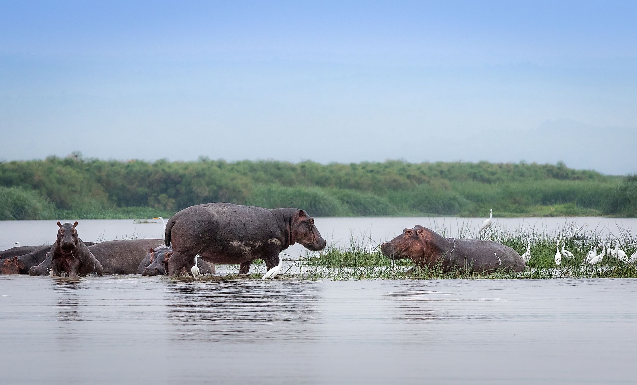
Lake Albert hosts several animal species, including Nile crocodiles, hippos, turtles, water birds, and frogs. The lake is home to about 55 fish species, though its fish diversity is lower than other African Great Lakes like Lake Malawi. It contains at least nine cichlids, including three tilapias. Nile perch, African tigerfish, elongated tigerfish, Cornish jack, marble lungfish, and Albert Lates are also common in the lake. Lake Albert is the second-largest fish produce after Lake Victoria, yielding over 150 million kgs per year. It accounts for 30% of Uganda’s fish production.


