The Forests You Can Camp In For Free
You can camp for free in most of the 154 national forests in the United States. No reservation is required, and no fee is charged. The practice is called dispersed camping, and it covers pitching a tent, parking a van, or setting up a small RV outside a paid campground, usually along a forest service road. Some ranger districts have closed entire corridors after crowds wore them down, while others have miles of open road and a 14-day clock as the only real limit. The free-camping rules for national forests differ from those on Bureau of Land Management, or BLM, land. This guide breaks both down, then covers six forests still open to dispersed camping and two that got shut down.
National Forests vs. BLM Land

Two federal agencies hand out most of the free camping in the country. National forests answer to the USDA Forest Service, part of the Department of Agriculture, and dispersed camping is permitted across most of their acreage by default. Bureau of Land Management acreage sits under the Interior Department, its rules shift from one field office to the next, so a trick that works on forest service land won't necessarily work on BLM ground next door. Dispersed camping, boondocking, and primitive camping all describe the same setup: no facilities, you handle your own water and your own waste. Boondocking usually implies a vehicle, primitive camping usually implies walking in, and the Forest Service uses dispersed camping as the umbrella term on its own signage and maps.
Play By These Rules
Free camping comes with federal rules, and breaking them can mean a fine. The essentials:
- Stay limit: 14 days in one spot, then move on, often 25 miles or more. Some districts cap you at 28 days total in the forest per calendar year.
- Water setback: Camp at least 100 to 200 feet from any stream, river, or lake.
- Road setback: Stay within about 150 feet of the road centerline, and use a pull-off that's already been cleared instead of making a new one.
- No amenities: No toilets, water, tables, or trash pickup. You pack in everything and pack out everything, toilet paper included, and bury human waste in a hole at least six inches deep.
- Fire rules: These change fastest. California requires a free campfire permit even for a propane stove, available online or at any Forest Service, BLM, or Cal Fire office. Seasonal bans override everything, so call the ranger district the week you go.
Mount Baker-Snoqualmie

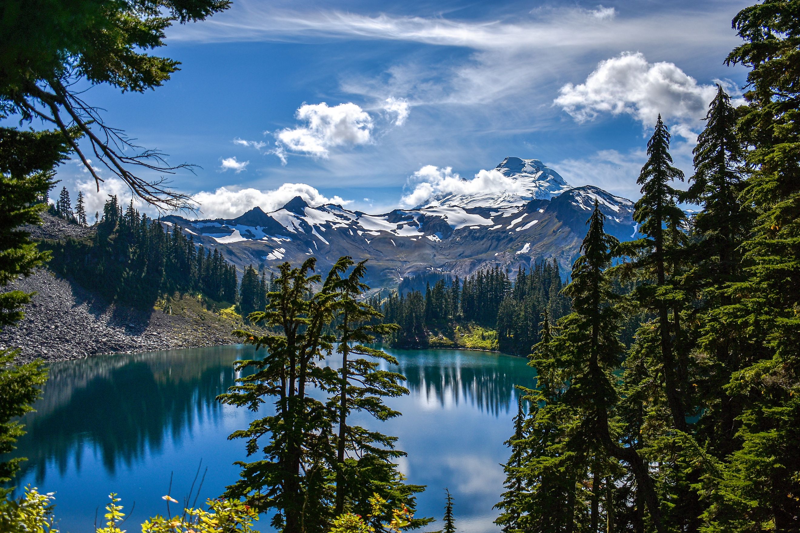
Baker Lake Road tracks the length of a lake fed directly by glacier melt off Mount Baker, and the pull-offs scattered along it put a tent within a few steps of the water. A handful sit on a bluff with the lake spread out below and the volcano filling the skyline behind it. Campers report finding open sites even on Labor Day weekend, since the road runs for miles and the crowd thins the farther in you drive. Access is NF-11 off Highway 20 near Concrete, gravel for most of its length and manageable in a standard sedan outside of storm season, though the surface potholes badly after heavy rain.
Forest Road 1130 branches off toward Baker Hot Springs, where a walk of about a fifth of a mile reaches a natural soak with no fee and no developed platform around it. Mountain Loop Highway, a separate corridor in the same forest, has its own riverside sites near the Big Four Ice Caves trailhead, a flat walk to a wall of glacial ice at the base of the mountain. The forest caps dispersed stays at 14 consecutive days and 28 days total per calendar year.
Inyo

Inyo bans dispersed camping across more terrain than it permits. June Lake Loop, Rock Creek, Bishop Creek, Big Pine Canyon, Convict Lake, Whitney Portal, Horseshoe Meadows, and the Ancient Bristlecone Pine Forest are all classified as developed recreation areas and closed to it entirely. Land along the Owens River belongs to the City of Los Angeles and is closed as well, which catches people who assume the whole valley floor is public.
The open ground holds some of the best camping in the eastern Sierra. Mammoth Scenic Loop Road connects the town of Mammoth Lakes to Highway 395 across roughly nine and a half miles of pavement with forest service spurs branching off both sides. Sites near the main road hold trailers comfortably. The ones farther back need higher clearance and buy real separation from neighbors. Near Mono Lake, spurs off Highway 120 look out over the tufa towers, and the stay limit runs 28 days per six months per ranger district.
White River

Lincoln Creek Road climbs out of the Roaring Fork valley on a shelf road rough enough to turn back most passenger cars, and sites stay open 20 minutes from downtown Aspen because of it. Bring four-wheel drive. A number of the sites come with steel bear boxes bolted into the ground, and campers single out sites 5, 8, and 11 for their size and the view down the drainage. Forest Road 130S, reached off Highway 82, threads through comparable country and connects to trailheads without pavement in between.
White River covers a huge area of central Colorado's high country, and dispersed sites turn up on valley floors near Glenwood Springs and high roads above Vail. Lower drainages stay open into November while high-country roads can close by early October. The Motor Vehicle Use Map for each ranger district marks which roads permit dispersed camping, and the 14-day limit applies forest-wide. Fire bans get called often in dry summers, so pack a stove that runs on gas.
Coconino

Camping along Forest Road 525 outside Sedona now is inside one of eight designated pockets. Surprise, Windmill, Cockscomb, Greasy Spoon, and Nolan hold roughly 200 sites between them, free and first-come, with a 14-day cap. Camping anywhere in west Sedona outside those eight areas is prohibited outright. Wood and charcoal fires are banned year-round across the corridor, though propane stoves and grills that shut off cleanly remain legal.
Forest Road 525 is also known as Loy Butte Road, and it leaves Highway 89A about three miles west of Lower Red Rock Loop Road. The surface is dirt and washboarded, passable for motorhomes up to about 26 feet in dry weather. Schnebly Hill Road, Forest Road 153, runs east of town and climbs through pine cover toward red rock canyon views from Schnebly Hill Vista. It needs high clearance from the Sedona side, and the elevation makes it the better bet once the valley floor heats up.
Ocala

Ocala measures its terrain in springs and sinkholes. The dispersed sites follow water instead of altitude across roughly 383,000 acres of sand pine scrub. Grassy Pond, a former recreation area now open to backpackers on the Florida Trail, sits above a prairie pond reached by a blue-blazed side trail north of County Road 316. Hidden Pond, deeper inside the Juniper Prairie Wilderness, is spring-fed and one of the more popular stops for hikers walking the 72 miles of Florida Trail that cross this forest.
Some backcountry sites here cap stays at four days not 14, shorter than almost anywhere else on this list, so check the posted limit at the trailhead. Forest Road 65 leaves State Road 40 less than a mile west of Juniper Springs Recreation Area, hard-packed sand for most of its run. December through February brings daytime highs around 72 degrees and far fewer biting insects, and summer afternoon storms soften the sand roads enough to strand a two-wheel-drive car.
Pisgah

Pisgah restricts dispersed camping to named corridors, and the Wilson Creek corridor is closed to it. In the Grandfather Ranger District the option is Curtis Creek, the first tract of eastern forest the federal government purchased under the 1911 Weeks Act, the law that built the entire national forest system east of the Mississippi. The creek runs cold through hardwood cover, and the campground at its mouth sits on ground with more history than anywhere else in the district.
The Pisgah Ranger District south of Asheville permits dispersed camping along Cathey's Creek, Courthouse Creek, Wash Creek, Headwaters, Yellow Gap, and Avery Creek. Avery Creek Road is the easiest to reach and the fastest to fill, with turnouts often taken by Thursday through the summer, so a Sunday or Monday arrival changes your odds considerably. Sites here put you within a short drive of Looking Glass Falls and Sliding Rock, and black bears are active enough that hanging food or using a canister is standard practice.
Free Camping Is Disappearing

Crested Butte banned dispersed camping in seven drainages around town, Slate River, Washington Gulch, Brush Creek, Cement Creek, Gothic, Kebler Pass, and Lake Irwin, under a forest order that took effect in 2022, after years of overflow crowds wore down the creek banks. Sedona did something similar along Forest Road 525 once RVers had nicknamed it "The Main Drag" and residents on the private inholdings started calling rangers about the traffic. Both closures come out of the same multiple-use mandate that lets a national forest permit logging, grazing, and mining on the same ground it permits camping on. A district weighing recreation against watershed damage can close a road as readily as it opened one. The six forests below still have room.
Keep These Sites Open
Pack out your own trash and waste, all of it. Also, use an existing fire ring instead of building a new one, and never leave coals unattended. Warm coals can restart a fire in dry grass hours after you drive off. Campers who follow these steps keep these forests open. Crested Butte and Sedona show what happens when they don't. Check the ranger district's page on fs.usda.gov before you leave home, then call the station once you're in cell range, since fire restrictions can shift mid-week during a dry spell. The fire ring is the one thing standing between this list and a shorter one next year.