The US Lakes That Went From Polluted To Clean
Lake pollution is often harder to reverse than it looks because the source may sit far beyond the shoreline. Continued sewage inputs can feed algae, phosphorus accumulated in bottom sediments can be released back into the water, and industrial chemicals can persist long after factories close. The successful recoveries below worked because managers targeted the sources. In Seattle, sewage was rerouted out of Lake Washington. In Michigan, contaminated sediment was removed, and mercury pathways were cut off. In Minnesota, runoff controls reduced phosphorus entering lakes from farms, streets, and developed land. Several of these waters later met state standards or lost formal Great Lakes pollution designations, providing unusually clear before-and-after examples of large-scale lake restoration.
Lake Washington, Washington

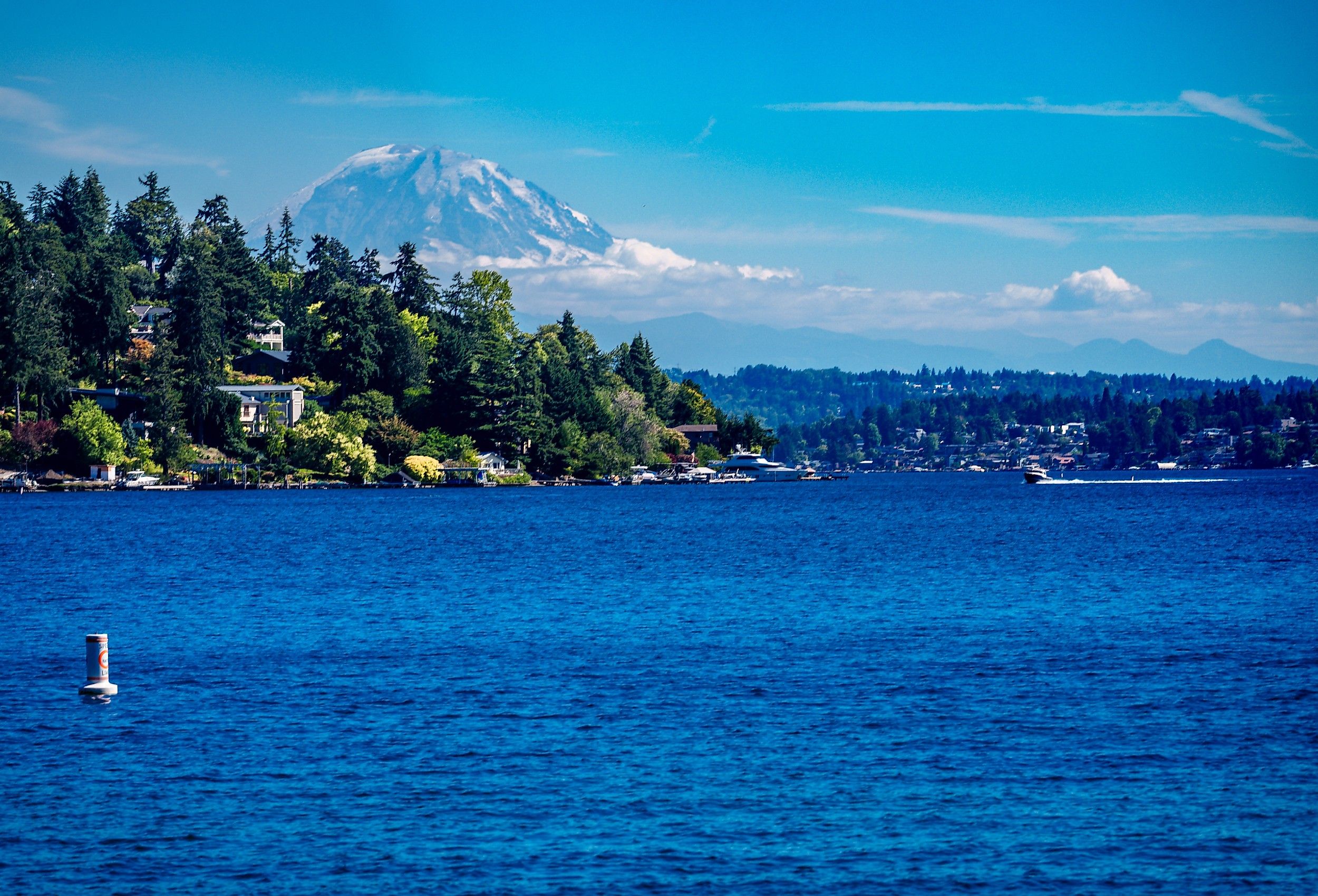
By the early 1960s, Lake Washington was receiving about 20 million gallons of treated sewage every day. That nutrient load pushed phosphorus concentrations to roughly 70 parts per billion and fueled dense cyanobacteria growth. Water clarity fell to about 30 inches in 1964, while decomposing algae fouled parts of the shoreline. Seattle-area voters created a regional sewer agency in 1958 to deal with the problem. Between 1963 and 1968, that agency laid more than 100 miles of trunk lines and interceptor sewers, carrying wastewater to new treatment plants at West Point and Renton, well outside the lake. By February 1968, sewage flow into Lake Washington had fallen to zero. Phosphorus dropped to about 16 parts per billion, cyanobacteria declined sharply, and clarity reached about 10 feet that same year before improving further over the following decades. The lake now supports swimming beaches, rowing, fishing, boating, and heavily used waterfront parks around Seattle and neighboring communities.
Muskegon Lake, Michigan

In September 2025, Muskegon Lake was removed from the Great Lakes Areas of Concern list after all nine of its designated beneficial-use impairments had been cleared. The lake had absorbed waste for more than a century from sawmills, foundries, factories, municipal discharges, and shoreline industries. Sediments contained petroleum hydrocarbons, mercury, lead, PCBs, PAHs, pesticides, and other contaminants, while natural wetlands and shorelines had been filled or hardened. Four sediment remediation projects removed more than 190,000 cubic yards of contaminated material, and habitat and wetland restoration followed. Regulators eventually lifted impairments involving beaches, algae, fish and wildlife habitat, dredging, drinking water, and other uses. Muskegon Lake became the fourth Michigan Area of Concern to leave the list. Michigan still publishes fish-consumption guidance for anglers, but the lake no longer carries the federal pollution designation that followed it for decades.
White Lake, Michigan

White Lake is a 2,571-acre drowned river mouth in Muskegon County connected to Lake Michigan by a federally maintained navigation channel. More than 100,000 cubic yards of contaminated sediment were removed from White Lake during its restoration. Pollution had built up after decades of chemical manufacturing, tannery waste, municipal sewage, industrial dumping, and contaminated groundwater. White Lake was designated a Great Lakes Area of Concern in 1987 with eight beneficial-use impairments. Cleanup crews excavated polluted sediment and tannery waste, repaired the shoreline, and restored more than 50 acres of wetland, riparian, and nearshore habitat. Regulators later removed impairments involving algae, dredging restrictions, fish and wildlife consumption, habitat loss, bottom-dwelling organisms, drinking-water concerns, wildlife populations, and poor aesthetics. White Lake was delisted in October 2014, becoming the first US Area of Concern in the Lake Michigan basin to complete the process. Restored shoreline and habitat now support recreation and wildlife, but Michigan warns that chemicals remain in White Lake fish and directs anglers to current consumption guidelines.
Deer Lake, Michigan

In 1981, Michigan issued a "do not eat" advisory for all fish from Deer Lake, Carp Creek, and the Carp River because of high mercury concentrations. The contamination was linked to mining-related sources and wastewater pathways around Ishpeming in the Upper Peninsula, while inadequately treated sewage added excess nutrients. One major restoration project diverted Partridge Creek away from contaminated underground mine workings and rebuilt a surface stream channel with pools, riffles, wetlands, and trout habitat. Wastewater improvements cut another source of pollution. Deer Lake had three official Great Lakes impairments: restrictions on fish consumption, undesirable algae, and wildlife reproductive problems. Bald eagles were the wildlife case. A nesting pair was present through much of that period but produced no observed eaglets from 1964 through 1996, and successful reproduction resumed in 1997. All three impairments were eventually removed, and Deer Lake left the Areas of Concern list in 2014 as the first US site in the Lake Superior basin to be delisted. Current fish-consumption guidance still applies to anglers, but the blanket ban that once covered Deer Lake is gone.
Whiskeytown Lake, California

California placed Whiskeytown Lake on its impaired-waters list in 1990 after monitoring found elevated fecal-coliform bacteria at the Brandy Creek and Oak Bottom swimming beaches. Investigators traced the contamination to heavy visitation, inadequate sanitation facilities, scattered waste, pets, and wildlife. The National Park Service upgraded toilets and wastewater facilities, added parking limits and fees to spread visitors out, improved garbage handling, and kept dogs off the swimming beaches. Regional Board sampling in 2006 and 2007 found no exceedances of the state's single-sample limit for E. coli, and California removed the bacteria listing in 2010. Mercury remains a separate listed impairment for the lake, which the bacteria cleanup did not address. Park staff still test the designated swimming areas throughout the summer, and short precautionary advisories have followed spikes in bacteria at Brandy Creek in recent years, including 2025.
Lake Rebecca, Minnesota

The average phosphorus in Lake Rebecca once measured about 81 micrograms per liter. In the dataset later used for delisting, the figure was about 33. Excess nutrients had been feeding algal blooms, leading to poor clarity, low oxygen, and occasional fish kills west of Minneapolis. Minnesota listed the lake as impaired in 2008. A 93-acre horse farm outside the park was a significant outside source of phosphorus, while invasive curly-leaf pondweed complicated the lake's nutrient cycle. Managers improved manure and stormwater controls at the farm, treated runoff from developed parts of the park, restored shoreline, managed invasive vegetation, and applied aluminum sulfate in the fall of 2010 and the spring of 2011. The alum-bound phosphorus in the sediment reduced the amount available to fuel algae. Minnesota removed Lake Rebecca from its impaired-waters list in 2018, making it the first Three Rivers Park District lake delisted for nutrients. The surrounding park reserve now includes swimming, fishing, cycling, hiking, and habitat used by trumpeter swans and other waterbirds.
Lake Shaokatan, Minnesota

Runoff from farmland was the main source of Lake Shaokatan's pollution. Phosphorus and sediment washed into the 995-acre lake in southwestern Minnesota and fed nuisance algae severe enough to impair recreation and aquatic life, and the state listed it as impaired in 2002. Local partners spent more than two decades reducing those inputs across the watershed. Tile inlets were removed or modified, septic systems were upgraded, and farms adopted practices that cut soil and nutrient losses during runoff events. Agencies tracked phosphorus and algae levels while those changes accumulated. By the time Minnesota reviewed the lake for delisting, monitoring showed that it was again meeting the applicable water-quality standards. Lake Shaokatan was removed from the impaired-waters list in 2018 after years of lower nutrient loading from the surrounding agricultural landscape.
Mitchell Lake, Minnesota

Mitchell Lake entered Minnesota's impaired-waters list in 2002 after excess phosphorus fueled algae and reduced water clarity. Eden Prairie residents and local agencies responded with stormwater projects around the watershed, including rain gardens, rain barrels, and permeable pavement. Shoreline vegetation was restored, aquatic weeds were harvested, and Canada goose management reduced another local nutrient source. Upstream Round Lake received an alum treatment because water moving through that system was carrying phosphorus toward the 114-acre lake. Monitoring between 2006 and 2013 found growing-season averages of about 57 micrograms per liter of phosphorus, 20.7 micrograms per liter of chlorophyll a, and 1.3 meters of Secchi-disk clarity. Those results met the standards used for delisting, and Mitchell Lake was approved for removal from Minnesota's impaired-waters list in 2018.
Beaver Lake, Minnesota

Urban stormwater drove Beaver Lake's water-quality problems in the eastern Twin Cities. Streets, lawns, rooftops, and developed parcels sent phosphorus and other pollutants into the lake, helping create eutrophic conditions. Minnesota listed Beaver Lake as impaired in 2002 because it was not meeting standards for aquatic recreation. The watershed district funded stormwater-treatment projects, shoreline improvements, and runoff-control measures on developed properties. Managers then relied on long-term monitoring to determine whether the gains lasted. Ten-year averages for phosphorus, chlorophyll-a, and water clarity showed that Beaver Lake had consistently met the relevant eutrophication standards from 2006 onward. Minnesota removed it from the impaired-waters list in 2014. Keller, Carver, and Battle Creek lakes, all in the same watershed district, came off the list in the same action.
Madawaska Lake, Maine

Madawaska Lake's worst years followed intensive timber harvesting and shoreline development in northern Maine during the 1980s. Forest roads, exposed soil, erosion, and septic-system impacts increased the amount of phosphorus and sediment reaching the water. Between 1987 and 1992, four nuisance cyanobacteria blooms cut water clarity to less than two meters and interfered with swimming and aquatic life. Maine placed the roughly 1,600-acre lake in Aroostook County on its impaired-waters list in 1988. Conditions improved after statewide forestry standards tightened, erosion controls strengthened, road management improved, and development around the shoreline faced closer oversight from state and county regulators. Water-quality data began improving during the mid-1990s, and the state removed Madawaska Lake from the impaired list in 2006. The lake remains largely forested and continues to support boating, fishing, swimming, and shoreline camps.
Lake Hazle, Mississippi

Residential and commercial growth around Hazlehurst sent sediment, nutrients, organic matter, oil, and grease into Lake Hazle through stormwater runoff. The 22-acre city lake south of Jackson developed turbidity, nutrient enrichment, and low dissolved oxygen, and Mississippi added it to the impaired-waters list in 1996. Managers focused on reducing the runoff carrying those pollutants into the water, planting vegetation at eroded sites, and installing structures to slow and filter stormwater. Later sampling found nitrate-nitrite, phosphorus, and turbidity below state screening levels, while oil-and-grease results below 5 milligrams per liter were judged to meet Mississippi's narrative standard. Dissolved oxygen also improved enough for the lake to support its designated aquatic life use. Mississippi removed Lake Hazle from the impaired-waters list in 2004 after monitoring showed that the lake again met the applicable criteria.
Fellows Lake, Missouri

Fellows Lake had two impairments to clear: mercury in fish tissue and excess nutrients. Missouri added the reservoir north of Springfield to its impaired-waters list in 1994, citing agricultural inputs from livestock, fertilizer, farm practices, and wildlife. The 826-acre lake serves as a drinking-water source and supports a muskie fishery that draws anglers from across the region. Watershed projects used conservation practices, runoff controls, improved land management, and public education across the Fellows Lake and larger Sac River drainage areas. Fish sampling by state and federal agencies in 2002 and 2006 found mean mercury concentrations below the national criterion of 0.3 milligrams per kilogram. Monitoring also showed slight downward trends in nitrogen and phosphorus. Missouri later removed both impairments from the lake's Clean Water Act listing, and Fellows Lake remains an active drinking-water reservoir with fishing, paddling, trails, and wooded shoreline around its coves.
What The Cleanups Actually Changed
The successful projects targeted very different sources of pollution. Seattle rerouted sewage out of Lake Washington. Crews excavated contaminated sediment from White Lake. Deer Lake required a mercury pathway to be cut off, while several Minnesota lakes improved after phosphorus inputs from farms, streets, and developed land were reduced. Delisting did not mean every trace of pollution disappeared. It meant monitoring showed that specific impairments or water-quality standards had improved enough for regulators to remove those designations. Some lakes still require fish-consumption guidance, sediment monitoring, or other long-term controls, but the conditions that originally placed them on official pollution lists have changed substantially.