How Lake Tahoe Could Cover All Of California In Water
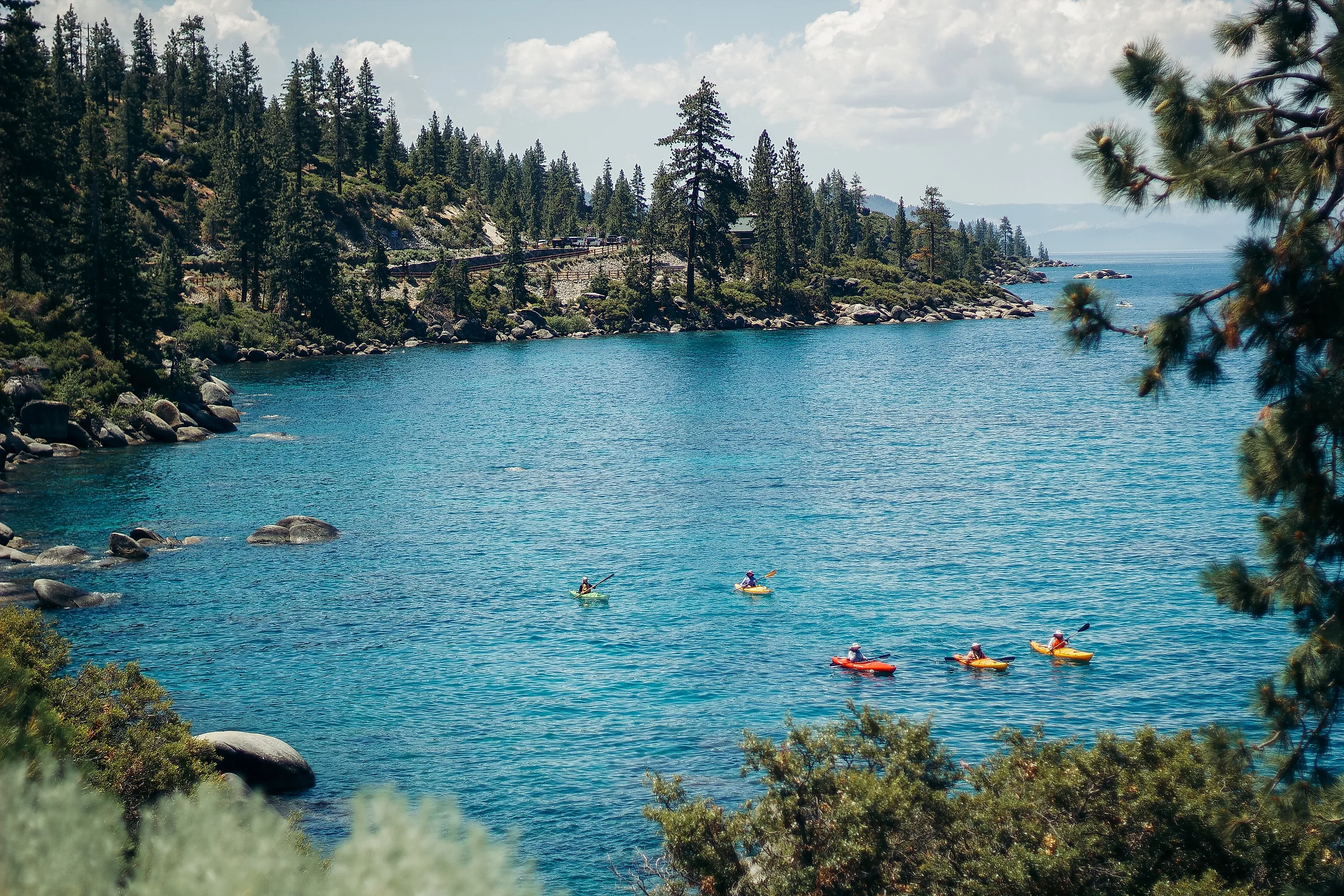
Lake Tahoe looks enormous from its shoreline, but its true scale is hidden below the surface. The lake covers about 191 square miles along the California-Nevada border, a tiny area compared with California's roughly 156,000 square miles of land. Yet Lake Tahoe holds close to 39 trillion gallons of water. If that entire volume could somehow be removed and spread evenly across California, it would form a layer approximately 14 inches deep over the state's land area.
The comparison sounds impossible until you consider Tahoe's unusual shape. The lake is not exceptionally large because of its surface area. Its extraordinary volume comes from depth. Lake Tahoe averages close to 1,000 feet deep and reaches 1,645 feet at its deepest point. That immense vertical column of water lets a relatively compact lake hold enough freshwater to produce one of the most striking volume comparisons in North America.
The Math Behind the 14-Inch Claim

The calculation begins with Lake Tahoe's estimated volume. The UC Davis Tahoe Environmental Research Center puts it at roughly 39 trillion gallons. Converting that figure into acre-feet, a unit commonly used to measure large quantities of water in the western United States, gives approximately 120 million acre-feet.
One acre-foot is the amount of water required to cover one acre of land to a depth of one foot. California contains approximately 155,858 square miles of land, equivalent to about 99.7 million acres.
Dividing Tahoe's roughly 120 million acre-feet of water by California's 99.7 million acres gives a theoretical depth of about 1.2 feet. Converted to inches, that is approximately 14.4 inches.
The result varies slightly depending on the estimates used. Some references put Tahoe's volume closer to 40 trillion gallons, while calculations using California's total geographic area rather than land area produce a slightly smaller depth. For that reason, "about 14 inches" is more scientifically appropriate than presenting 14.4 or 14.5 inches as an exact measurement.
Tahoe's Depth Is the Real Reason

Lake Tahoe's 191-square-mile surface is only a fraction of California's area. If Tahoe were shallow, its statewide water comparison would not be especially remarkable. Instead, much of the lake sits hundreds or even more than 1,000 feet below the surface.
Its average depth of around 1,000 feet means that every square mile of Lake Tahoe holds an enormous vertical column of water. California's land area is roughly 800 times larger than Tahoe's surface area. Spread an average water column around 1,000 feet deep across an area about 800 times larger, and the depth drops to little more than one foot.
This is a simple way to understand the calculation without converting gallons. Tahoe holds water vertically. California stretches horizontally. The lake's great depth makes up for its comparatively small footprint.
Tahoe is the second-deepest lake in the United States, behind Oregon's Crater Lake. Its maximum depth of 1,645 feet is greater than the height of many skyscrapers. A large portion of this deep basin lies well below the lake's visible shoreline, which makes its total water volume difficult to appreciate from the surface.
How Lake Tahoe Became So Deep

Lake Tahoe's depth is largely the product of geology. The basin did not form simply because glaciers carved a depression in the Sierra Nevada. Tectonic forces began shaping the region millions of years ago as faults let blocks of the Earth's crust drop relative to surrounding mountains.
The resulting depression became a large basin between rising mountain ranges. Later volcanic activity altered drainage patterns, while glaciers repeatedly reshaped valleys around the lake during colder periods.
Glaciers were especially important in shaping features around the southwestern shoreline, including areas near Emerald Bay, but they did not excavate the entire lake basin. Tahoe's exceptional depth ultimately reflects the combined effects of faulting, volcanism, and glaciation over millions of years.
This geological history is why such a large quantity of water can occupy an area that appears modest on a map. Tahoe is essentially a deep tectonic basin surrounded by steep mountainous terrain.
Why California Could Never Actually Be Covered Evenly

The 14-inch calculation is useful for understanding volume, but it describes an imaginary situation. California is obviously not flat, and water would never stay evenly distributed across it.
The state includes the Sierra Nevada, coastal mountain ranges, the Central Valley, deserts, and thousands of individual river basins. Water poured across California would immediately move downhill. Some would collect in valleys and reservoirs, while some would run into rivers, soak into the ground, or eventually drain into the Pacific Ocean.
Elevation differences are enormous. Mount Whitney rises more than 14,000 feet above sea level, while Death Valley reaches below sea level. A uniform 14-inch layer could exist only if the entire state were a perfectly level, watertight surface.
The comparison therefore measures equivalent depth, not flood potential. Saying Lake Tahoe could "cover California" does not mean draining Tahoe would produce a 14-inch flood everywhere.
Most of Tahoe's Water Is Not Available Reservoir Storage

Another important distinction concerns how much of Lake Tahoe can actually be controlled for water supply.
A dam stands at Tahoe City, where water exits the lake into the Truckee River. Lake Tahoe is a natural lake, though, not an artificial reservoir created by that dam. The modern structure regulates only the upper portion of the lake.
The U.S. Bureau of Reclamation lists approximately 744,600 acre-feet of usable storage in the upper 6.1 feet of Lake Tahoe. Set against the lake's roughly 120 million acre-feet of total volume, that is well under 1 percent of all the water in Tahoe.
The vast majority sits below the level the dam controls. No one can simply release it as though Tahoe were a giant conventional reservoir.
If only the controlled storage were spread across California, the resulting statewide layer would measure far less than one-tenth of an inch. The famous 14-inch comparison therefore depends on counting essentially every drop in the entire natural basin.
A Lake That Takes Centuries to Refill

Tahoe's enormous volume also affects how slowly its water is replaced. More than 60 streams carry water into the lake, along with rain and snow falling directly onto its surface. Only one major surface outlet exists: the Truckee River.
According to UC Davis researchers, if Lake Tahoe were somehow emptied, natural inflows would need roughly 600 years to refill it under typical hydrologic conditions.
That long replacement time shows the difference between Tahoe and a fast-moving river reservoir. Much of its water stays in the lake for extraordinarily long periods. The basin holds a massive natural store of water in the Sierra Nevada.
Its slow water replacement has consequences for ecology as well. Pollutants and nutrients entering such a large, slow-flushing lake can linger in the system for extended periods, which is why protecting Tahoe's famously clear water matters so much.
What the Comparison Really Tells Us
The idea that Lake Tahoe could cover California with roughly 14 inches of water is not a prediction of what would happen if the lake were drained. It is a way of translating an almost incomprehensible volume into a familiar measurement.
Thirty-nine trillion gallons is difficult to picture. A layer of water more than a foot deep across an entire state is easier to grasp.
The calculation also points to what makes Tahoe exceptional. Its surface area alone does not explain its enormous water supply. The answer lies beneath the surface, where a fault-formed basin descends more than 1,600 feet.
Lake Tahoe shows how dramatically depth can change the scale of a lake. A body of water occupying only about 191 square miles can hold enough that, in a purely mathematical exercise, it could place roughly 14 inches over nearly 100 million acres of California. That extraordinary ratio is one of the clearest ways to appreciate just how deep Lake Tahoe really is.