The Breadbaskets of the World
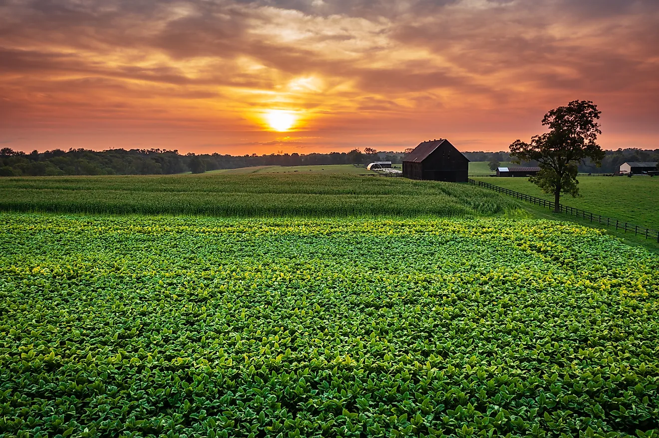
From the early days of human civilization, agriculture has supported countless communities, providing essential food for growth. Grains are essential, and a growing population has rapidly increased the amount required by humans. With global populations exceeding eight billion in 2022 and projected to continue rising at a rate of around 0.85% per year, enhancing food security and production is paramount. Thankfully, many regions across the world have thriving conditions allowing a massive output of grains and supporting large populations. These areas are known as “breadbaskets,” and some of the most prominent are the North China Plain, Indo-Gangetic Plain, U.S. Midwest, Russian Steppe, Ukrainian Steppe, the Pampas, Cerrado Agricultural Region, and Mekong Delta.
These breadbasket areas feature richer soil with advantageous climate conditions that allow them to produce large amounts of grains. They are vital for the global food system, enabling large-scale production to be concentrated in a small area. This article delves into the most prominent bread baskets in the world.
Breadbaskets Of The World
| Region | Geographic Location | Most Prominent Crop |
|---|---|---|
| North China Plain | Northeastern China (around the Yellow River basin) | Wheat |
| Indo-Gangetic Plain | Northern India, Eastern Pakistan, Nepal & Bangladesh | Wheat & Rice |
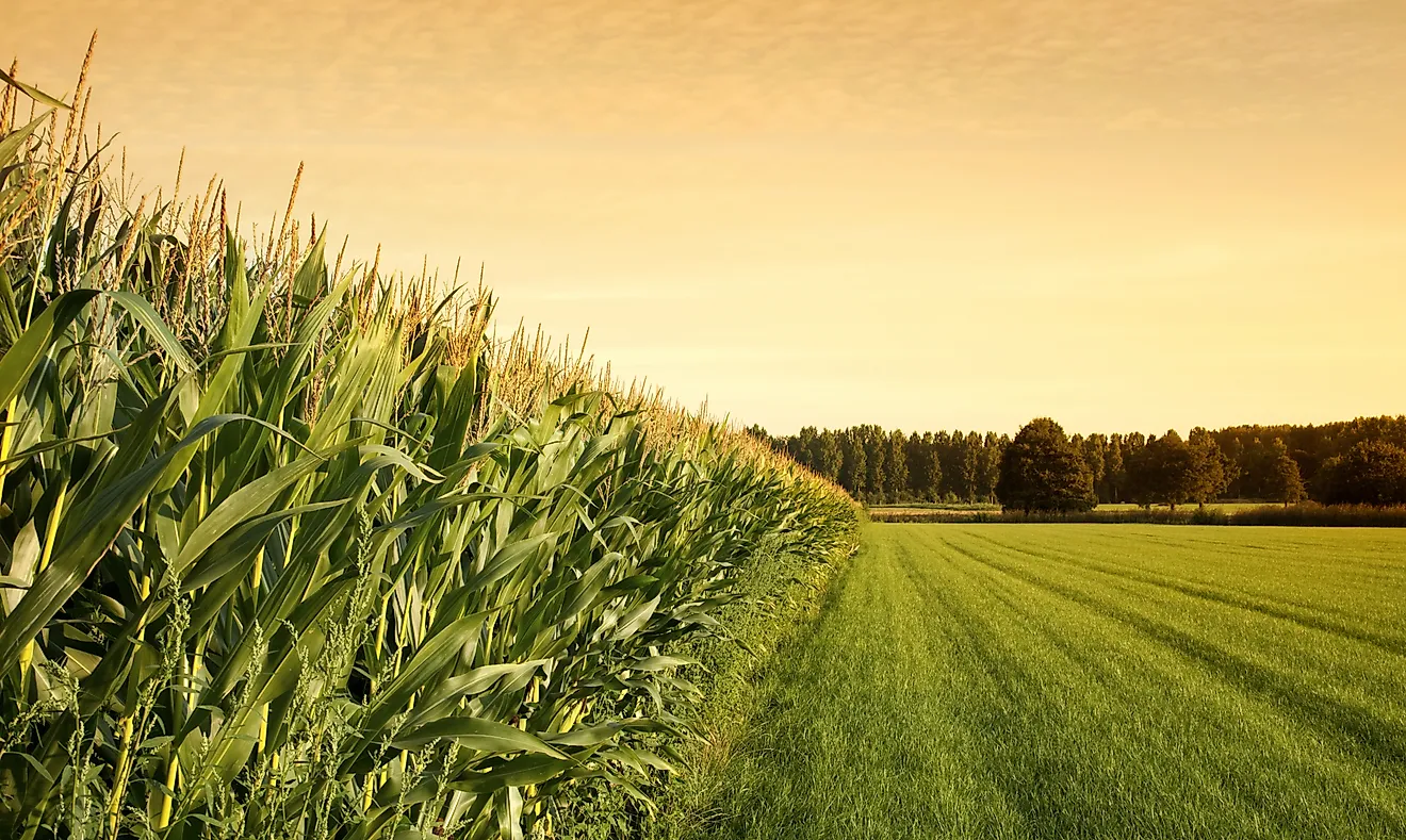
| U.S. Midwest | North-Central United States (Corn Belt states) | Corn |
| Russian Steppe | Southern Russia from Black Sea toward Siberia | Wheat |
| Ukrainian Steppe | Southern & Eastern Ukraine and nearby Eastern Europe | Wheat & Sunflower |
| Pampas | Central Argentina extending into Uruguay & Brazil | Corn & Soybeans |
| Cerrado Agricultural Region | Central Brazil | Soybeans |
| Mekong Delta | Southwestern Vietnam along the Mekong River mouth | Rice |
North China Plain (China)

The North China Plain is a prominent agricultural region in northeastern China, renowned as one of the world's most fertile areas. Considered a breadbasket due to its fertile soil and rich irrigation, thanks to the Yellow River, this expansive flat area spans 409,500 square kilometers (158,100 sq mi), with most areas being less than 50 meters (160 ft) above sea level. According to recent estimates, approximately 60-65% of the total area is used for agriculture, with winter wheat and maize being among the most prevalent crops. According to data from 2016, the North China Plain accounts for over 35% of China’s total grain yield and 20% of the nation’s total cropland.
Estimates place total grain production at around 200 million tons, which is a notable portion of global supply. Thanks to its flat terrain, fertile alluvial soils, reliable irrigation, and an increasingly advanced agricultural system, the North China Plain remains one of the most productive farming regions on Earth. Its output plays a crucial role in feeding China’s massive population and supporting national food security. However, the region also faces growing challenges, including groundwater depletion, urban expansion, and the impacts of climate change.
Indo-Gangetic Plain (India & Pakistan)

The Indo-Gangetic Plain is a fertile plain located across northern India, eastern Pakistan, southern Nepal, and Bangladesh. It is spread across a whopping 700,000 square kilometers (270,000 sq mi) and is named after the Indus and Ganges Rivers, two major bodies of water that drain the region. Thanks to this rich water resource, coupled with heavy rains and fertile alluvial soil, this is one of the world’s most agriculturally rich and densely populated areas.
It is referred to as the breadbasket of India and boasts a diverse array of crops, including wheat, rice, pulses, sugarcane, and oilseeds. Wheat is one of the most widely cultivated crops, with massive fields that account for 70-80% of India’s 100+ million-ton wheat production. Along with this, rice production remains stable to support the large requirement in India, where it is a staple food for many households. While it is a vital area for both national and global food security, this rich plain is facing issues due to overpopulation and subsequent pollution, making it important to separate residential and agricultural areas.
U.S. Midwest

The Midwestern United States, also known as the Heartland, is the northern central part of the United States. It consists of 12 states and numerous large population hubs, such as Chicago, as well as extensive agricultural regions like the Corn Belt. In total, the Midwest is home to over 127 million acres of agricultural land, out of which 75% is used to grow corn and soybeans. States in the region, like Iowa, managed to produce over 2.6 billion bushels of corn in 2024, which is around 18% of national production.
Together, the region produces over one-third of the world’s corn and a significant share of global soybeans, much of which is exported to international markets for food, animal feed, and biofuel. The fertile prairie soils, reliable rainfall, advanced farming technology, and highly mechanized agriculture systems make the Midwest one of the most productive farming regions on Earth. However, the region also faces challenges such as soil erosion, changing rainfall patterns, and concerns about over-reliance on monoculture crops like corn and soybeans. Apart from corn, the U.S. Midwest also produces a variety of crops, including onions, alfalfa, apples, cabbage, carrots, and wheat.
Russian Steppe (Russia)

The Russian Steppe stretches across southern Russia from the Black Sea toward Siberia, forming one of the world’s largest continuous grassland regions. This vast plain is mostly flat and open, with fertile chernozem (black soil) that is extremely rich in organic matter. Combined with a continental climate that supports seasonal farming, vast open farmland, and expanding irrigation in certain areas, the Russian Steppe has become one of the most productive agricultural zones on the planet. Much of Russia’s large-scale grain cultivation is concentrated here, where the landscape allows for huge farms and highly mechanized agriculture.
The steppe is especially famous for wheat production, along with barley, rye, and sunflowers. Russia has become the world’s largest wheat exporter in recent years, with a total grain harvest of 135 million tonnes as of 2025. A significant share of that comes from the steppe regions, playing a significant role in feeding markets in the Middle East, Africa, and Asia. However, the region also faces challenges such as drought risk, soil degradation in some areas, and geopolitical instability that can disrupt exports and global supply chains.
Ukrainian Steppe (Ukraine)

The Pontic-Caspian Steppe, also known as the Ukrainian Steppe, lies just southwest of its Russian counterpart in Eastern Europe. This vegetation zone spans approximately 994,000 square kilometers (384,000 sq mi) through Ukraine and nearby countries like Bulgaria, Romania, and Moldova. Since the 4th millennium BCE, when Indo-Europeans occupied it, this area has been a fertile haven, considered a breadbasket in the region. Similar to the Russian Steppe, the region has fertile chernozem promoting large-scale agricultural activities.
This region has historically supported nomadic pastoralism; however, most areas are now used for intensive grain farming, which significantly contributes to Ukraine’s production of wheat, barley, corn, and sunflower oil. Before recent conflicts, Ukraine produced around 70-85 million tons of grain annually and was one of the world’s top wheat and sunflower oil exporters, supplying markets across Africa, Europe, and Asia. However, agriculture here also faces significant challenges, including disruptions from ongoing geopolitical tensions, which have had a major impact on global food supply chains.
The Pampas (Argentina)

Primarily located in Argentina and extending into parts of Brazil and Uruguay, the Pampas is one of South America’s lush breadbaskets. Also known as the Pampas Plain, this vast 1,200,000 square kilometre (460,000 sq mi) expanse of land comprises fertile low grasslands, plains, and some wetlands. Most of the region lies below 600 metres (2,000 ft) in altitude and experiences a temperate climate with reliable rainfall, creating ideal conditions for large-scale farming. As a result, the Pampas has become one of the world’s most productive agricultural regions, supporting extensive cultivation of grains such as corn, wheat, and sunflowers.
Today, the Pampas region produces over 80% of Argentina’s main crops, including maize, wheat, and soybeans. Argentina is also one of the world’s leading agricultural exporters, ranking as the fourth-largest maize producer globally with over 50 million tons produced in recent years. Along with crops, the Pampas supports intensive cattle grazing, helping shape Argentina’s strong beef industry. That said, heavy agricultural expansion has also replaced significant portions of natural grassland, leading to soil degradation and environmental concerns in some areas.
Cerrado Agricultural Region (Brazil)

The Cerrado is a tropical savanna ecoregion just north of the Pampas in Brazil. Spanning approximately 2,000,000 square kilometres (770,000 square miles), this is the second-largest biome in Latin America, taking up around 23% of the country’s land surface. The vast area and rich mix of forests, combined with a tropical climate and numerous bodies of water, create a region ideal for agricultural activities. Not surprisingly, it has been the breadbasket of the area for many years, with over 40% of the land dedicated to farming. Primary crops include soybeans, corn, maize, and beans, which account for 60% of Brazil's agricultural production. Soybean production is so prevalent that the region accounts for 22% of global soybean exports.
While fruitful, the Cerrado’s success has come with serious challenges. Over 30 million hectares of native savanna have already been cleared for farms, making it one of the fastest-disappearing ecosystems in the world. This loss threatens wildlife, Indigenous lands, and even farming itself, as deforestation is linked to delayed rainy seasons, falling groundwater levels, and rising drought risk.
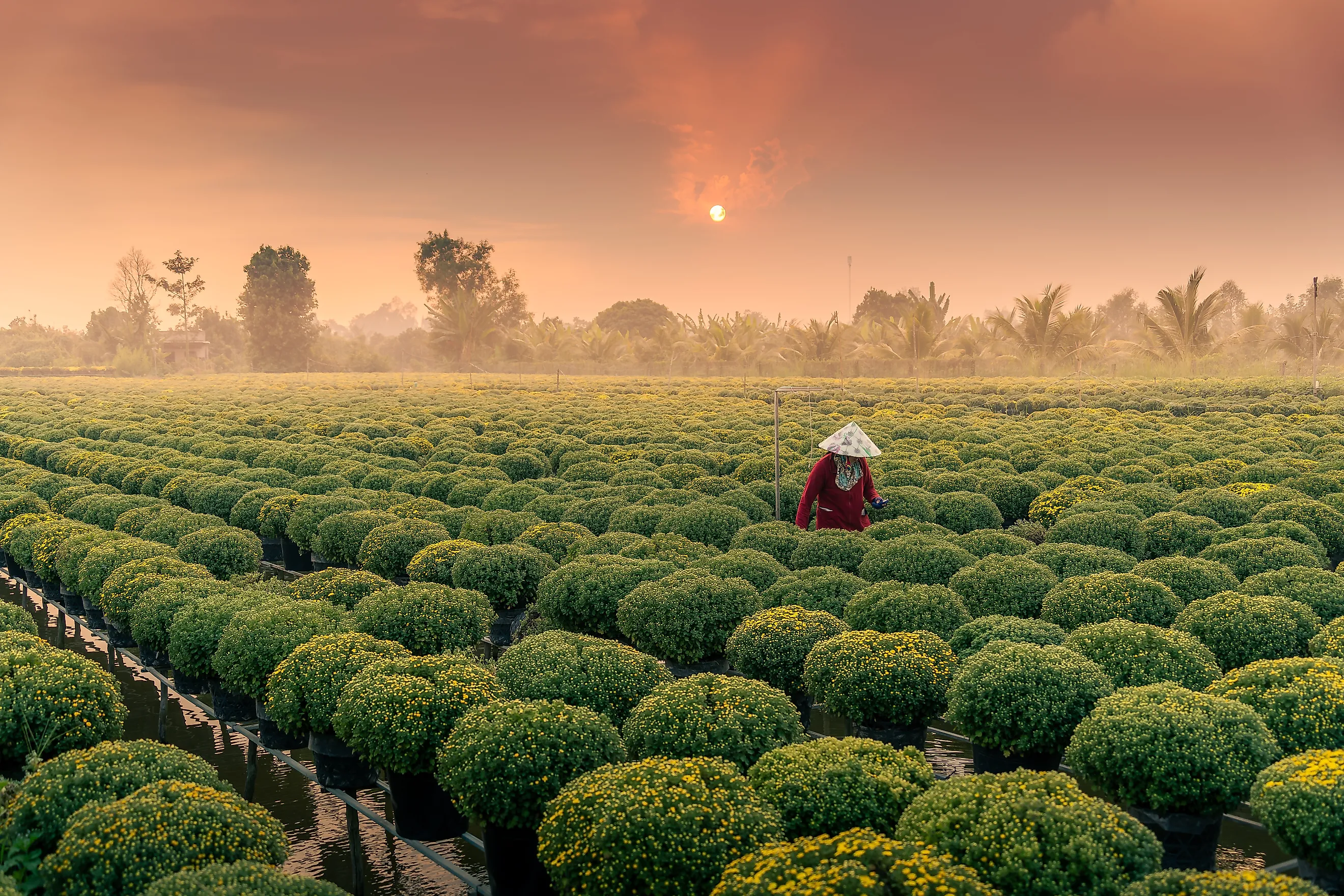
Mekong Delta (Vietnam)

The Mekong Delta comprises the southwestern part of Vietnam, where the Mekong River ends its route and empties into the sea. The wet coastal area spans approximately 40,500 square kilometres (15,600 sq mi), although this can vary depending on water levels, seasons, rainfall, and other factors. Thanks to its unique geography and ample water resources for irrigation, the delta is a vital area for agriculture in the country, providing food for millions of people both locally and globally. Rice benefits immensely from the wet environment, and the Mekong Delta has around four million hectares of agricultural land, producing over 50% of Vietnam’s rice and 90% of rice exports.
Along with rice, the region is also known as Vietnam’s “fruit basket,” producing nearly 70% of the country’s fruits. Fisheries and aquaculture add further economic value. Even so, the delta is facing serious challenges. Vietnam’s agriculture ministry estimates that the region loses around 500 hectares of land per year due to erosion. Meanwhile, saltwater intrusion, declining freshwater supplies, pollution, and upstream dam development threaten long-term productivity. Despite this, major climate resilience projects such as the Mekong Delta Climate Resilience and Integrated Transformation Project (MERIT) are underway to preserve one of the world’s most critical agricultural lifelines.
The Breadbaskets Of The World
Although these regions are located in different parts of the world, they all share a crucial role: feeding millions of people every day. Their fertile soils, favorable climates, and long farming traditions make them essential to the global food system. At the same time, many of them now face challenges from climate change, overuse, and geopolitical issues, making their protection and sustainable management more important than ever for future food security.