Which County Has The Most Miles Of Coastline In America?
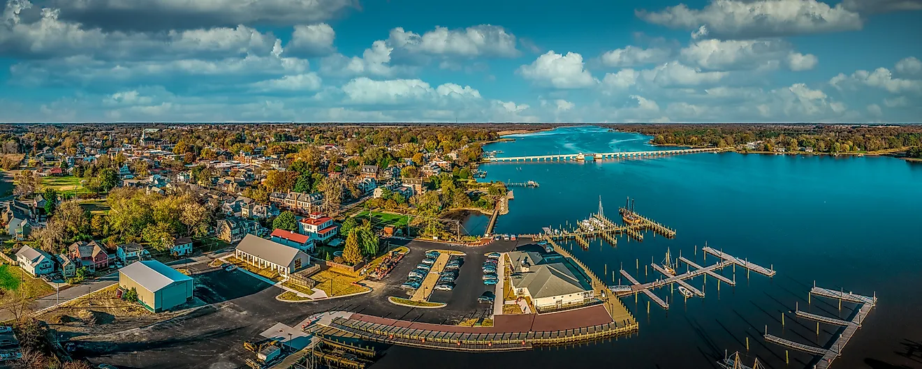
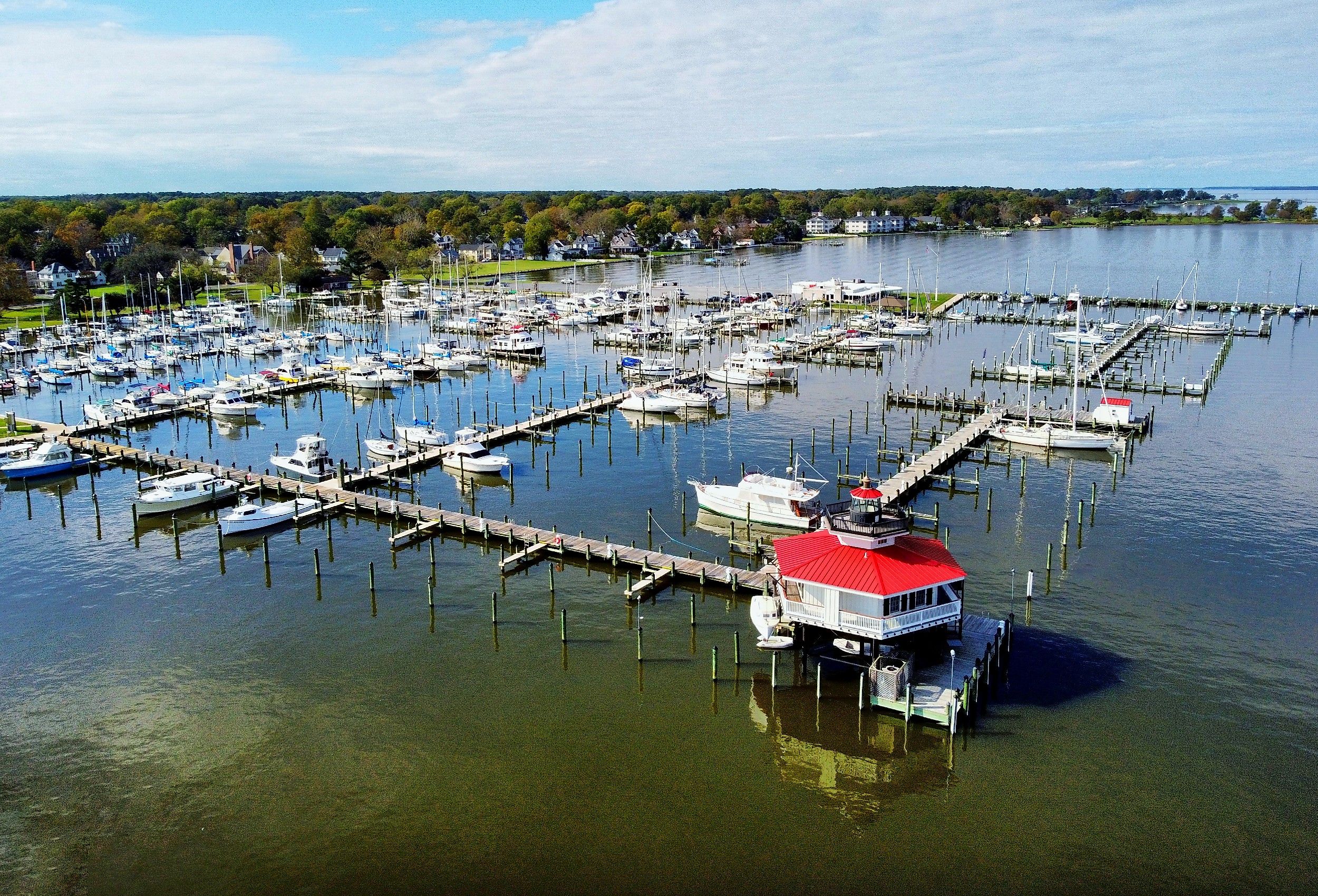
The county with the most miles of coastline in America is Dorchester County, Maryland, which the Maryland Geological Survey (MGS) measured at 1,539 miles of shoreline, the largest figure on the public record for any US county. That total belongs to a county of just 593 square miles, which works out to more than two and a half miles of shoreline for every square mile of dry land. Dorchester earns the title not by stretching a long way along the water but by defying straight lines. State surveyors digitized every bend and inlet of the Chesapeake Bay, its marshes, and its rivers from aerial photography, and the tidal fingers of the Eastern Shore kept multiplying the figure. No county in large coastline states like Texas or California comes close to that ratio, because their shores are comparatively straight.
Shoreline totals depend as much on the ruler used as on the coast surveyed. Measure the same marsh at a finer scale, and the number climbs, an effect cartographers call the coastline paradox. This is why NOAA carries two national figures rather than one: 95,471 miles from a hand measurement made in 1939-40, with the Great Lakes added in 1970, and a modern digital calculation of roughly 222,000 miles, which the agency has never adopted as official. It is also why Dorchester's crown belongs specifically to the Lower 48, since Alaska's boroughs have never been surveyed on a comparable basis. Among the states that publish county-level numbers, a tight group of runners-up sits behind Dorchester, but Maryland's coastal county takes the cake.
Maryland's Eastern Shore Dominates

Three of the longest documented county shorelines in the country sit within about an hour's drive of one another on Maryland's Eastern Shore. Working from orthophotography flown between 1988 and 1995, the MGS put Dorchester County at 1,539 miles, while just to the south, Somerset County packs 1,106 miles into a land area of only 338 square miles. That gives Somerset a surprising twist, since it ranks eighteenth among Maryland counties by area yet second in shoreline. Smith Island, a cluster of low-lying marsh-divided islands roughly twelve miles from Crisfield, accounts for much of the Somerset figure.

The mainland is just as fractured, with local rivers cutting deep inland from the sound and salt marshes covering the western half. Dorchester follows the same blueprint on a larger scale, several major rivers slicing the land into narrow, winding fingers that wrap around the roughly 28,000 acres of the Blackwater National Wildlife Refuge, most of it tidal marsh. State surveyors caution that these numbers are estimates rather than legal boundaries, but because the same method was applied to every county, Maryland's internal ranking is the most reliable county-level comparison available anywhere in the country.
Four more Maryland counties round out the pattern. Worcester County has the Ocean City boardwalk facing the open Atlantic, but behind its narrow beach lies a network of shallow bays that pushes its total to 774 miles. Talbot County, by contrast, has no ocean beach at all and still records 605 miles, almost entirely through winding rivers that meander around peninsulas near St. Michaels and Easton. Anne Arundel County, anchored by the state capital at Annapolis, encompasses 508 miles, most of it along local rivers rather than the open bay, while St. Mary's County closes out the region with 536 miles framed between the Potomac and Patuxent rivers.
Long Island's Forked Ends and Maine's Granite Islands

The strongest challengers outside Maryland both clear 900 miles. Suffolk County makes up the eastern two-thirds of Long Island, New York, and a direct line traced along its outer ocean edge would measure less than ninety miles. New York State's own county profile puts the shoreline at 980 miles, a number repeated in county legislative resolutions and coastal erosion reports. The difference comes from the eastern tip splitting into two peninsulas, the North Fork and the South Fork, which wrap around Peconic Bay. A long chain of barrier islands and sheltered bays, among them Great South Bay, Moriches Bay, and Shinnecock Bay, then lines the southern coast, adding mile after mile of protected edge behind the beach.
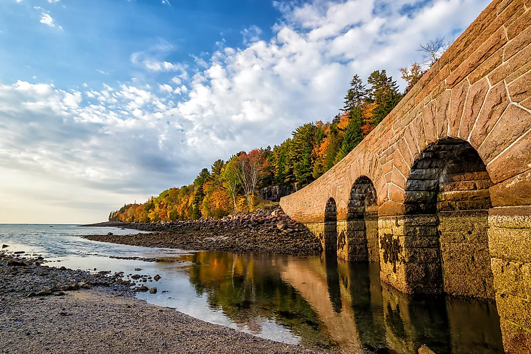
Hancock County, Maine, produces the same effect on a rocky coast. According to the county's official disaster planning records, its coastline spans 952.7 miles, the longest of any county in the state. A large share of that comes from Mount Desert Island, which packs a remarkable variety of features into a small area: the town of Bar Harbor facing Frenchman Bay, a deep fjord known as Somes Sound cutting straight into the island, and the granite cliffs of Acadia National Park framing the shore. Smaller islands and the bays around Union River and Blue Hill add still more. For scale, California's entire tidal shoreline is roughly 3,427 miles, and Maine's is 3,478 miles, which means a single Maine county claims nearly a thousand miles of its state's total.
Barnstable County And The Moving Edge Of Cape Cod

Barnstable County, Massachusetts, covers virtually all of Cape Cod, taking in all fifteen of its towns, and it shows better than anywhere else on this list how much the method matters. A regional watershed assessment places the shoreline at 586 miles, the town of Barnstable's Economic Development Office cites about 550, and other references round the total closer to 400. Each figure is correct within its own context, reflecting different measurement scales and mapping detail. The landscape underneath is not in dispute: the open Atlantic battering the Outer Cape, the calm water of Cape Cod Bay filling the interior of the hook, and sandbars around Chatham that shift often enough that state officials track them through ongoing historical mapping rather than a single fixed boundary. A sandy peninsula that rebuilds itself every winter has no permanent edge, so the number rises with the resolution of the survey, and it rises for the same reason it does everywhere else on this list: water folded back on itself again and again.
County Made of Islands in Washington

Every county so far sits on the Atlantic or the Chesapeake, which raises the obvious question of how the West Coast compares. San Juan County, Washington, answers it by posting a large shoreline total without a single mile of traditional mainland coast. The county consists of San Juan, Orcas, Lopez, and Shaw Islands, plus dozens of smaller landmasses scattered throughout the Salish Sea. Local government reports put it at over 400 miles of marine shoreline, and the county's 2013 shoreline inventory totals roughly 464 miles, 439 of which are marine. That is consistently reported as having more marine coastline than any other county in the state, and the landscape explains why. East Sound cuts so deeply into Orcas Island that it nearly splits the island in two, and no bridge connects any of these four ferry-served islands to the mainland or to one another. Every additional island, however small, contributes a full perimeter of its own.
What The Leading Counties Have In Common
Set Dorchester's 1,539 miles beside San Juan's 464, and the gap looks decisive, though the two numbers come from different agencies working to different standards. Maryland used a statewide geographic survey; New York used coastal erosion reports; Maine used disaster planning records; Massachusetts used a watershed assessment; and Washington used a county inventory. Finer resolution finds more creek mouths and marsh edges, so a county measured closely will always outscore one measured coarsely. The practical rule is to compare within a survey rather than across several, which is what makes Maryland's internal ranking the sturdiest part of the picture, and why NOAA keeps two national totals rather than forcing them into one.
What these counties share is not size or latitude but shape. A county facing open ocean along a relatively straight line records a modest total, no matter how long its beach looks from the road. A county webbed with tidal rivers, sheltered bays, or scattered islands records several times more, because every bend, every marsh gut, and every island perimeter counts separately. Dorchester has rivers and marshes, Suffolk has forks and barrier bays, Hancock has granite islands, Barnstable has a hooked sandy spit, and San Juan has nothing but islands. Measuring any of them with a straight ruler would take forever. Following the actual water's edge, one crease at a time runs from hundreds of miles to well past a thousand, and that gap is the difference between a coast and a coastline.