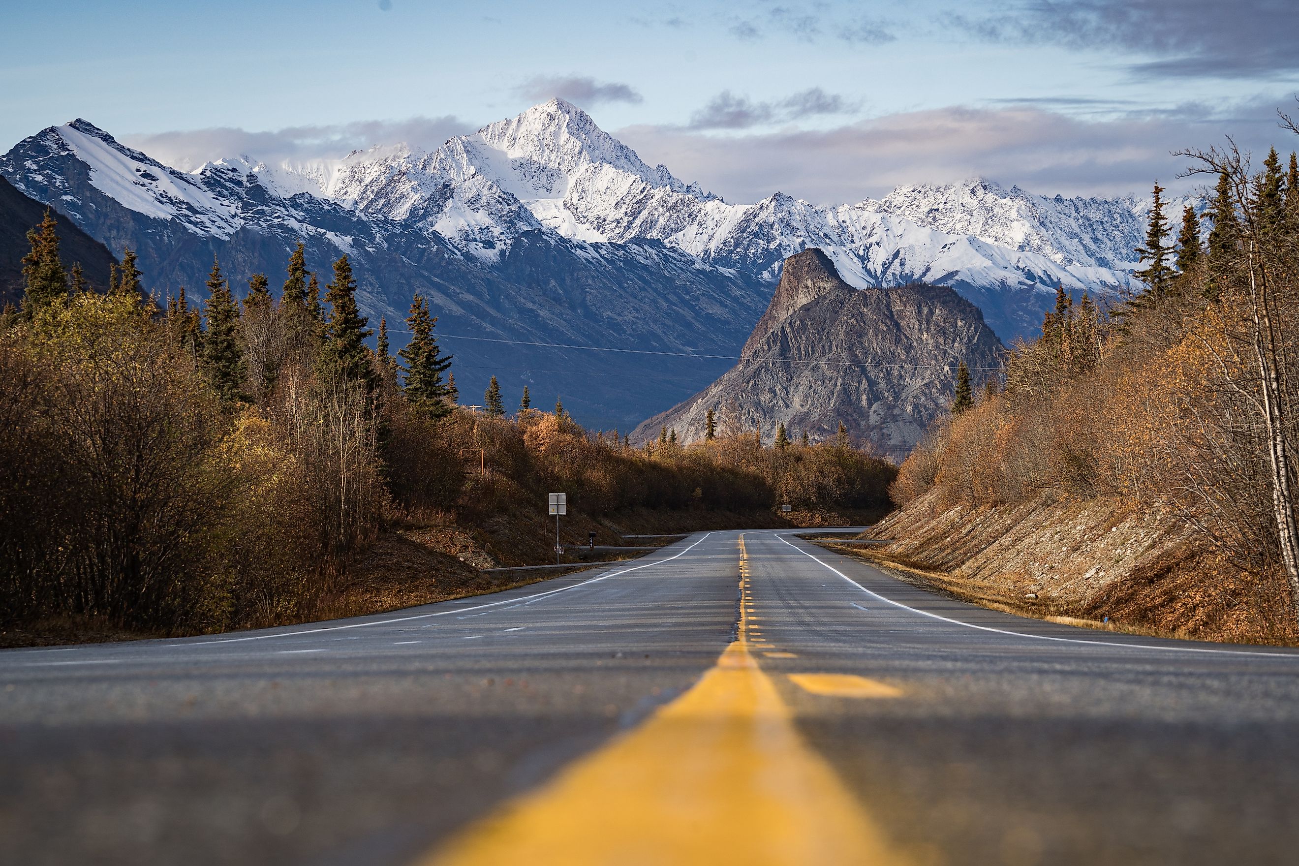
8 Great Road Trips to Take in Alaska
Alaska's highway system covers only a small part of the state, but the roads that do exist pass through an extraordinary range of landscapes. A single drive might trace glacier-fed rivers, climb mountain passes, follow rugged coastlines, or cross wide stretches of tundra before the scenery changes again. The best road trips are defined by their route just as much as by their destinations. With scenic pull-offs, wildlife viewing areas, historic roadhouses, and state parks breaking up the miles, these eight drives showcase the highways where the journey through the terrain becomes the main attraction.
Seward Highway

The Seward Highway is one of Alaska's designated National Scenic Byways, running 127 miles as AK-1 and AK-9 to connect Anchorage with Seward in about three hours. The terrain changes noticeably along the way. The first section follows Turnagain Arm, where numerous pull-offs provide views of the tidal inlet and surrounding Chugach Mountains. Beluga Point and Bird Point are among the most frequently used stops, with opportunities to watch for beluga whales during the summer and Dall sheep on the mountains year-round.
South of Girdwood, the highway passes the junction for Portage Valley, where a side road leads to the Alaska Wildlife Conservation Center and the Begich Boggs Visitor Center on Portage Lake. The road then climbs through the Kenai Mountains before descending toward Moose Pass and the shoreline of Kenai Lake. From there, the final stretch continues through Chugach National Forest before reaching Resurrection Bay and downtown Seward. Late May through September is generally the best time to make the drive, when road conditions are most reliable and roadside facilities are open.
Richardson Highway

Built as a gold rush pack trail in the late 1890s, the Richardson Highway is Alaska's oldest major road. Its 368 miles of AK-4 and AK-2 link Valdez with Fairbanks in roughly eight hours, and the scenery changes dramatically over that distance. The highway connects the Gulf of Alaska with the Interior, making it one of the state's most varied road trips. Beginning in Valdez, the route climbs through Keystone Canyon, where roadside pull-offs provide access to Bridal Veil Falls and Horsetail Falls before reaching Thompson Pass, one of the snowiest mountain passes in North America. Just beyond the pass, Worthington Glacier sits beside the highway, with short walking trails leading to views of the ice.
North of the pass, the terrain opens into the Copper River Basin as the highway passes Glennallen and follows sections of the Gulkana and Delta Rivers. The drive continues through Delta Junction, the official end of the Alaska Highway, before entering the forests and broad river valleys of the Interior on the final stretch to Fairbanks. Summer is the best time to drive the full route, but for a sight of the iconic snow-capped mountains, late fall and early winter are optimal.
Glenn Highway

The Glenn Highway runs 189 miles as AK-1 between Anchorage and Glennallen, a drive of about four hours. It follows the Matanuska River Valley before climbing into the eastern Chugach Mountains, connecting Southcentral Alaska with the Copper River Basin. The stretch between Anchorage and Eureka Summit carries National Scenic Byway designation, passing through a mix of farmland, river valleys, mountain passes, and glacial landscapes. After leaving Anchorage, the highway travels through the Matanuska-Susitna Valley before reaching the Matanuska Glacier, which can be viewed directly from the road. Several pull-offs along this section provide clear views of the glacier and the surrounding valley.
East of the glacier, the road climbs past Sheep Mountain and Gunsight Mountain to Tahneta Pass and Eureka Summit. At 3,322 feet, Eureka Summit is the highest point on the route, and the highway descends from there toward the Copper River Basin. Along the way, drivers encounter marked overlooks and state recreation sites. The route ends in Glennallen, where the Glenn Highway meets both the Richardson Highway and the Tok Cutoff, making it a common starting point for longer drives across the terrain. June through September is the best time to drive the highway, when mountain passes are clear, and visibility is at its best.
Denali Highway

The Denali Highway was the first road to reach Denali National Park, and it remains one of the state's most remote drives. AK-8 covers 135 miles between Paxson and Cantwell, a trip of five hours or more. Roughly 110 miles of that distance are unpaved, making the route better suited for slower travel and dry conditions. Beginning in Paxson on the Richardson Highway, the road crosses open tundra, glacial rivers, wetlands, and broad valleys with frequent views of the Alaska Range. Numerous pull-offs grant access to hiking trails, fishing streams, public campgrounds, and viewpoints along the route.
The highway also crosses the Maclaren and Susitna Rivers before it descends into the Nenana River Valley. The route ends as it approaches Cantwell and the George Parks Highway. Wildlife sightings are common, with caribou, moose, grizzly bears, and trumpeter swans regularly seen from the roadside. The road is maintained only from mid-May through mid-September, and it closes to vehicles for the winter.
George Parks Highway

The George Parks Highway connects Southcentral and Interior Alaska, serving as the primary route between Anchorage and Fairbanks. AK-3 itself runs 323 miles, starting at the Glenn Highway junction about 35 miles north of Anchorage. Driving the whole way from the city covers closer to 358 miles and takes about seven hours. The highway crosses the Susitna Valley and skirts the eastern edge of Denali National Park and Preserve. Several designated viewpoints along the route offer some of the most reliable roadside views of Denali, particularly from Denali State Park.
The highway passes through Wasilla, Cantwell, Healy, and Nenana. Trailheads and state recreation sites are spaced along the way. Between Cantwell and Healy, the route runs alongside the Nenana River before continuing into the forests of Interior Alaska on the approach to Fairbanks. Late May through September is generally the best time to make the drive, when clear weather provides the best views of the surrounding country.
Haines Highway

The Haines Highway connects Alaska's Inside Passage with the Yukon, running 148 miles between Haines and Haines Junction in about four and a half hours. The route travels as AK-7 for its first 40 miles, then crosses roughly 45 miles of British Columbia before continuing as Yukon Highway 3. Leaving Haines, the road follows the Chilkat River through the Chilkat Bald Eagle Preserve before climbing toward Chilkat Pass. Roadside overlooks open onto glaciers and the broad valleys of Southeast Alaska. As the highway gains elevation, dense coastal forest turns into alpine terrain before descending into the open landscapes of Canada's Yukon.
Several recreation sites and trailheads sit along the route, and Chilkoot Lake State Recreation Site is a short detour from Haines on Lutak Road. Between late fall and early winter, the Chilkat Bald Eagle Preserve becomes one of the best places in North America to see bald eagles gathering along the river during the salmon run. Summer and early fall bring the most reliable road conditions with little snowfall and precipitation.
Edgerton Highway

The Edgerton Highway is a shorter drive than many of Alaska's major routes, covering about 33 miles of AK-10 that runs east into Chitina off the Richardson Highway near Copper Center, a trip of under an hour. It serves as the primary road access to Wrangell-St. Elias National Park and Preserve. The highway follows the Copper River before turning toward Chitina through a broad valley framed by the Wrangell Mountains. Several marked stops along the route overlook the Copper River and its surrounding bluffs, while interpretive signs explain the region's geology and the river's role in Alaska's salmon fishery.
The drive ends in Chitina, where the pavement gives way to the McCarthy Road, the only land route leading toward the historic communities of McCarthy and Kennecott. Although Edgerton is fully paved, it is still a thoroughfare to one of the state's most remote regions and connects people with some of Alaska's largest protected wilderness. May through October is the best time to take this drive, when access to the wilderness and roads beyond is open.
Steese Highway

The Steese Highway heads northeast from Fairbanks into Alaska's Interior, connecting the city with the Yukon River community of Circle. AK-2 and AK-6 cover 161 miles between the two, and the gravel sections make it a five-hour drive at best. About half the route is paved, with the gravel beginning around Mile 81, well south of Central. The road carries drivers through boreal forest and long stretches of undeveloped country. Steese Highway is unusual for its path through the Interior's wide valleys and the Yukon-Tanana Uplands, with long views across forests and low mountain ranges.
Several stops and recreation sites break up the drive, including the wayside at Eagle Summit, one of the highest points on Alaska's highway system at 3,652 feet. The route also passes the historic mining community of Central before ending in Circle, which sits about 50 miles south of the Arctic Circle. The summer months are the best times to take this drive, ensuring that the roads are in good condition.
Alaska's Highways Go The Distance
Alaska's roads cross mountain passes, follow glacier-fed rivers, climb above the tree line, and reach parts of the state that are otherwise difficult to access. Each highway brings a different driving experience, whether it is a paved scenic byway, a gravel wilderness route, or an international highway linking Alaska with Canada. Weather and distance shape every one of these drives, and on the Denali Highway, the maintained season runs only about four months. Plan accordingly and experience an Alaskan road trip like none other.